Occupy the Dune

2013 - New York, NY, USA

Occupy the Dune

New York, NY, USA

CLIENT Moma PS1 (Rockaway Call for Ideas) / STATUS Winning Proposal 2013 / DESIGN TEAM Balmori Associates

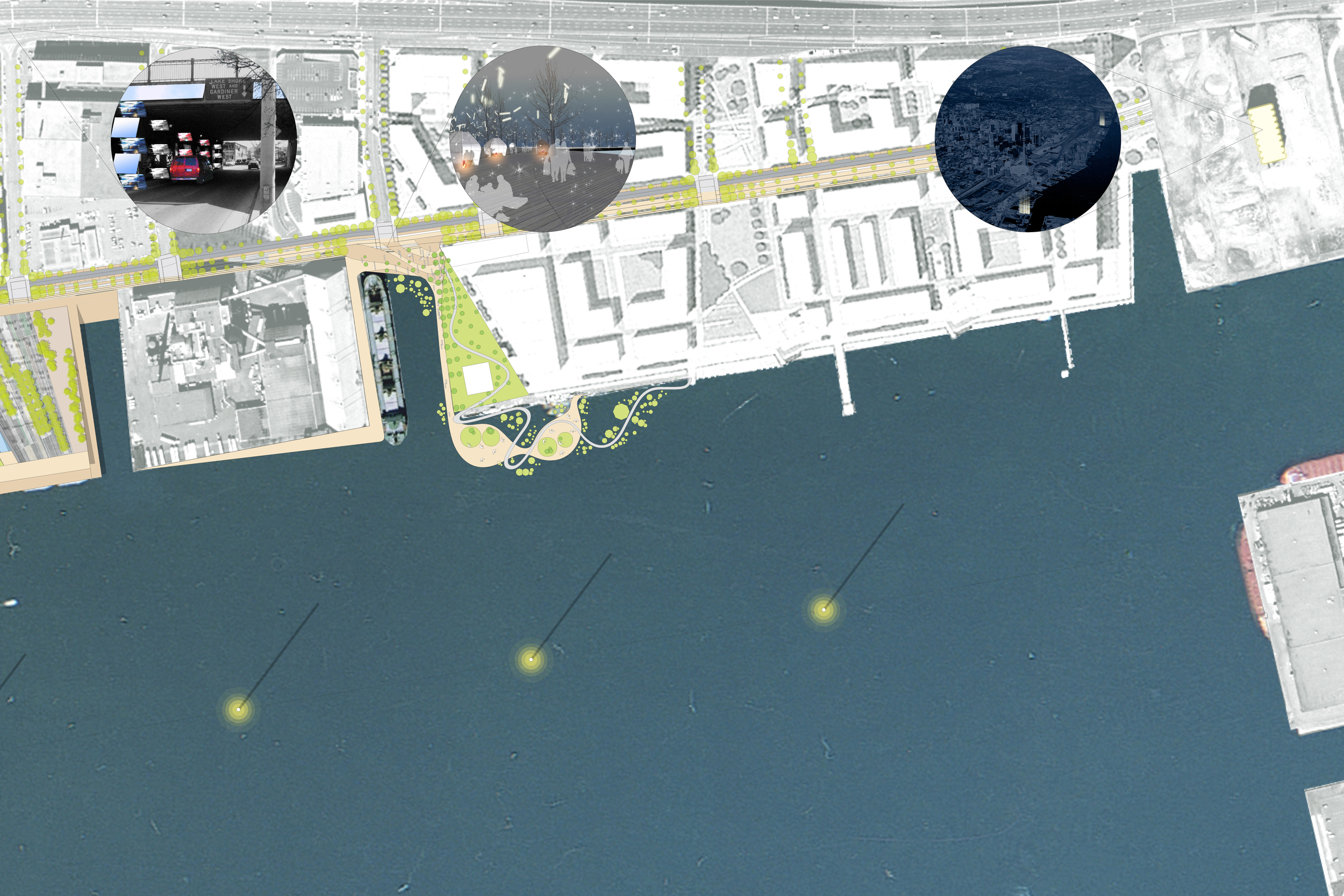
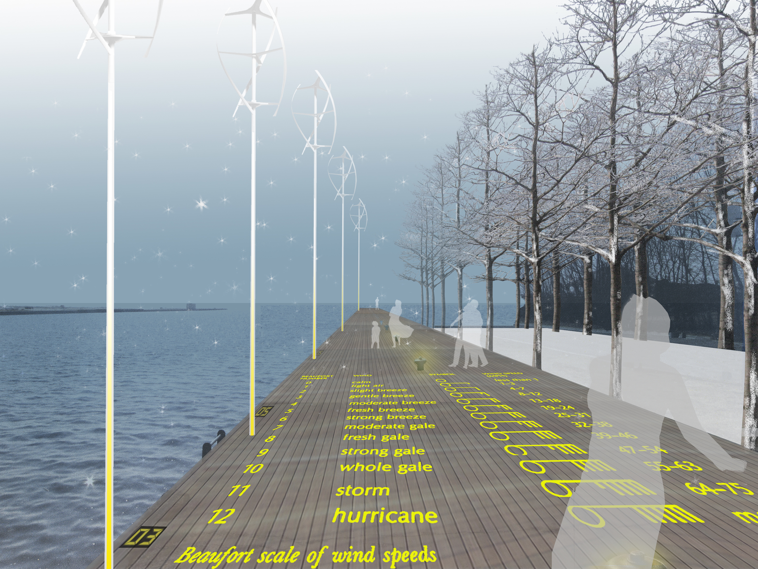
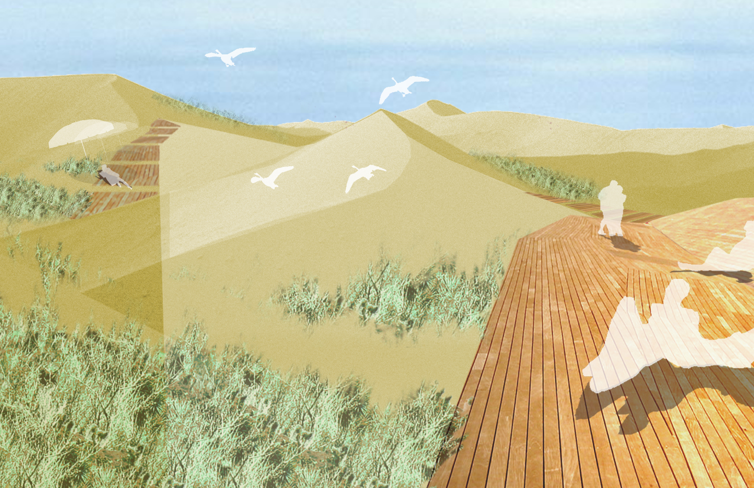
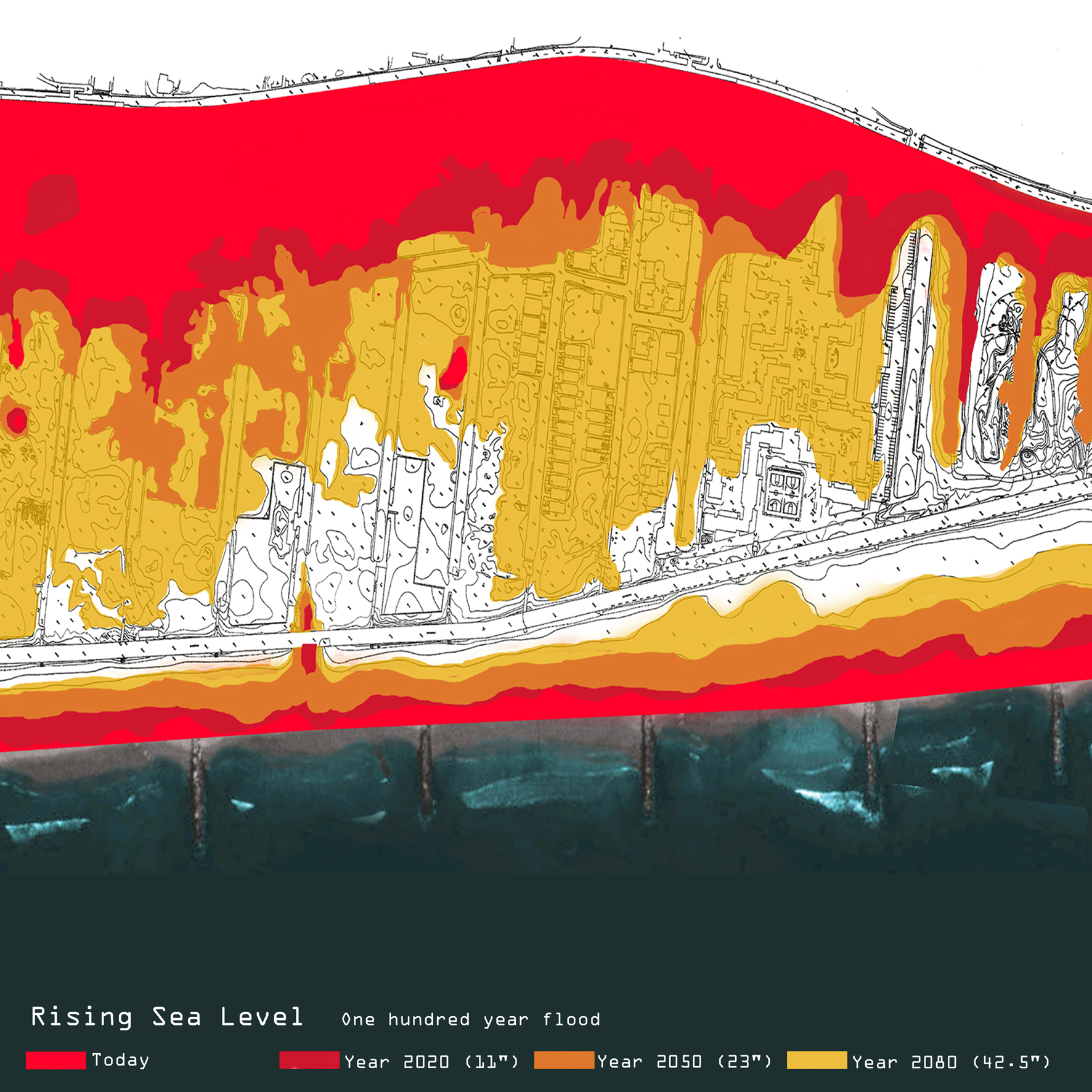
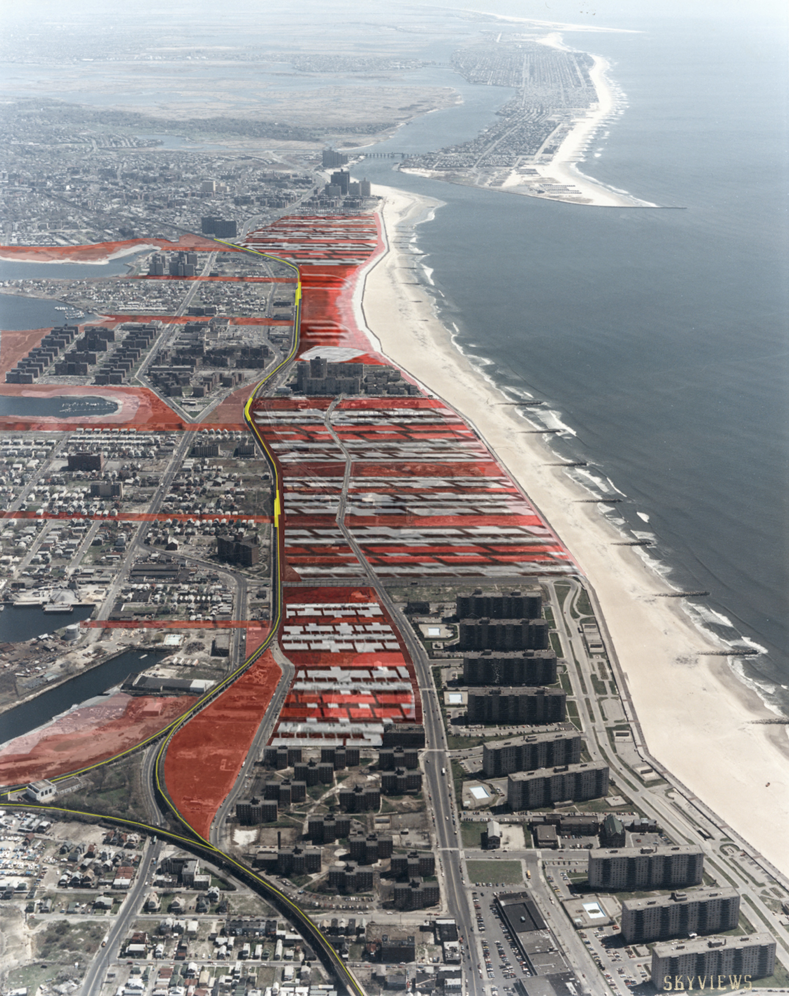
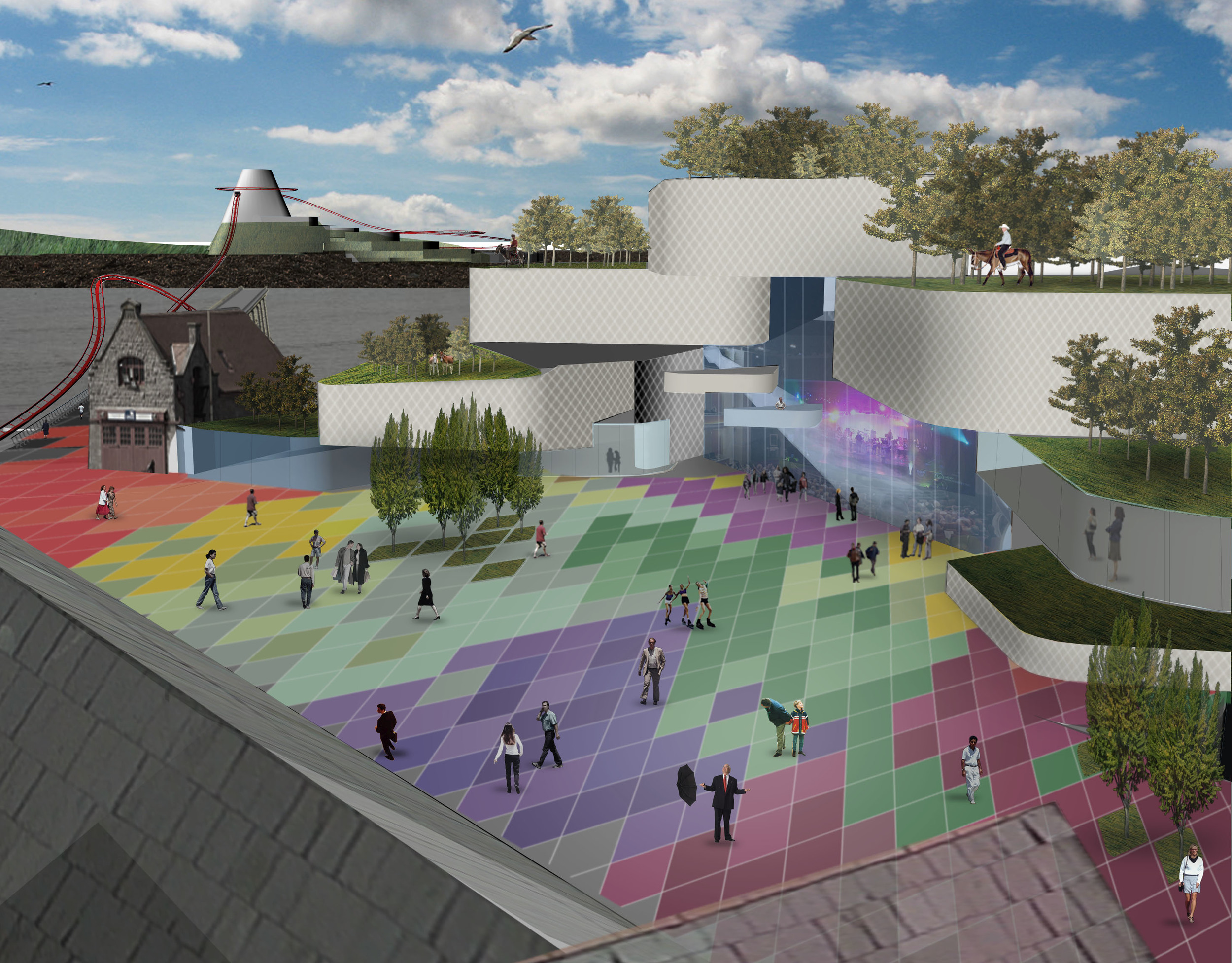
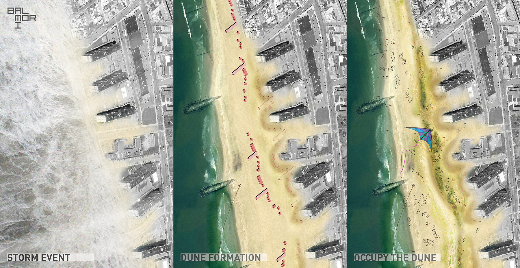
In March 2013, MoMA PS1 invited artists and designers to rethink the post-Sandy Rockaways, a peninsula of Long Island located in the New York City borough of Queens. The competition sought ideas for alternative housing models, creation of social spaces, urban interventions, the rebuilding of the boardwalk, protection of the shoreline, and actions to engage local communities in the effort to rebuild from Hurricane Sandy.      

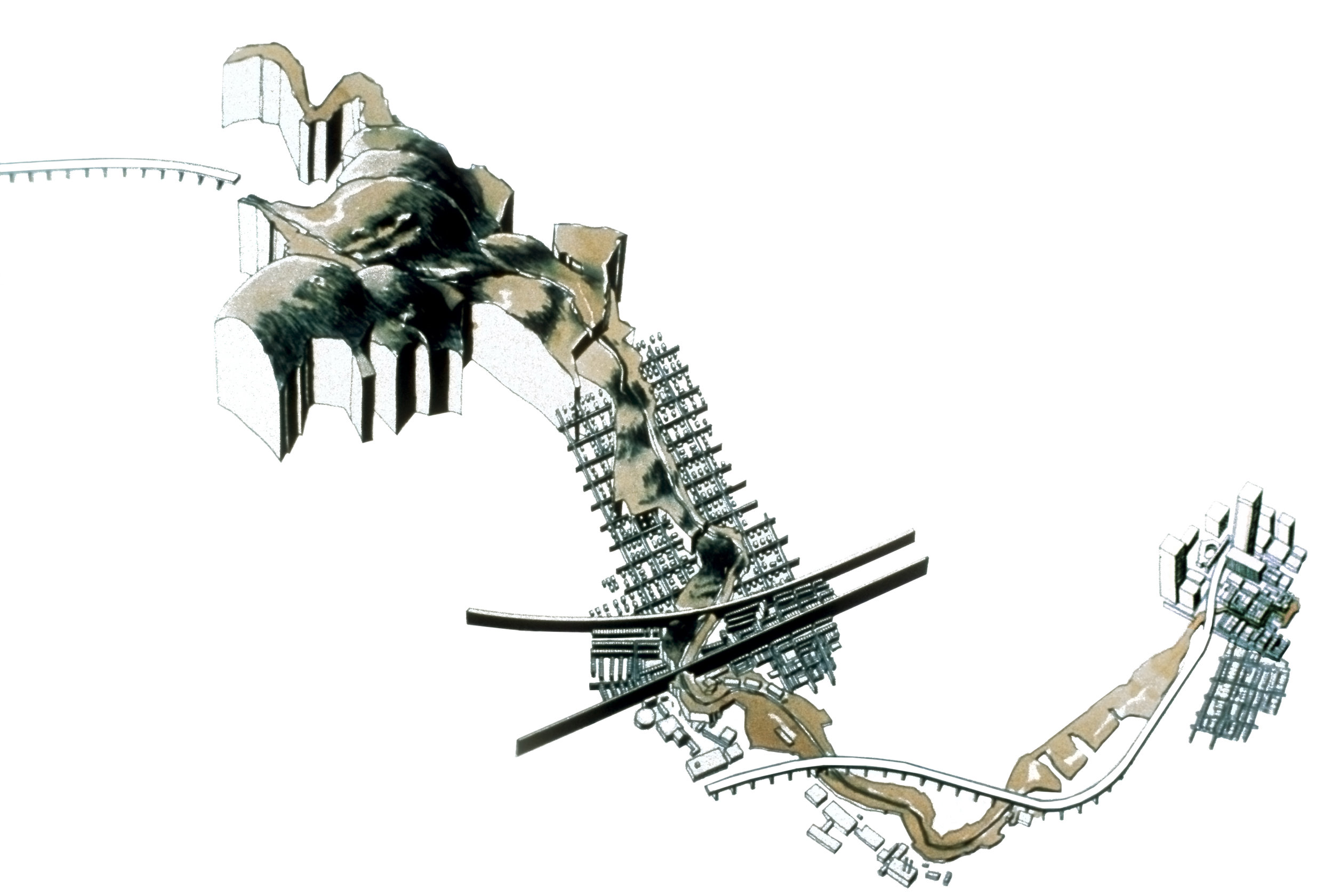
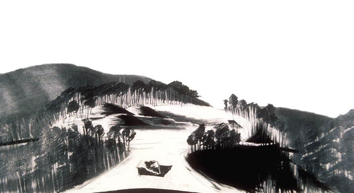
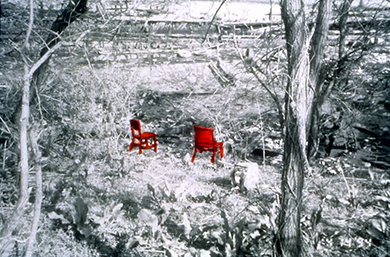
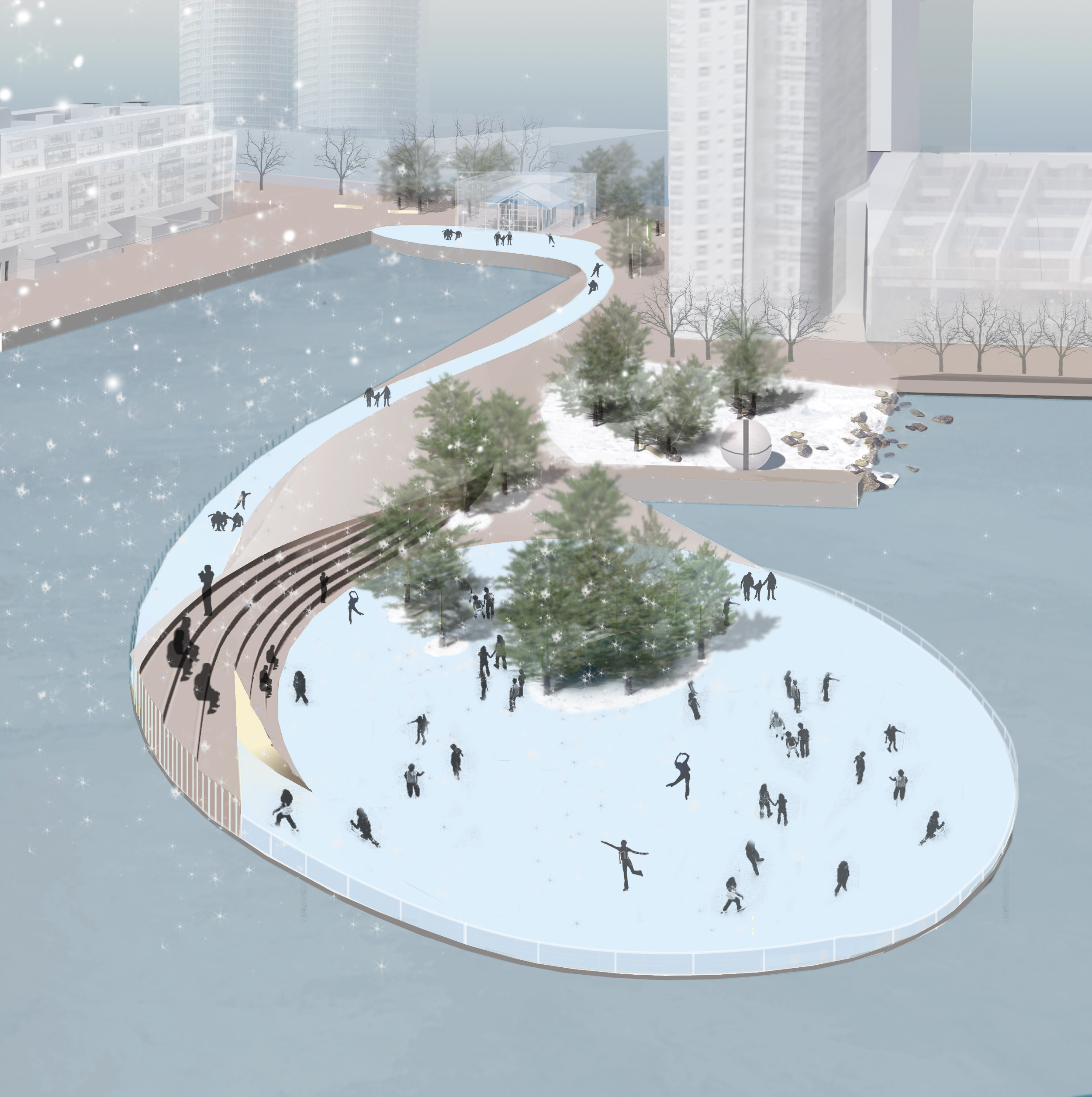
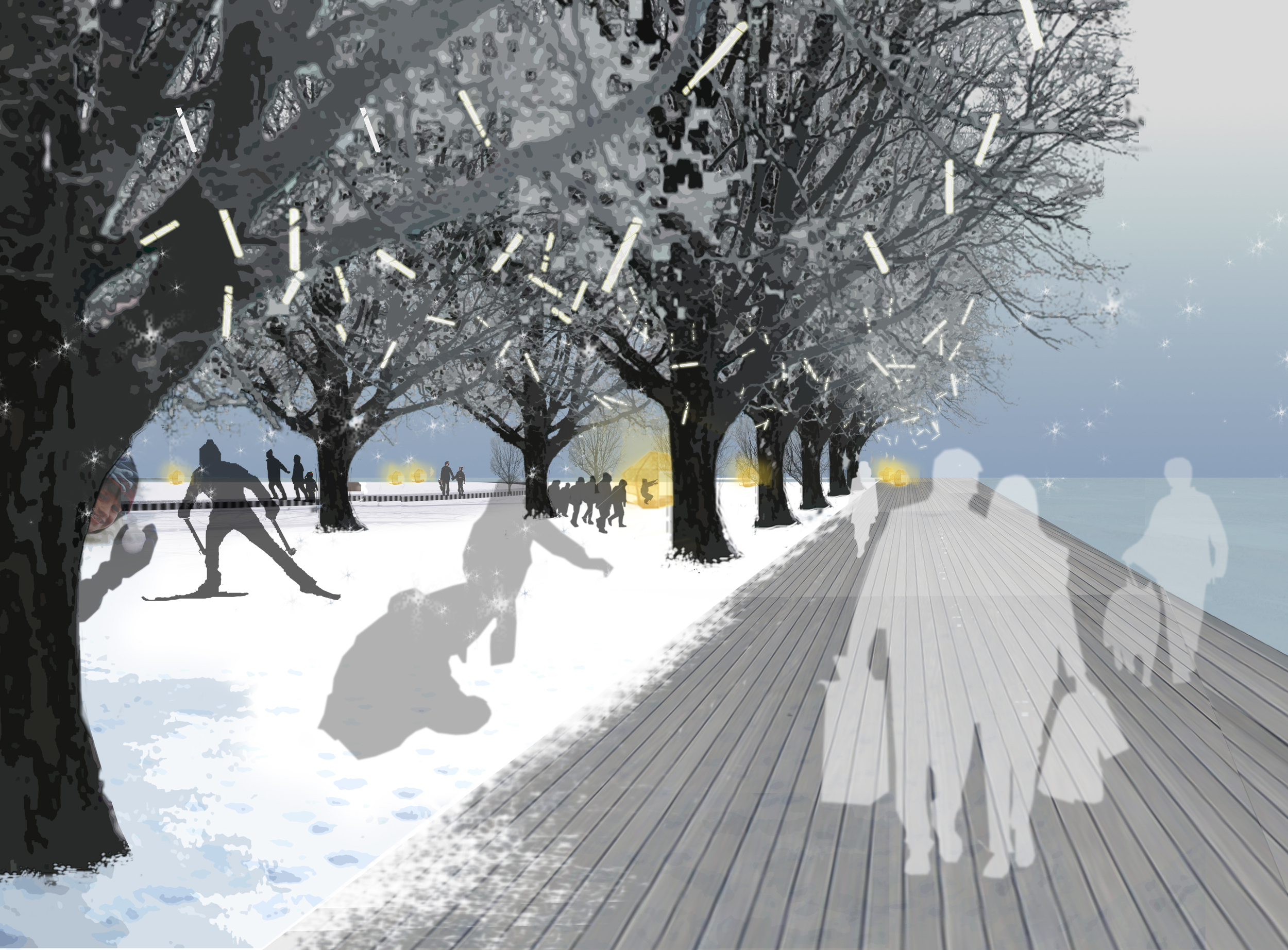
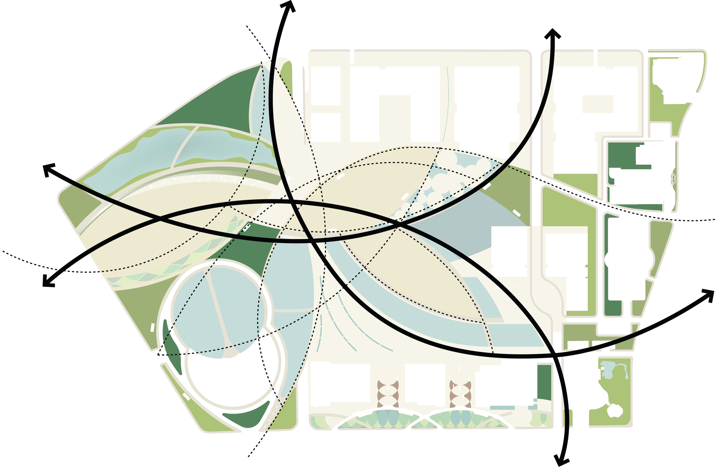
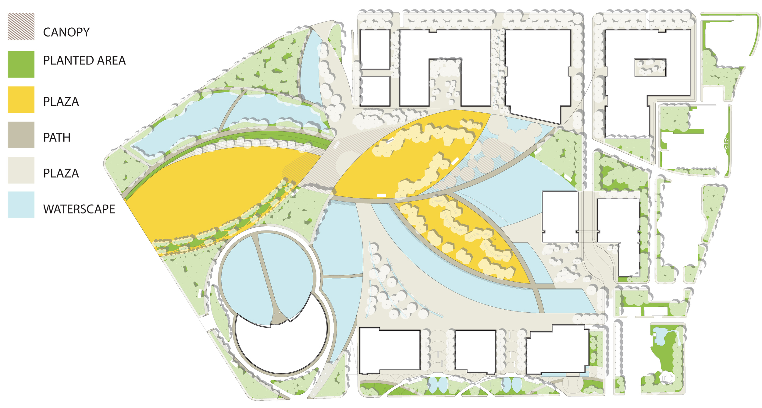
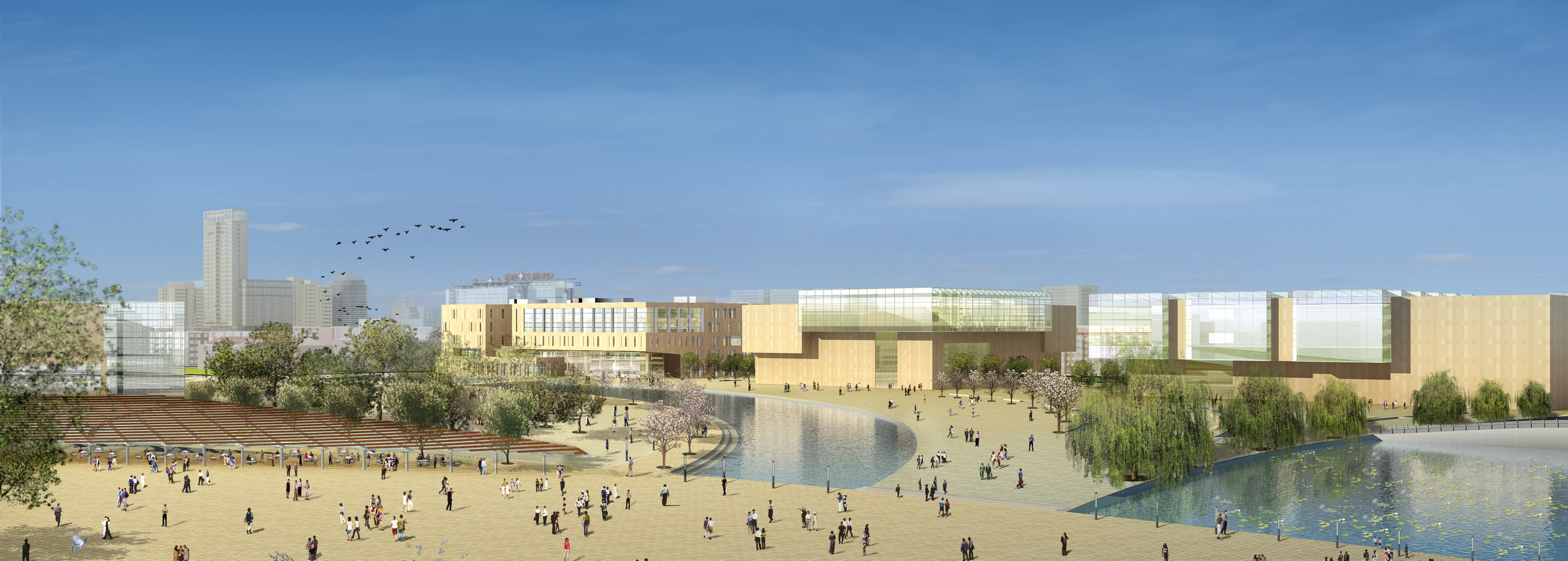
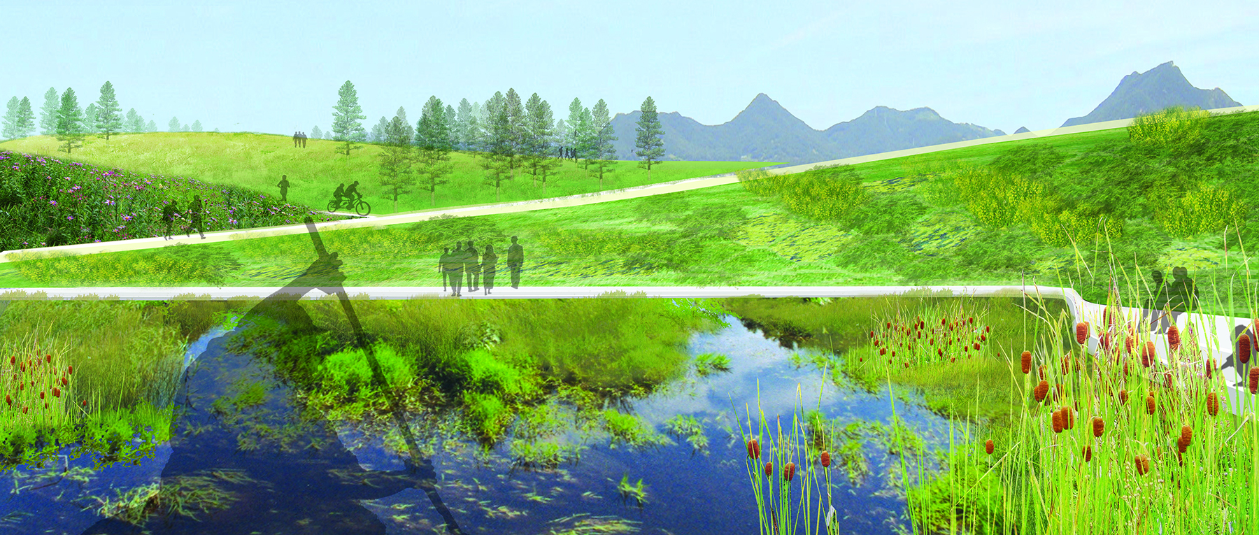
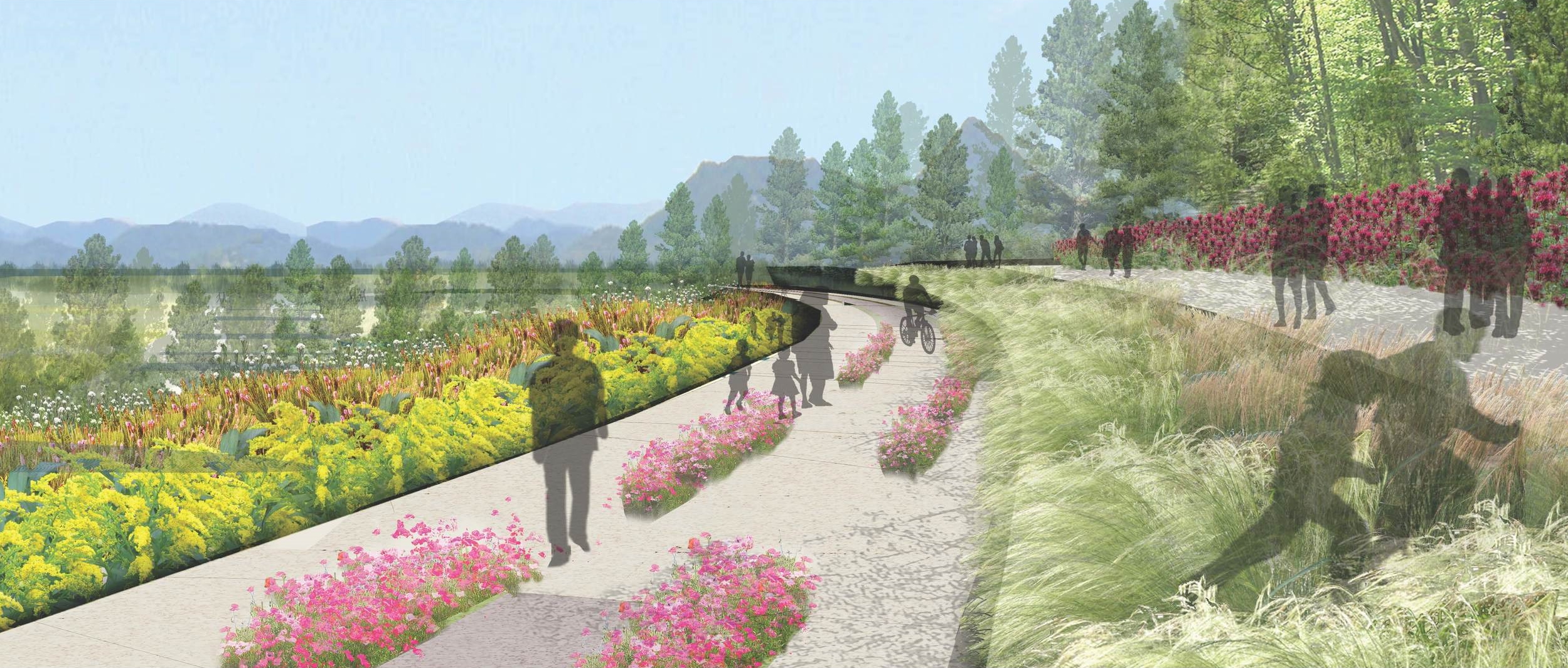
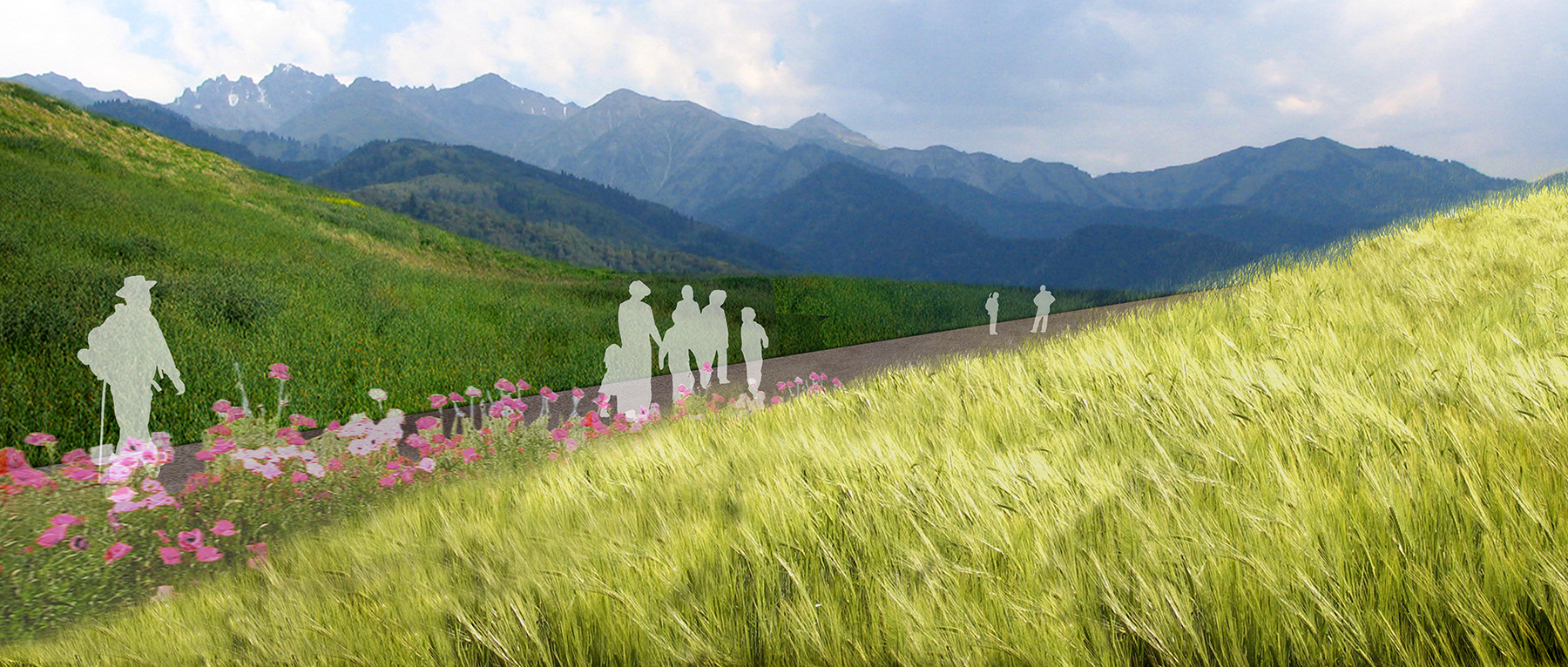
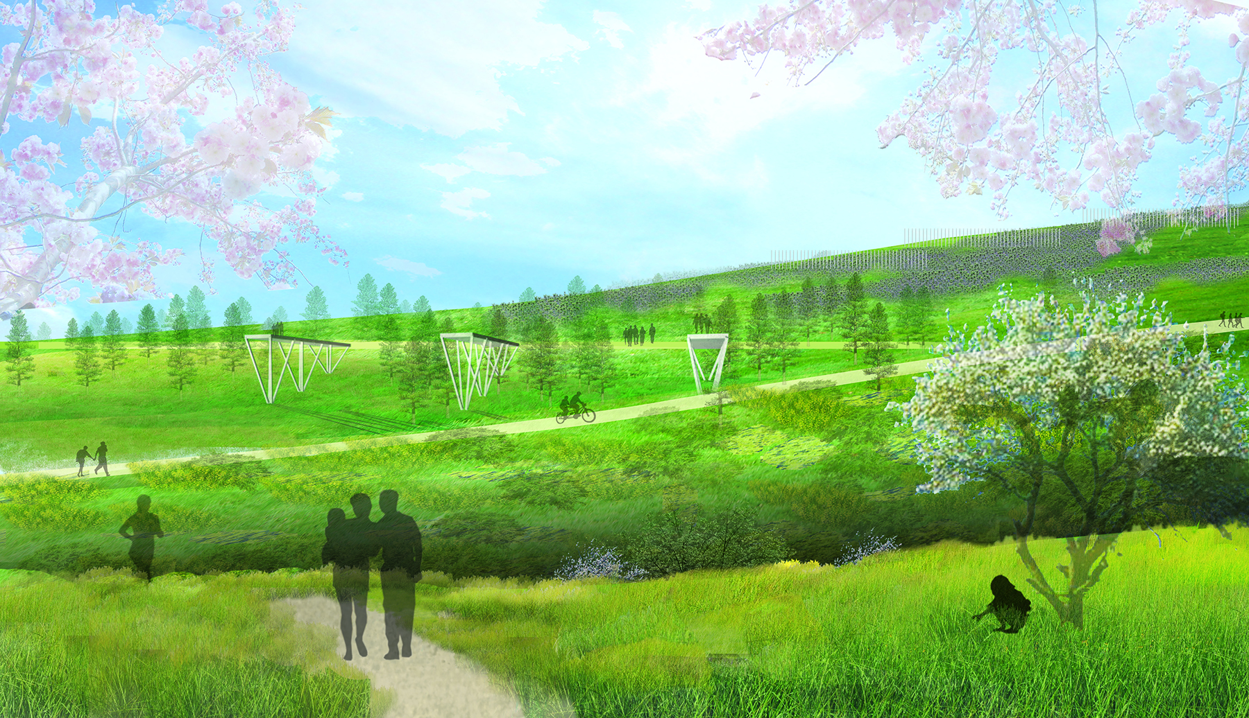
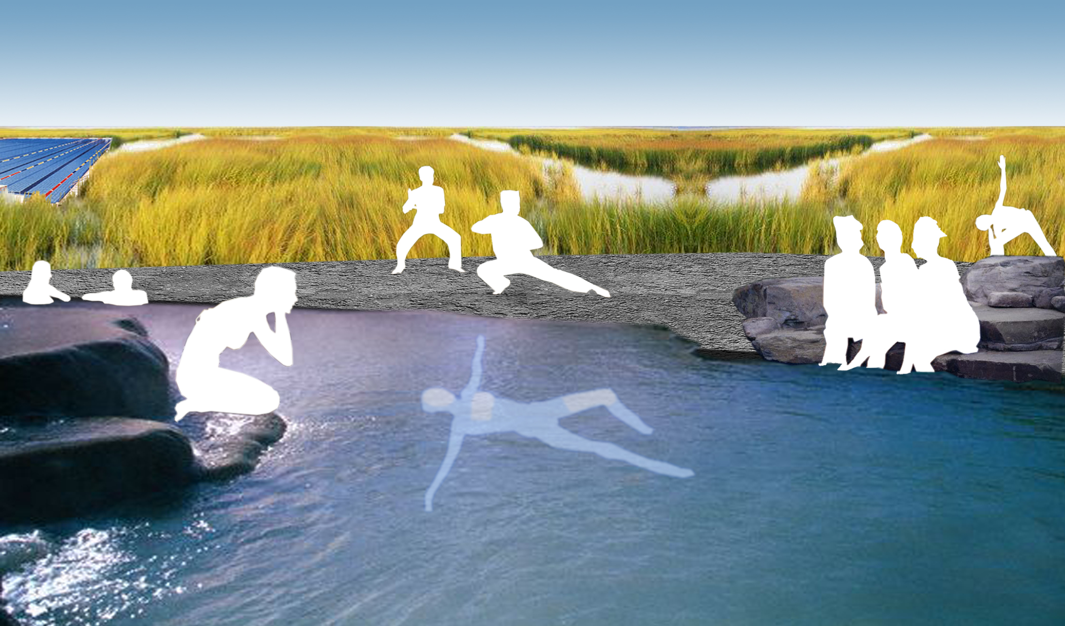
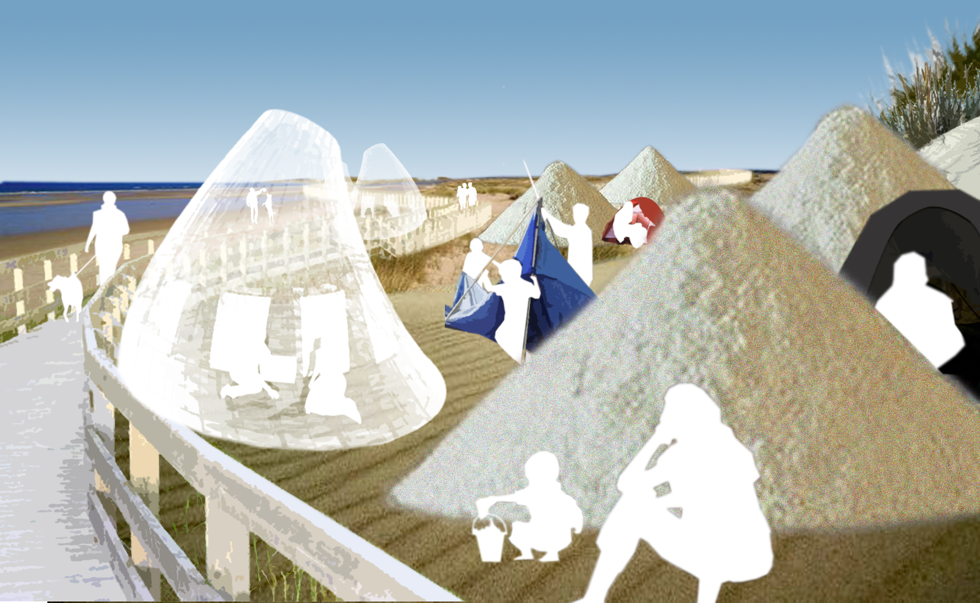
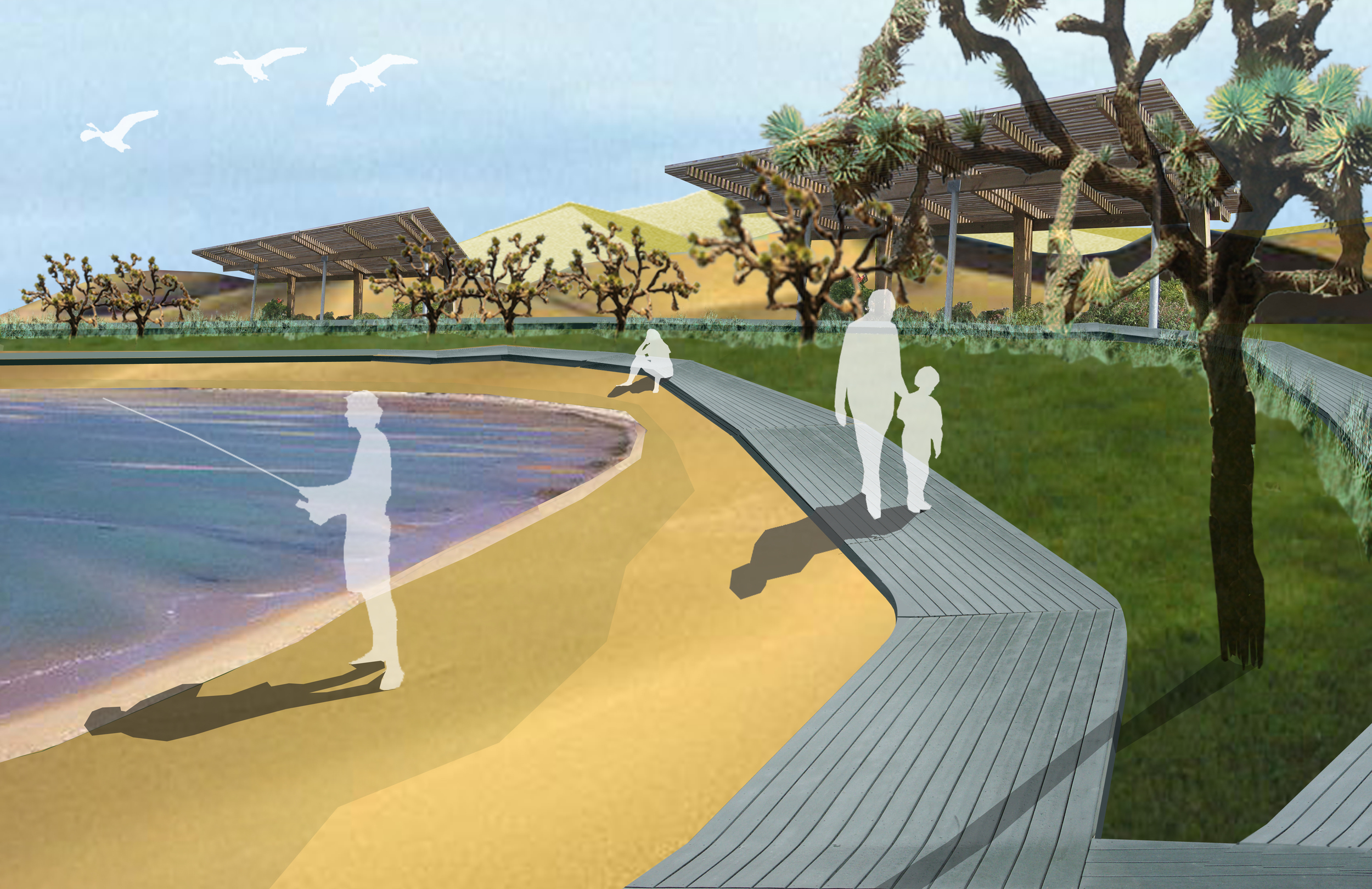
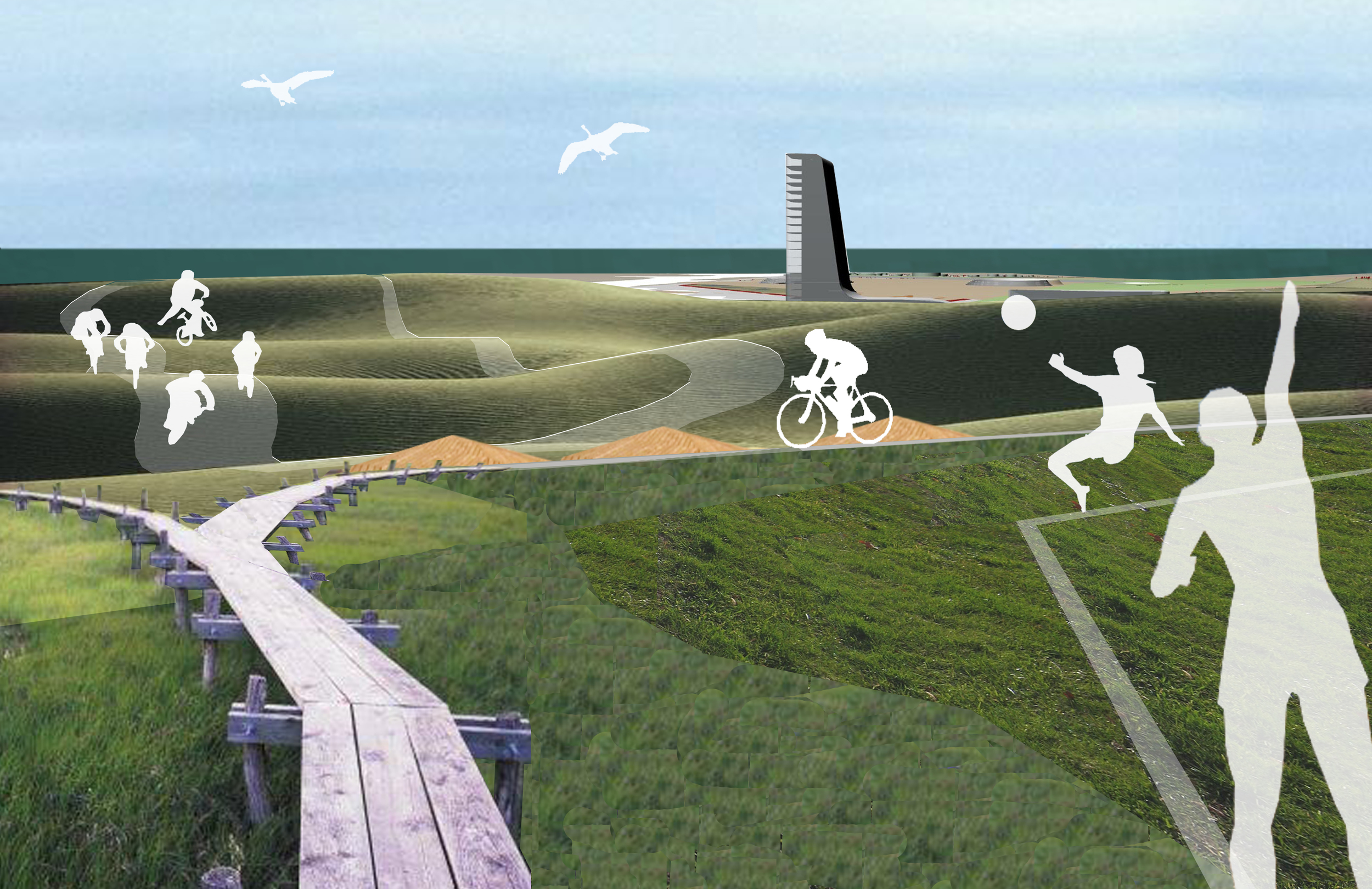
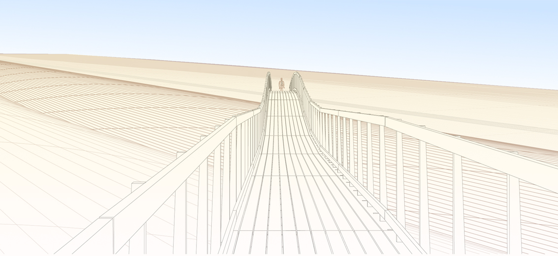
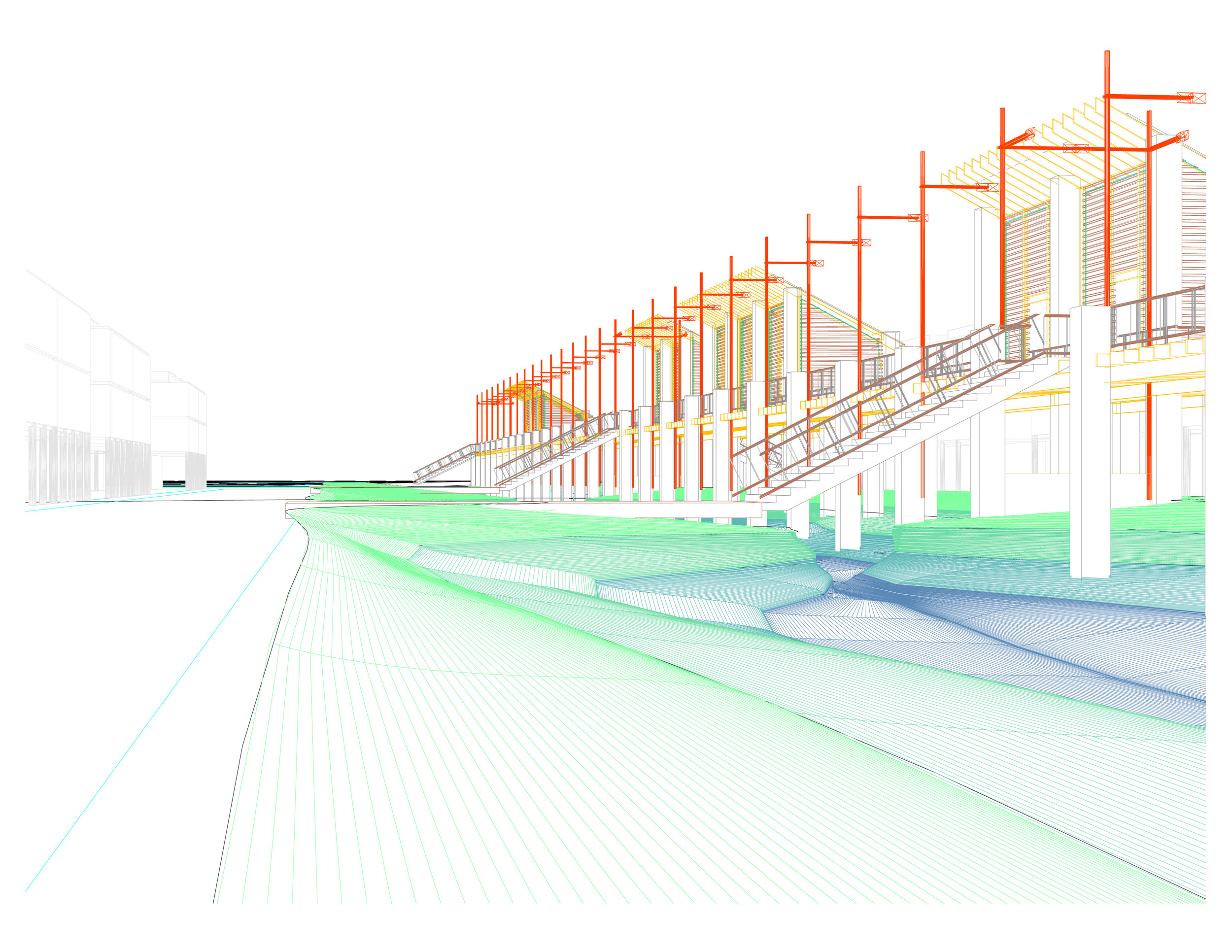
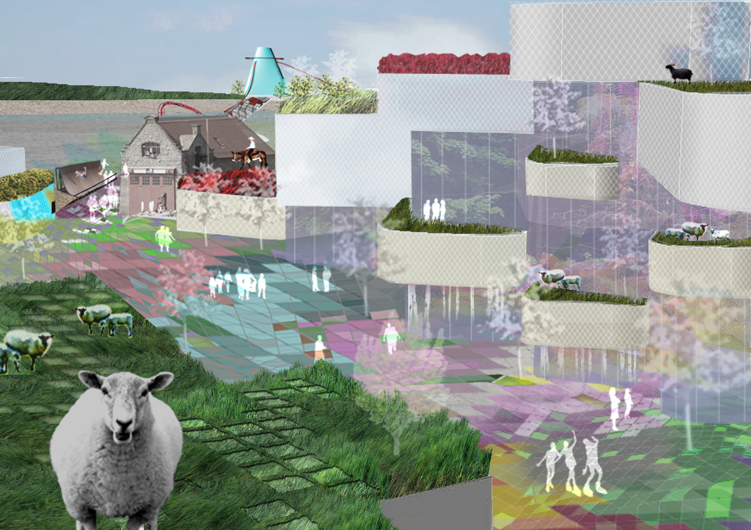
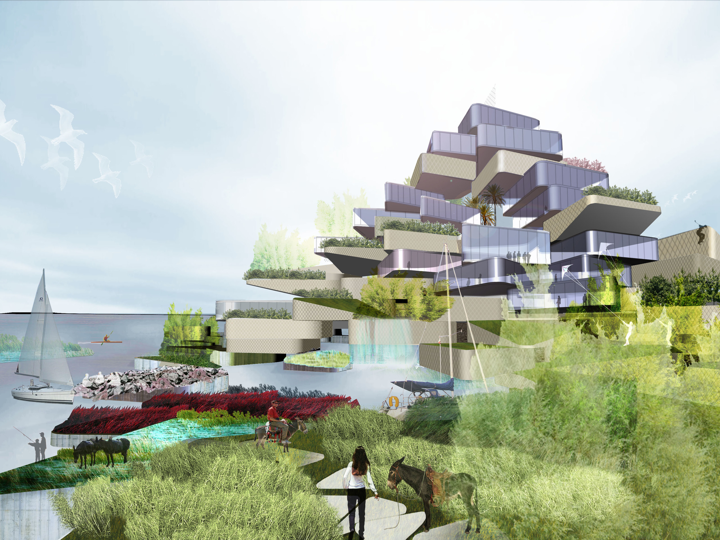
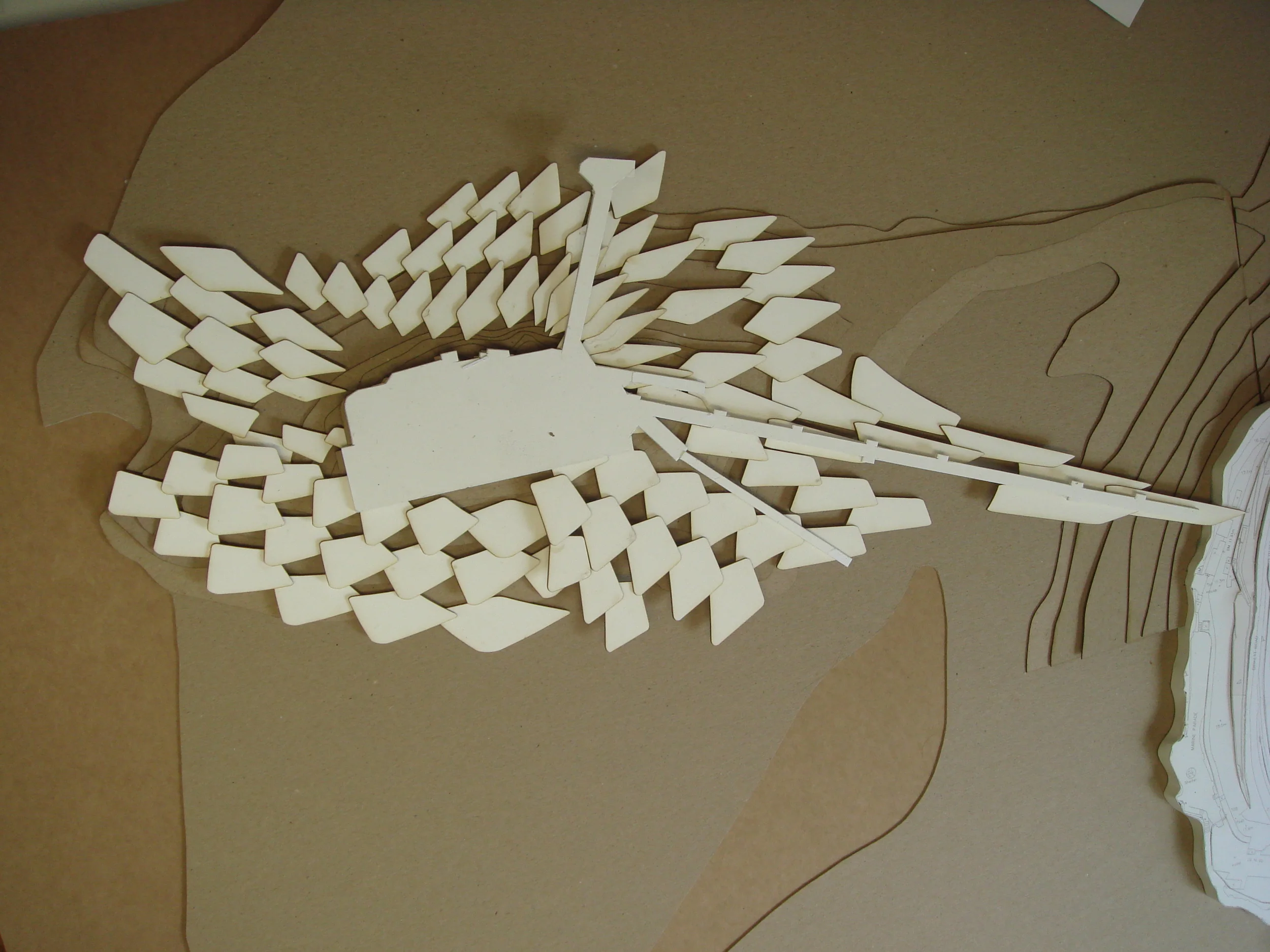
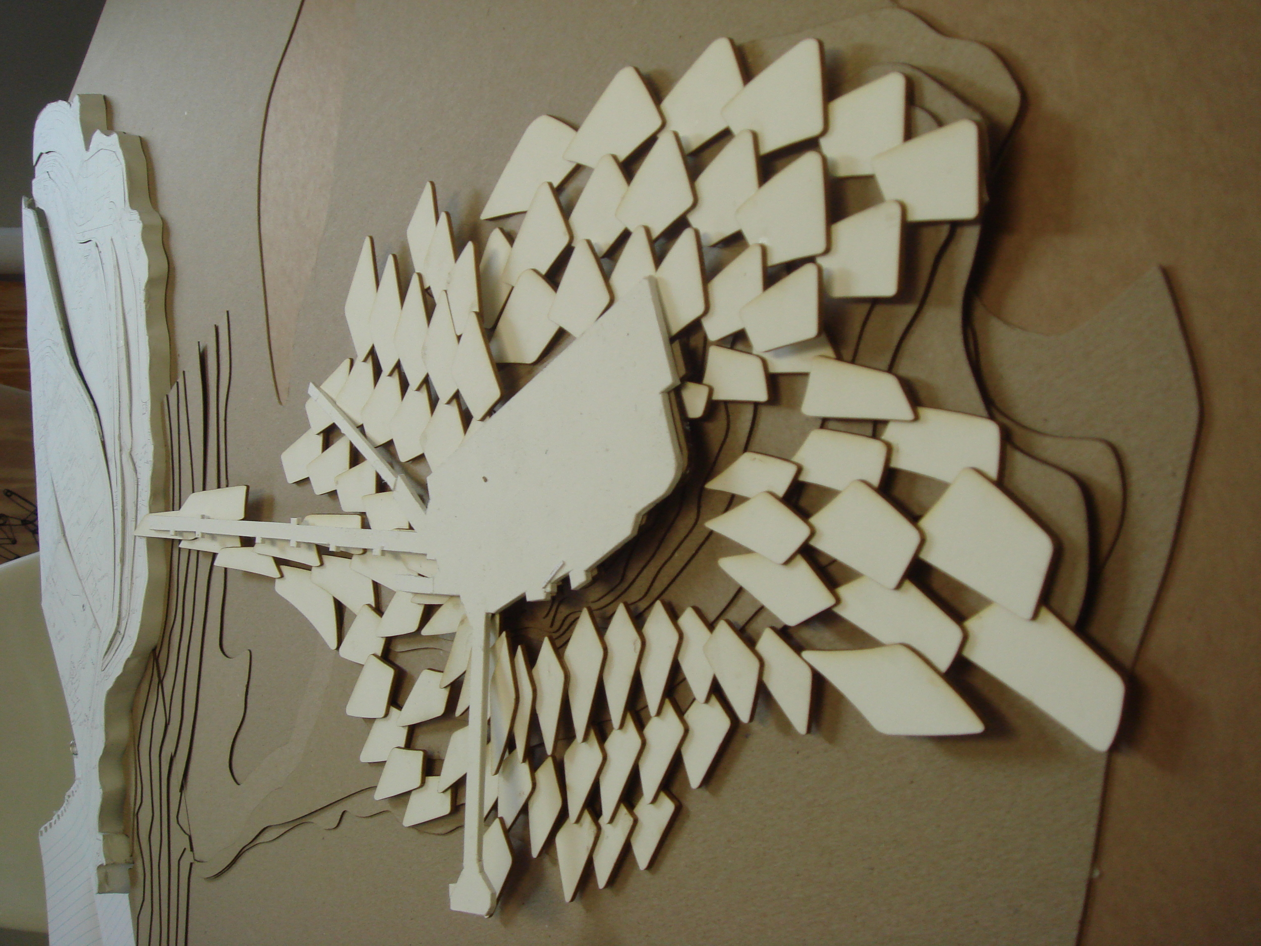
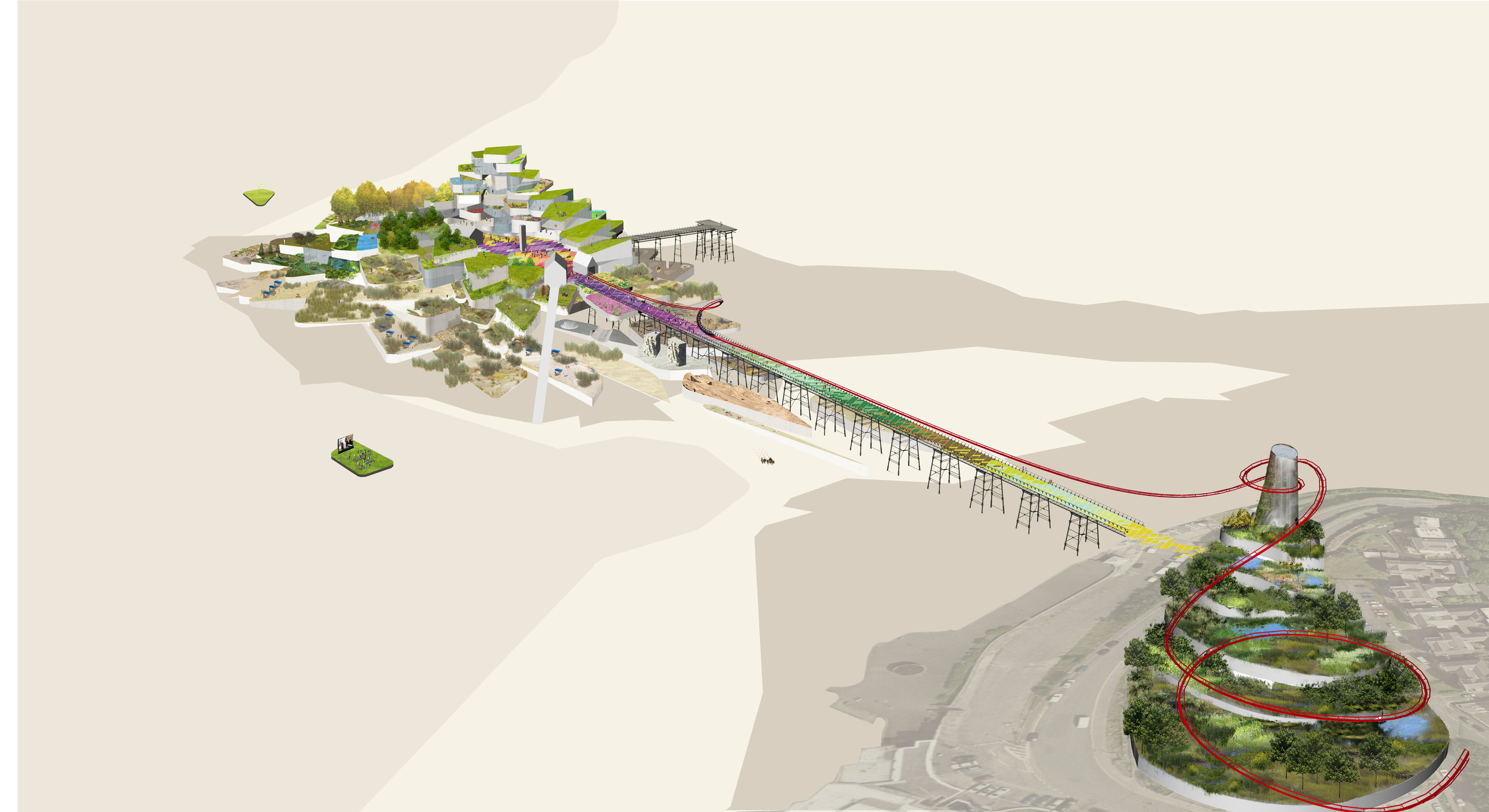
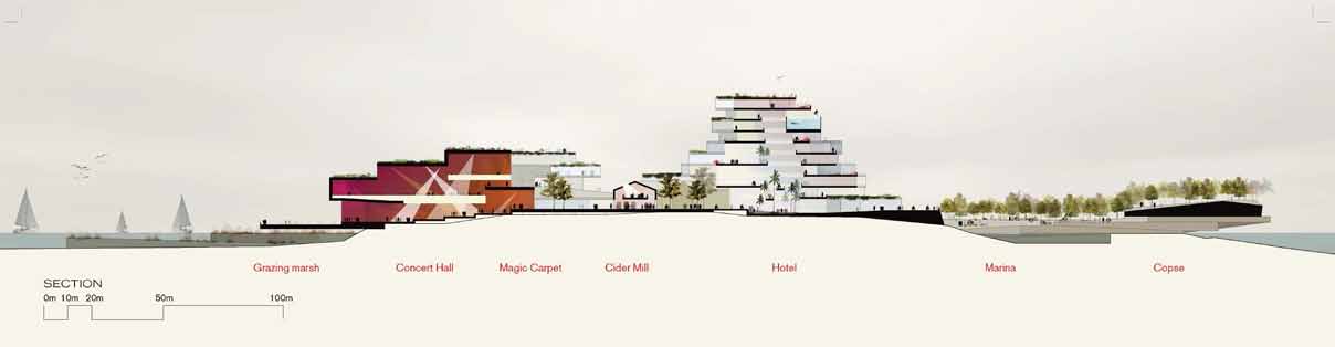
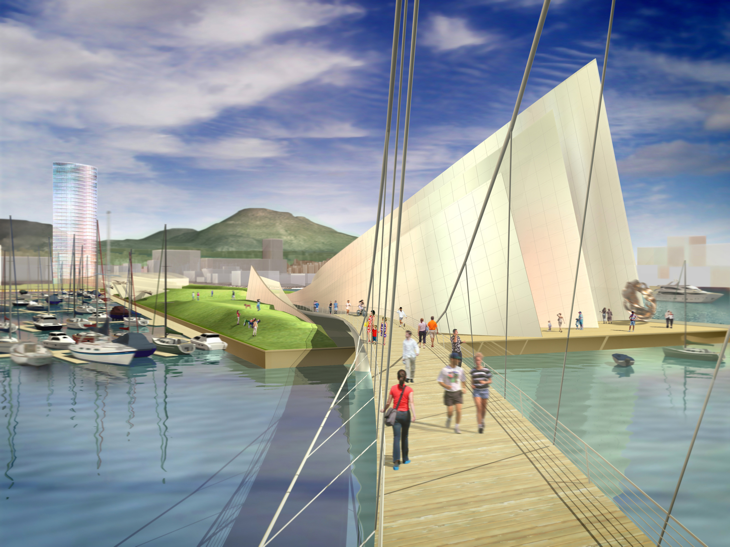
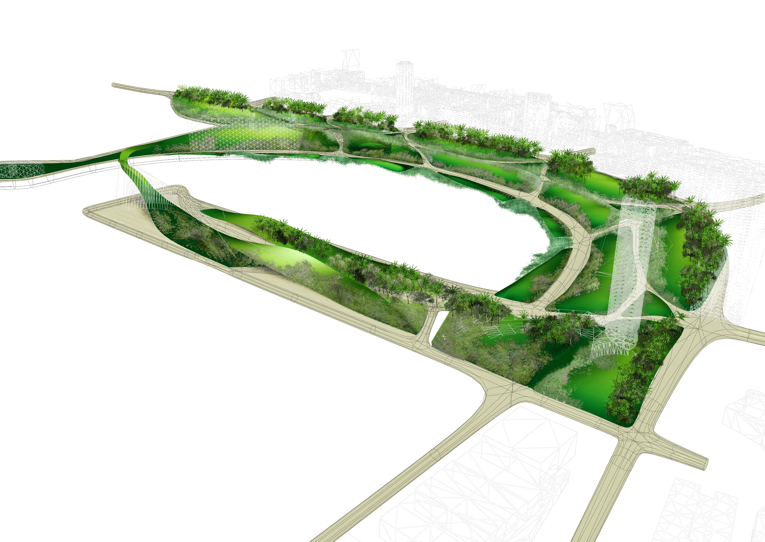
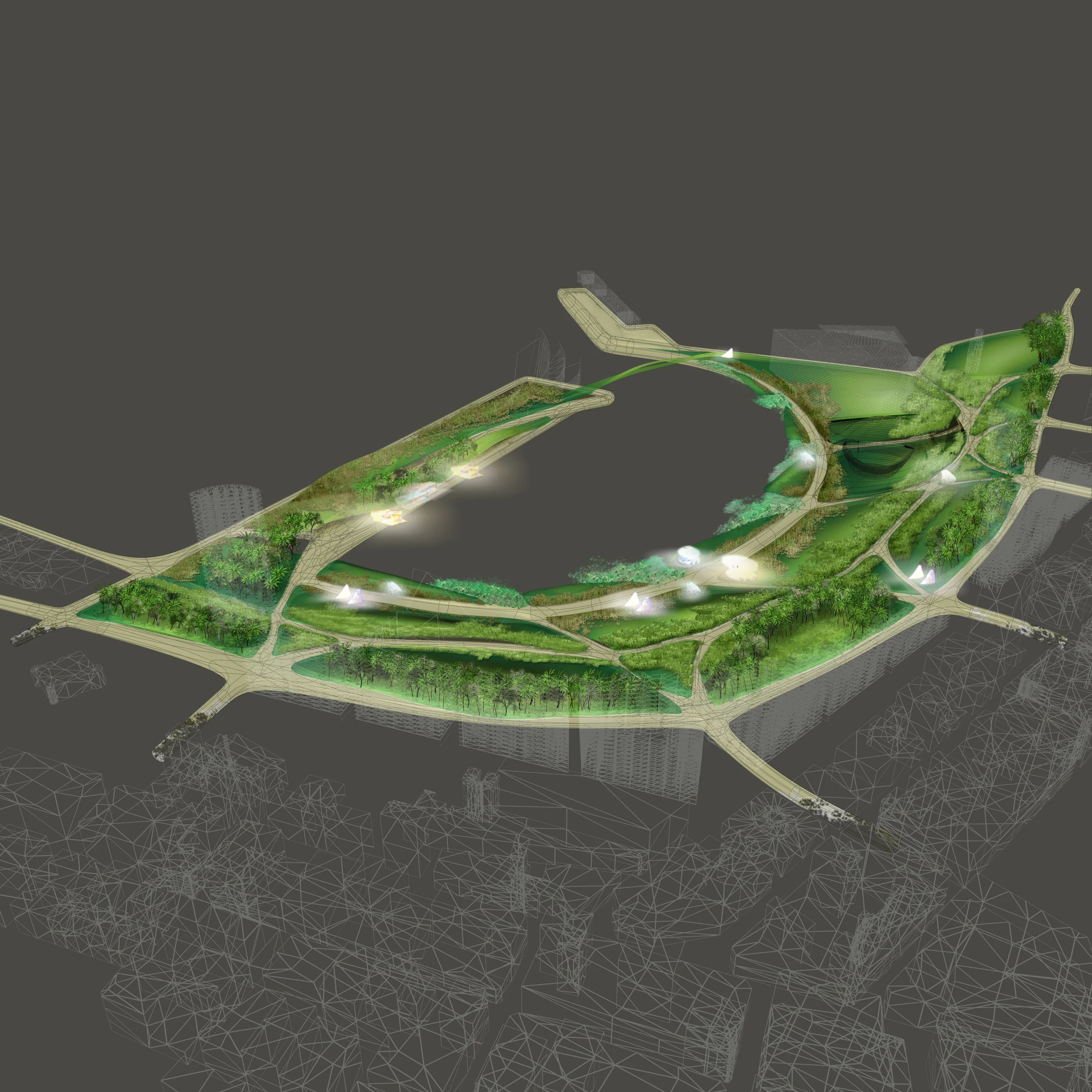
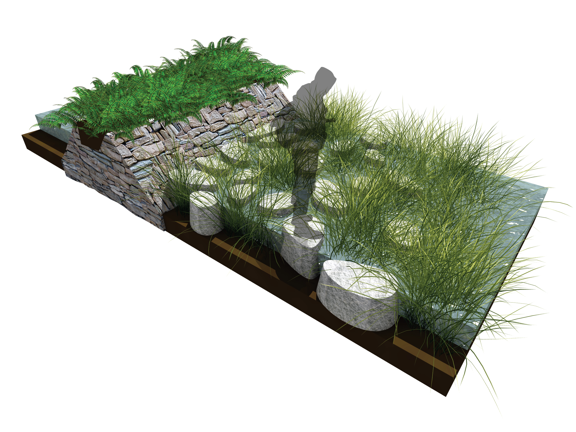
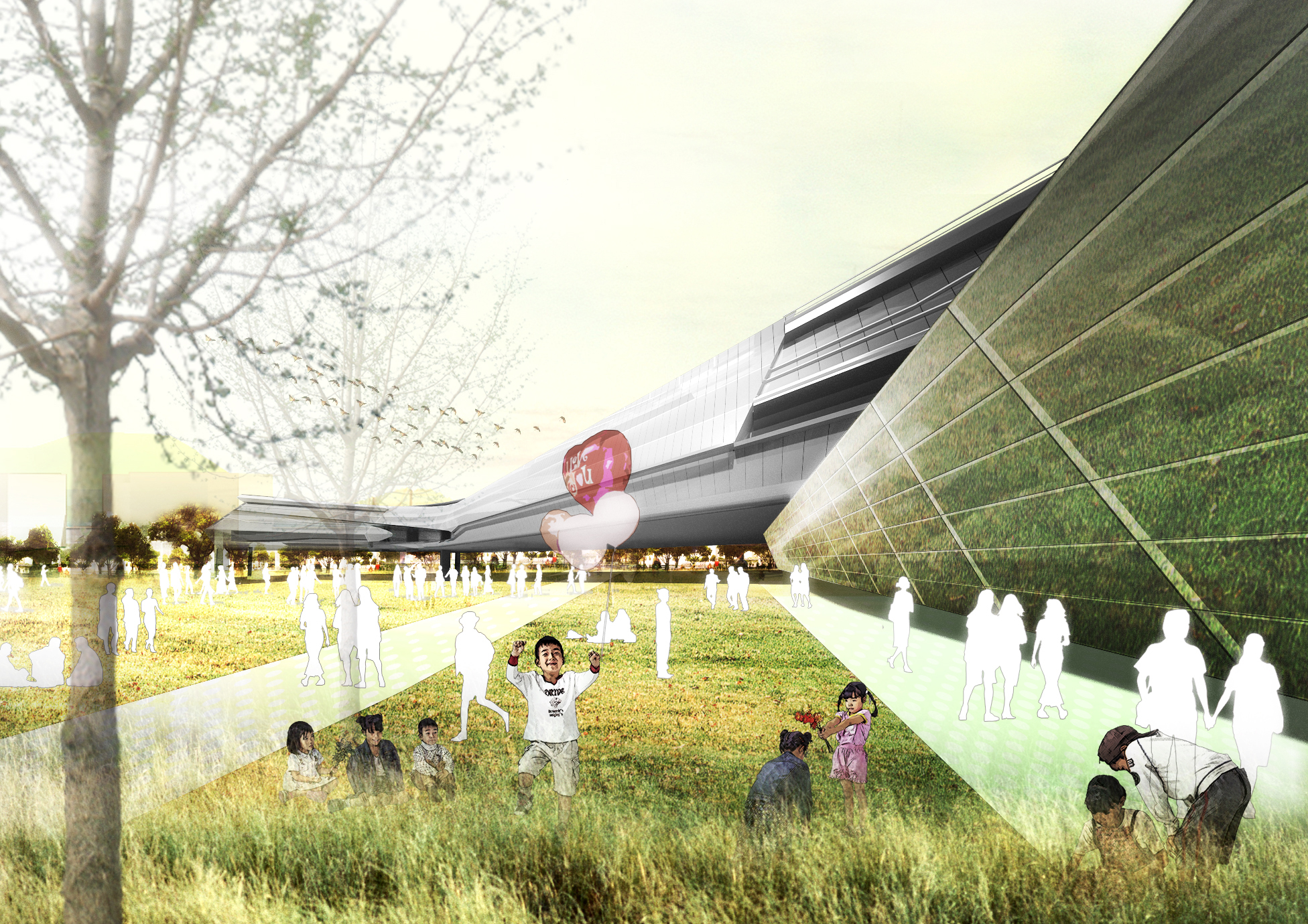
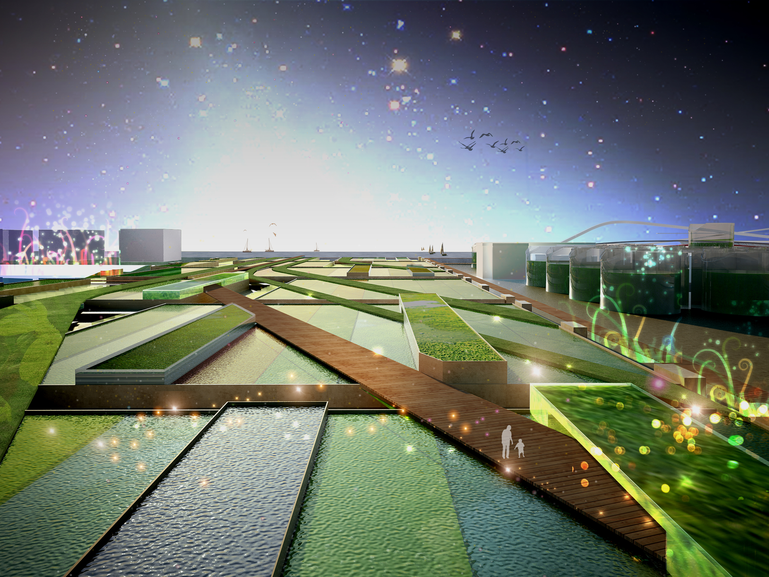
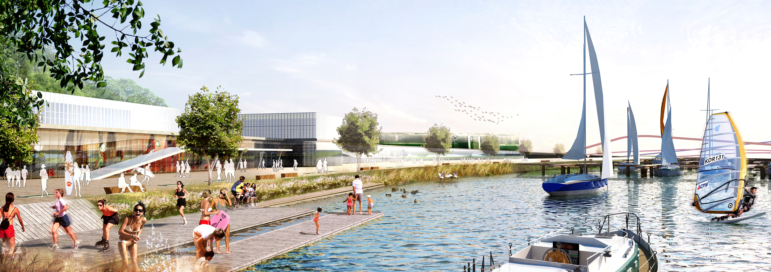
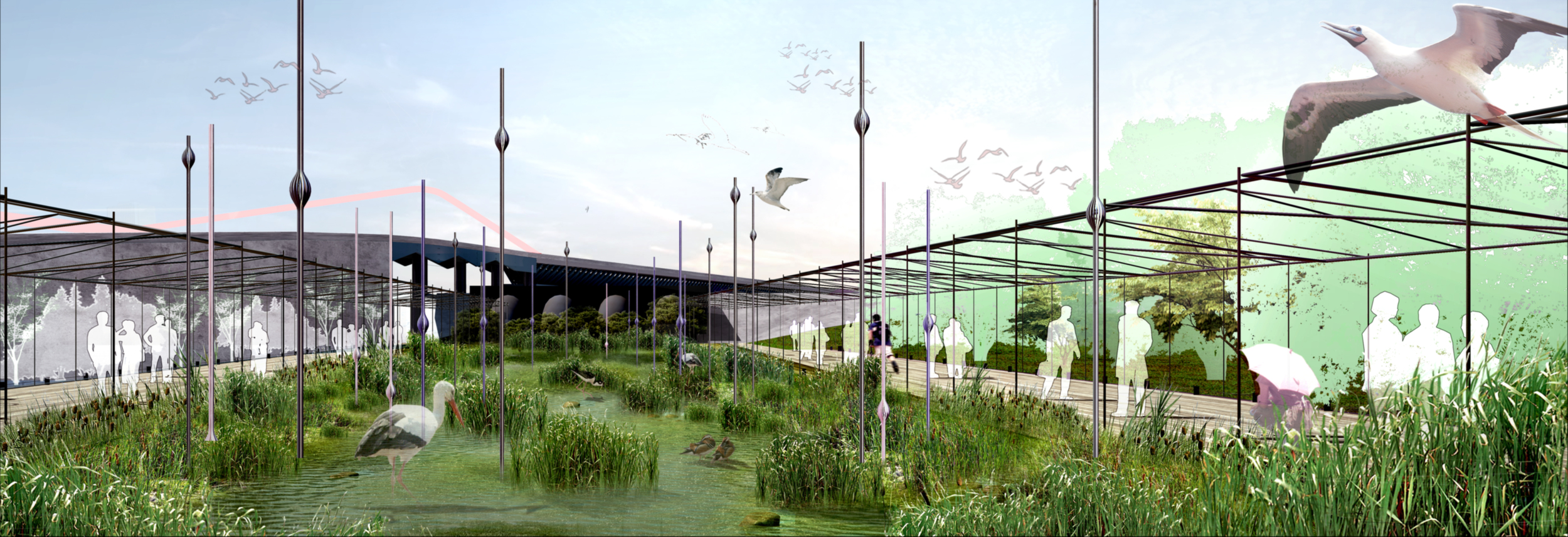
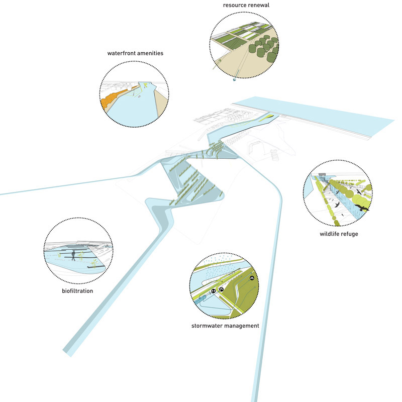
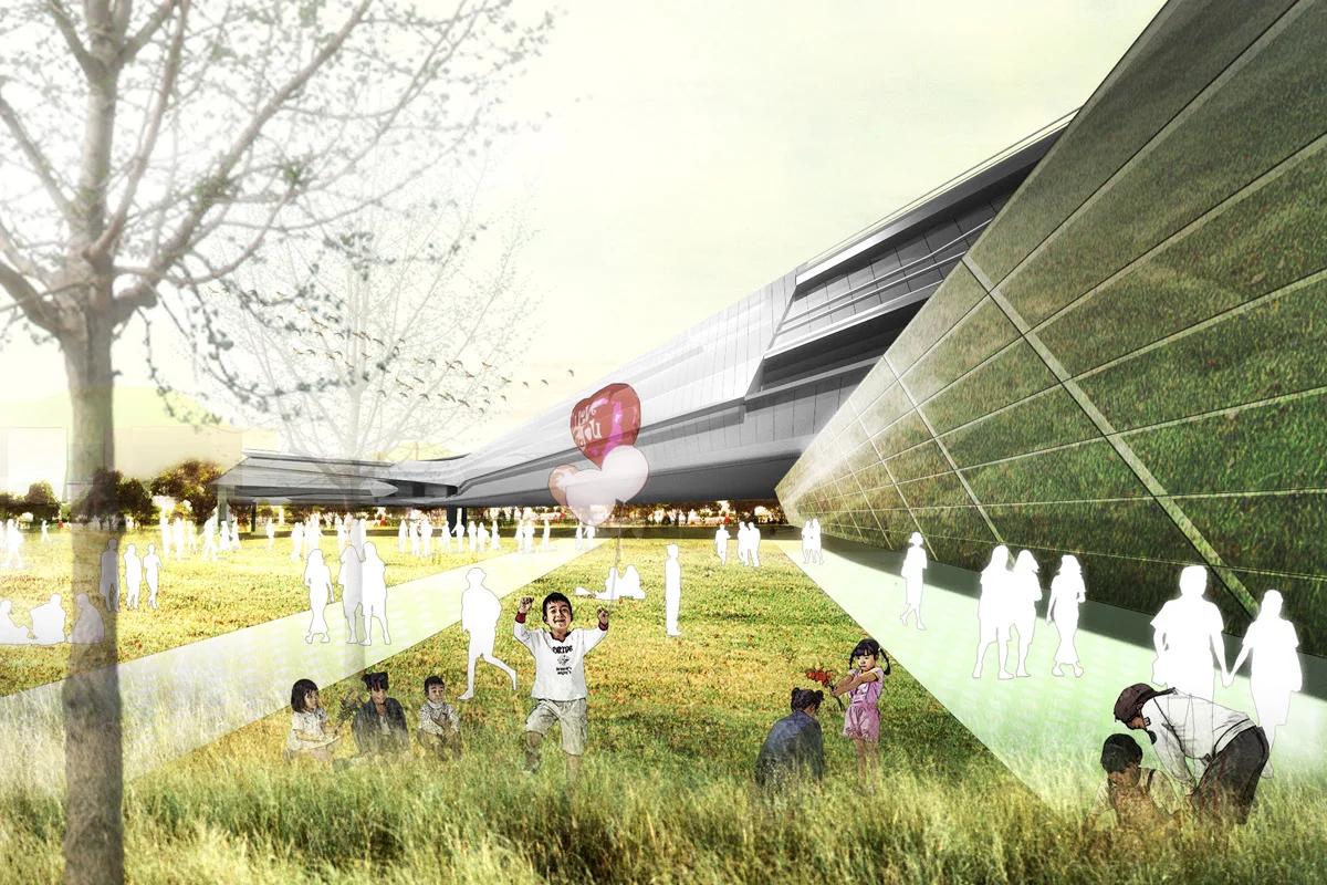
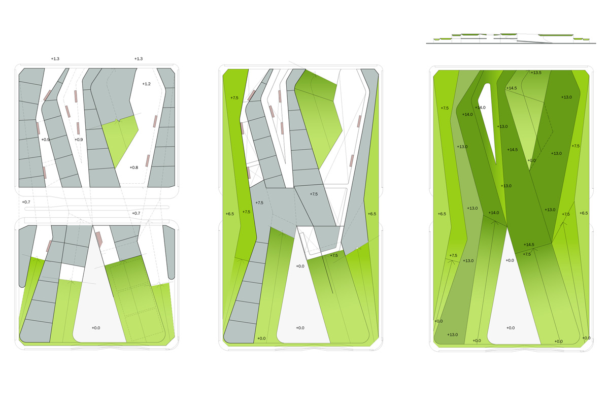
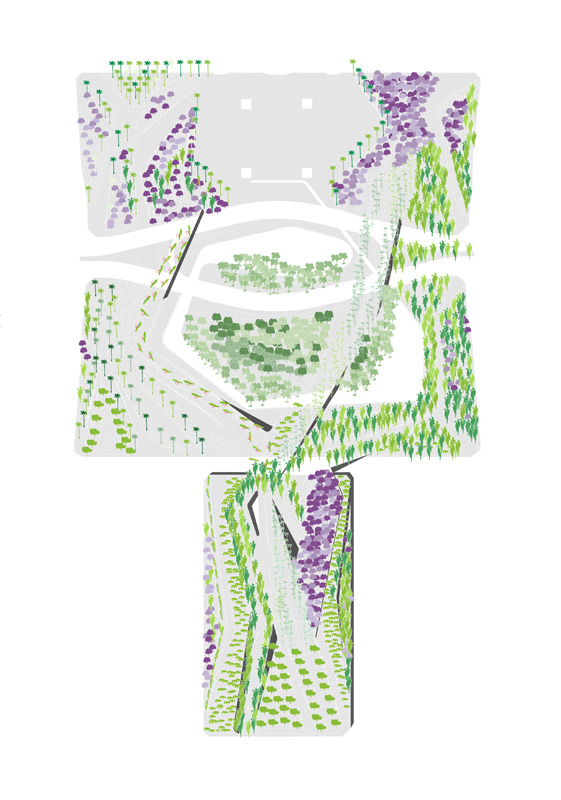
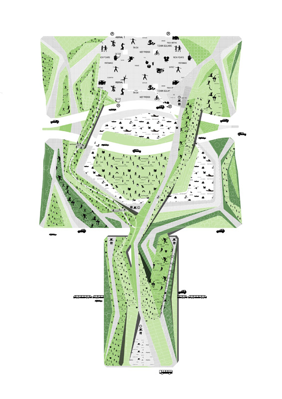
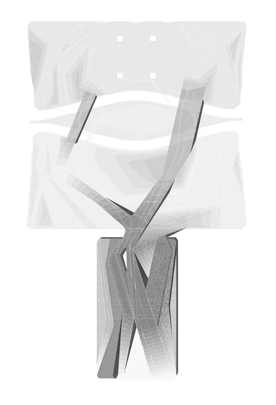
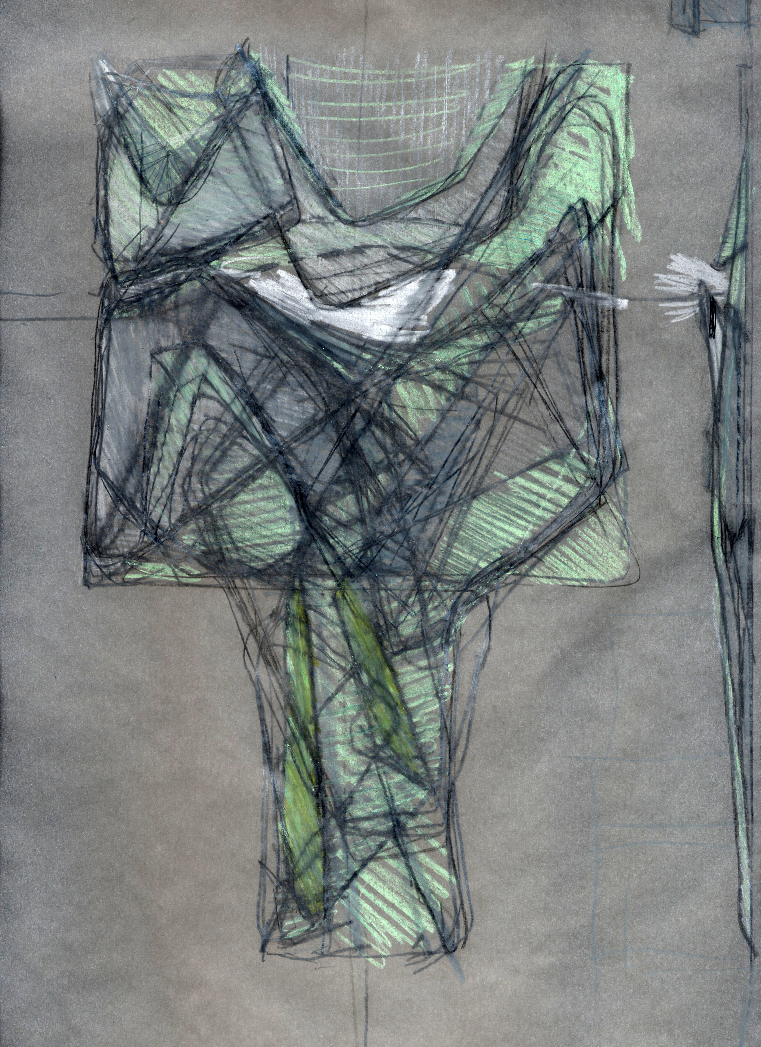
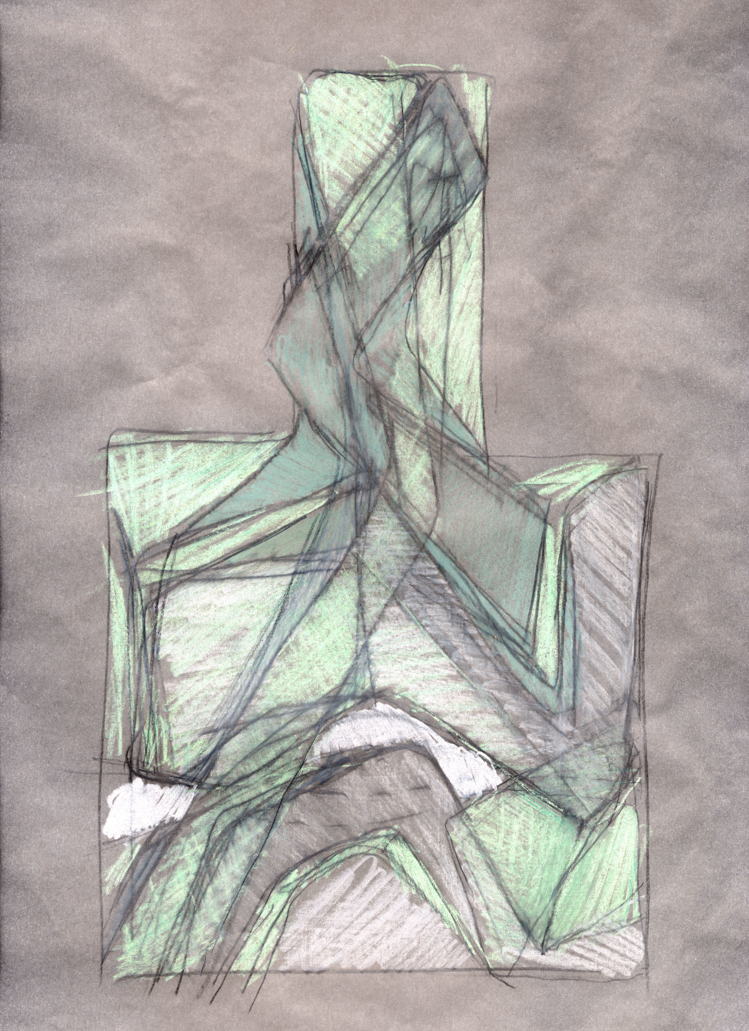
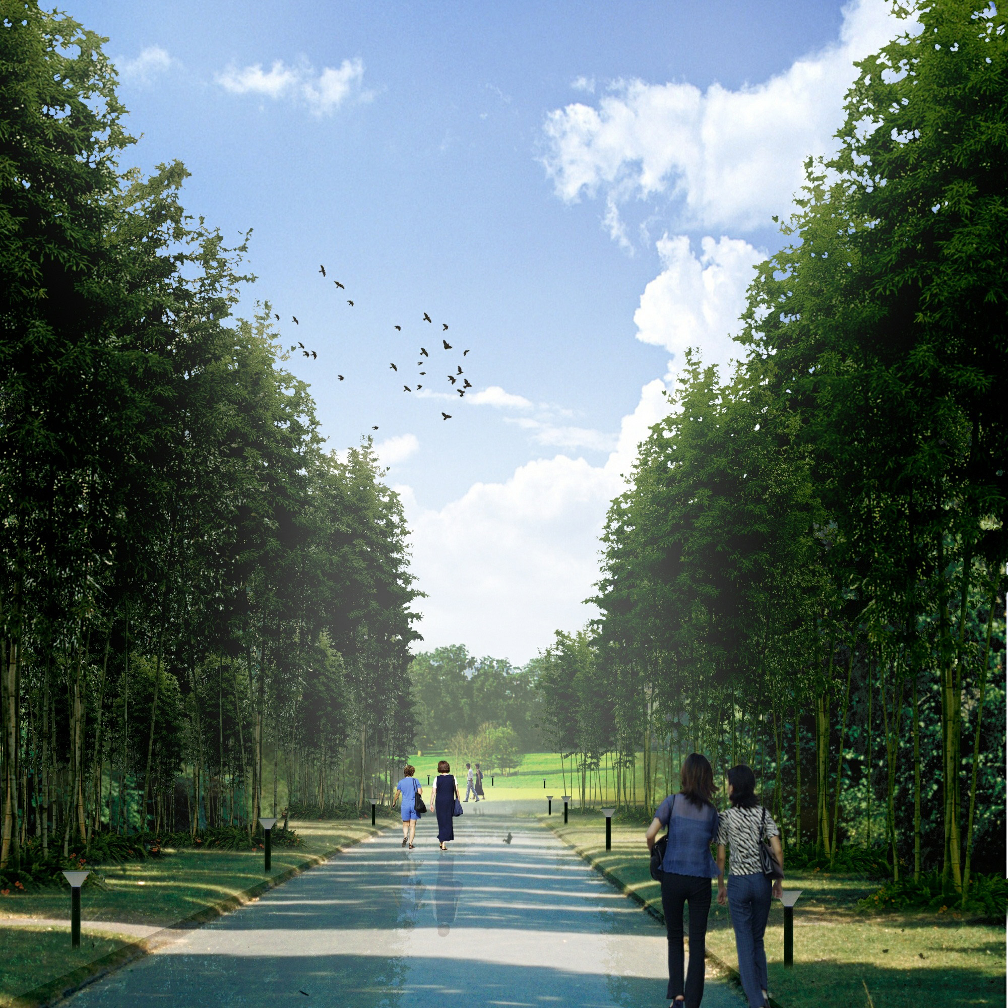
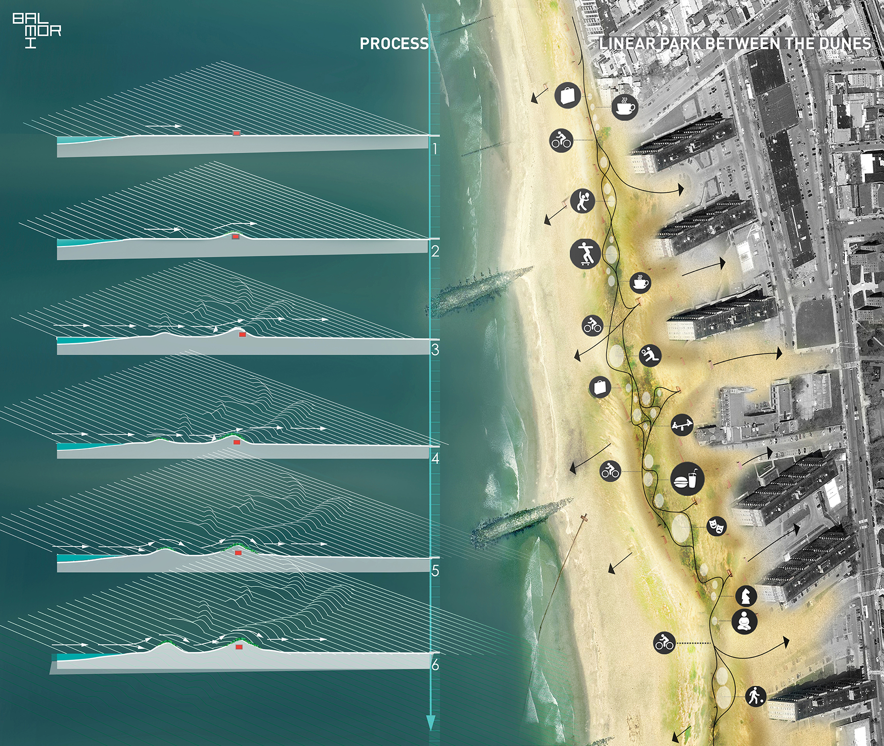
Balmori’s “Occupy the Dune” was among the twenty-five proposals exhibited on Rockaway Beach. Balmori proposed an infrastructure as the center for civic activity, capable of protecting the community while connecting it socially and ecologically. Vegetation that colonizes the dunes surface is the most critical part of the ecosystem, adding strength and stability against extreme blunt winds and storm surge. Many inhabited coastal areas have flat beaches that leave the city exposed to violent storm events. Creating dunes makes these areas more resilient, but can separate the community from the coastal landscape. The protected area formed between the primary and secondary dunes is less sensitive, allowing this interstitial space to become a linear park capable of hosting an array of civic and recreational activities.

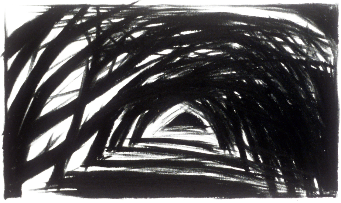
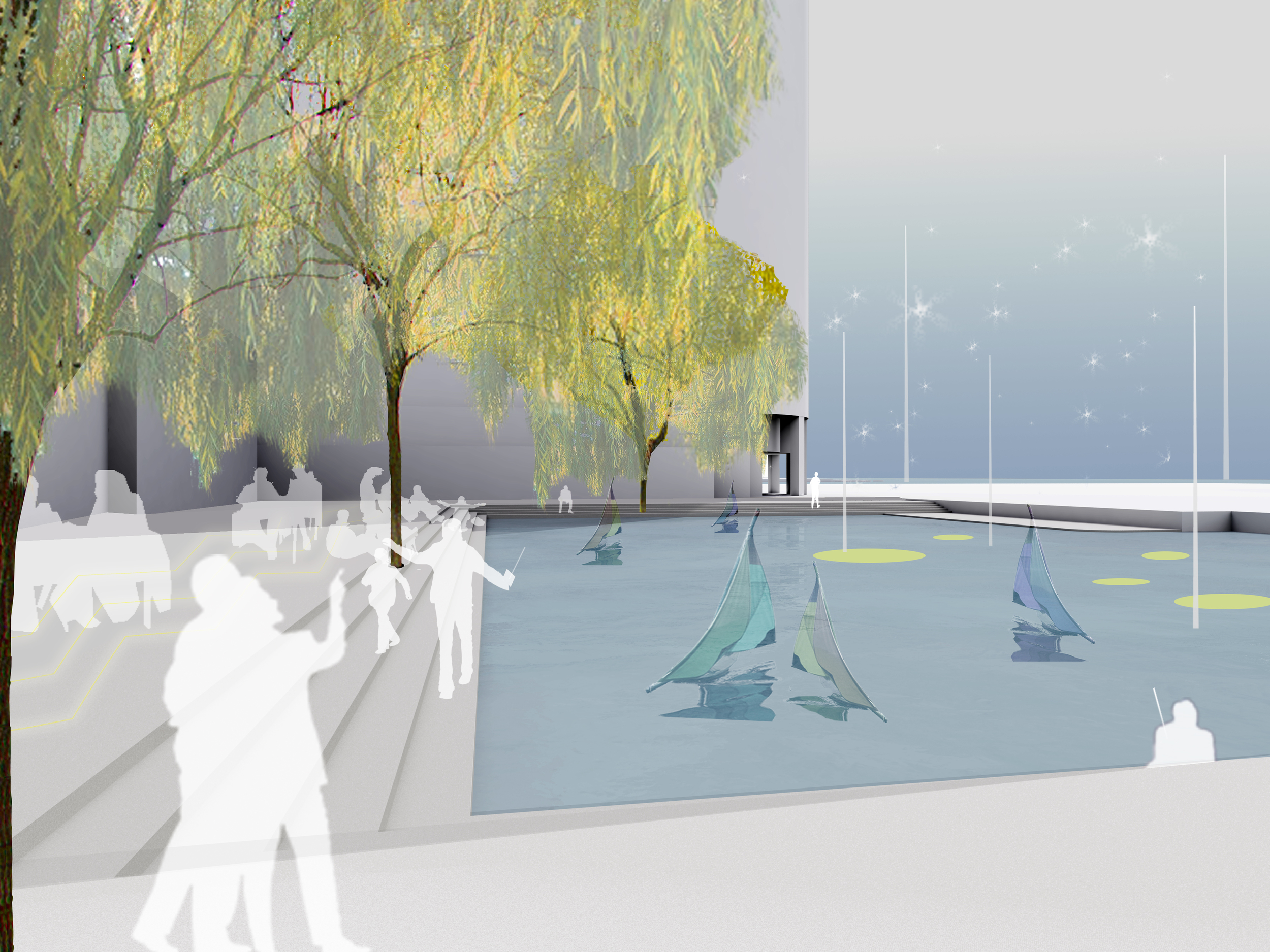
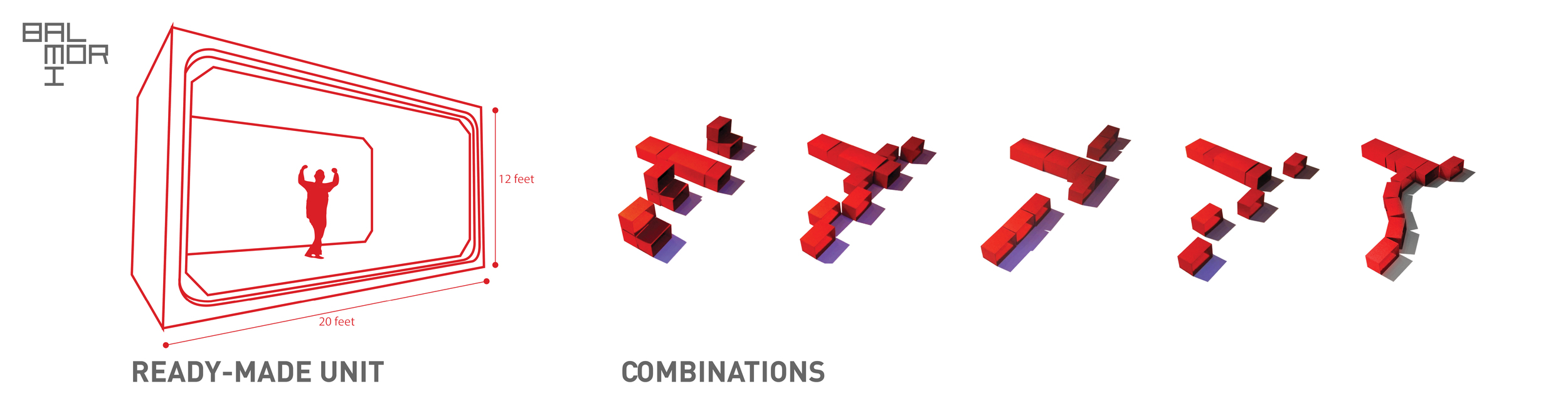
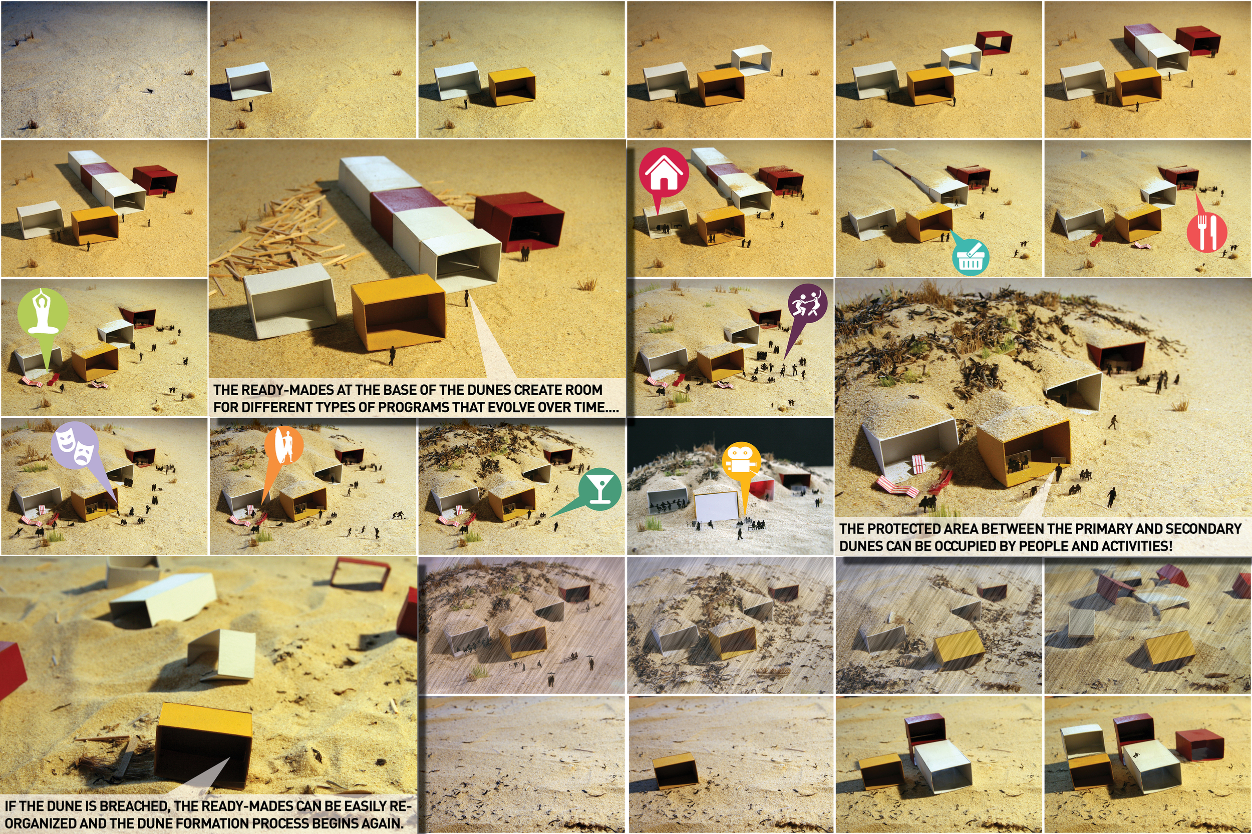
Prefabricated concrete storm drainage boxes are used to create void spaces in the base of the dunes, leaving room for different types of programs that can evolve over time. The flexible void spaces can accommodate temporary housing for displaced residents, community activities, cabanas, cafes, retail shops, and can act as passages between city and coastal landscape.

AWARDS: Winning Proposal, Moma PS1 - Rockaway Call for Ideas

PRESS: ArchDaily

Parque Del Rio

Medellin, Colombia

Parque Del Rio

Medellin, Colombia

CLIENT China Vanke Co.Ltd / STATUS Proposal / DESIGN TEAM Balmori Associates, Studio Area 4

Imagine a city that takes its river channeled, it revives two water systems, crosses and recruza with beautiful bridges intertwined with parks in its entirety and intertwines all social groups equally at the same time. Imagine that and think if any other city capable of creating this intense set of transport, water, park and bridges; all twisted together and made one set. Venice and invented a creative solution to their situation that became the world's most beautiful city, Medellin has the opportunity to become a unique and beautiful city overhauling the things you need without wasting anything.

The Gwynns Fall Trail Masterplan

1995 - Baltimore, MD, USA

The Gwynns Fall Trail Masterplan

Baltimore, MD, USA

CLIENT The Trust for Public Land, City of Baltimore Department of Recreation of Parks / STATUS Completed 1995 / SIZE 14 miles / DESIGN TEAM Balmori Associates, Meg Webster, Jonathan Fishman Architects, Edward Orser, Paul Barten, Kirsten MacDougall

Restoration of a stream established connections between the diverse neighborhoods along its path. The Gywnns Falls Trail Masterplan project is a response to community interest in restoring the Gywnns Falls Stream Ecosystem, which had been damaged over time by industrial pollution, illegal dumping, and neglect. The masterplan drew public attention to the stream and its watershed by outlining revitalization strategies, which included educational activities for area public schools and annual public celebrations. The design team consulted with citizens from 16 neighborhoods, 7 Baltimore city agencies and departments, as well as 47 public and private organizations and institutions.

The trail has seven separate segments running through various geographic and cultural areas of Baltimore, Maryland. The proposals were developed with respect to the particular terrain, vegetation, and cultural context of each trail segment.  The masterplan was a comprehensive study outlining recommended designs for trail routes, safety, signage, planting schemes, ecological restoration, and historical features management. In addition, the masterplan explored ethical and environmental procedures for its design and construction, namely eliminating the use of pollutants. This practice helped to produce jobs for the surrounding communities and was integrated into the educational process of the community.

The Gwynns Falls Trail vision was built on an earlier vision created for open public space in Baltimore.  In 1902, the Baltimore Municipal Art Society commissioned the Olmsted brothers to design a masterplan for Baltimore parks. Completed in 1904, the Olmsted Report recommended that the city acquire three principal stream valleys to protect the watershed from future development; it also envisioned a network of stream valley parks. The Olmsted Report was a starting place for Balmori Associates' evaluation process for urban open space because of its foresight, broad vision and its understanding of parks as an integral part of our cities.

Underline

2015 - Miami, FL, USA

Underline

Miami, FL, USA

CLIENT Friends of the Underline / STATUS 2nd Stage Finalist 2015 / DESIGN TEAM Balmori Associates, Interboro, NADAA, Cure&Penabad, R&R Studios, Mobility in Chain, Bruce Mau Design, Transsolar, HR&A, Lisa Hammer, Geomantic Design, David Plummer & Associates

IMAGINE A THICK TROPICAL GREEN LINE creating a shady arbor snaking its way through Miami city rising up to the Metro station in parts, sinking to canal level in others, weaving its path around and under the Metro line.

IMAGINE ITS CHANGING CHARACTER, as it crosses differentcommunities, bringing in their best feature and adding a vision of the future common to the whole, an artistic interpretationof Miami as city of the future

IMAGINE PUTTING FORTH ITS VISIONARY PAST, a city only a hundred years old, creating artificial islands off its coast when nobody had thought of them. Christo/Jeanne-Claude wrapping them in fuchsia to call attention to them. Inventing a tropical landscape with Asian trees and producingan extraordinary section of the city with them.

IMAGINE THIS LINE BECOMING PART OF THE EVERGLADES AT ONE END AND PART OF CALLE OCHO AND BRICKELL AT THE OTHER, AND CONNECTING TWO   NATIONAL PARKS.  A thick green line, a thin green line,a meandering green line, a straight green line picking up the strong COLORof Miami, itsARTistic side (Christo, Art Basel, Perez Museum, Design District.....) its   OUTDOORNESS, the INVENTIVENESS of its tropical landscapeand its NEWNESS as a city.

IMAGINE THIS NEWNESS TAKING HOLD OF MOBILITY IN A NEW MANNER, making a unit of metro, bikeway, pedestrian way and Dixie Highway through a system of the latest technology which sensors the movement of each and coordinates all their movements. And integrating health stations along the way that deal with highway pollution.

This is the city of the future. This is Miami.  

Old Detroit, New Scale

2010 - Detroit, MI, USA

Old Detroit, New Scale

Detroit, MI, USA

CLIENT TIME Magazine / STATUS Written & Designed 2010 / DESIGN TEAM  Balmori Associates

Industrial cities reaching the end of an industry on which they were based, unable to stem the loss of jobs, the loss of capital and of people has become familiar to us since the 20th century.  In the US perhaps there is no example as stark as that of Detroit, though Manchester in England, Essen in Germany are equally dire European examples.

Four points can serve as start-ups:

·  To address the city’s issues not in physical layout terms of master plans.

·   To address population needs in terms of developing transformations of the base industry and conserving its knowledge base at all costs.

·  Any new venture which wishes to build a new urban nucleus needs to look at broader parameters e.g. not look at a map of the city, but also at its suficial geology, its position on the planet climatically, at its life history and not only of human life but of that of plants and animals, and of rivers and streams.  New spots of growth will grow then from a different model of a city.

·  To select the scale of the intervention, a critical element. In these circumstances, master plans for whole cities are the wrong instrument, at the wrong scale.  Infrastructure set up in the nineteenth century has made us think that we must do things at the same scale e.g. whole city, all at once, which a decaying city can never afford.

Given our new technologies we can create smaller units with local control – that can eventually hook up with each other is so desired, in other words, a web of systems.  It allows for modest regeneration where needed.  Water systems can be treated this way, electrical, sewage, etc…

Toronto Waterfront

2006 - Toronto, Canada

Toronto Waterfront

Toronto, Canada

CLIENT Toronto Waterfront Revitalization Corporation / SIZE 3.5km / STATUS Competition Finalist, 2nd Place, 2006 / DESIGN TEAM Balmori Associates / H3Architecture / Lobko Architect / NARCHITECTS / Weiz + Yoez / Halcrow / Sasaki Associates / Snohetta

The finalist scheme for the competition to redesign the Toronto Waterfront was inspired by the city of Toronto’s medley of thriving and lively neighborhoods and international population. Instead of a homogeneous master plan we assembled multiple ideas, inspirations, and visions, and crafted a unique waterfront. The design strategy was to reach into the city to connect the vital urban energy of its streets and neighborhoods to the waterfront, transporting Torontonians out onto the lake to be in it, on it and surrounded by it. Toronto Waterfront’s weather is cold and windy in winter, and hot and breezy in the summer. The public spaces we designed reflected and indicated the rhythms and measures of temperature, wind, light and shadow. This makes a vibrant and variable waterfront experience. We proposed a series of gestures that read at the scale of the entire harbor, at the neighborhood scale, and at the human scale. We conceived specific designs and programming ideas for heads of slip, new piers and a new Queens Quay boardwalk that give each place a unique and magnetic attraction and an iconic waterfront.

Tianjin Culture Park

2009 - Tianjin, China

Tianjin Culture Park

Tianjin, China

CLIENT Tianjin New Library / STATUS Invited Competition Entry 2009 / DESIGN TEAM Balmori Associates / Pelli Clarke Pelli Architects

The Tianjin Culture Park is both a centralized park that defines the heart of the cultural district and an extension of the surrounding city.  Sweeping arcs of pathways and landscape carve out a layered hierarchy of active public space and parks that unfold, weaving together the cultural, retail, and social architecture of the surrounding areas.  The architecture is embedded with this network of paths and park. Water features facilitate the flow of the landscape through the site while the spines of the adjacent pathways animate the flow of the city. The main promenade moves across the park from the city to the museum, library and performing arts core.  Secondary pathways connect the retail to the museum and the city.  Each of the pathways run parallel to water and defines a character of park.  The central plaza is a grand space for public spectacle and events.  Moving across the site a large canopy with a moon gate separates a market park for smaller scale gatherings and events.  The canopy is repeated 3 times as sculptural elements that both define the different spaces and provide shade and covered spaces for markets, cafes and site amenities.   They canopies are also iconic sculptural elements which frame the architecture and orient the site.  The next space is an entry plaza to the museum and library, with benches and gardens to relax and socialize.  

The water features serve a dual purpose to the park.  They are part of water collection and filtering system and have varying levels to allow for various uses and feeling and light reflection.  The first (starting from the west) is a naturalized pond with interpretations of traditional bridges traversing willow trees and gardens.  The next pool has a few steps that people can sit on and rent a model boat.  The pool leading up to the museums and library is also line with steps and is a shallow reflecting pool – then in times of low rainfall or for events can be drained as additional plaza space or ice skating in the winter.  The pools all engage the architecture, allowing the buildings to borrow the image and feeling of being near the water.  Waterfalls in front of the large iconic canopies feed the water in front of the performing arts center.  Finally, in front of the retail mall, floating decks sit in the water as people eat at cafes under the canopy.  The movement between the levels will be choreographed to provide a visual spectacle, and clean the water.

We propose to make Tianjin Culture Park a Special Ecology Zone or SECOZ: an area that encourages experimentation in groundbreaking ecological technologies, creating a space that demonstrates the leading edge in the transformation of public space into an active ecological engine.  The SECOZ transforms Tianjin Culture Park into a green connector; a continuous swath of green open space filters air and water and provides relief from urban congestion.

Duke University Central Campus Master Plan

2011 - Durham, NC, USA

Duke University Central Campus Master Plan

Durham, NC, USA

CLIENT Duke University / STATUS Completed 2011 / DESIGN TEAM Balmori Associates / Pelli Clarke Pelli 

The New Campus landscape will follow the founding principals and identity of Duke University, for which it is so successful and appreciated, as a University of buildings connected to the land, as thoroughly described in the recently published Duke University Landscape Guidelines. The New Campus will respond to the existing Piedmont topography and landscape of Hollows and rolling hills, and seek to bring together the West and East Campuses by blending their respective legacies of a University in the Forest and a University in the Park. Natural drainage systems and ecological patterns will be preserved and enhanced through thoughtful landscape design, forest management and the use of native vegetative cover. Open spaces and tree-shaded allées will create visual and physical connectivity with the forested spaces, creating a blend of forest and habitable space that weaves between the architecture.

The New Campus will emphasize University connectivity by providing landscaped pedestrian ways to historic East and West Campuses, as well as bicycle and public transportation routes, and finding its own unique character through a focus on sustainability. The New Campus will link forested spaces and restore the natural environment so that the system may better perform ecological services including stormwater management and pollution filtering, while providing enigmatic landscapes that make Duke a “living laboratory”.  In this way, the New Campus can be a visual display of ecological processes that informs academic study, campus enjoyment and the replication of similar sustainability models elsewhere at Duke University, as well as beyond. 

The Solaire

2003 -New York, NY, USA

The Solaire

New York, NY, USA

CLIENT Albanese Development Corporation  / SIZE 9,530 SF / STATUS Completed 2003 / DESIGN TEAM Balmori Associates, Pelli Clarke Pelli

As the first ‘green’ residential high-rise in the United States, the Solaire building has introduced a new intercon­nection between architecture, its urban setting, and landscape in sustainable design. Balmori Associates col­laborated with the design architects, Cesar Pelli & Associates, to incorporate ecologically beneficial green roofs and a hydrological system into the infrastructure of the building.

Balmori Associates employed two types of green roofs for Solaire: an extensive vegetated roof, or a covering of groundcovers and sedums in 4” of growing medium; and an intensive green roof, which has deeper planting beds for a variety of vegetation ranging from perennials to bamboo trees. Located on the 19th floor, the inten­sively planted rooftop provides outdoor public space for the residents of the building, high above the city.

There are many ecological benefits to the inclusion of the greens roofs. They absorb solar heat which in turn lowers the building’s temperature, saving energy, and helping to mitigate the urban heat island effect. Rainwater is absorbed by the vegetation, reducing the amount of storm water entering the municipal system, and is cleaned of heavy metals and pollution in the process. The excess run-off is collected in a basement cistern, along with the building’s grey water, and is later used to irrigate the green roofs as necessary and is channelled to nearby parks.

Balmori Associates was given a 2004 Green Roof Award of Excellence for their design by Green Roofs for Healthy Cities. The Solaire was the first building to be designed in response to an ambitious set of new guide­lines for green architecture developed by the Battery Park City Authority. It has been awarded a Gold Leed Rating and received New York State’s Green Building Tax Credit. In 2002, Solaire was one of five projects selected by the United States Department of Energy to represent the nation at the International Green Building Challenge in Oslo, Norway.

Talgar Master Plan

2007 - Talgar, Kazakhstan

Talgar Master Plan

Talgar, Kazakhstan

CLIENT Alau Co. LLP / STATUS Competition Entry , 2007 / SIZE 6 acres / DESIGN TEAM Balmori Associates / Space Group

The landscape design for this project was an active ecological surface, filtering, cleaning, building and sustaining Talgar and the regional surrounds. Innovative development strategies add a layer of ecological infrastructure that enhance the diversity and richness of the site. The site operates as a responsive habitat, constantly evolving and changing according to the ecological processes and social usage patterns.

This fluid development strategy twines the landscape with development blurring the lines between both. Swaths of open space that protect sensitive natural features, steep slopes and wetlands, allow for fluid movement of both people and nature between site conditions. Considered insertions of residential and commercial development will advantage the spectacular setting and respect the existing terrain while maximizing site development potential. A unique system of physical and visual passages and linkages between the region and the people, the constructed and the natural, the ground and the sky, it allows for free movement from one realm to the other. With few barriers in Talgar, enhanced interactions will contribute to an environmentally responsible, adaptable and efficient development. This strategy will reach beyond the site as Talgar engages adjacent developments and landscapes.

Talgar was designed to be a Loop City with zero waste. In nature, all waste from one system becomes the food for another. Loop City emulates nature’s efficiency; independent but interconnected infrastructure systems help reuse waste and reduce pollution while taking care of essential development functions.

Qing Huang Dao Park

2005 - Bejing, China

Qing Huang Dao Park

Bejing, China

CLIENT City of Qinghuandao / SIZE 98 acres / STATUS Competition Winner, 2005 / DESIGN TEAM Balmori Associates / MAD Architects Office

The entry for the Qinghuangdao Park invited competition consists of juxtaposed landscapes, extreme in their differences, some indigenous, some foreign.  Five ecological zones compose a landscape mosaic: tidal marsh, dune prairie meadow, red pine forest, oak woodland, and finally a purely urban landscape.  The landscapes have been jumbled and mixed to produce intense experiences.  Woven together by active recreational programming, a network of paths, and architecture, they appeal to a wide variety of senses—smell, sign, touch.

The entire seaside site reads as one landscape that reveals its richness within each mosaic. The division of the parcels and landscape mosaics may take many forms. The contrasts between program and landscape in each parcel enliven the mosaic and create unique public and private spaces such as a spa in the marsh and a camping in the dunes. The development parcels paired with landscape mosaics are an innovative model of ecological design and development.


Bay of Pasaia Masterplan

2009 - Pasaia, Spain

Bay of Pasaia Masterplan

Pasaia, Spain

CLIENT Provincial Government of Gipuzkoa / SIZE 68 Ha / STATUS Competition Finalist, 2009 / DESIGN TEAM Balmori Associates / S333 / IKEI / Lantec

The Bay of Pasaia was once an attractive, natural estuary for the River Oiastzun but over time the waterfront areas have been transformed into large man-made sites for shipyards, warehouses and for the storage of materials and goods. Titled ‘Revealing the Water’, the masterplan is premised on breaking down this artificial land, returning the waterfront sites to their natural state. The masterplan is premised on five planning concepts:

(1) revealing the water and transforming the present sites to a hybrid state that allows for new development while improving drainage, water quality and biodiversity;

(2) making waterfront parks and open spaces, linked into a wider network of parks and routes around the bay, such as the Camino de Santiago;

(3) re-establishing connections to the surrounding context at different scales by road, rail and boat;

(4) strengthening the existing neighborhoods around the bay, reflected in their distinctly different identities, architectures, public spaces, streetscapes and relationships to the coastline;

(5) building on local know-how to establish an accompanying cultural renewal and branding the site’s future in a solid base of marine and energy technology, gastronomy and fashion through Paco Rabanne’s label.


Arverne

2001 - New York, NY, USA

Arverne

New York, NY, USA

CLIENT Architecture League of New York / SIZE 100 acres / STATUS Yale Design Charrette, 2001 / DESIGN TEAM Yale School of Architecture Team, Balmori, Deborah Burke, Peggy Deamer, Keller Easterling.

Arverne, a housing proposal produced as part of a Yale competition with Deborah Burke, Peggy Deamer, Diana Balmori and Keller Easterling in collaboration with two other universities and a Dutch team, was an attempt to influence developers building housing on the site.

Balmori’s contribution to the work was based on the site’s present condition and the prospect of rising water levels over the next eighty years. Taking into account the rising sea levels and already yearly floods makes this a reinvented site. Water drainage becomes the leitmotif for its reinvention. Even its dunes, nearly destroyed by misuse, have to be recreated and protected.  The houses were placed on stilts facing the street with only a garage at the ground level. At their backs, they were lined up along a swale (or small stream) that filtered and drained gray water, as well as any flood water, from the site. These swales were used as backdoor public gardens (in addition to their drainage function). They vary in length and planting throughout the seasons.

Super Duper Mare

2008 - Weston Super Mare, UK

Super Duper Mare

Weston Super Mare, UK

STATUS Competition Entry 2008 / DESIGN TEAM Balmori Associates, Work AC / PHOTOS Courtesy Balmori Associates, Work AC

Birnbeck Pier’s history is re-imagined as a Twenty-First Century Victorian Pleasure Garden, where landscapes offer a multi-programmed architectural lattice of recreation and event spaces. Birnbeck Island blossoms with activity and life- programmatically through the creation of an island of leisure and diverse activities that include clubs, concerts, spa and hotel – with a series of thematic and distinctive gardens that mirror the landscapes of the region.

We imagine the island’s activities matched with its natural environment and sustainable systems, creating a unique destination combining the excitement of massive events with the serenity of garden strolling. The project will be primarily serviced with sustainable systems that include a wind and tidal power generation. We propose many of the island’s activities to occur with the tidal cycle rather than night-day. Inspired by sources as diverse as the clumps of mussels found in the Severn Estuary, the rock formations of East Quantoxhead and Kilve, and the ecotones of the region, our design concept creates a new statement for Weston Super Mare through programmatic “chips” that stack on top of each other to create areas such as the hotel and “pleasure cave,” or layered at different levels so that the overall effect and spatial configuration changes dramatically with the tide. Each “chip” is set deep enough to support abundant plant life as a green roof and generous space within it.

Phoenix Island

2008 - Sanya, China

Phoenix Island

Sanya, China

STATUS Commissioned in 2008 / DESIGN TEAM Balmori Associates, Inc. MAD Architects

Sanya Phoenix Island, located in Sanya China, covers an area of 300,000 square meters, with a total project investment of over 3 billion yuan, Phoenix island is an artificial island designed by Balmori Associates along with MAD architects. With high-level seven-star resort hotels and six hotel-style apartment complexes and a harbor for international passenger liners, the landmark will be the highest hotel in the region of Hainan. The underlying public space are tentacles that extend from the starfish, covering the ecological park. The island will represent the future of Sanya as the international tourism and resort city. Construction work is due to finish in 2014.

Parque de la Luz

2005 - Canary islands, Spain

Parque de la Luz

Canary islands, Spain

CLIENT Ayuntamiento de Las Palmas de Gran Canaria / SIZE 4,000 acres / STATUS Competition winner, 2005 / DESIGN TEAM Balmori Associates / Pelli Clarke Pelli

The Park of The Light is designed as a fundamental change of infrastructures, from a hard infrastructure of an ancient port to a soft one of living systems, producing a beautiful green belt in the middle of the water. This living system cleans the water, protects against the wind, and provides an inviting setting for visitors and residents. The park creates a remarkable postcard image of Las Palmas for the ships who anchor to his edge.

Bands of the interface between the sea and the ground, previously lost to urban development, are re-created to improve the quality of the water and diminish the environmental impact of the marina.  The straight angles of the bulkhead, which would normally accumulate sediment, are filled to become floating islands of vegetation. These refuges are in direct contact with the daily changes of the tides, forming diverse biological communities that contribute to the health of the water by oxygenating and purifying it from pollutants.

Separate channels at opposite ends of the marina promote flow-through currents, directing the flow of the water towards the center of the marina. This diminishes future costs by protecting the bulkhead structures from water erosion.


Mobisle

2006 - New York, NY, USA

Mobisle

New York, NY, USA

CLIENT City of the Future 2016 /  STATUS Competition Finalist 2006 / DESIGN TEAM Balmori Associates, Joel Sanders Architect, Consulmar 

Manhattan, by means of an elastic coastline, could become the most flexible and changing of cities over the next hundred years. Climate Change, with its raised level of waters in the Hudson and East Rivers, will bring about loss of shoreline. MOBIsLEs, a fleet of self-propelled islands that circulate around the periphery of Manhattan, can accommodate incremental change over the short and the long term. Our engineering proposal consists of a kit-of-parts built in a factory and literally shipped to the waterfront, composed of modular strips 50 ft. wide and eight ft. deep for open space and 150 ft. wide and sixteen ft. deep for built space. Through the use of water turbines with generators some of these islands can be self -propelled, others can harness the energy of the water to power their programs. Inspired by the logic of dominoes these modular strips come in 20 profiles that can be reassembled to achieve a variety of topographies. MOBIsles can overlap the coastline where the shore permits or they can link with an urban fabric by means of bridge-like extensions of existing street located at major east-west thoroughfares along the length of Manhattan. These access docks would function as recharging stations both for vehicles and for islands themselves.

Magok Water (Works)

2007 - Seoul, Korea

Magok Water (Works)

Seoul, Korea

CLIENT The City of Seoul / SIZE 30 Acres / STATUS Competition Entry, 2007 / DESIGN TEAM Balmori Associates

Water (Works) is a public park and an ecological infrastructure that is formally shaped by the flow of water. The park is a sophisticated network of ecological processes that weaves linear public space with natural and experimental technologies. Water (Works) is a working model of the park as an urban regenerator and prototype for future development. It is the green heart of the new R&D zone, an immersive environment of water remediation and a regional playground. Water (Works) is an ‘enhanced’ natural air and water cleaning infrastructure. Wetlands, phytoremediation, blackwater treatment and air cleaning trees form the basis of the layout and plantings. The living machine provides clean air, water and soil. Park paths and strips of program move alongside working wetlands, squash fields are framed by algae tanks and the convention center and marina are interlaced with the water system. The Marina engages the Han River, bringing it into the park as a lively recreational port. The Marina doubles as both social mixing zone and the final cleansing reservoir in the Water (Works). It is protected from summer flooding be a levee and gate system that serves as an outlook over the park and river. The nature of R&D is innovative and often unexpected. The sublime nature of the park posits the traditional park programs can coexist and thrive alongside cleansing and energy producing landscapes. Water (Works) is an educational park for children as well as an experimental think tank and laboratory for ecology and green technology.


Shenzhen Cultural Park

2003 - Shenzhen, China

Shenzen Cultural Park

Shenzhen, China

CLIENT Shenzhen Municipal Planning & LandInformation Center / STATUS Competition Finalist 2003 / SIZE 136.38 acres / DESIGN TEAM Balmori Associates, MAD Architects Office

Shenzhen Cultural Park reflects an understanding of the forces at work in modern cities and no longer interprets the park as an isolated and passive precinct of the city. It features the park as an active shaper of the city; a conveyor of pedestrians, bikers and skaters; a fluid connector of green system with arms that extend to unite as many living pockets in the city as possible, enhancing the sustainability of all. It is conceived as an active set of strands weaving through the city and enlarging at times into modes of intensified activity and overlapping cultural functions.

Another idea governing the design of this park is that its forms derive from the intersection of landscape and architecture. The landscape is treated as a continuous surface which sculpts the land three-dimensionally according to the city’s particular dynamic and results in layers crossing and weaving; surfaces changing into volumes. Forms result from the intersection of landscape with the roads, buildings, and programs at work in this new city. This intersection of landscape with architecture gives rise to a new entity we call Parkitecture.