City Tech Courtyard

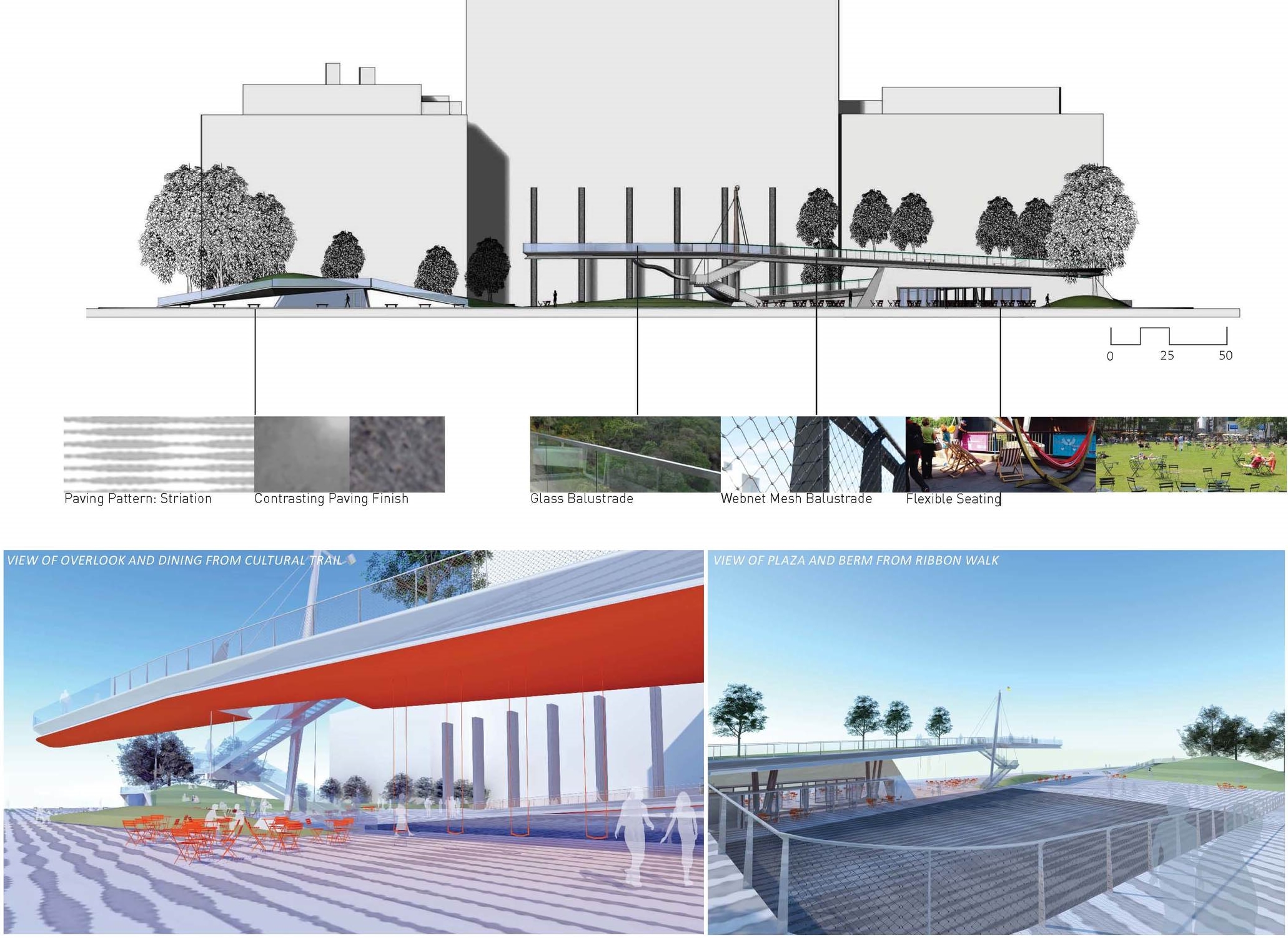
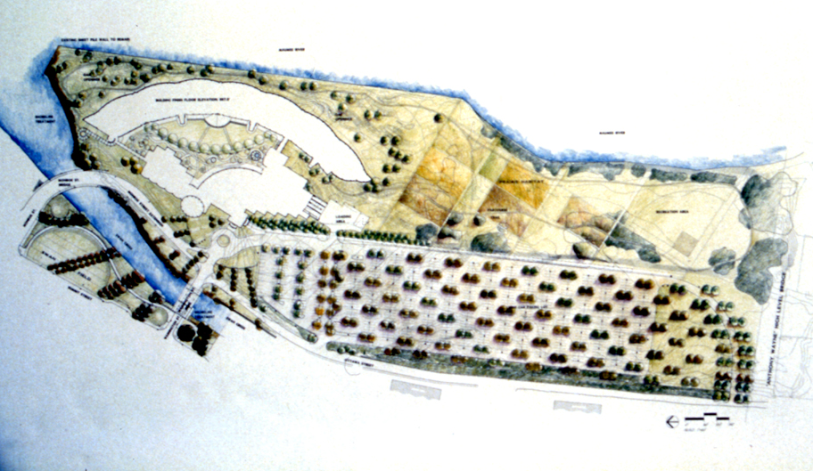
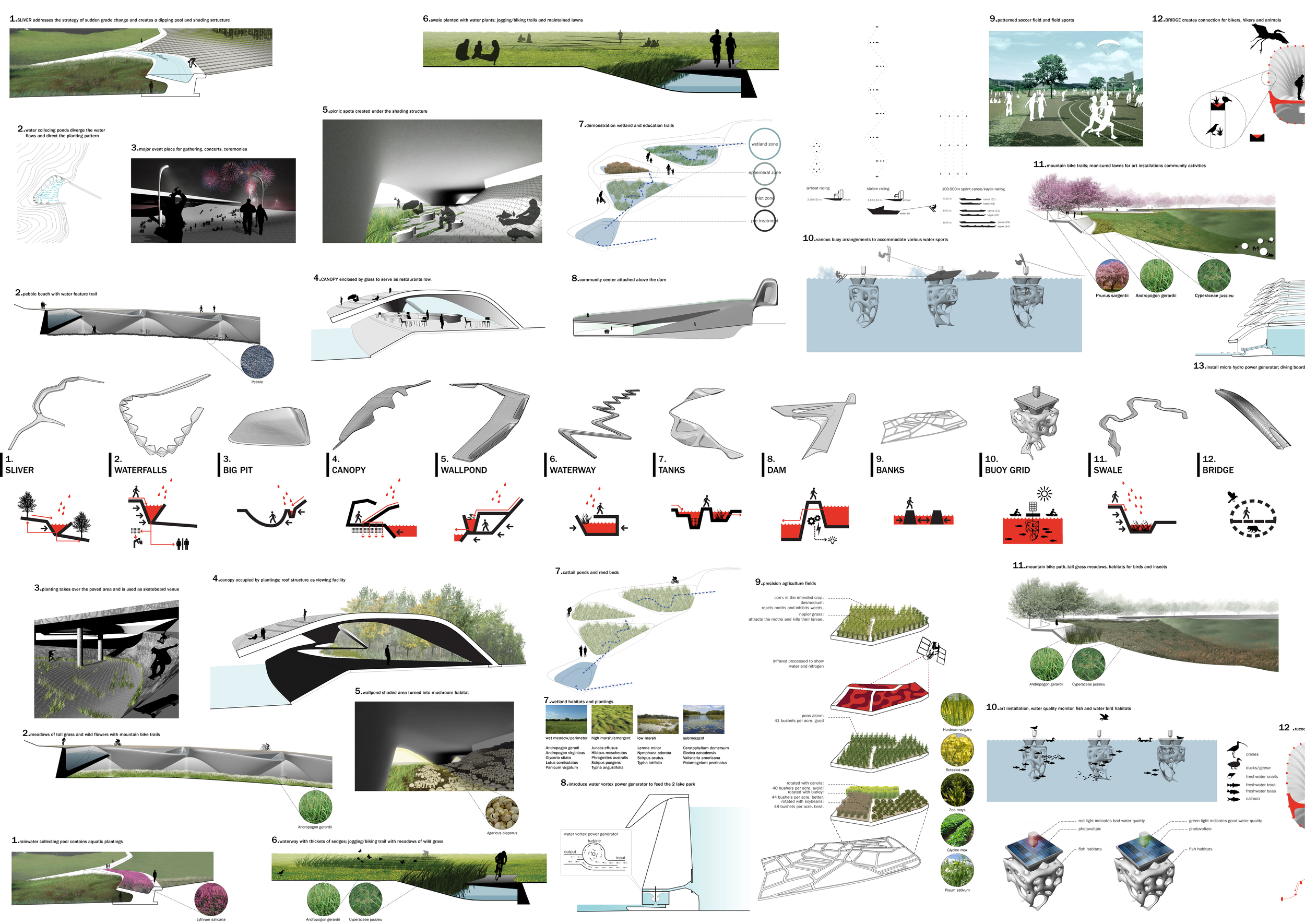
2017 - Brooklyn, NY, USA

City Tech Courtyard

Brooklyn, NY, USA

CLIENT The City University of New York, City Tech Campus / STATUS Under Construction / DESIGN TEAM Balmori Associates, Inc. / Perkins Eastman

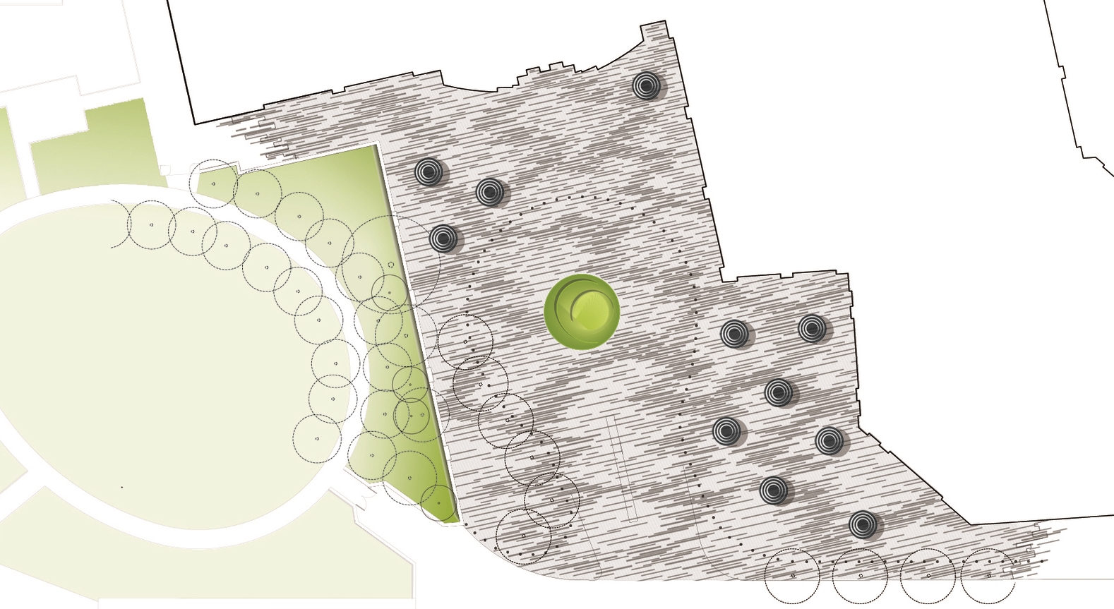
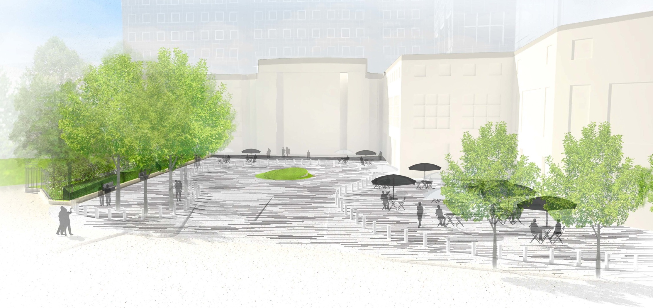
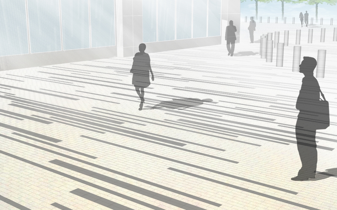
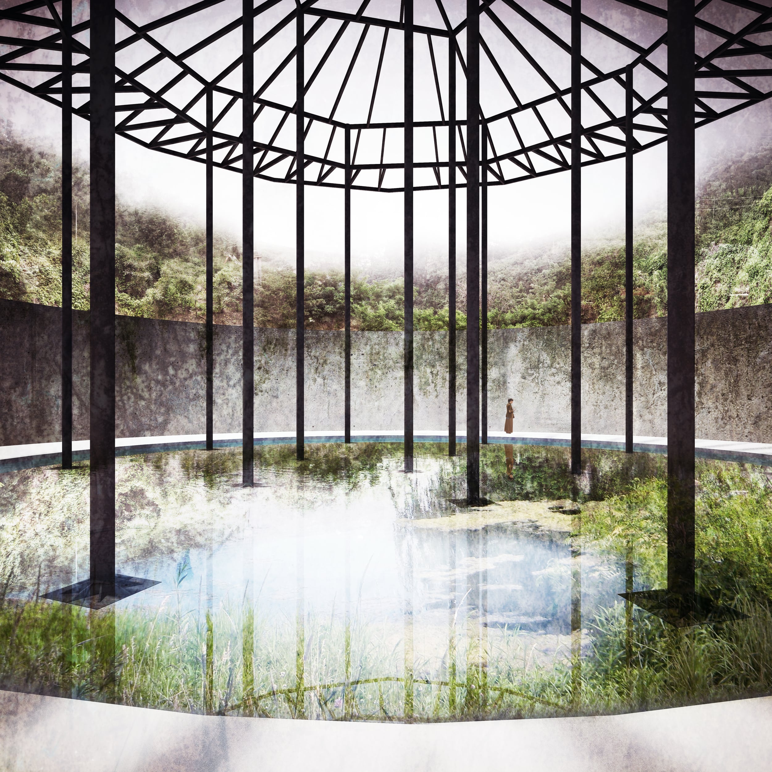
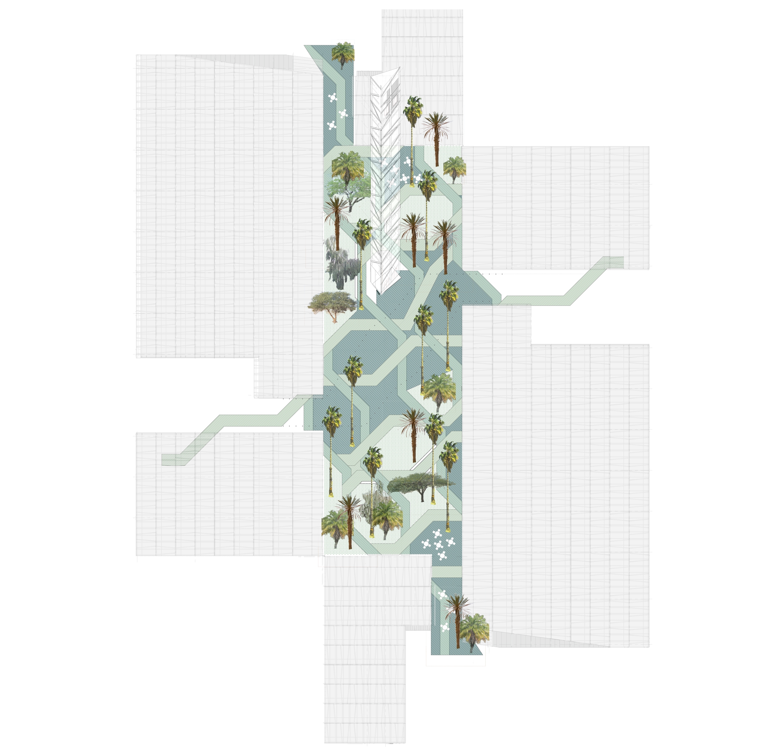
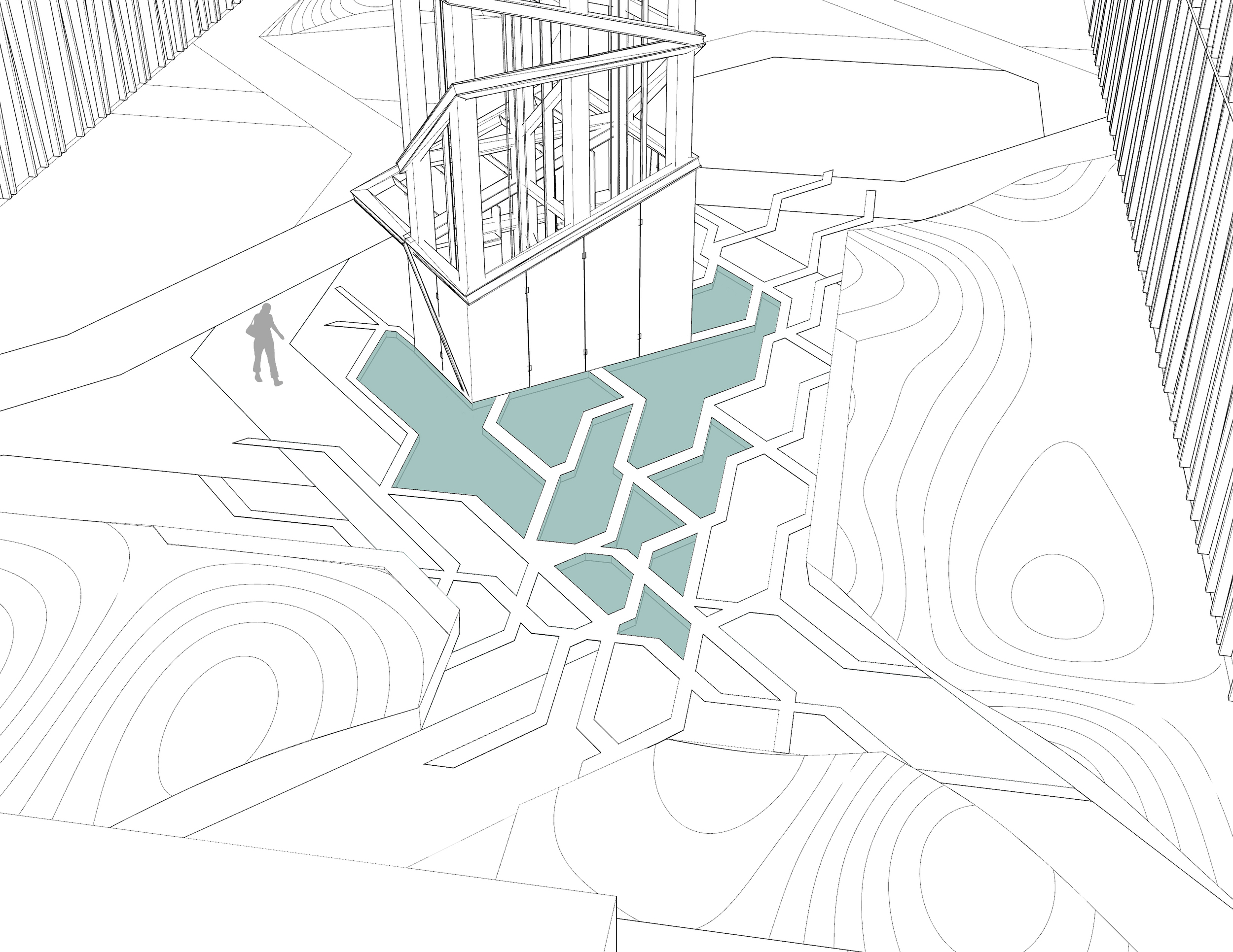
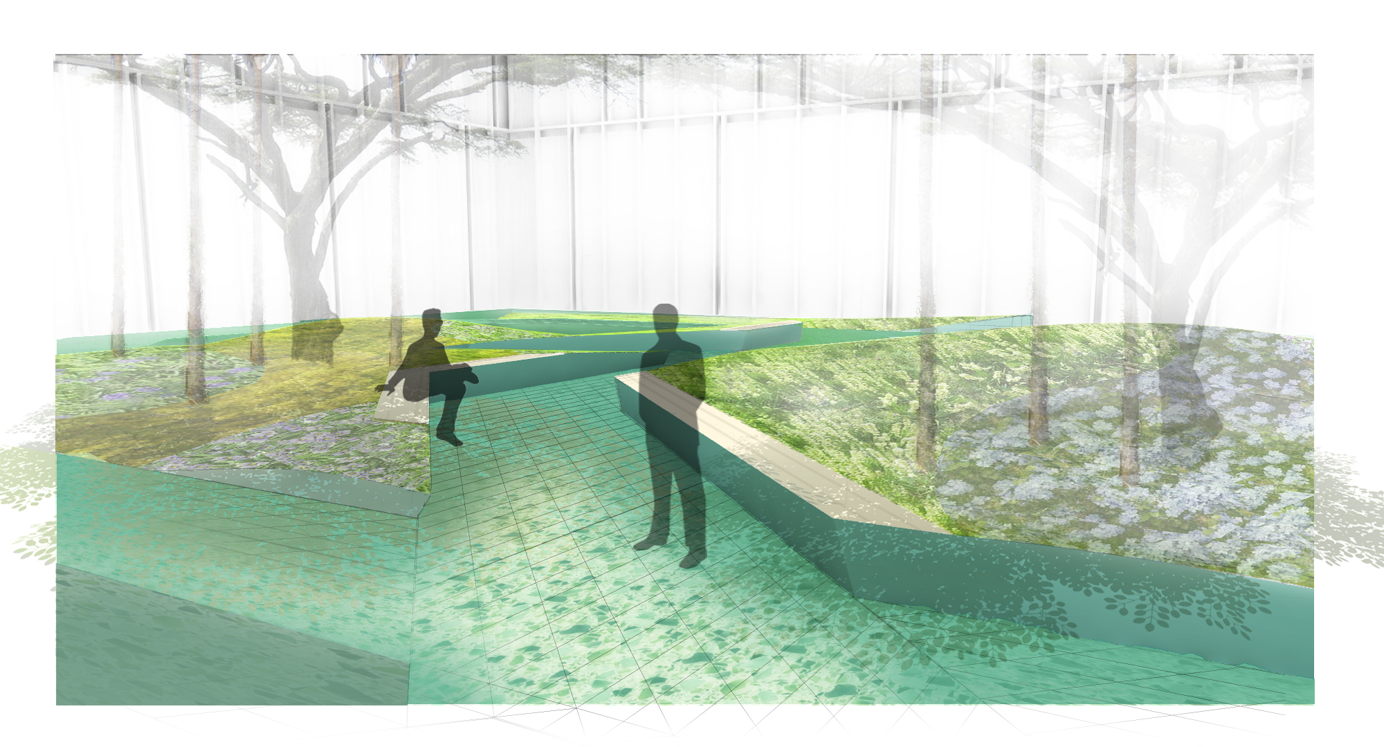
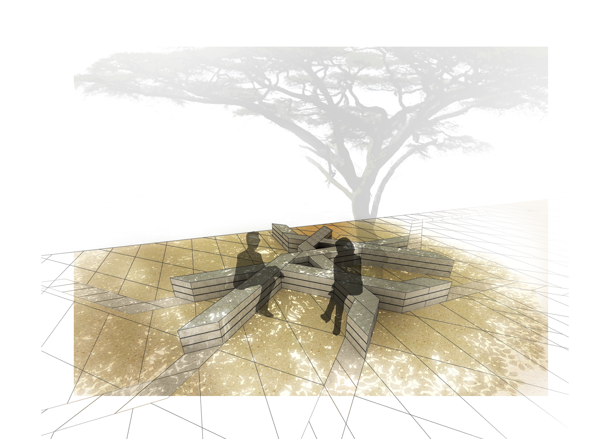
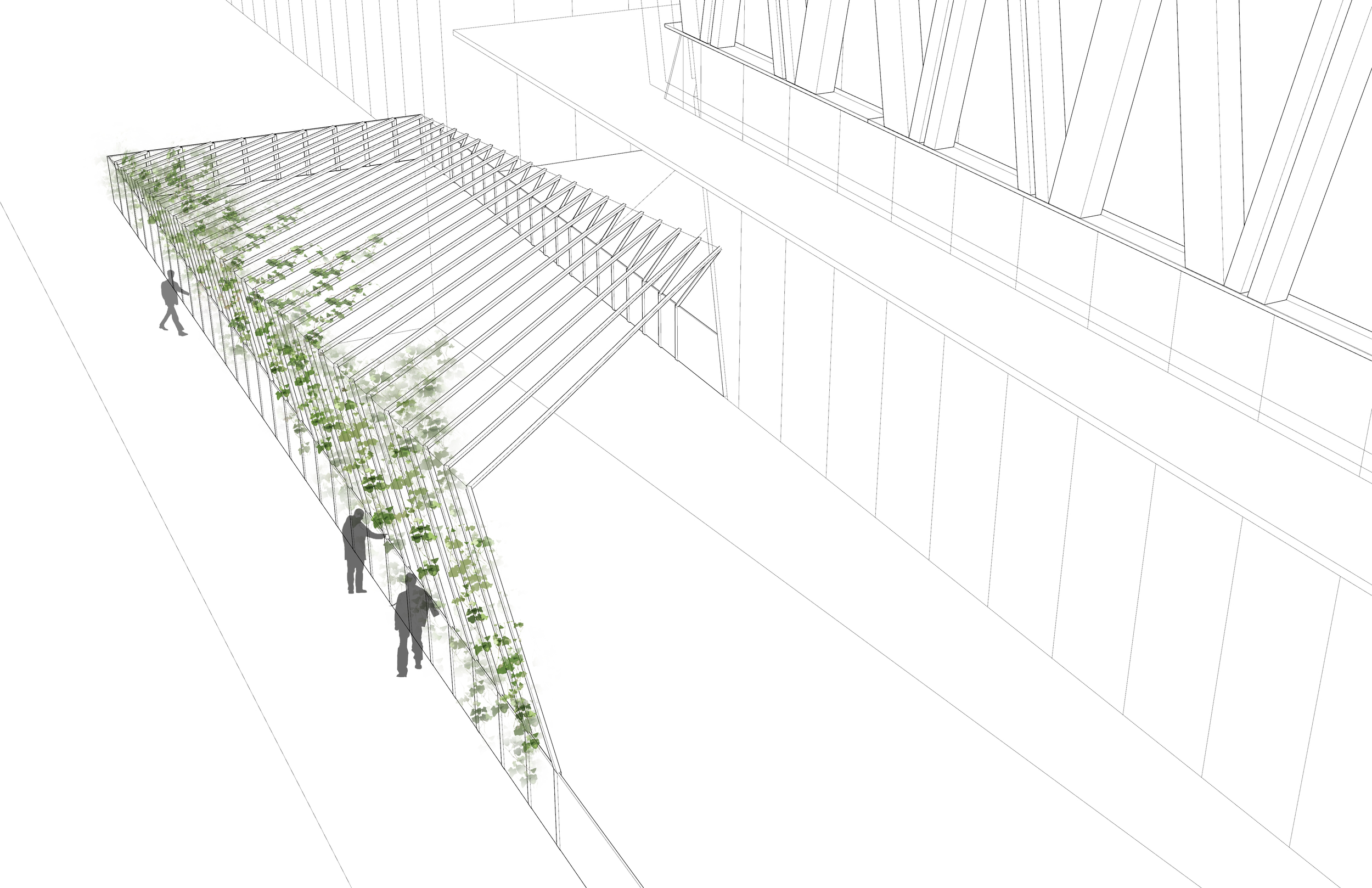
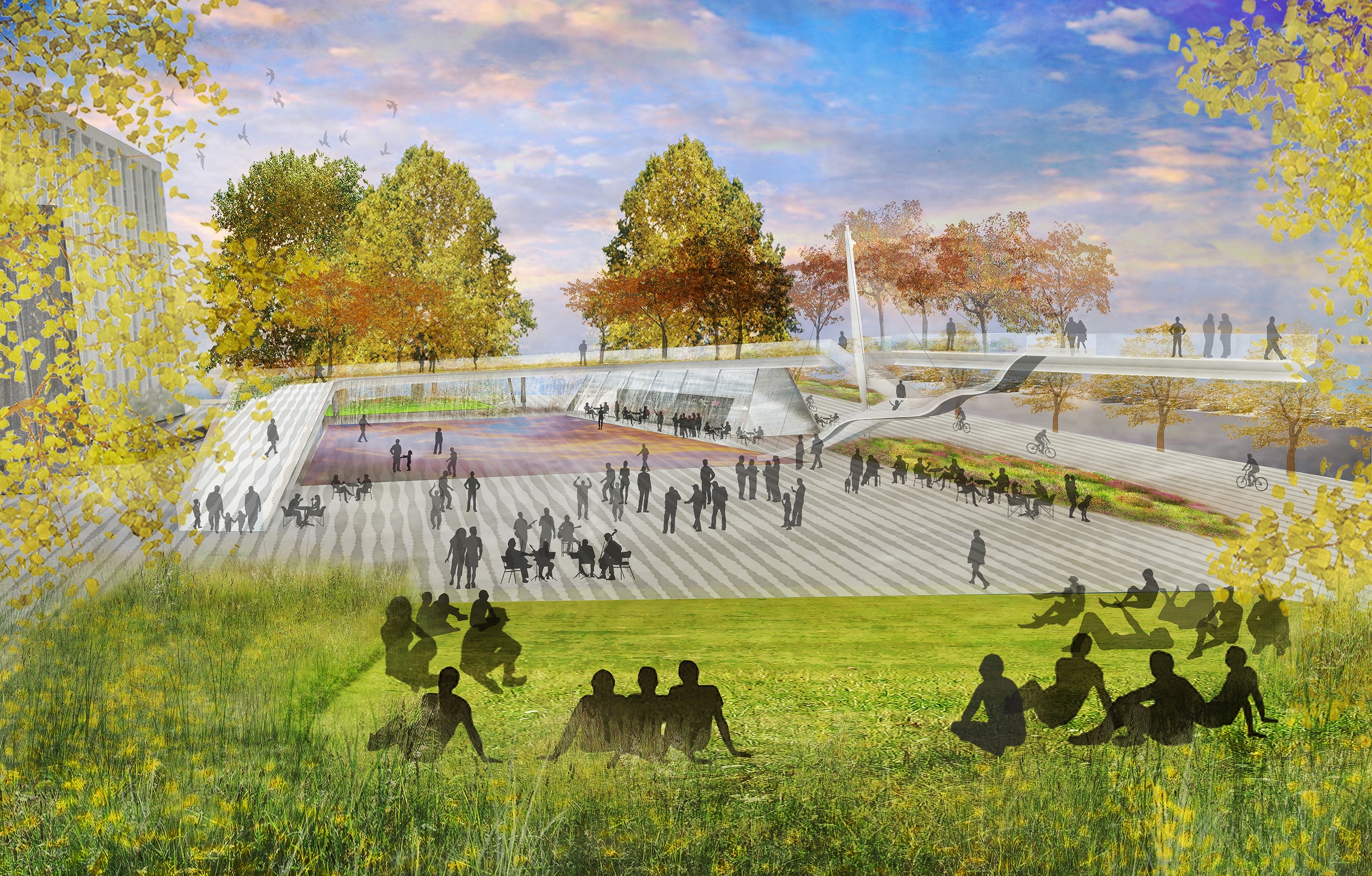
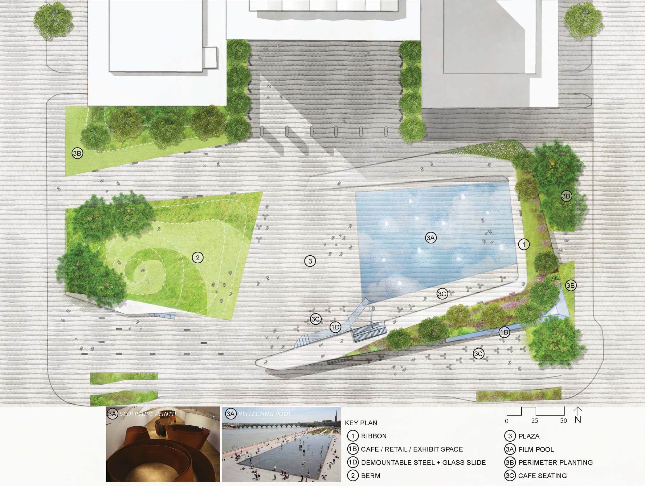
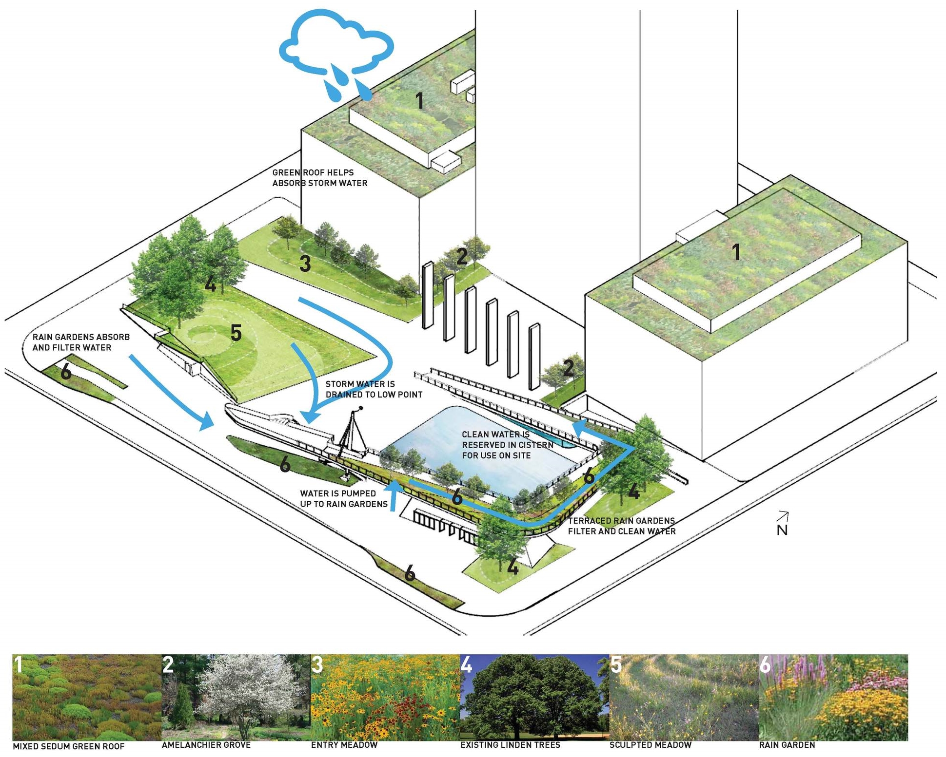
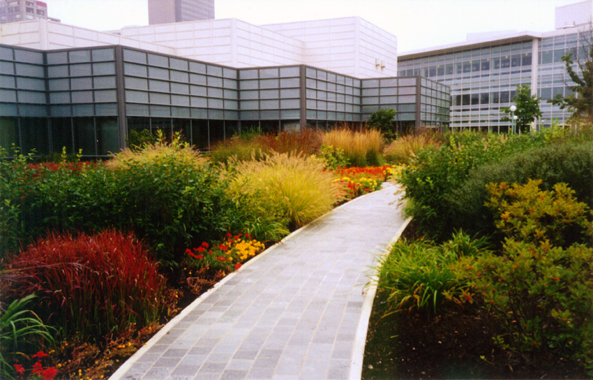
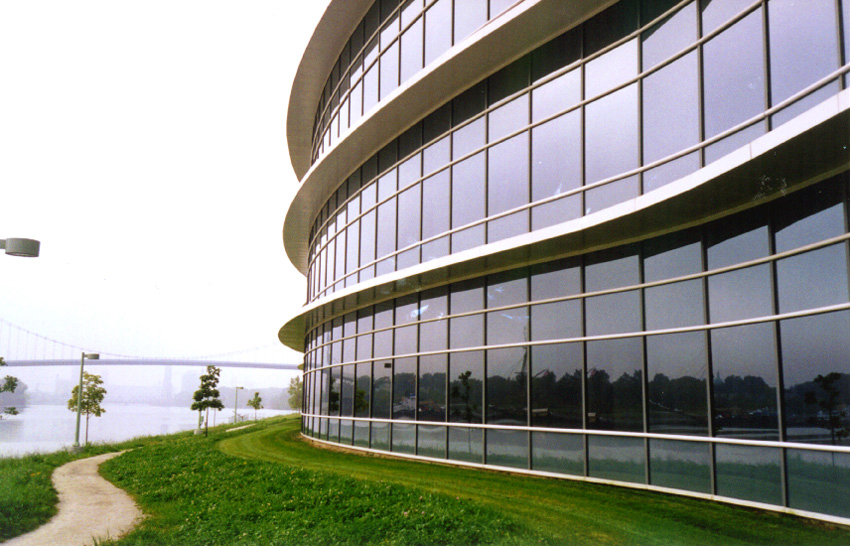
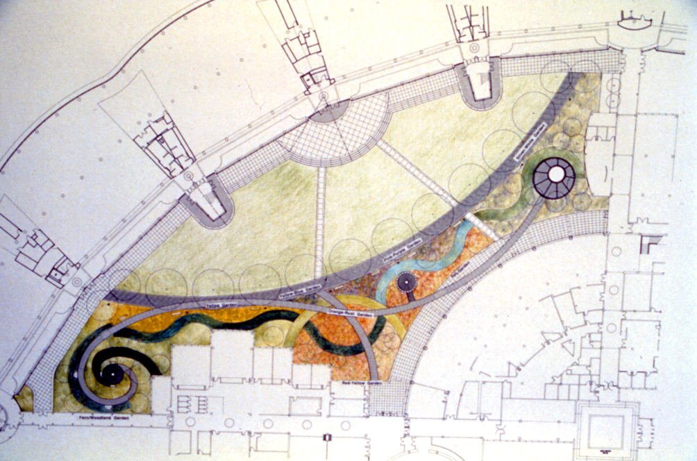
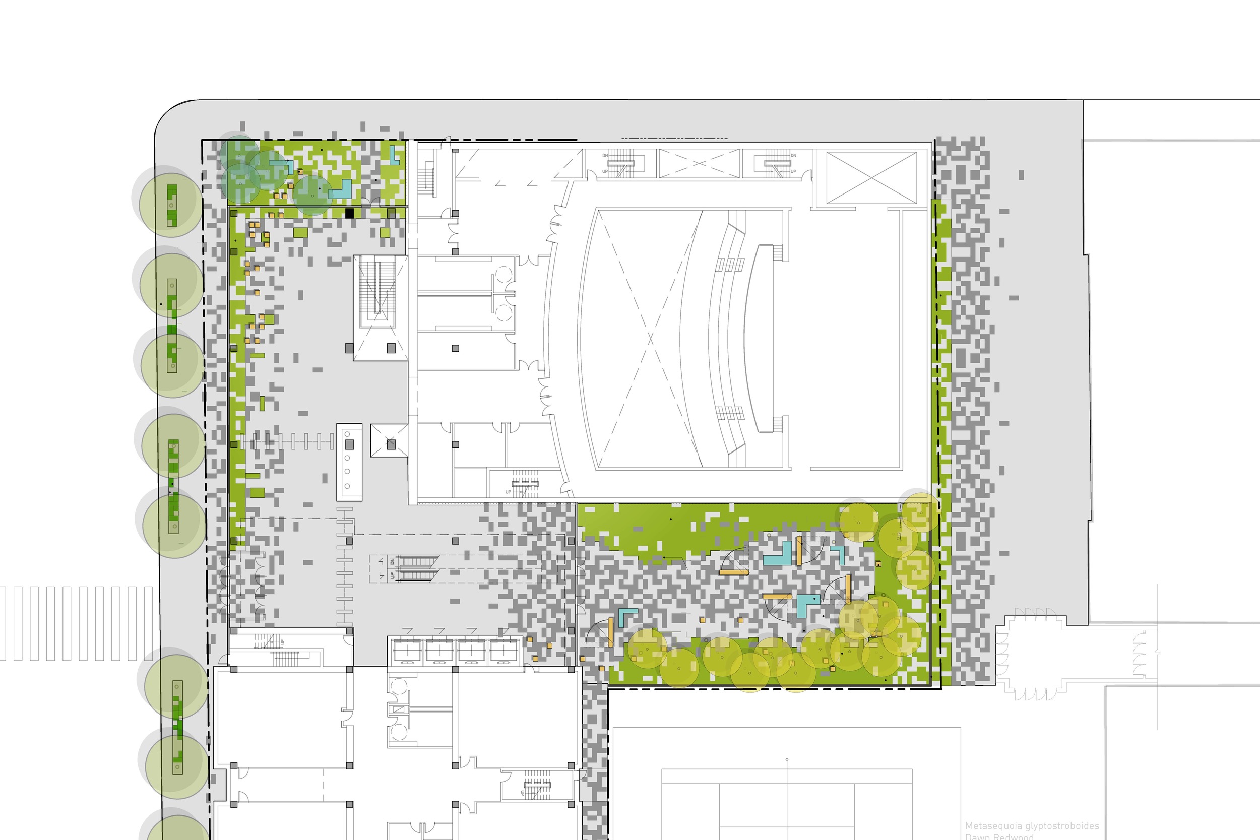
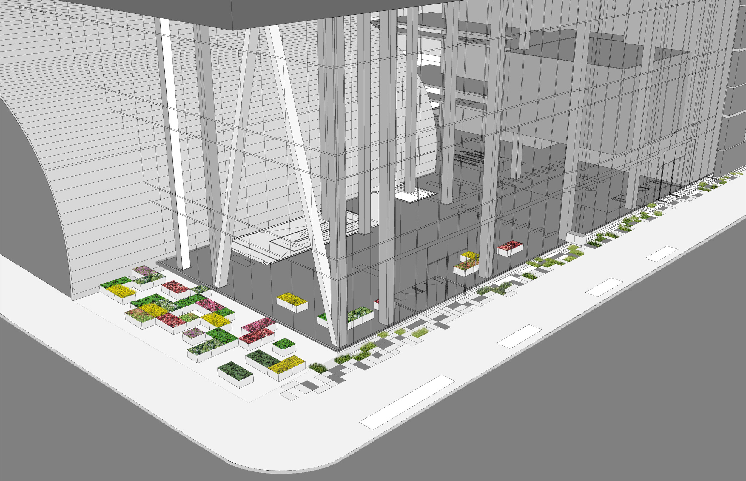
The new LEED CUNY City Tech Academic Building in Brooklyn New York, was created as a landscape that forms a continuous surface from the sidewalk entrance through the lobby to a garden courtyard. The idea is to enliven the public spaces and create a sense of the garden in the lobby.  The design plays with a pixilated pattern of the paving that feathers into the lobby and auditorium and then fades into the courtyard. 

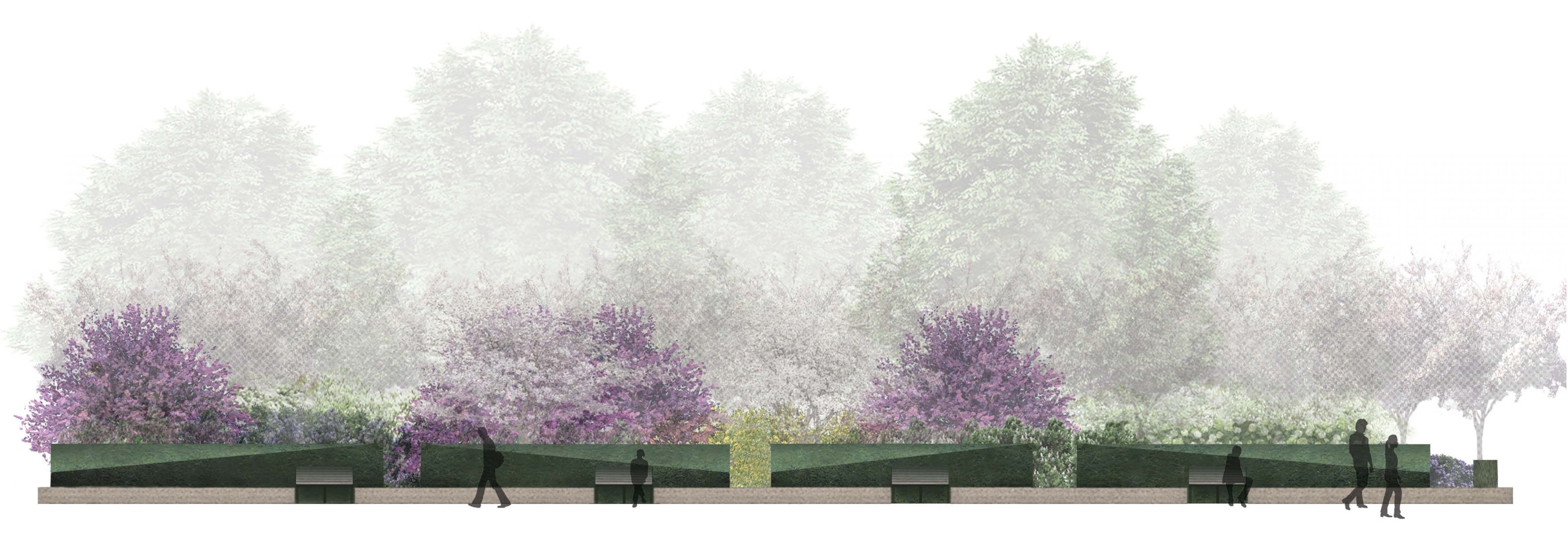
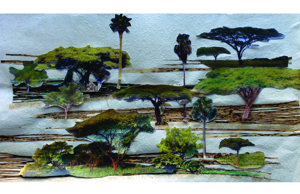
The pattern extrudes in the entry garden to become shallow reflecting pools made of stone that catch light when turned on and are sculptural objects when turned off. The pattern fades from paved to planting along the curtain wall edge and lobby with both exterior and interior plantings. As the pattern moves through to the courtyard- again the ratio of green to paved transforms into a lush garden with a perimeter of planting. Low water native plantings are used and materials will be chosen for their sustainability, reflectivity and efficiency. Recycled water for reflecting pools and irrigation could also be used as part of the design.  


Main Avenue Bridge Underpass

2015 - Cleveland, Ohio, USA

Main Avenue Bridge Underpass

Cleveland, Ohio, USA

CLIENT Downtown Cleveland Alliance / STATUS Competition finalist 2015 / SIZE 3.1 acres / DESIGN TEAM Balmori Associates, Tillet Associates and artist Stacy Levy

The approach we took jointly as a group, Balmori Associates, Tillet Associates, and artist Stacy Levy, has been to take on specific conditions of the site and work with them to increase the site’s human use and enjoyment. One of these conditions is that of the wind blowing under the bridge, an effect of its location by the water and the bridge’s channeling effect. Another is that of the darkness under the bridge particularly at the intersection of Ninth and Main Streets. The third condition is that of the great fields of paving, which impart to the site its character of being a place only for cars, not people.

From its beginning Cleveland has been indelibly linked to both Lake Erie and the Cuyahoga River both as a key piece of infrastructure fueling the economy of the city and as a defining part of the cultural identity of the city. Lake Erie also defines the environment and climate that Cleveland residents reside in. The great lakes region is a special ecological system creating micro-climates around it banks.

A series of suspended trucking tarp strips transform what was considered on the fringe of downtown into a spectacle of industry and recreation, making the invisible force of the wind visible. Lake Effect is a strategic intervention on an urban scale capable of linking to development, public spaces, and destinations in the Flats Entertainment District and Warehouse District. Lake Effect is a bright and lively gesture reflective of The Flats rich industrial heritage and responsive to the thriving waterfront district to come.

Cleveland.com

Artlantic

2012 - Atlantic City, NJ, USA

Artlantic

Atlantic City, NJ, USA

CLIENT Atlantic City / SIZE 7.5 acre rectangle  / STATUS Completed, 2012 / DESIGN TEAM Balmori Associates / Fung Collaboratives 

Located in proximity to Atlantic City famous boardwalk, Artlantic: Wonder Park serves the community as a public venue for art and an urban amenity providing green space. The landscape complements the art, and does not compete with it. Winding paths lead the viewers through the landscape. 

Brookfield Place

New York, New York, USA

Brookfield Place

New York, New York, USA

CLIENT Brookfield Properties  / STATUS Completed 2015 / SIZE 2 acres / DESIGN TEAM Balmori Associates

Located in the heart of Lower Manhattan, the Brookfield Place Plaza is centered on a critical east-west pedestrian link connecting the World Trade Center memorial site to Battery City Park and the Hudson River. The plaza acts as an arrival for the southern part of the Brookfield Place complex as well as an urban terminus to the northern point of South End Avenue.  The plaza is bound on the western edge by Pumphouse Park, colloquially known as the Oval, a popular green enclave surrounded by cherry trees that creates a spectacle of blooms in the spring. Despite its strategic location, the plaza suffered from a lack of continuity and identity rendering the space little more than a cul-de-sac. Several problems plagued the space: a lack of ground plane continuity that was dominated by the vehicular traffic pattern, an abrupt transition between the park and the plaza, and obscured site lines across the plaza.

The intent for the design of the plaza was to create a new unified plan by extending a consistent paving through the entire space while eliminating the curbs that fracture the space and inscribe the vehicular traffic patterns.  As part of the work, the traffic pattern was altered for better vehicular efficiency causing the previously symmetrical relationship with the front entry and center line of the road to be shifted, creating two conflicting geometries. Balmori proposed three rotating vegetative planes emerging from the ground all centered on a different axis to reconcile the old and new geometries. Balmori also proposed moveable furniture to provide maximum flexibility for tenants of the ground floor space in the future.

Although many design proposals were not realized due to budgetary constraint developments some simple changes on site have made the plaza feel distinctly open, creating a fluidity between the plaza and adjacent greenspaces. Both the widening of pedestrian space and the removal of the tall fence which once divided the space have created a much more open plaza with clear views to the Hudson River.

Rehabilitating MAPO Oil Depot

2014 - Seoul, Korea

Rehabilitating MAPO Oil Depot

Seoul, Korea

CLIENT Seoul Metropolitan Government / STATUS Competition, 2014 / SIZE 75 acres / DESIGN TEAM Balmori Associates, N.E.E.D. Architecture / PHOTOS Balmori Associates, N.E.E.D. Architecture

The competition called for transforming an industrial relic into a cultural venue with specific programs in mind. As a deserted relic, the site lacks accessibility and urban connections, which are two pre-requisites for successful cultural intervention. The proposal tackles these two basic problems both directly and indirectly by creating resilient and open infrastructure.

Giant oil tanks in man-made craters, only reachable by climbing steep steps on a hill, are not fit for public use unless drastic occupancy control and safety measures are deployed. We propose bold earthwork, cutting away the front section of rock craters to allow for easy access and tucked-in service spaces. Cuts will surgically limit the area where the least amount of excavation occurs and the resultant crushed stones are recycled to pave a new porous parking lot. Repurposed steel plates from the tank #3 compose concrete formwork of the new retaining wall against the cuts.

Programmatic resiliency is built into the refurbished tanks. Except for the tank #1, which is preserved in its original state, other tanks are revised in such a way that, with use of heavy gauge materials and simple modifications, they can perform with greater flexibility and durability. Centrifugal plan with hollowed-out core allow for hosting various types of public events in different magnitude, overcoming the inherent disadvantage of contextually disconnected site through contingent adaptability.

Play Park

2015 - Dublin, Ireland

Play Park

Dublin, Ireland

CLIENT The Matheson Foundation and Dublin City Council / STATUS Competition - highly commended, 2015 / SIZE 3.75 acres / DESIGN TEAM Balmori Associates, John McLaughlin Architects

Play Park is designed as an inclusive space, accessible to all and full of attractive programs for people of every interest and age groups to enjoy. Teenagers can hang out at the skate park behind the berm; Parents with strollers can relax and enjoy a coffee with friends watching their kids climb, slide and roll down the rubber landforms; thrill seekers can bike through the bumpy BMX circuit; explorers can adventure in the enchanted forest and the bioswale to watch and learn about the local wildlife.

Intimate moments of tranquility and repose can be experienced at the flower garden and on the rolling hills. Spectacle and action can be enjoyed looking at the skate bowls and BMX tracks from the safe main path. For special events Play Park will transform into a venue buzzing with life and activity, the main open lawn becoming a large performance space accommodating from 100 to 500 people.

The programs and activity of Play Park are concentrated and organized along the main path that runs the length of the site.

Hermas Development

2017 - Doha, Qatar

Hermas Development

Doha, Qatar

CLIENT Hermas Investment Company / SIZE  10,000 m2 / STATUS Under Construction / DESIGN TEAM Balmori Associates, Kohn Pedersen Fox Associates, One Lux Studio

The Hermas Development will feature four office buildings organized around a central courtyard. Each building has retail on the ground floor, nine office floors, and a tenth roof level amenities connecting all four buildings. The roof level amenities house the Al Kamal headquarters, a Spa, Gymnasium and a restaurant for fine dining. Sitting on a site area of 15,220 m2 and rising 47 meters in height Hermas Development will be LEED Certified and have a 5 star QSAS rating.  

An Islamic pattern is reinterpreted through the site.  Modified, scaled, simplified, the pattern becomes at times the layout of the courtyard, at others, a paving pattern, the edge of the water feature, and benches.

The shade, the sound of the water, the vegetation and the color palette will provide a sense respite and freshness as soon as one enters the courtyard. Materials with warm colors are selected for the streetscape and cool color ones such as greens and greys for the courtyard.

The planting palette for the courtyard showcases native tall vertical palms and acacias well-known for their horizontal canopy. The sun study of the courtyard maps areas of sun exposure suitable for planting trees, and consequently where the earth berms up to allow for planting depth.

The terraces on the 4th and 10th floors feature pixel like planters allowing for more intimate spaces where one can sit alone or in a small gathering. The terraces of the 4th floor have a white, a red, a blue and a yellow garden; the ones on the 10th floor have a scent garden, an edible garden and an orange grove. The vegetated roof of the 9th floor displays arabesques of sedums.


City-County Building Plaza

2014 - Indianapolis, Indiana, USA

City-County Building Plaza

Indianapolis, Indiana, USA

CLIENT Central Indiana Community Foundation, The City of Indianapolis, Department of Metropolitan Development / STATUS Competition finalist 2014 / SIZE 1.94 acres / DESIGN TEAM Balmori Associates / Kevin Roche Dinkeloo Associates

The overall landscape design is to construct a system which takes cues from natural processes and makes them visible in an urban context. Three landscape systems define the organization of the plaza: the terraced rain gardens of the Ribbon, the sculpted native meadow of the Berm and the perimeter landscape.

The terraced rain gardens of the Ribbon create an occupiable interface between structure and landscape. Storm water is collected and then pumped up the Ribbon structure which has been designed to filter the water through a series of terraced rain gardens with a strategic native plant palette. The filtered water is then retained for site irrigation and water features in a large cistern at the base of the Ribbon. The planting on the ribbon creates a rich and unique experience as visitors walk along a tree-shaded and richly planted environment opening to a dramatic view towards the heart of downtown Indianapolis.

The sculpted native meadow of the Berm is planted with species that require no fertilizers or pesticides. The meadow is mown to provide an open lawn for visitors. Rather than using turf or “Industrial Lawn”, a “Freedom Lawn” introduces various grass species, clover and wildflowers that fix nitrogen and reduce the need for pesticides. Seven mature live Lindens are retained in the mounded site topography which brings green space to the public.

Canopy trees from the existing plaza such as Maples, Magnolias, Crabapples, and Viburnums are saved for reuse on site, with the addition of a formal grove of Amelanchier trees at the entrance of the CCB. The perimeter landscape creates intimate spaces for café seating and defines the center of the plaza as a flexible event space.

Owens Corning World Headquarters

1997 - Toledo, OH, USA

Owens Corning World Headquarters

Toledo, OH, USA

CLIENT Owens Corning / STATUS Completed 1997 / SIZE 35 acres / DESIGN TEAM Balmori Associates

A historic regional form of landscape is restored as a way to link a building to its surroundings. Known as 'oak openings' in prairie planting, this form of landscape was present in Ohio before the arrival of Columbus. Balmori Associates' design scheme conceived of the Owens Corning World Headquarters project as an opportunity to restore this landscape form the area, an island in the Maumee River which was formerly a railroad site and then a dump site. The headquarters is sited on this island, in the heart of downtown Toledo. The oak opening landscape surrounds the whole complex; an intersecting trail for joggers and sightseers runs by the river's edge and through this landscape.

A secluded gated courtyard nestled among the main buildings offers a garden landscape as a contrast to the oak opening prairie outside and provides protected seating during severe seasons.

The meandering willow and dogwood hedge provides enclosure for each individual garden. The arching brick path and parallel row of oak trees define the edge between the courtyard gardens and the great lawn. Outdoor summer concerts are one of the several types of events taking place on the landscape's great lawn.

The oak openings prairie is now established. One section has been geometrically planted with beds of wildflowers, which will eventually disperse their seeds over the whole site

Ronald Reagan Washington Airport

1999 - Washington, DC, USA

Ronald Reagan Washington Airport

Washington, DC, USA

CLIENT Metropolitan Washington Airports / STATUS Completed 1999 / DESIGN TEAM Balmori Associates/ Pelli Clarke Pelli/ Leo A. Daly Engineers

A landscape masterplan, terminal landscape and terraces, and roadway landscape were all implemented at the Washington National Airport simultaneously with the construction of a new million square foot terminal and original Main Terminal renovation.  Balmori's design addresses the varying site and programmatic conditions of the individual terminals and their connecting roadway while unifying the entire airport facility. 

A linear landscape fronts the new terminal building with a trellised serpentine concrete wall and planted slope. Terraced plantings of evergreen hollies, magnolias, weeping forsythia and wisteria provide green scenery for waiting passengers in the baggage claim area. Passengers waiting for flights can rest in the landscaped rooms provided by two outdoor terraces shaded by wisteria in the trellises overhead.  Linkages between the GW Parkway and airport parking facilities are improved and a direct link to the Washington Metro is provided.

Cedar Lake Park

1995 - Minneapolis, MN, USA

Cedar Lake Park

Minneapolis, MN, USA

CLIENT Cedar Lake Park Association / STATUS Completed 1995 / SIZE 133 acres / DESIGN TEAM Balmori Associates

Site-specific interventions occur throughout the length of a linear park, functioning as special connectors and markers, their forms using the iconography of threads and spirals.

Balmori Associates was asked to work with the Cedar Lake Trail's community group to select sites of special significance along the six-mile long path that traverses the Minneapolis suburbs, city center and Mississippi River. 

The first intervention is a spiral of trees in the triangle formed by the intersection of several paths.  Considered to be the heart of the linear park, this quiet space is to be memorialized by the active participation of the trail patrons, who will plant and commemorate the trees with plaques.

In the second intervention, an existing mound adjacent to Cedar Lake is slightly modified into a truncated cone. Two interlacing paths are inscribed into its surface, weaving up the landform.  A concave peak accommodates gnomons to indicate the path of the sun and its solstices.

A third intervention includes the creation of a mound that negotiates and crosses the railroad tracks by way of a spiral pathway that descends the earthwork and wraps around Spring Lake, bringing trail users into the city.

Two Lakes Park - Gwanggyo Trail

2008 - Gwanggyo, Korea

Two Lakes Park - Gwanggyo Trail

Gwanggyo, Korea

CLIENT International Design Competition for Gwanggyo / Lakeside Park / Gyeonggi Province, Suwon City, Yongin City, and Gyeonggi Urban Innovation Corporation / SIZE 1,828,836 m2 / STATUS Competition Entry 2008 / DESIGN TEAM Balmori Associates, Inc. / Heerim Architects & Planners / ARUP

Not long ago, the South Korean government began decentralizing its power with the aim to control urban planning of provincial governments. Subsequently, the development of new cities in South Korea is relatively unpredictable and uncertain. A relatively new competitor to the South Korean urban development market is the city of Gwanggyo. In order to thrive, Gwanggyo and its public amenities must be resilient.

We envision Two Lakes Park as an adaptable organism that can respond to a variety of cultural, societal, programmatic, economic and political circumstances. Our design concept embraces the future as a responsive pattern of cultivation that advances the evolution of the park’s landscape. We have intentionally abandoned the notion of a final, designed, object for Two Lakes Park and opted for the emergence of an evolving landscape.

Our design strategically places insertions in these areas not only to increase stability, but also to create an amenity out of existing physical conditions. For example, a water feature knows as the Ponds collects stormwater run-off at the base of a cliff. The cliff soil is reinforced with a retaining wall that also forms the walls for the retention pool. The hypothetical projection of park performance below charts an imaginary trajectory for park development. We envision a park where wildness and human activity are always in flux.


National World War II Memorial

1996 - Washington, DC, USA

National World War II Memorial

Washington, DC, USA

CLIENT National Competition for Government Services Administration / STATUS Competition Finalist 1996 / SIZE 14 miles / DESIGN TEAM Balmori Associates

In 1996, an international competition for a national memorial to the Second World War garnered over 700 entries; five were selected as finalists. Ours was one of them. An alabaster island within a black granite pool is nestled in the axis of the National Mall between the Washington Monument and the Lincoln Memorial. The island glows at night, lit from below. A Hall of Honor lies beneath, the island’s surface also the ceiling of an alabaster cube with luminous walls, ceiling, and floor.

The project is comprised of symbolic built elements: the cube whose roof is the glowing island is intersected above and below ground by two axes. The east-west axis represents time, while the axis running north-south represents space; the two weave together the war’s space and time into one cloth.  Procession down this promenade turns Island, Cube, Space-Time axes into memory in motion:  walking across the island in time--1931, 36, 41, 45 marked along the path-- down the ramps inscribed with the spatial maps of the war --Europe, Asia, America--through the Hall of Monitors showing individual histories, pausing in the Hall of Honor, exiting up to the mall and the end.

By day the pool’s black granite disappears beneath jets of white water.  On special occasions, the pool is emptied, and its large granite surface is used as a ground for parades and other public events.  The glass star inserted at the center of the island refers to the star banner used by thousands of Americans during the war to indicate they had a family member at the front.  

Town Branch Commons

2012 - Lexington, KY, USA

Town Branch Commons

Lexington, KY, USA

CLIENT City of Lexington / STATUS Invited Competition, 2012 / SIZE 2500 acres / DESIGN TEAM Balmori Associates, JDS Architects, Atelier Ten, Nitsch Engineering, James Lima Planning, Creative Concern

The future of Downtown Lexington is as exciting as it is unknown. The daylighting of the Town Branch Commons Creek presents an opportunity to kick off a strategy of multiple developments for Downtown Lexington. We have orchestrated this strategy by organizing it in zones of intensity rather than strict and linear phasing. Those zones are understood as districts and can be put into full or partial development in a flexible way. Our strategy’s center of gravity will be the portion of Vine Street defined by the Rupp Arena on one side and Limestone Street on the other. This segment is significant as it plugs itself on two zones of already existing capacity: on one hand, Rupp and its square, electrified at times of games and events in or out of the Arena, and on the other hand, Limestone, the main artery connecting the two universities, along which a series of small cultural and commercial programs already activate the neighborhoods.

By converting this key section of Downtown to public and smaller scale activities we will create a pocket of protected pedestrian life immediately adjacent to the surrounding buildings, transforming their relationship to the street into an active one. Main and High street will be changed to two-way traffic to provide a more fluid loop of car accessibility for downtown while narrowing car traffic on Vine street to a strict minimum of a single service lane on its South side. In time, the ground-floor of the surrounding facilities could be converted to more commercial activities as the neighborhood’s life develops. From this central node new intensity can radiate the adjacent districts in an almost random sequence. The most likely development to follow up or even be concomitant could be the Rupp Plaza, but also the residential and mix program (including parking) structure of Rupptown immediately South of the Arena.

Mobisle

2006 - New York, NY, USA

Mobisle

New York, NY, USA

CLIENT City of the Future 2016 /  STATUS Competition Finalist 2006 / DESIGN TEAM Balmori Associates, Joel Sanders Architect, Consulmar 

Manhattan, by means of an elastic coastline, could become the most flexible and changing of cities over the next hundred years. Climate Change, with its raised level of waters in the Hudson and East Rivers, will bring about loss of shoreline. MOBIsLEs, a fleet of self-propelled islands that circulate around the periphery of Manhattan, can accommodate incremental change over the short and the long term. Our engineering proposal consists of a kit-of-parts built in a factory and literally shipped to the waterfront, composed of modular strips 50 ft. wide and eight ft. deep for open space and 150 ft. wide and sixteen ft. deep for built space. Through the use of water turbines with generators some of these islands can be self -propelled, others can harness the energy of the water to power their programs. Inspired by the logic of dominoes these modular strips come in 20 profiles that can be reassembled to achieve a variety of topographies. MOBIsles can overlap the coastline where the shore permits or they can link with an urban fabric by means of bridge-like extensions of existing street located at major east-west thoroughfares along the length of Manhattan. These access docks would function as recharging stations both for vehicles and for islands themselves.