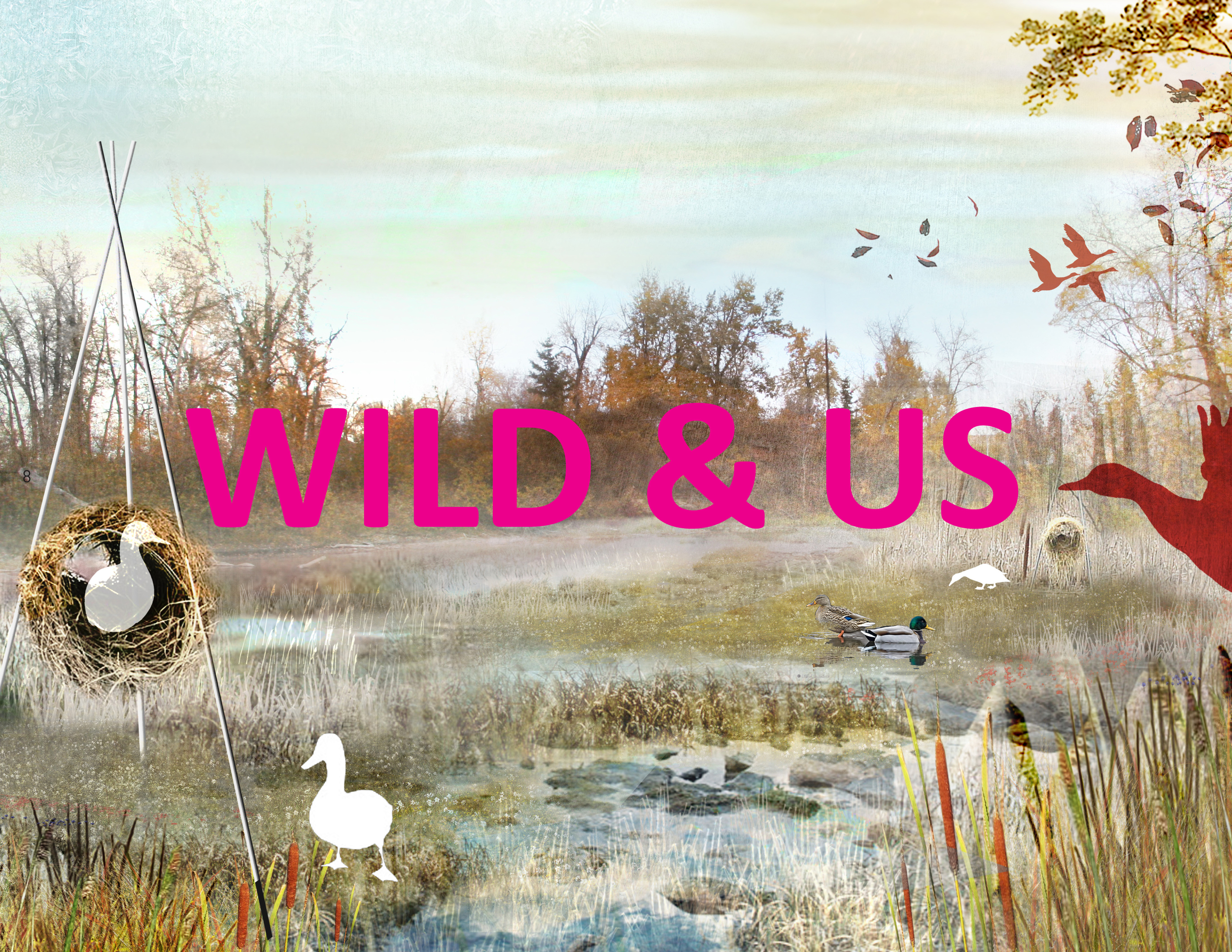
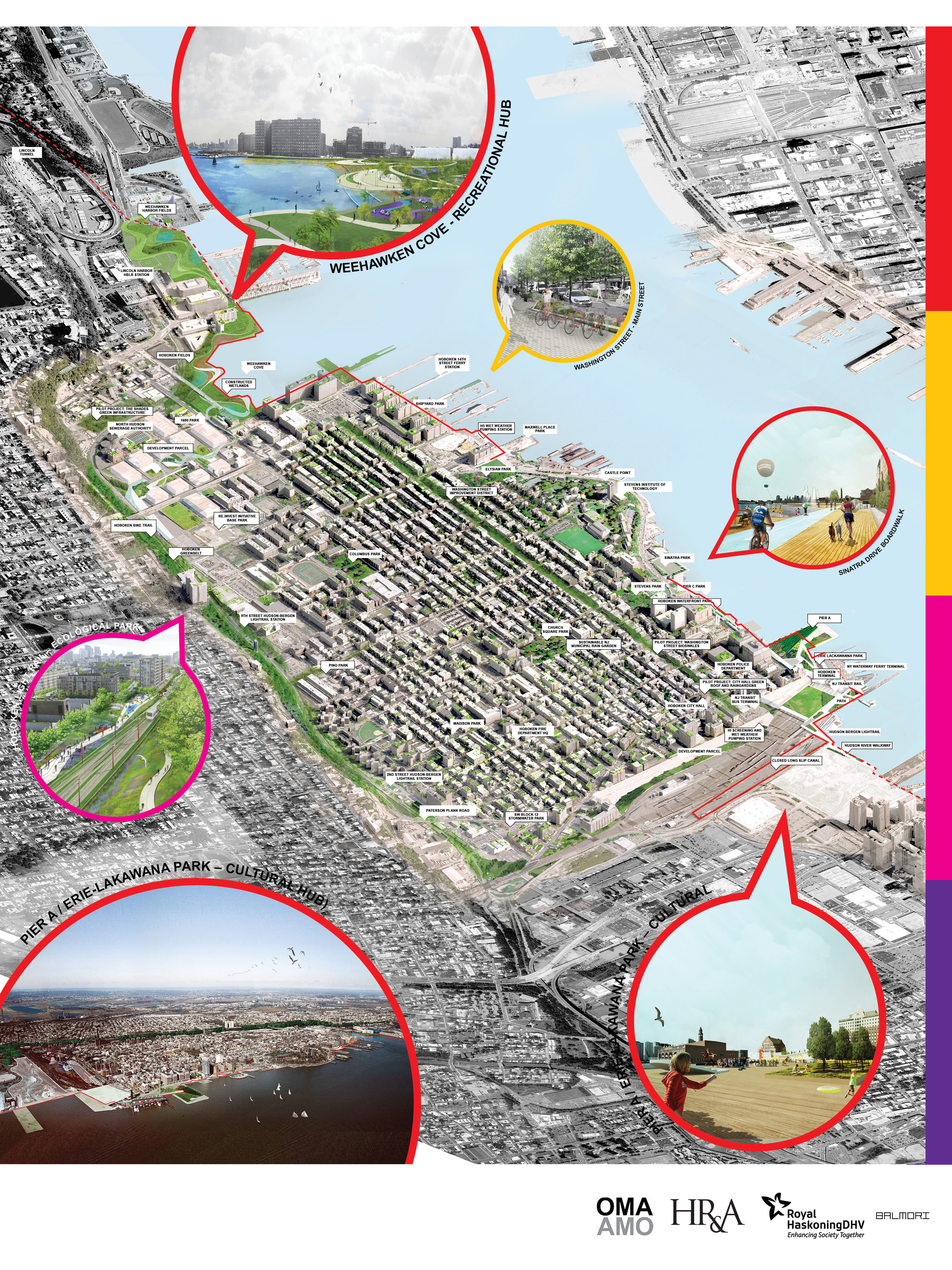
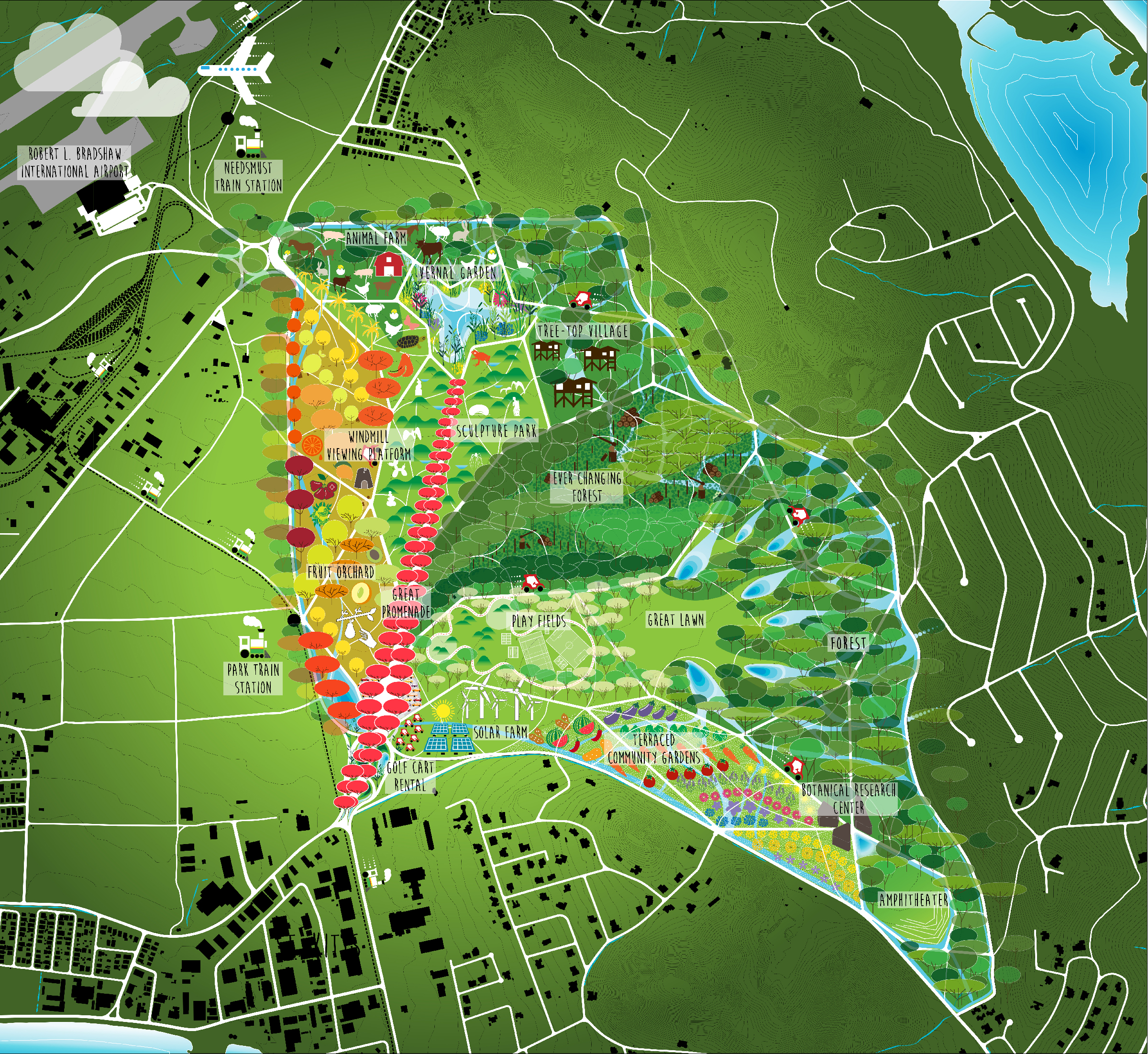
EAST LAKE CITY ECOLOGICAL PARK

HANOI, VIETNAM

East Lake City Ecological Park

SIZE 36ha, 89 acres / STATUS Completed, 2022 / DESIGN TEAM Balmori Associates, CAL, ARUP, Thornton Tomasetti

In 2021 Balmori Associates was commissioned to design the central park of a mixed-use development in the southwest suburb of Hanoi, Vietnam. The architectural scope integrated into the park includes a hotel associated with an École Hôtelière, a commercial pedestrian street, and a multipurpose center.

The park’s master plan is generated by a system of three loops that circles around and across the 20-hectare-lake. The paths’ width and material selection emphasize the character of each loop. The active, cultural, and nature loops create multiple ways of experiencing the park and provide activities for all users. The active loop includes jogging, cycling, athletic tracks, sports fields, picnics, playground, dog park, kayaking, and climbing among others; the culture loop, a sculpture walk, cooking and barbecue areas, viewpoints, a square dedicated to natural evolution and an Iris Collection; and the nature loop, a walk through a forest ecosystem, wetland and swamp areas, bird watching, floating islands, and lotus gardens, among others.

When combining the loops, the experiences of the park are multiplied and make each visit different and exciting. Additionally, the planting strategy highlights the character of the spaces around the lake with distinct blooming period, thus creating a new layer of experiences that varies at the rhythm of the seasons.

Madrid Nuevo Norte

MADRID, SPAIN

Madrid Nuevo Norte

CLIENT Distrito Castellana Norte / SIZE 560 ha, 1,400 acres / STATUS Under Design / DESIGN TEAM Balmori Associates / ARUP / Pelli Clarke Pelli Architects

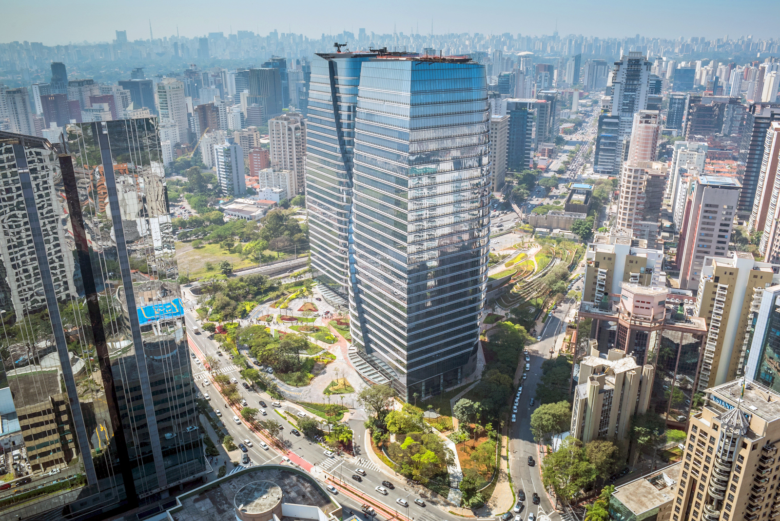
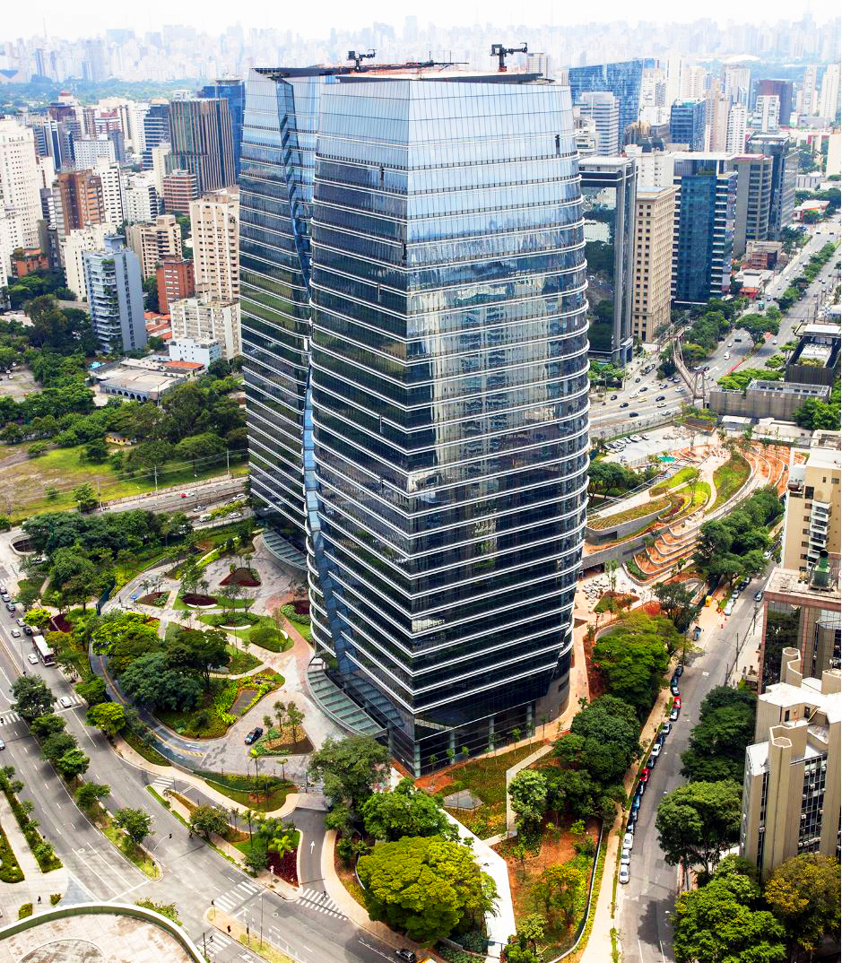
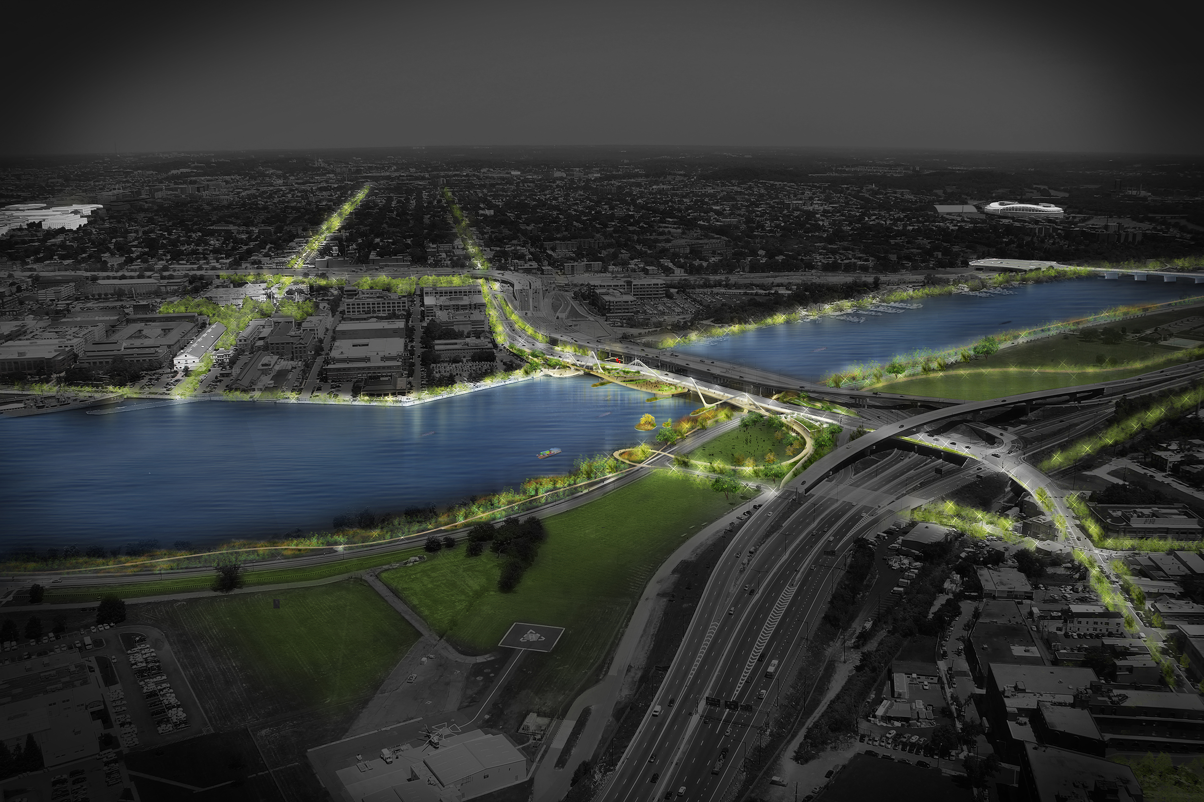
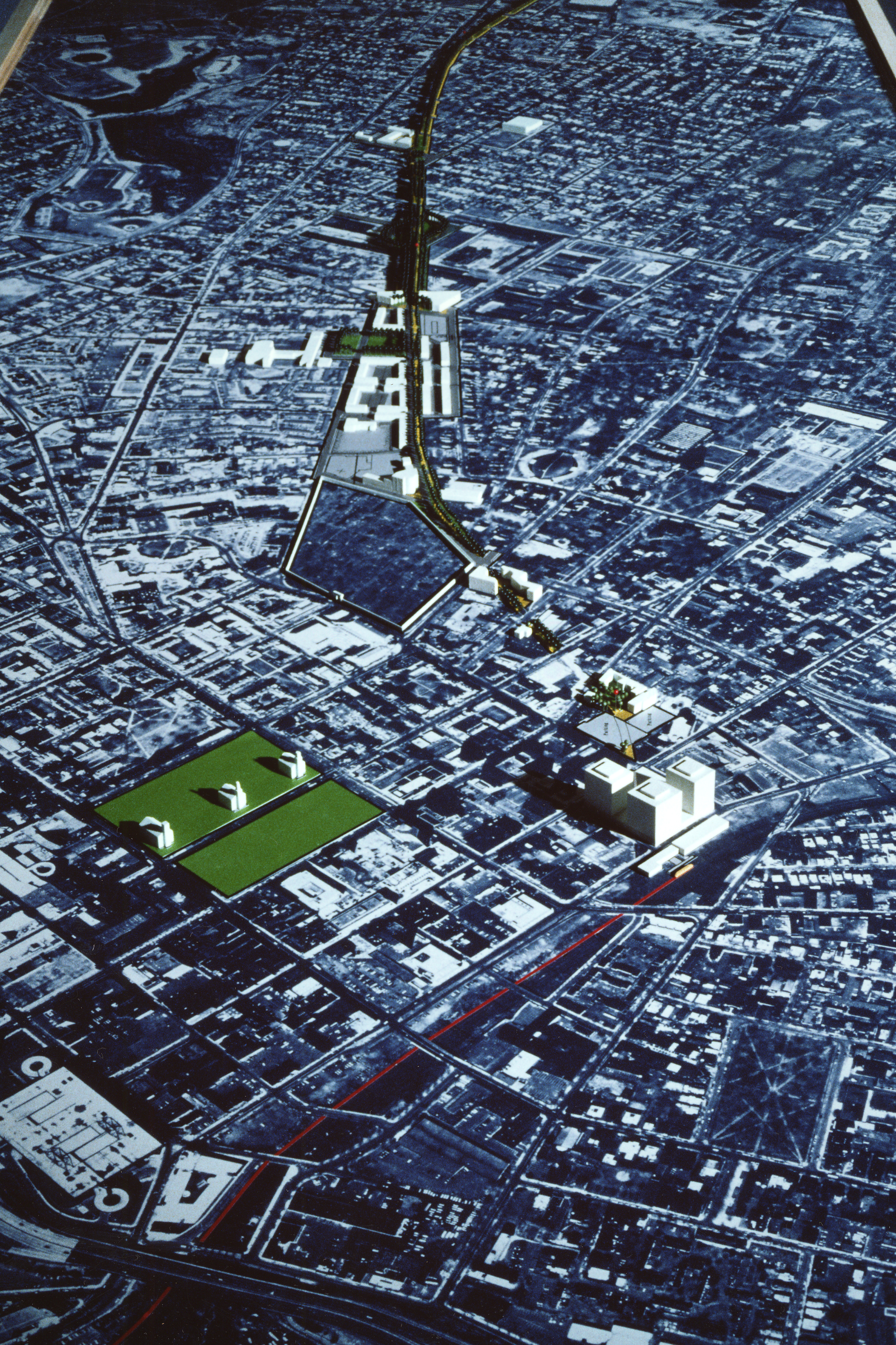
Madrid Nuevo Norte is the largest urban regeneration project in Europe. It will transform the north of Madrid and bring new opportunities to the Spanish capital. The area of the intervention spans from Plaza de Castilla to Monte el Pardo (one of the best-preserved Mediterranean forest in Europe).  It is 6 km (3.5 miles) in length and up to 1 km (0.6 miles) in width, an area of 329 hectares (813 acres.)

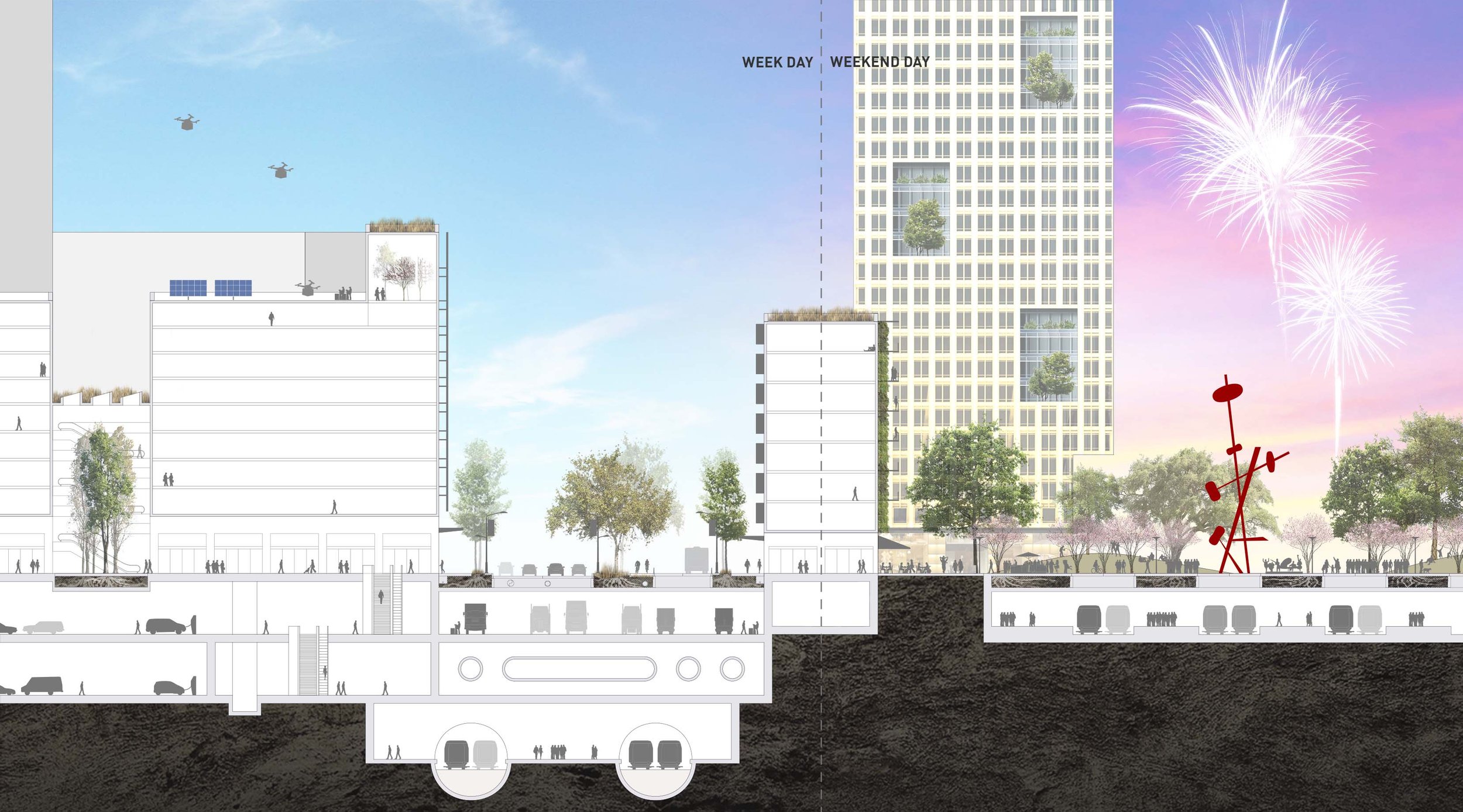
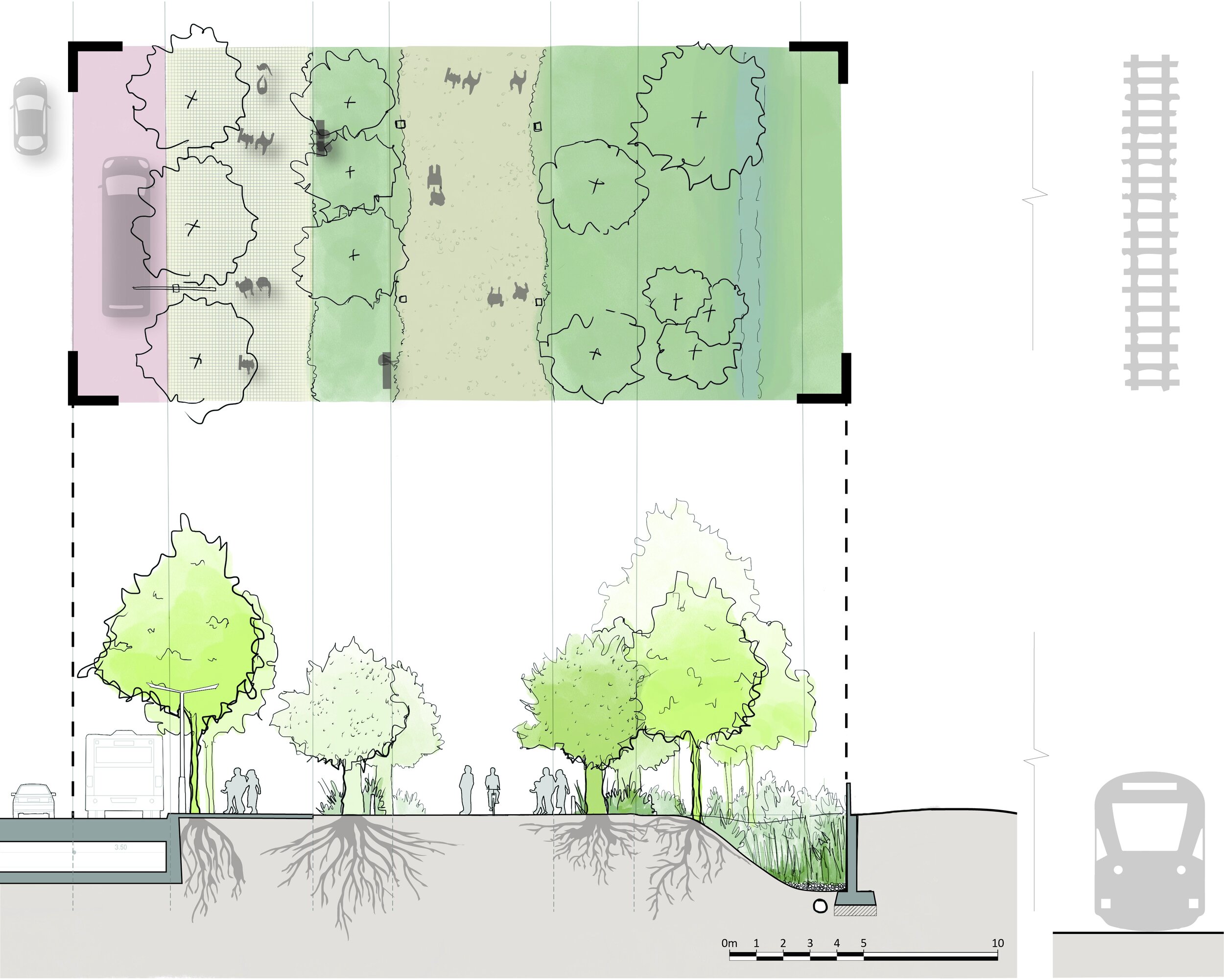
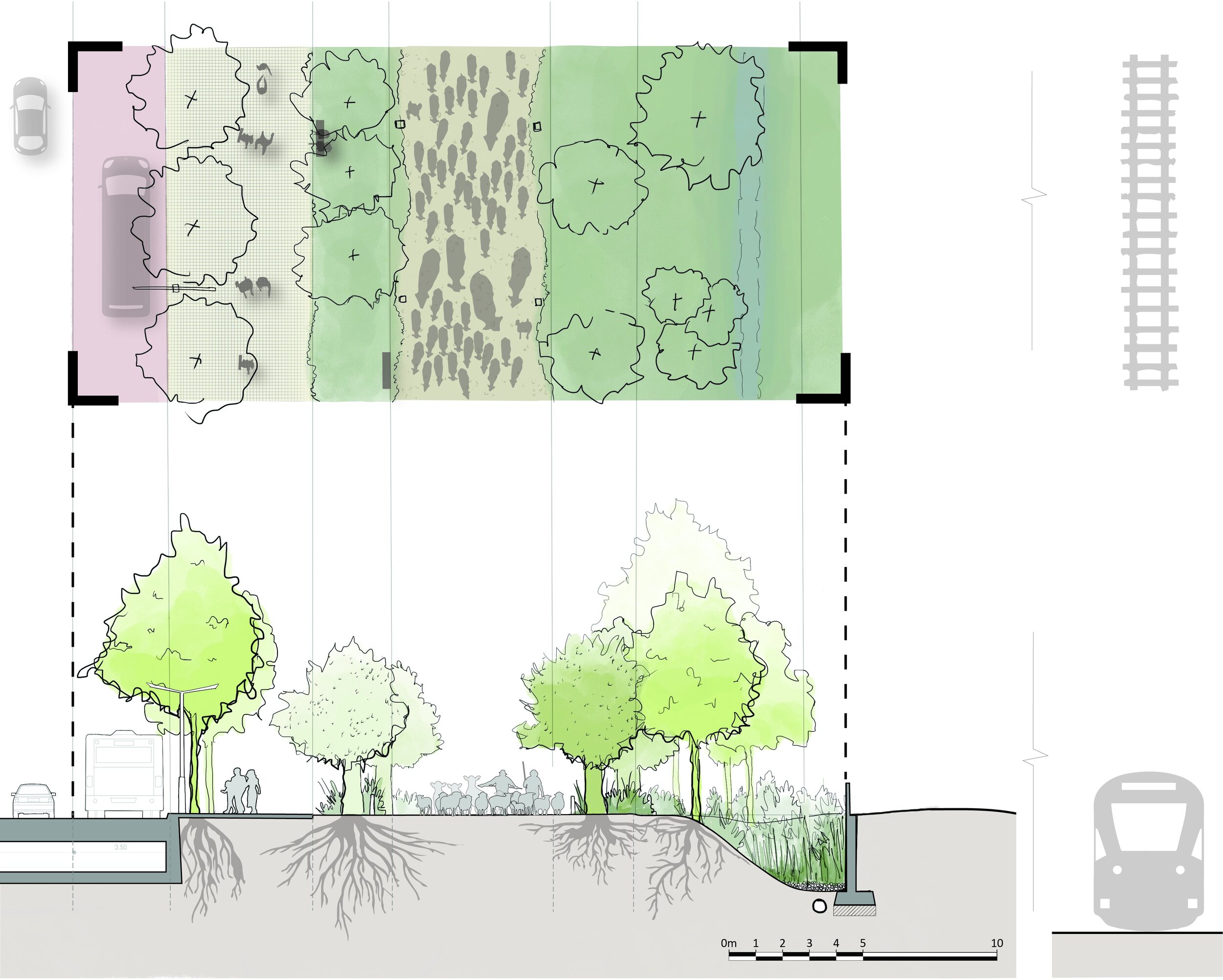
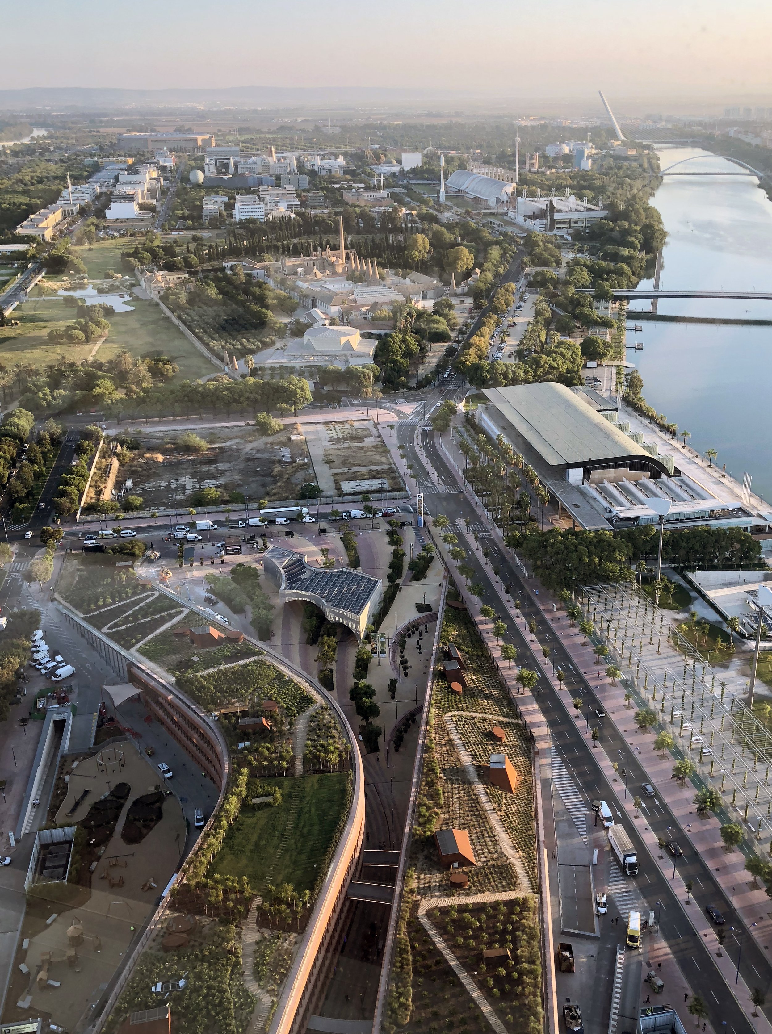
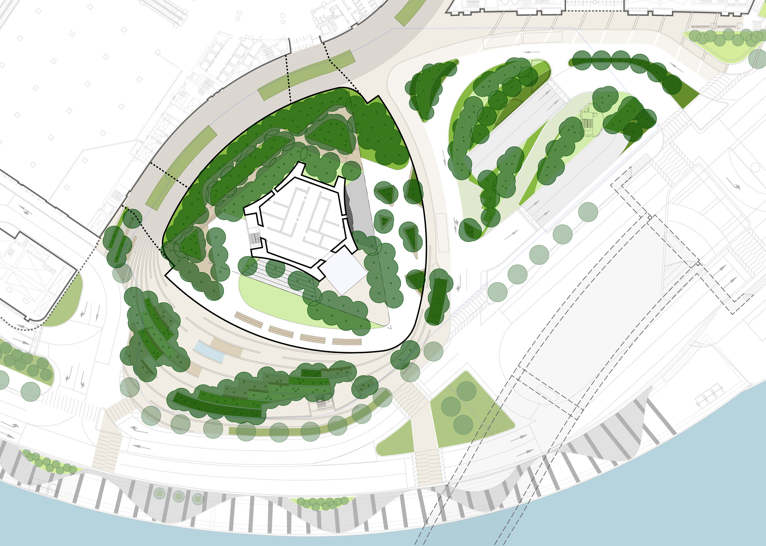
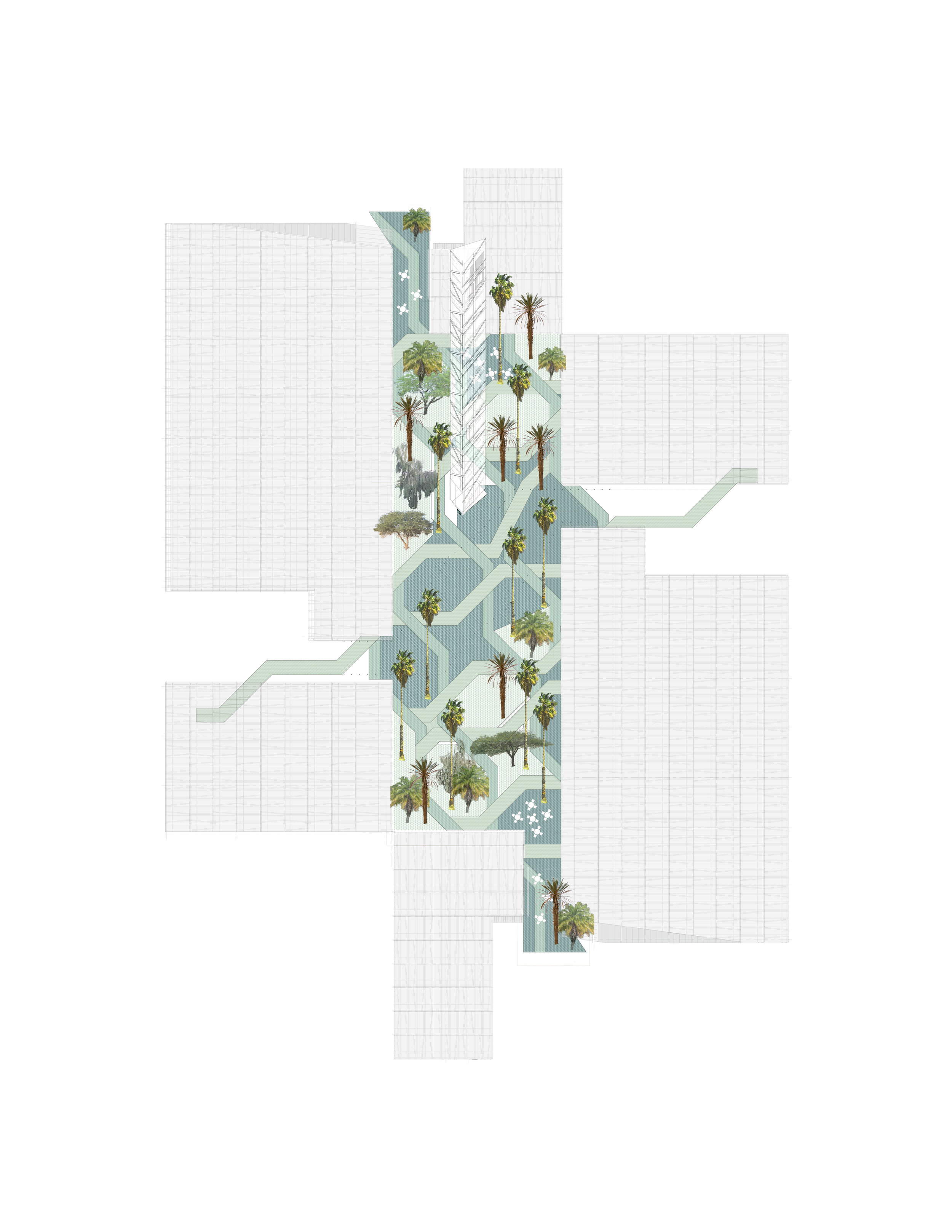
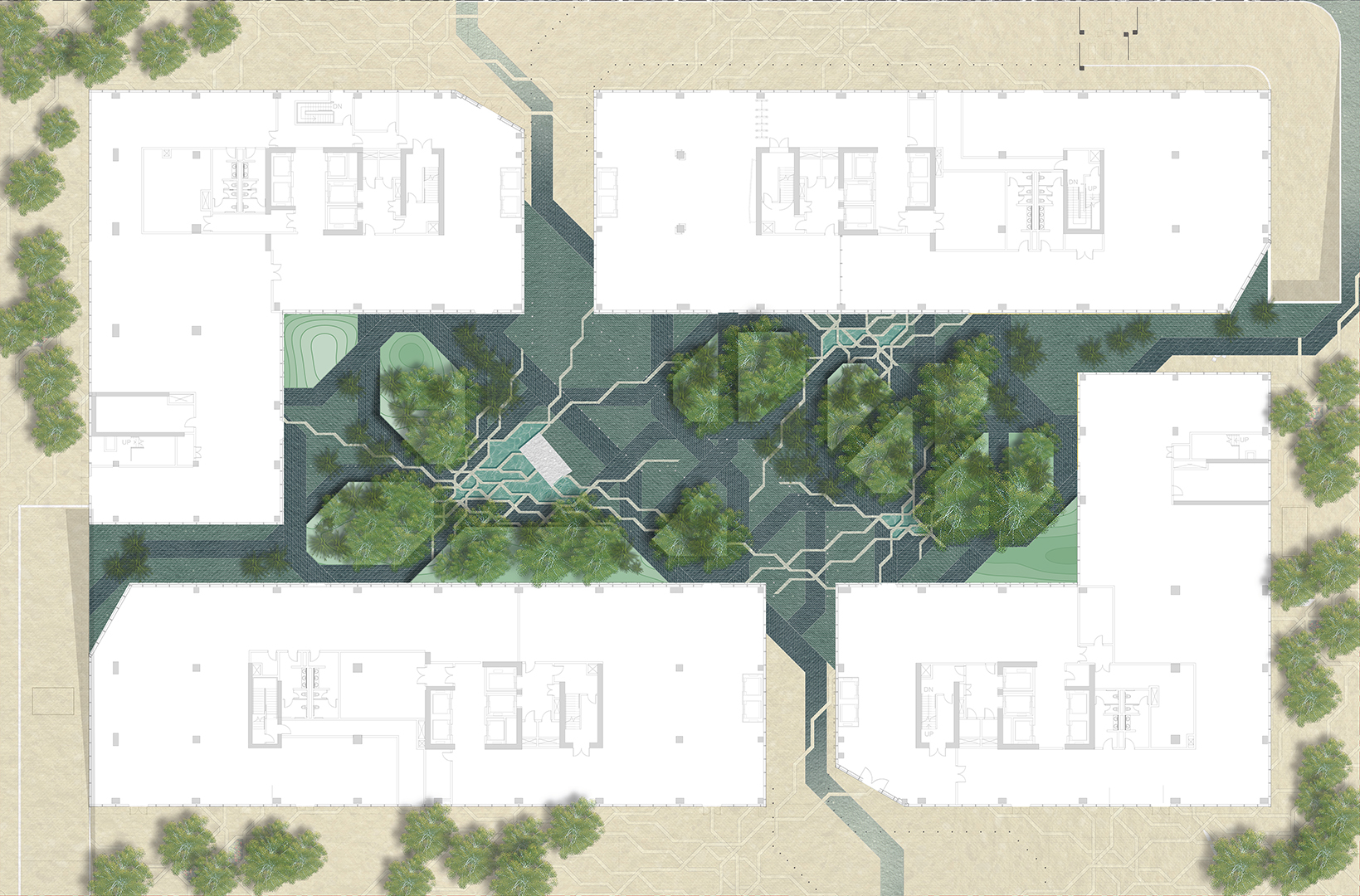
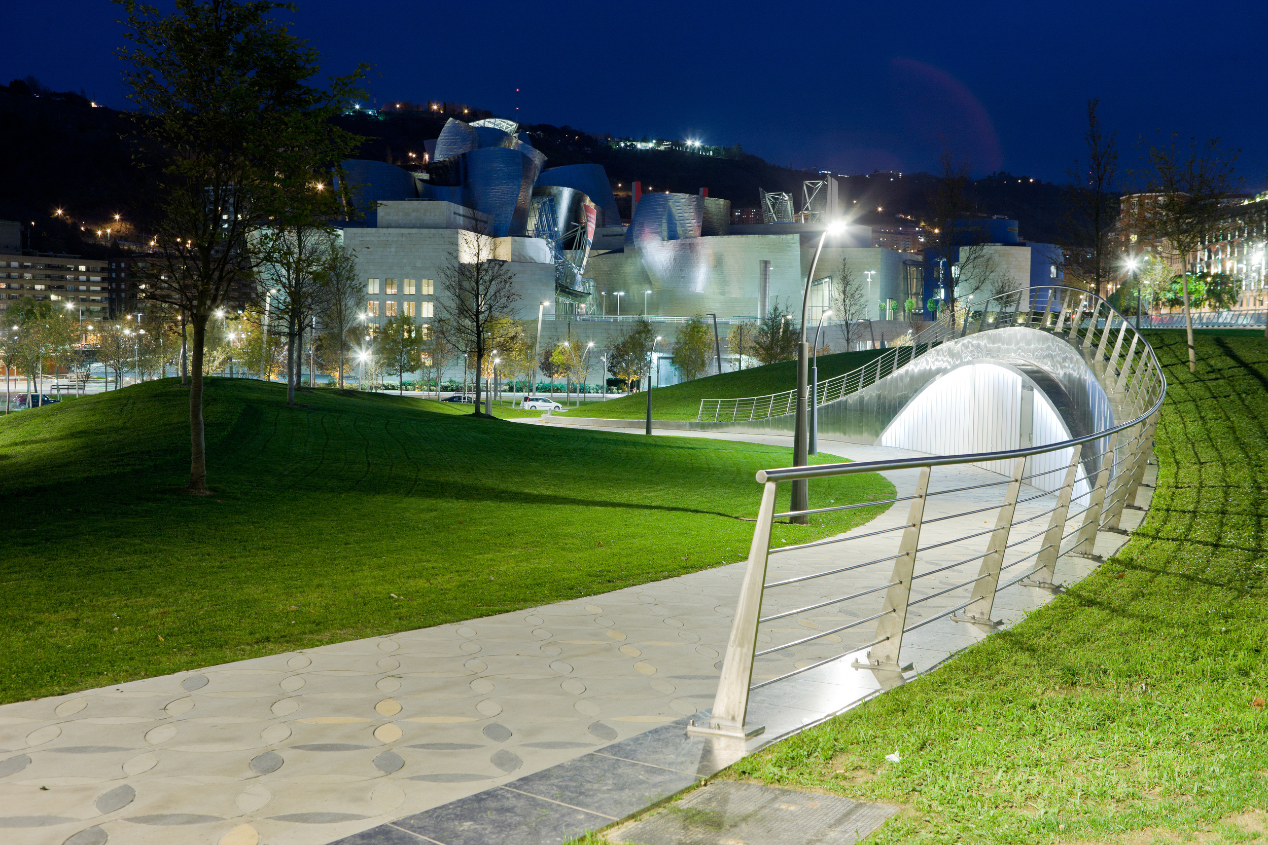
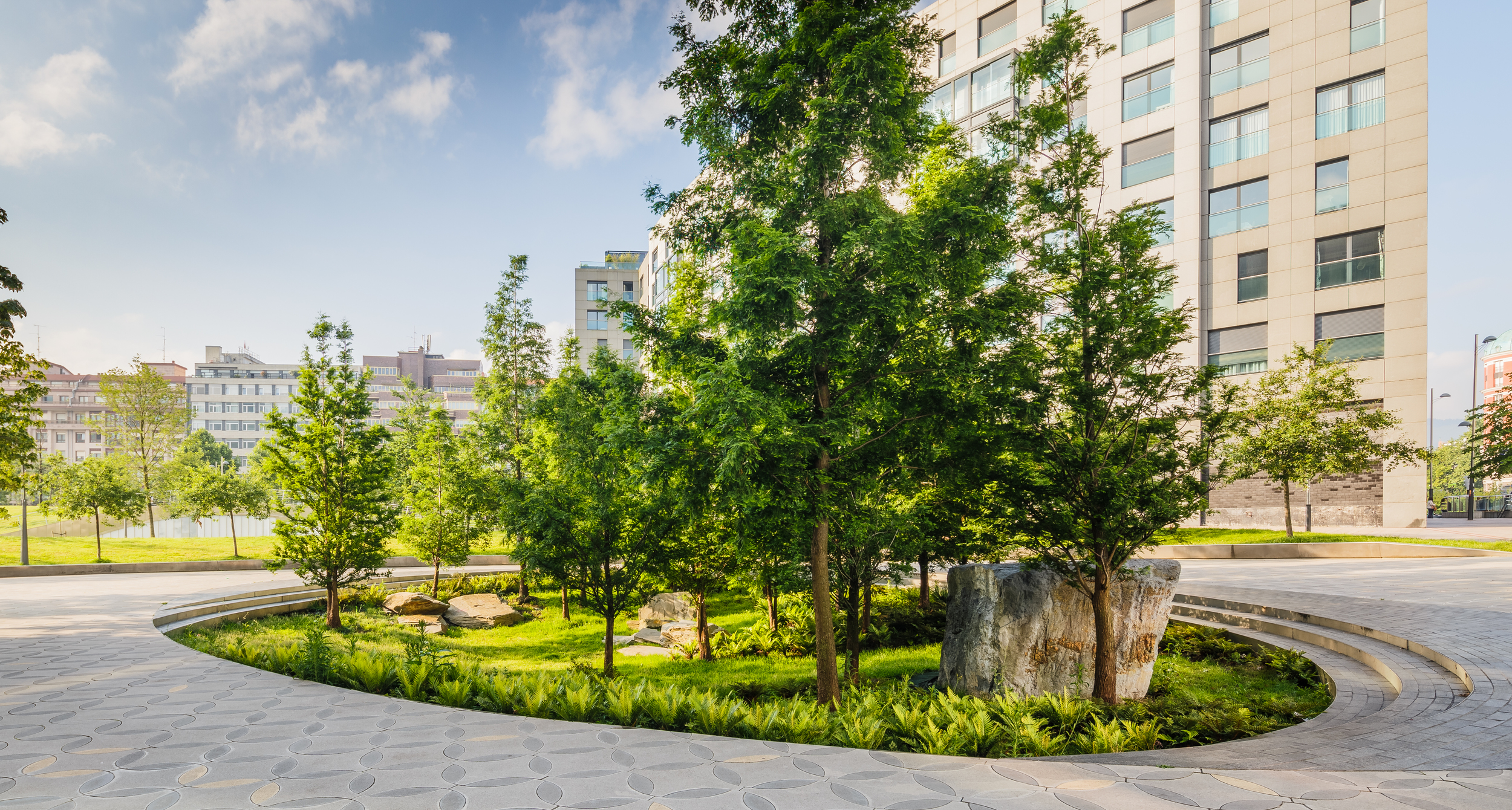
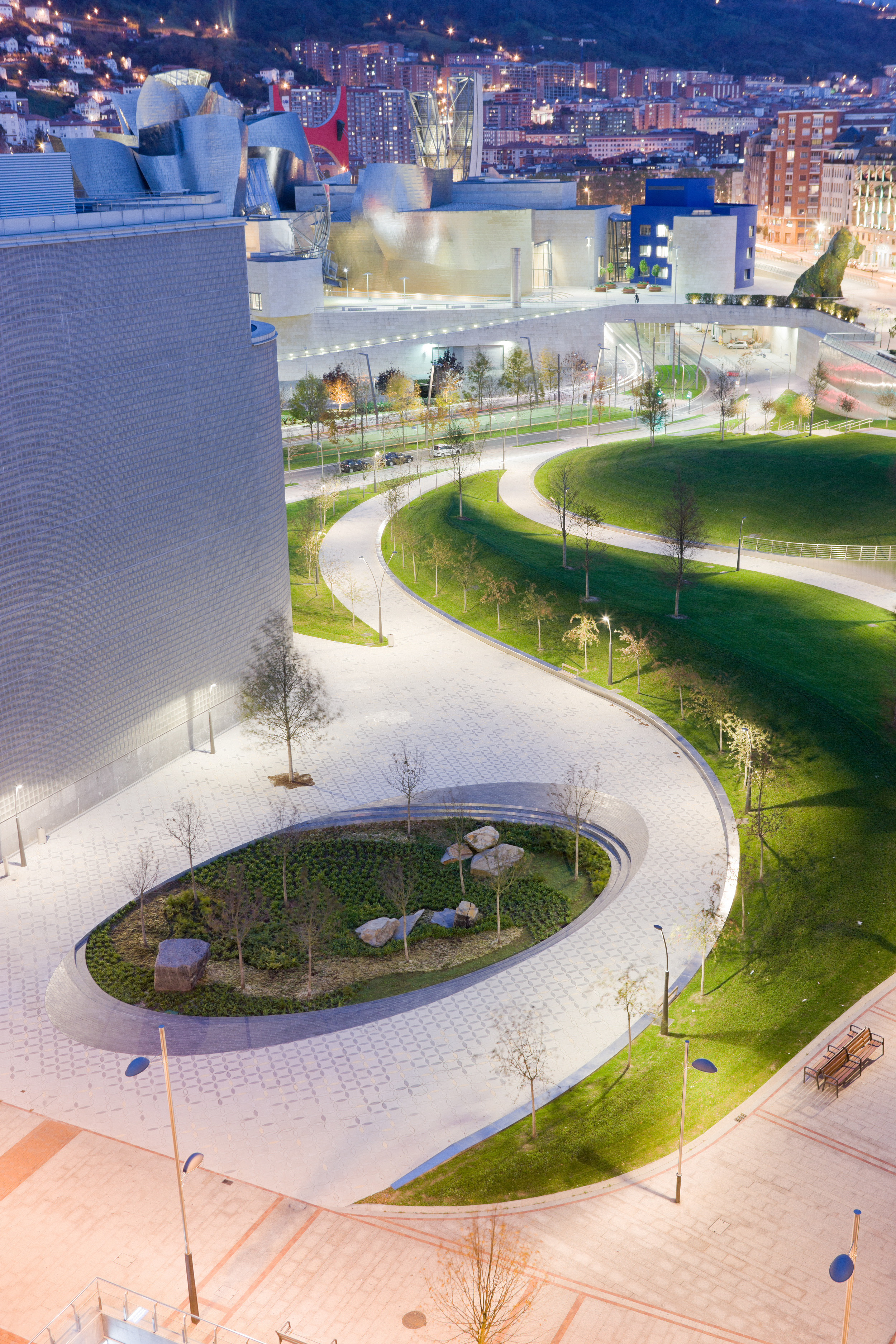
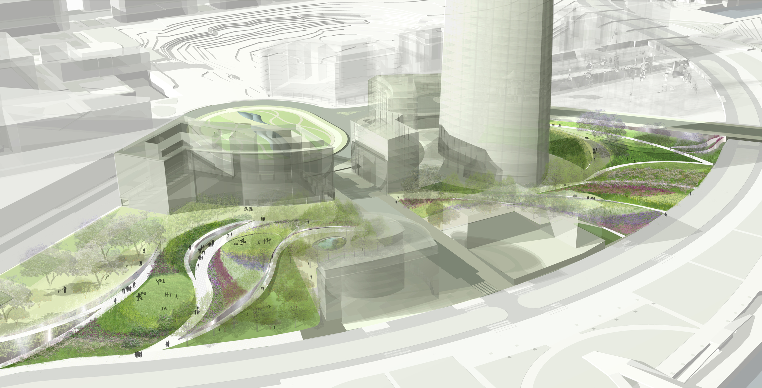
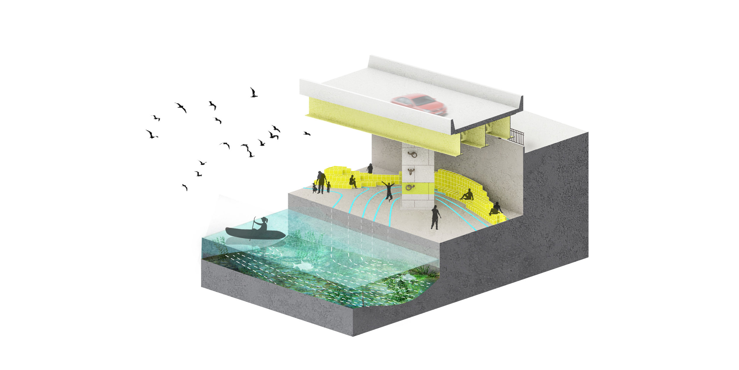
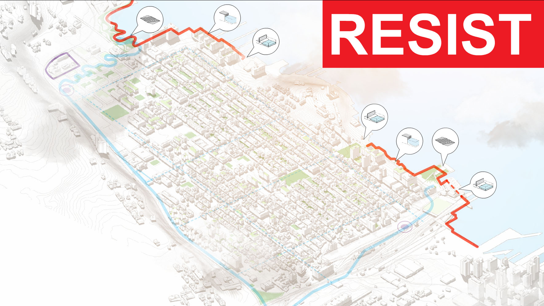
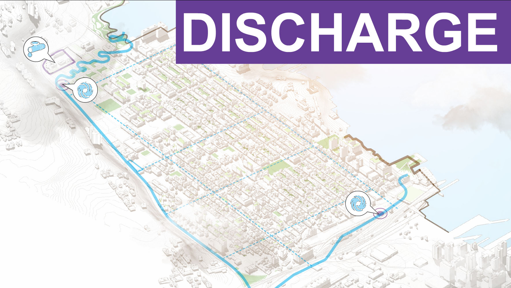
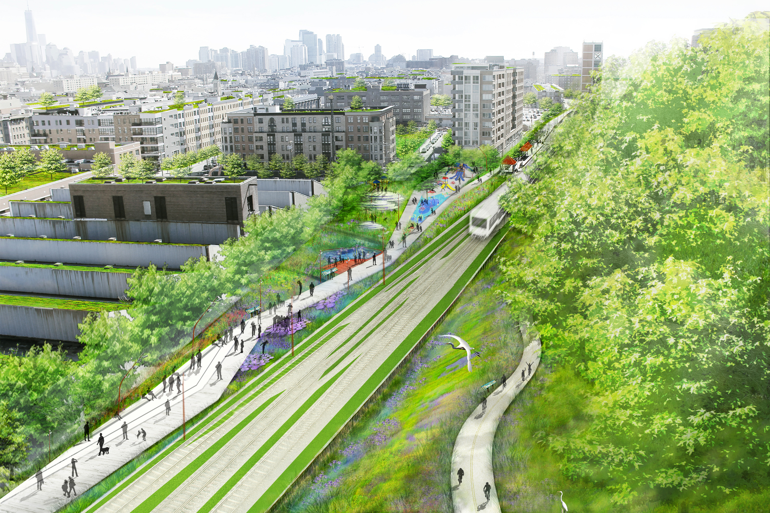
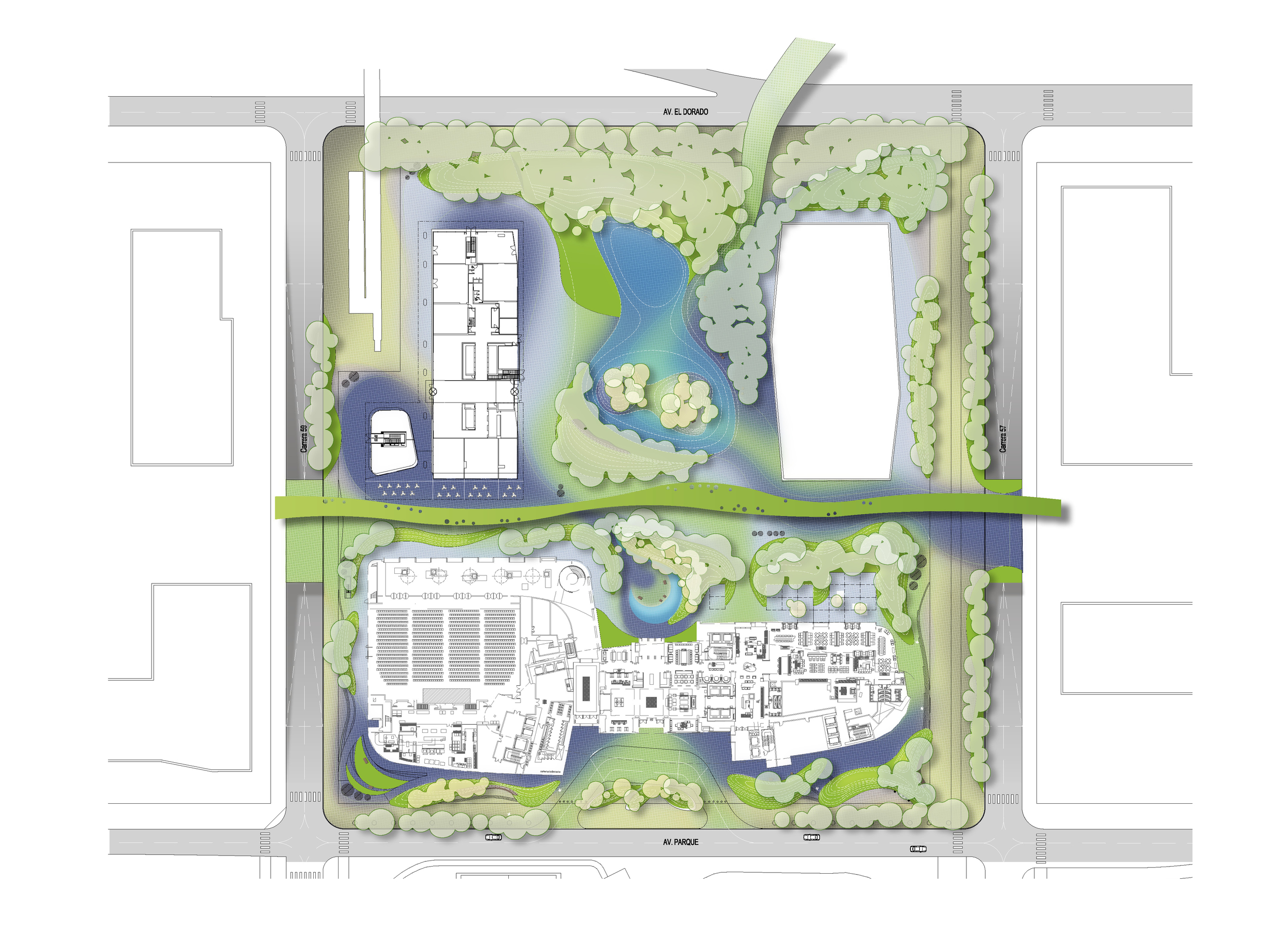
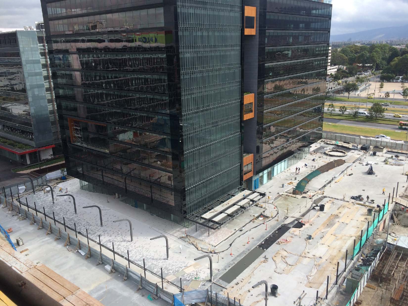
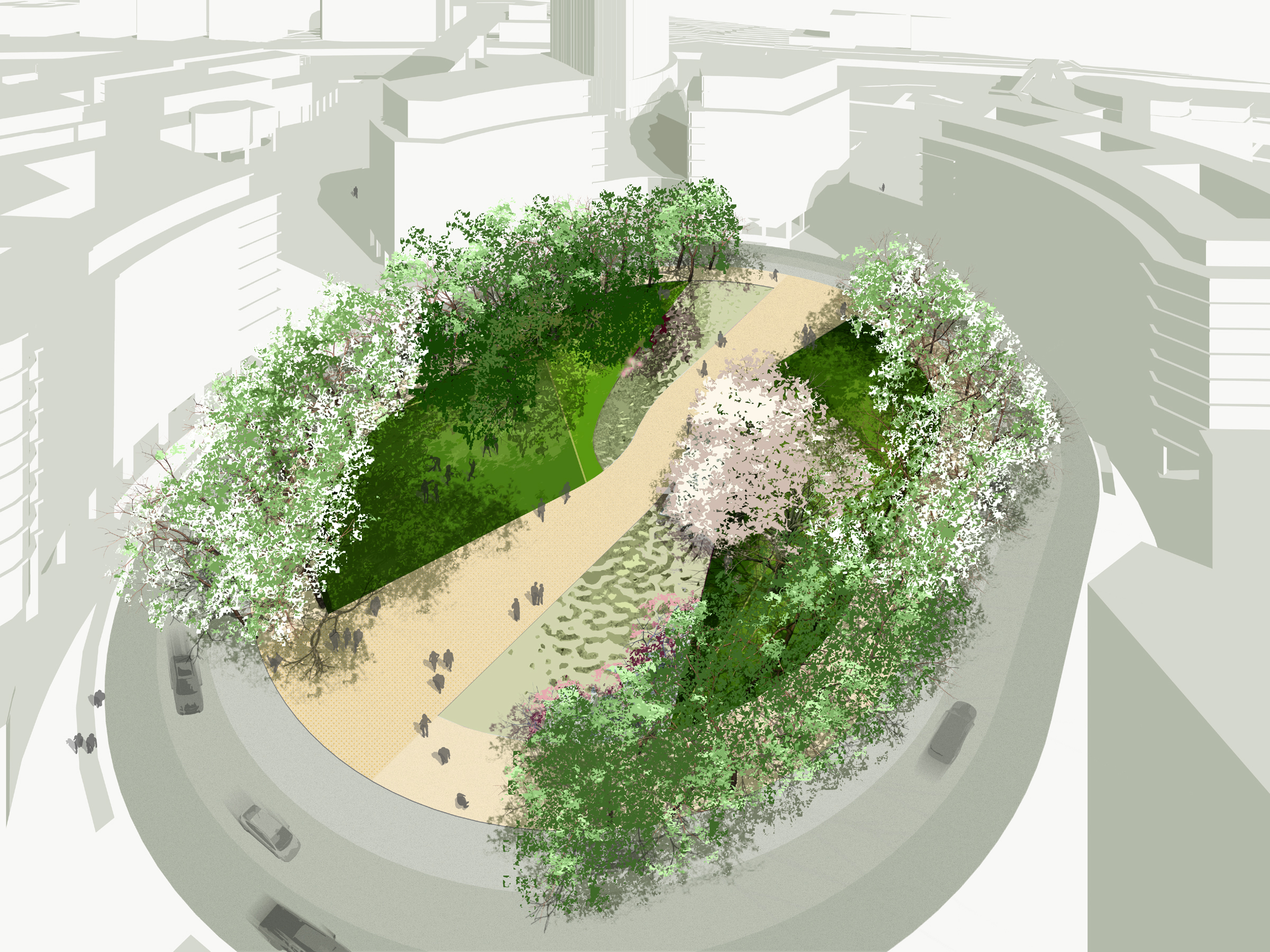
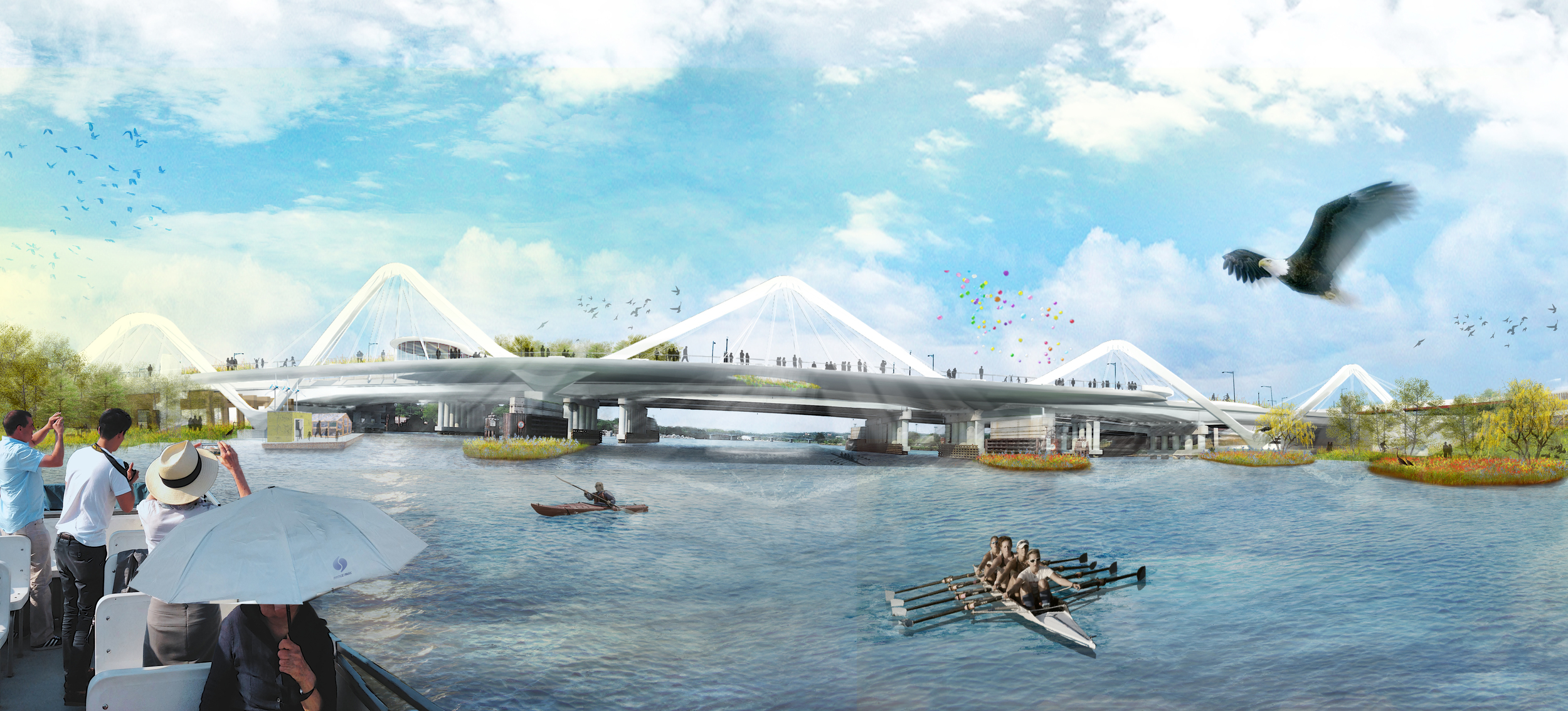
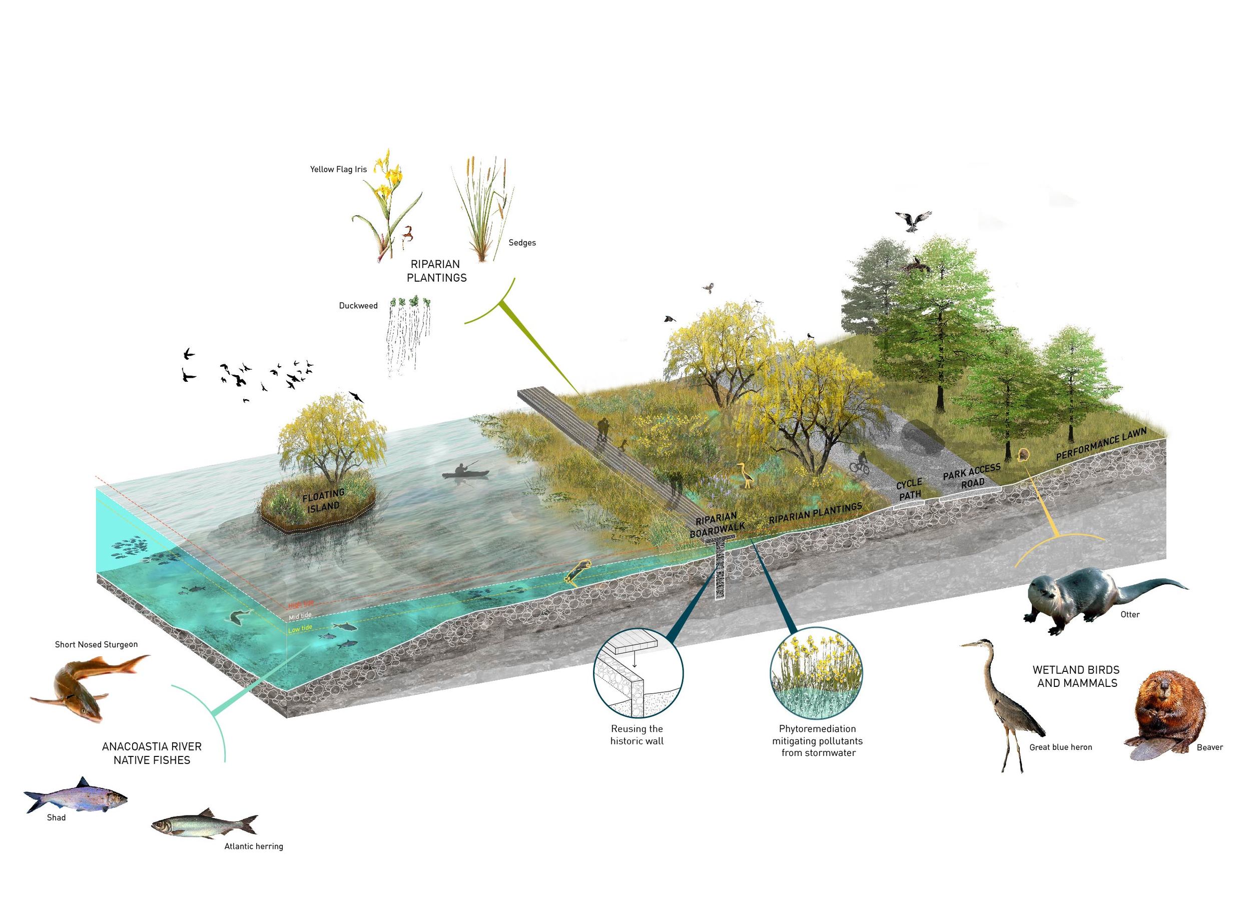
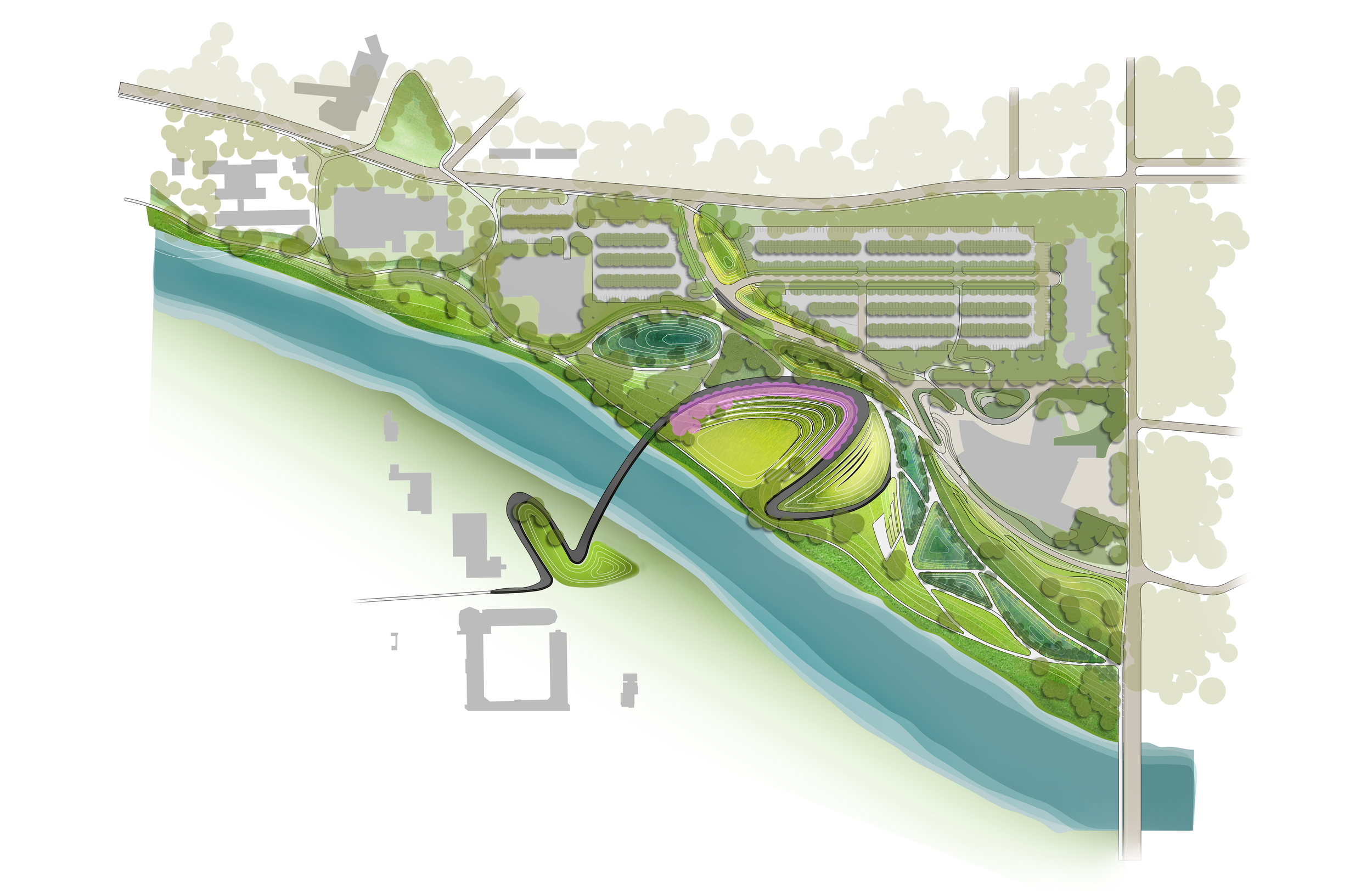
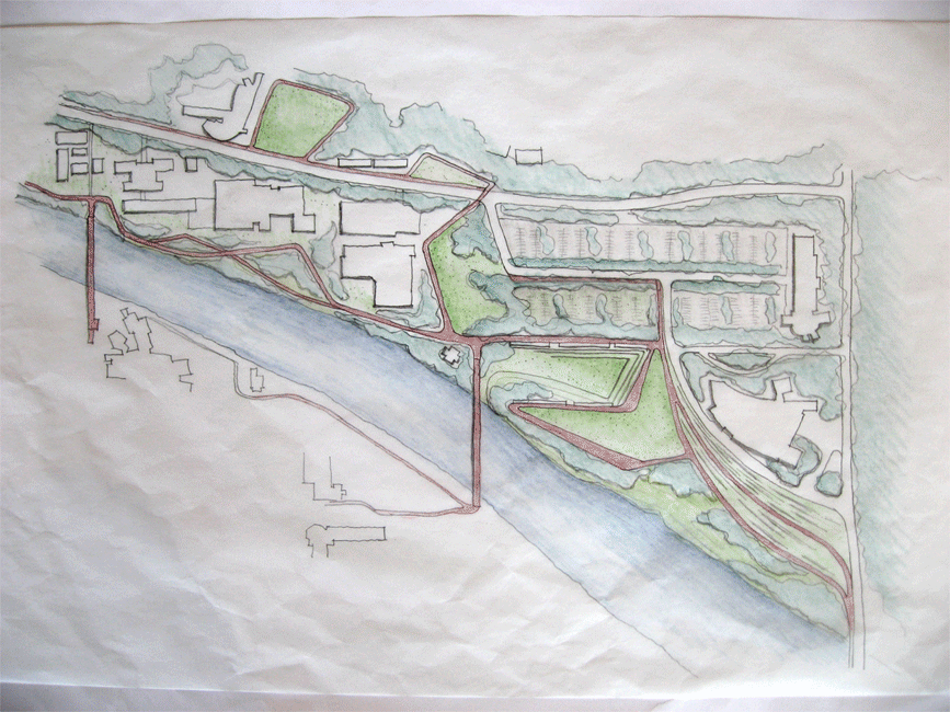
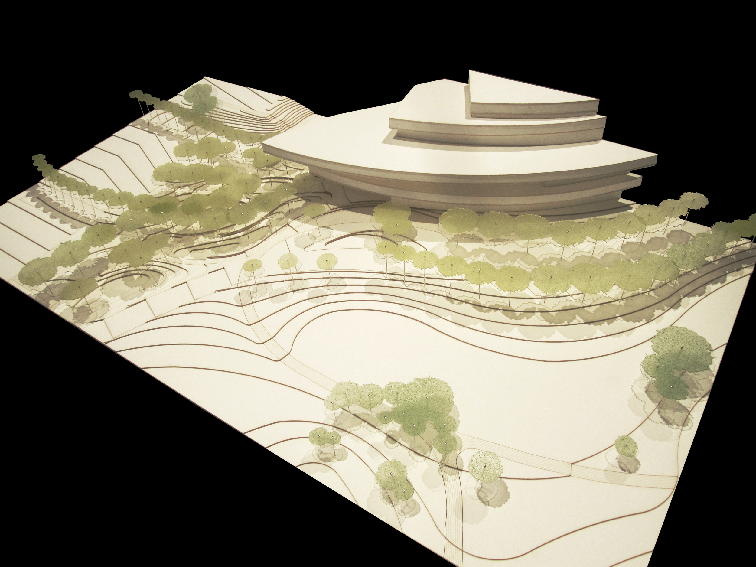
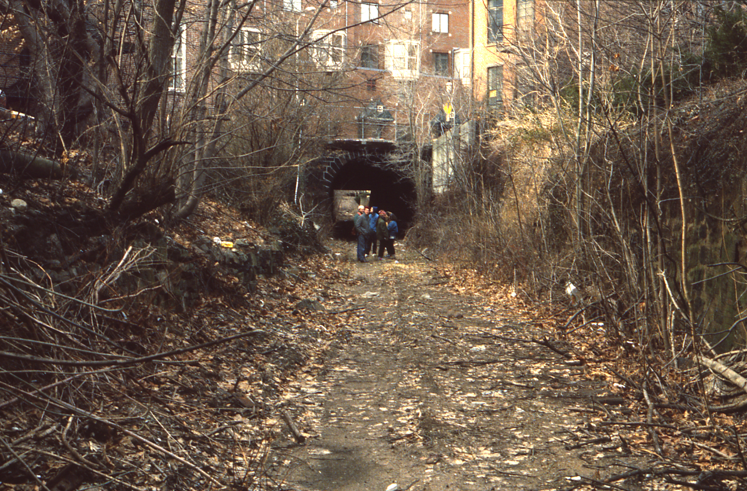
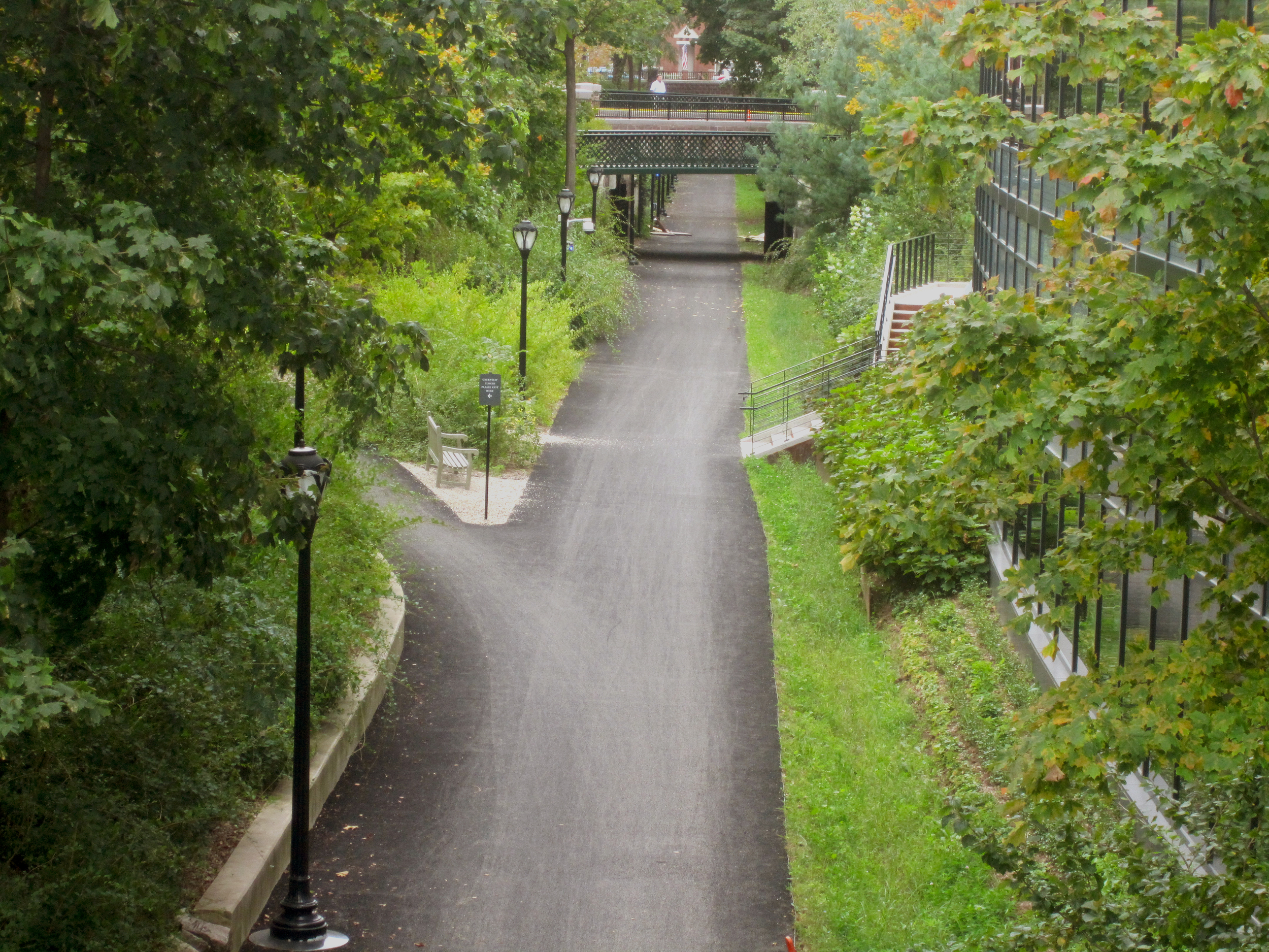
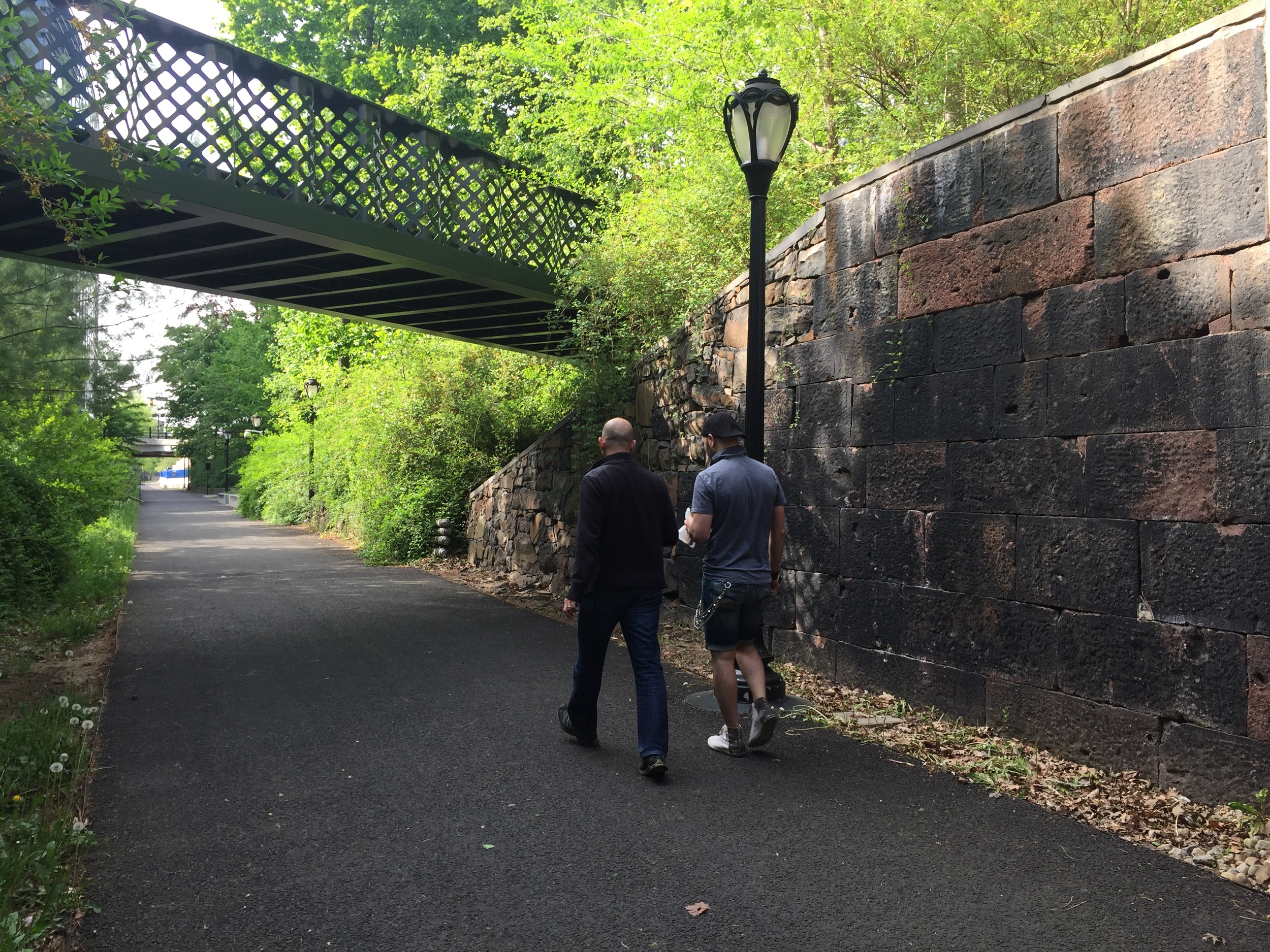
The project will develop the urban void created by Chamartín Station railyard by covering the tracks south of the M-30 ring road with a park. This old industrial wasteland and brownfield splits the north of Madrid in two creating a physical barrier between Plaza de Castilla and Avenida de Burgos. The intervention aims to stitch neighborhoods, reconnect green systems, create public spaces and improve mobility. Distrito Castellana Norte has registered the project to achieve BREEAM and LEED certifications. The team in charge of the design guidelines for all public spaces, streetscapes, and urban landscapes is led by Balmori Associates, with PCPA and Arup.

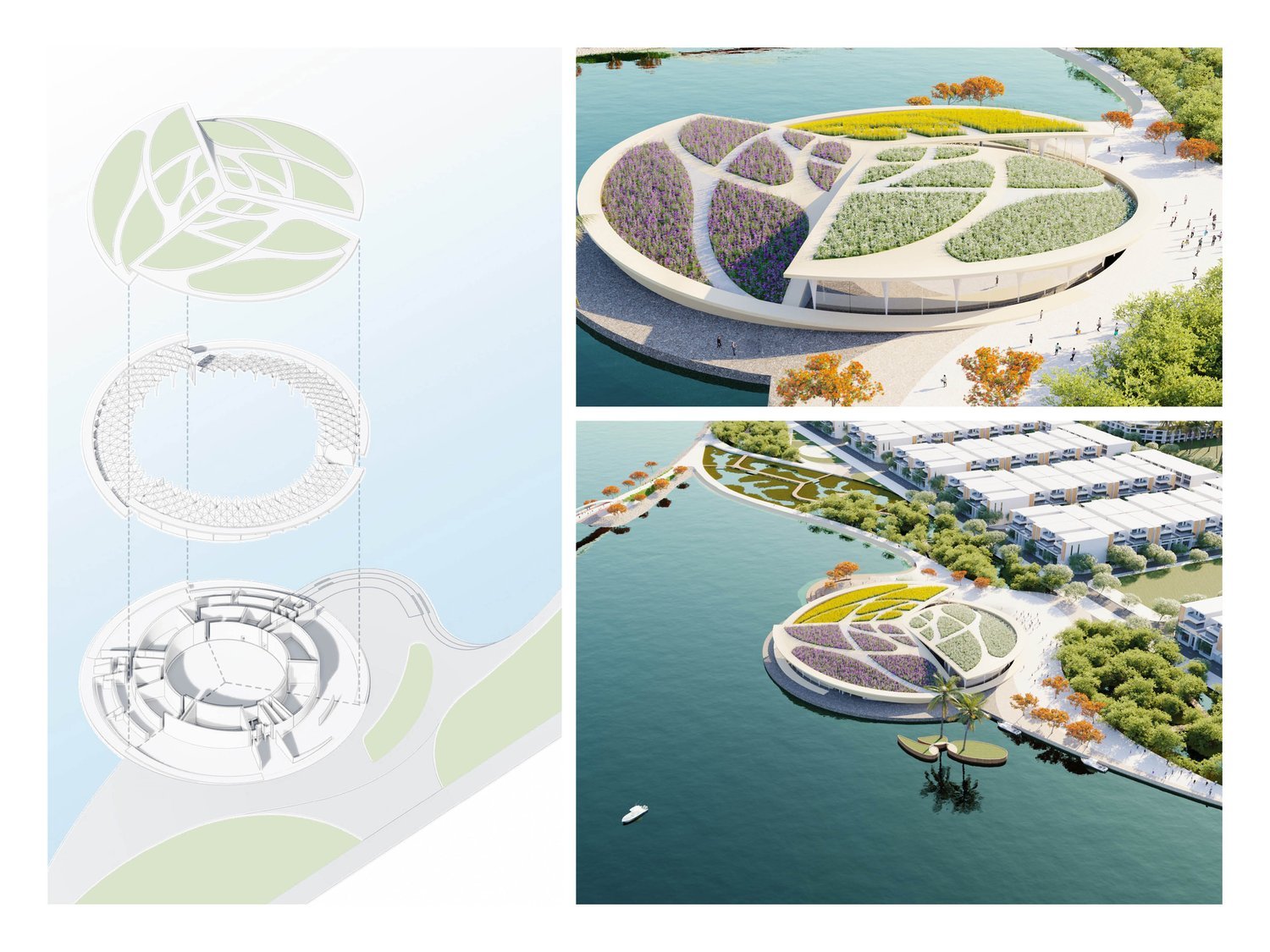
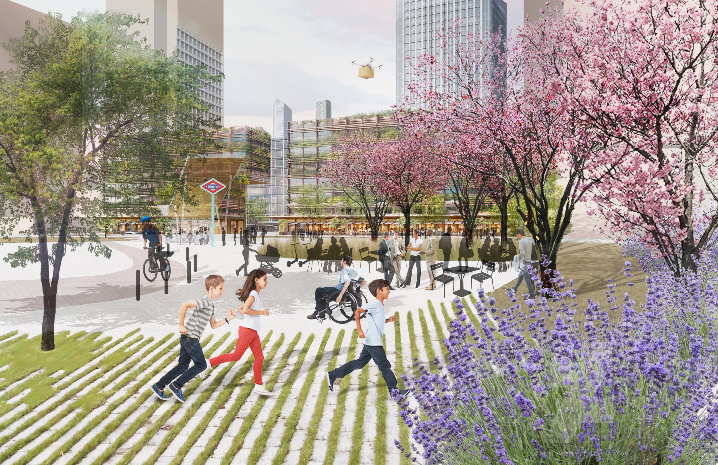
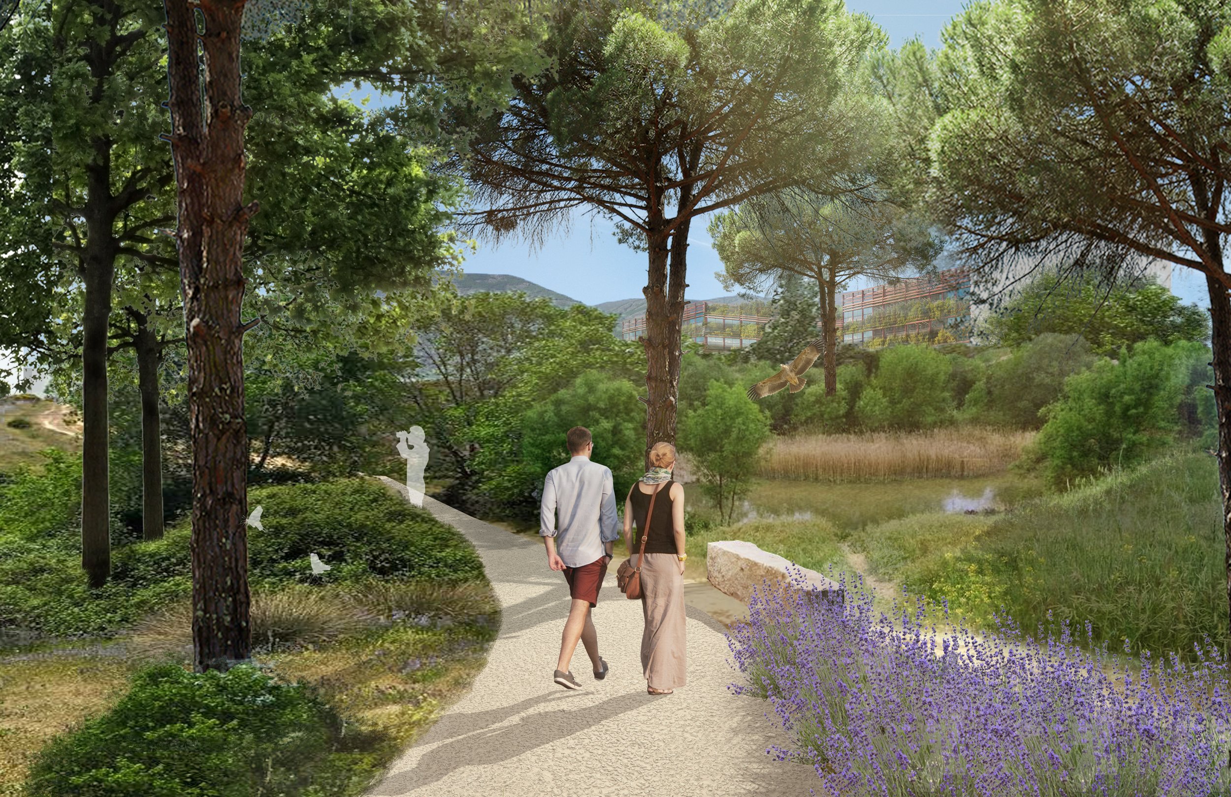
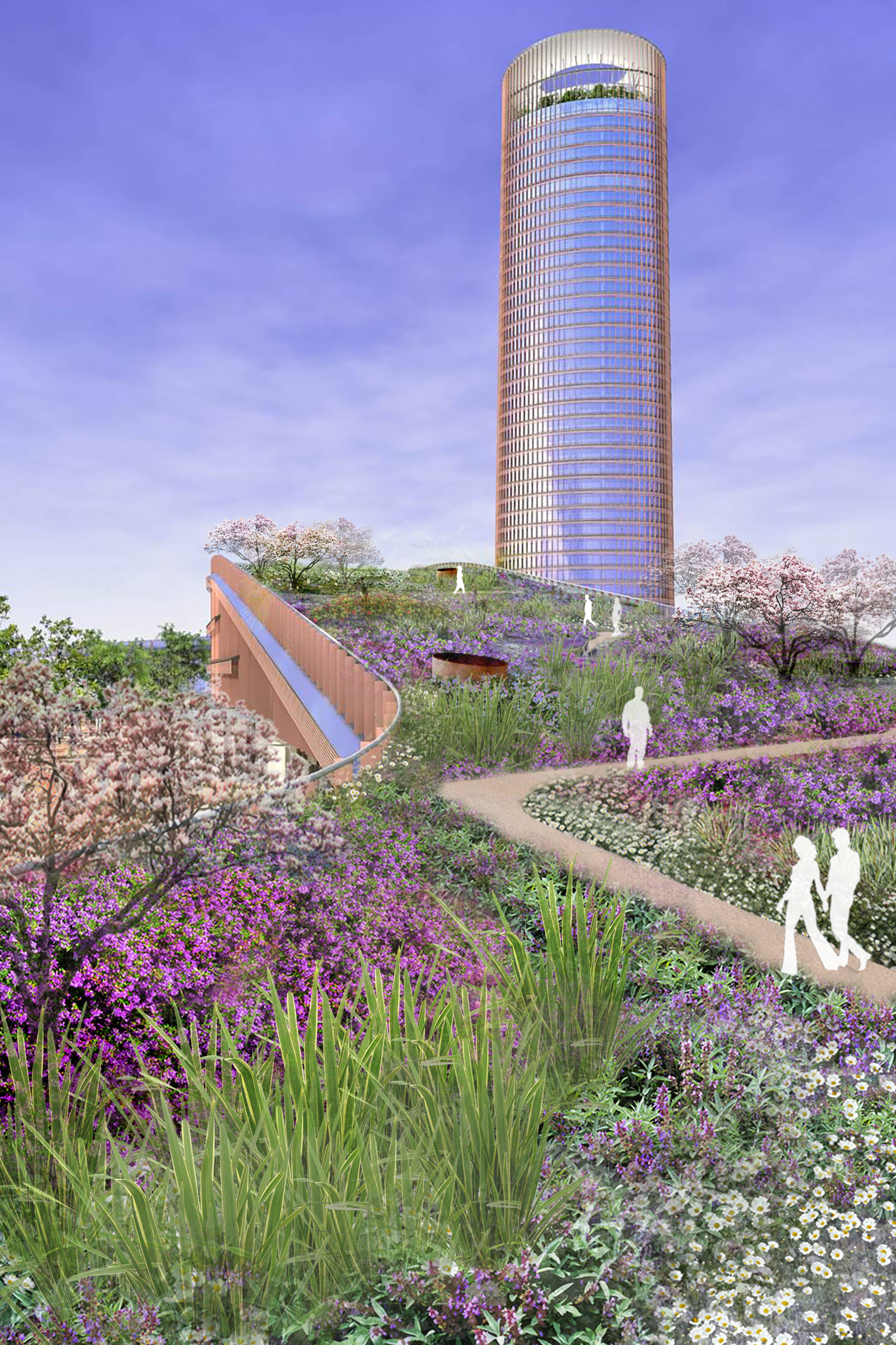
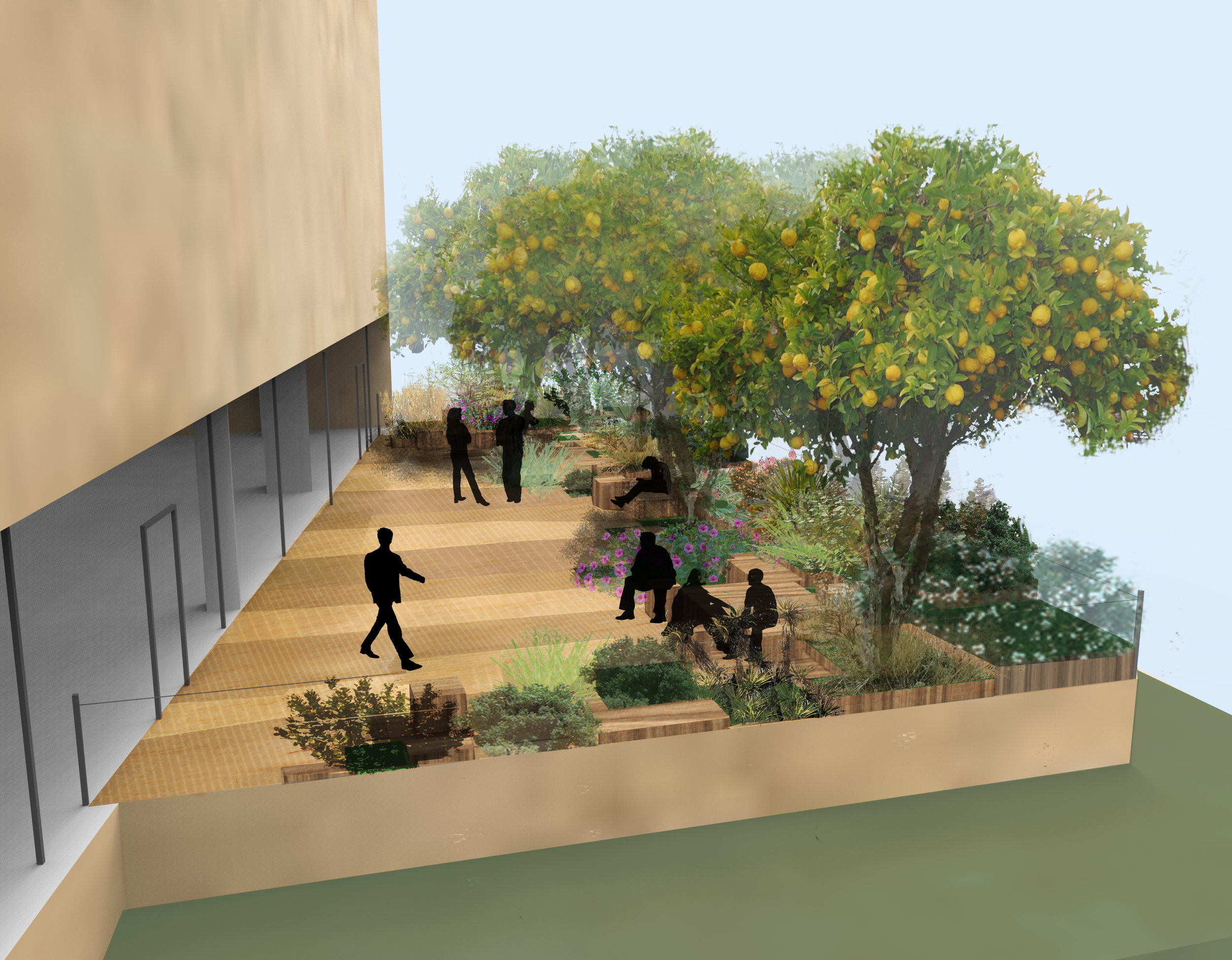
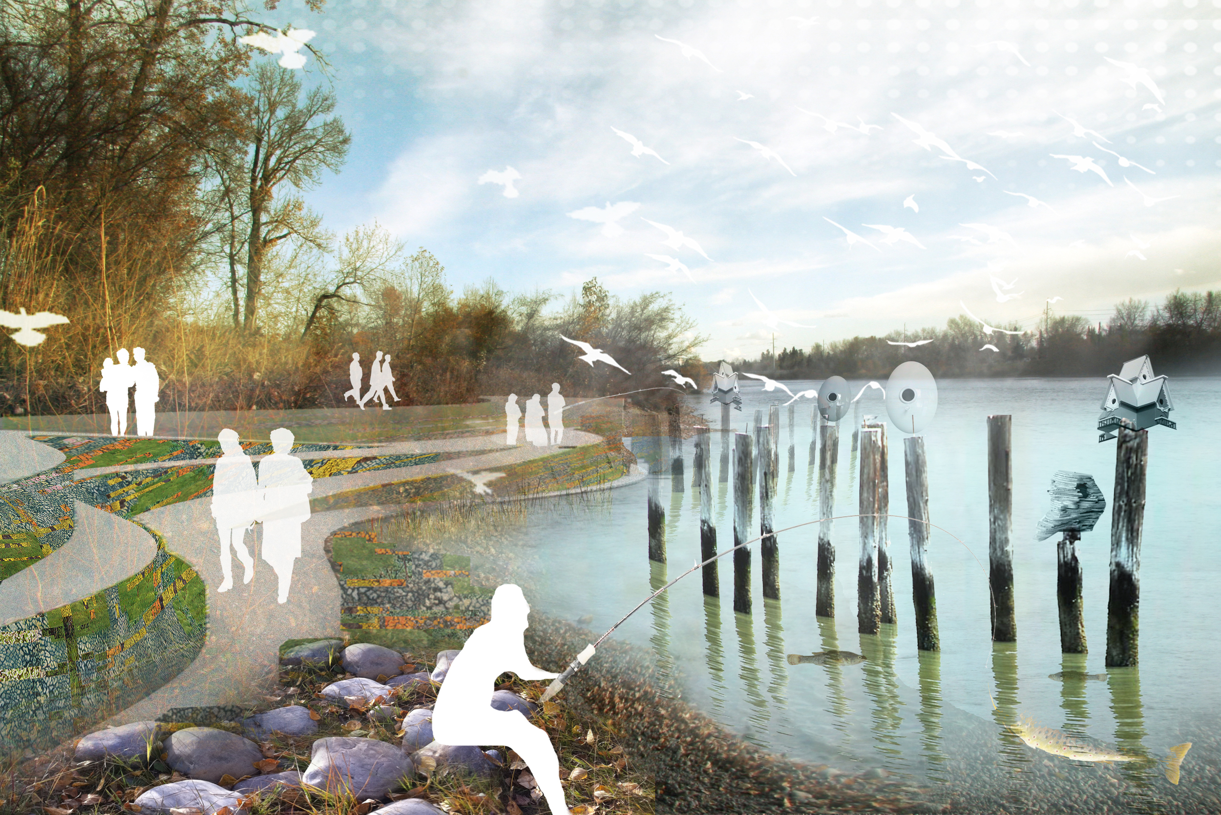
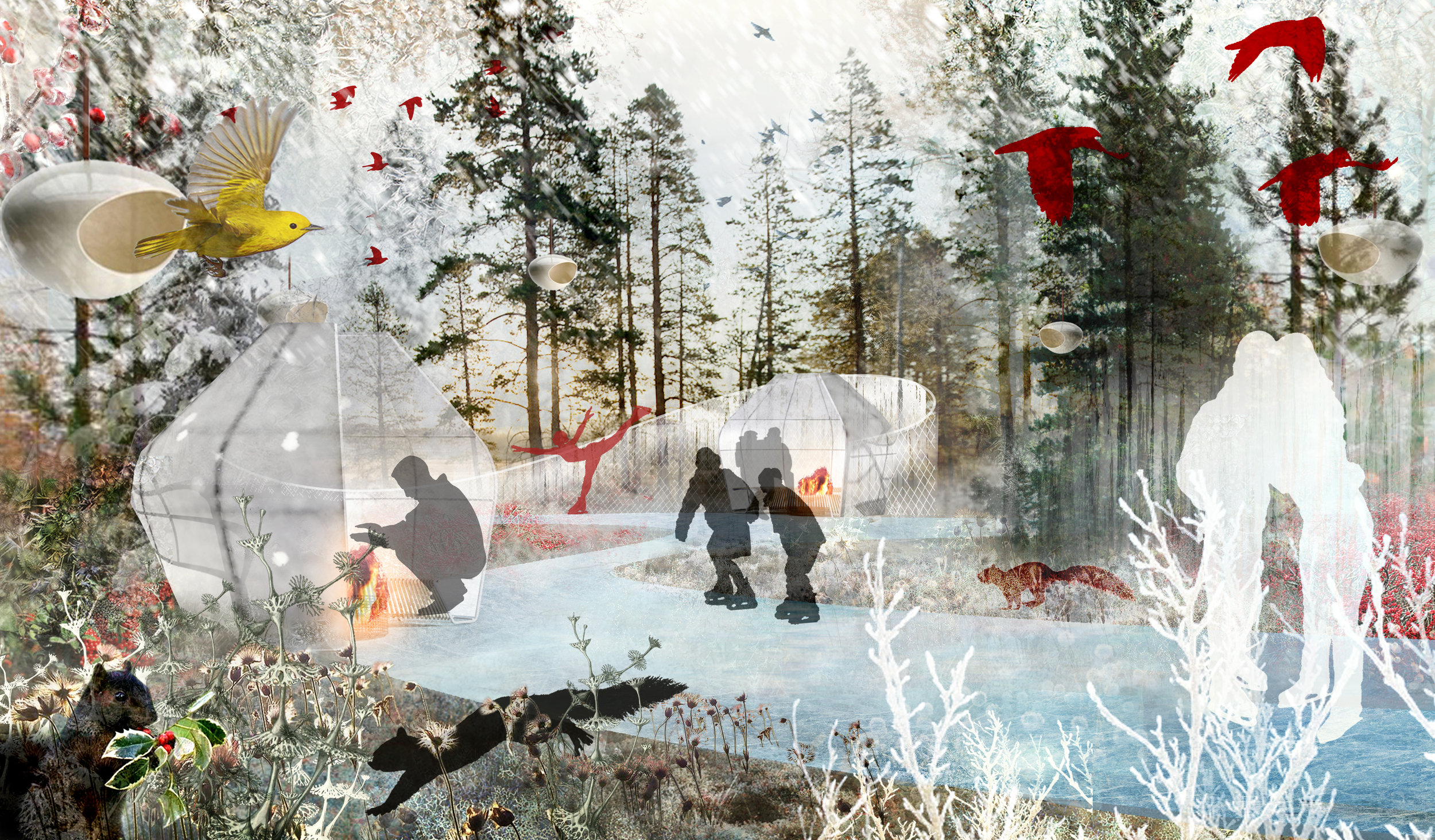
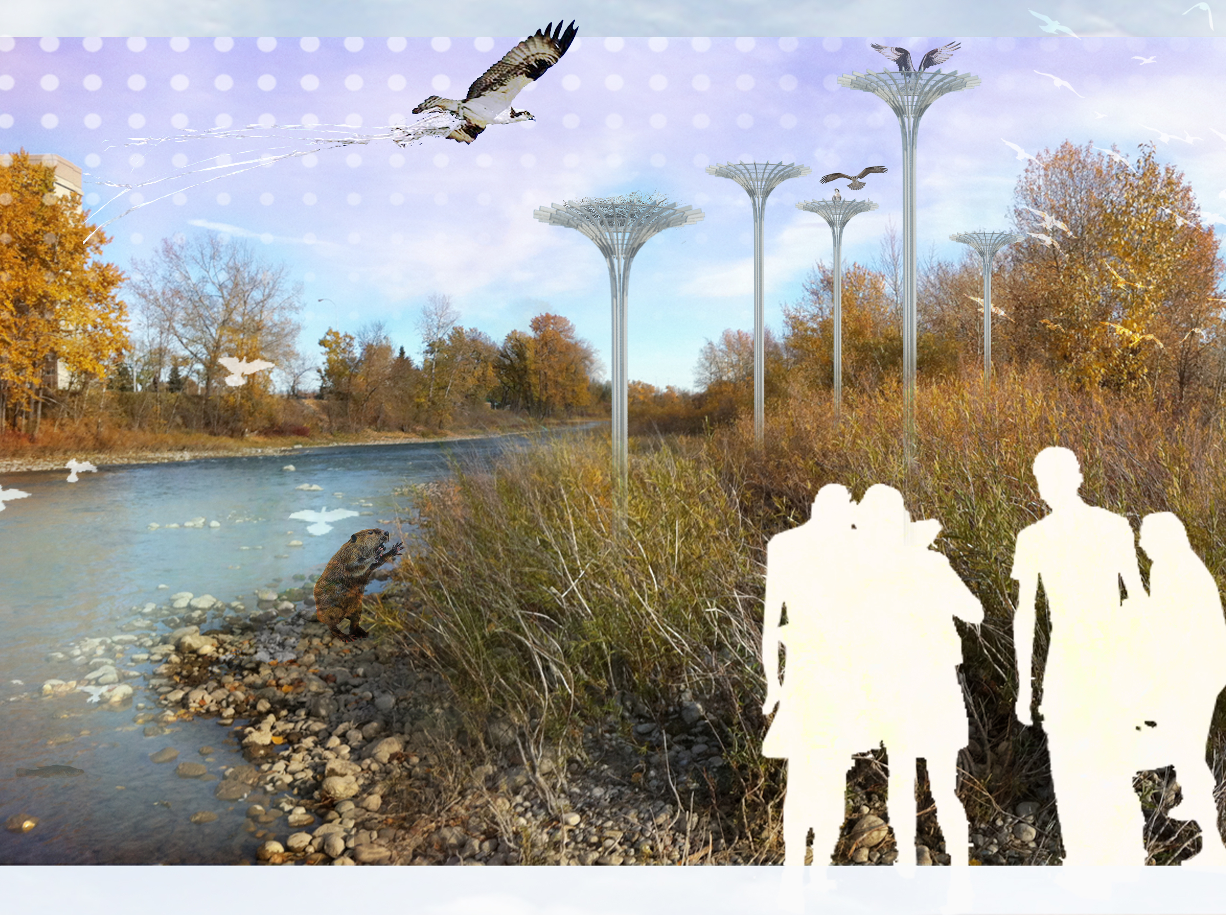
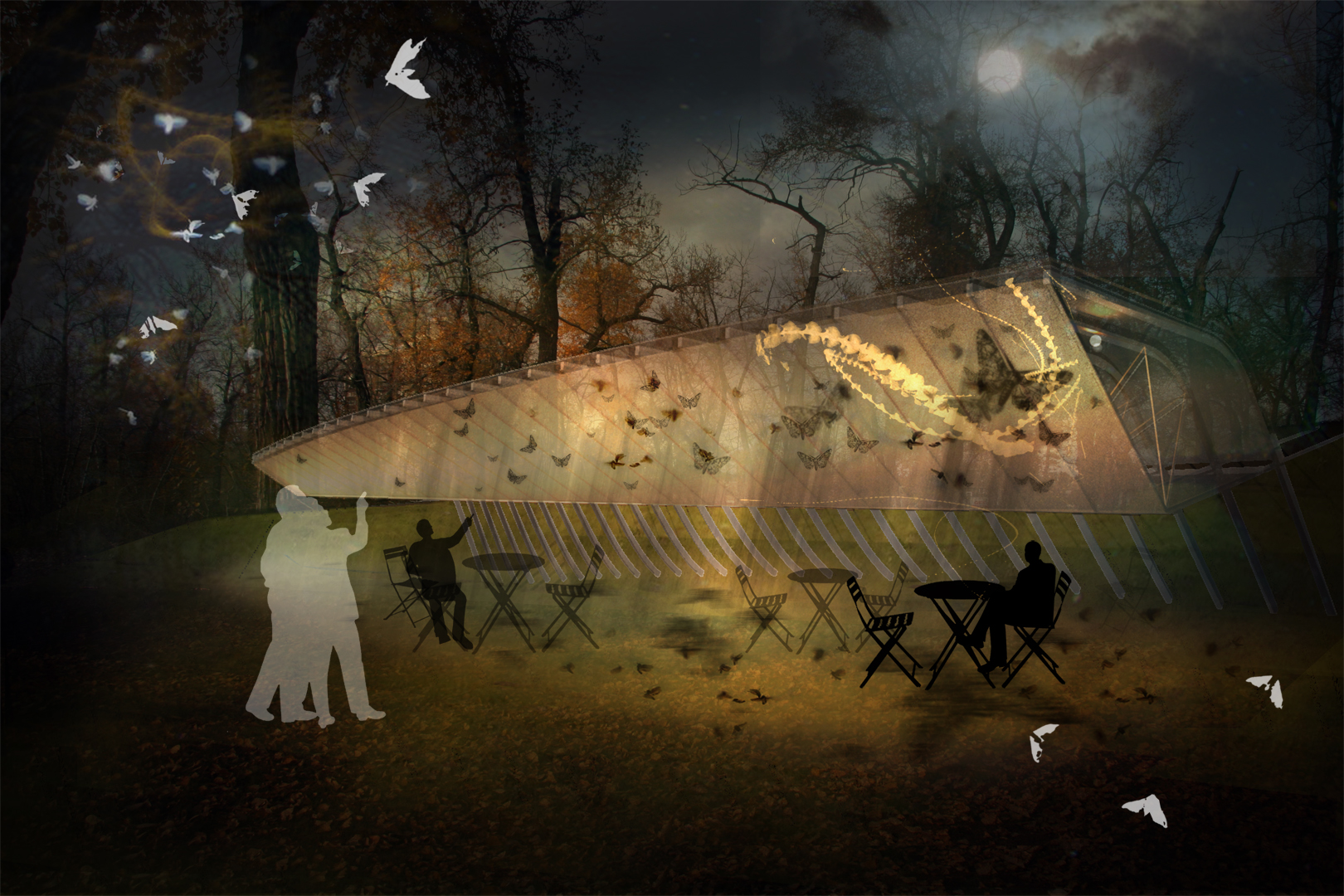
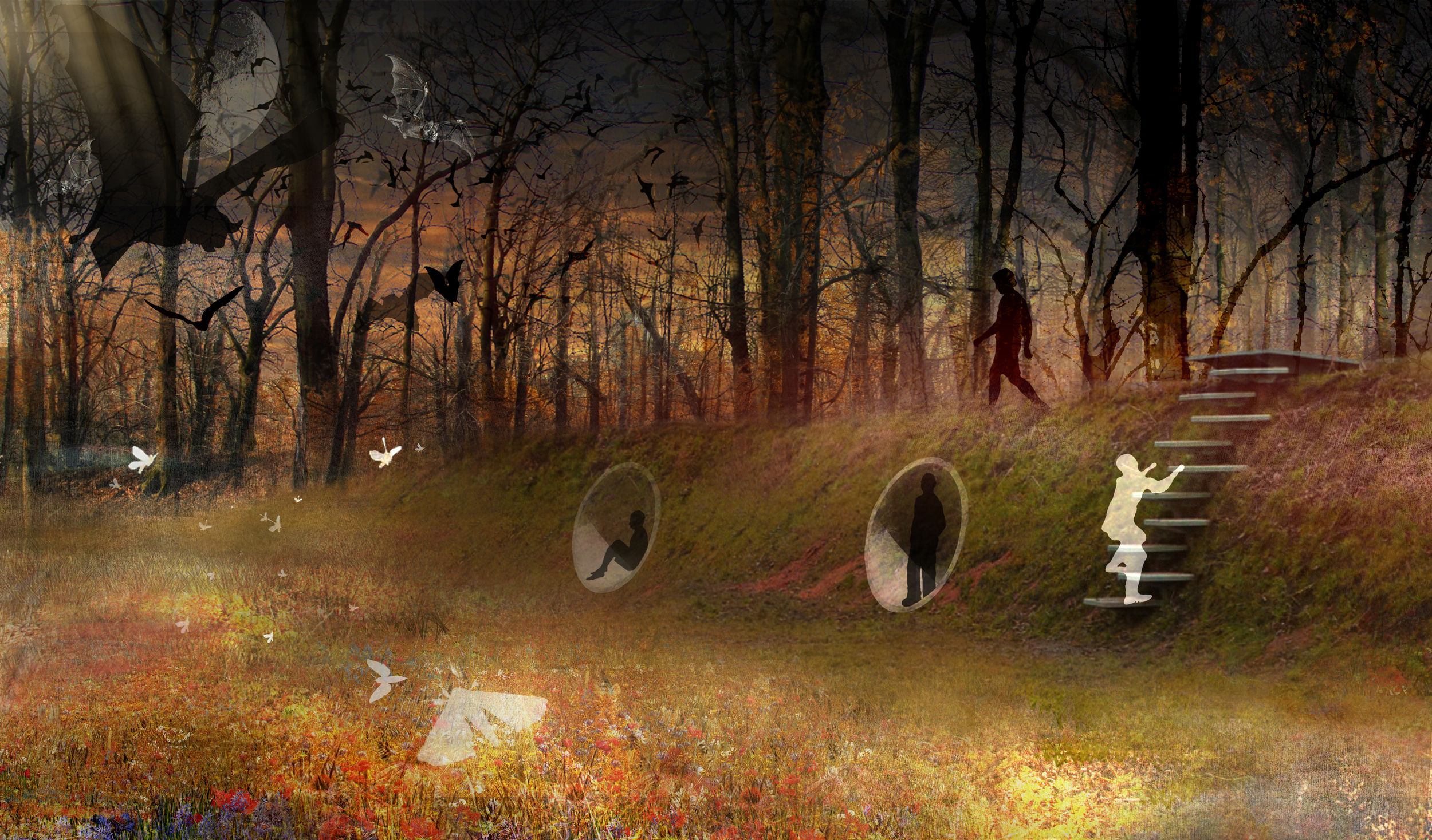
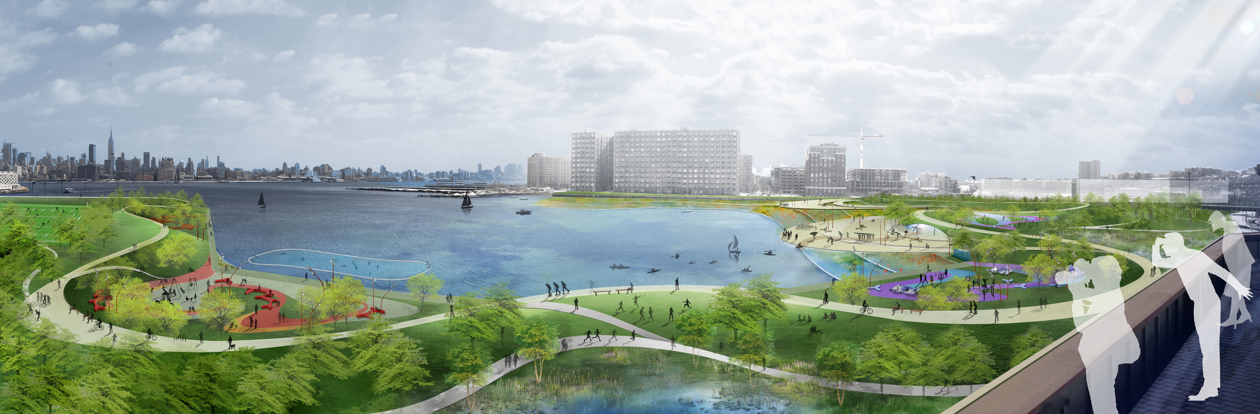
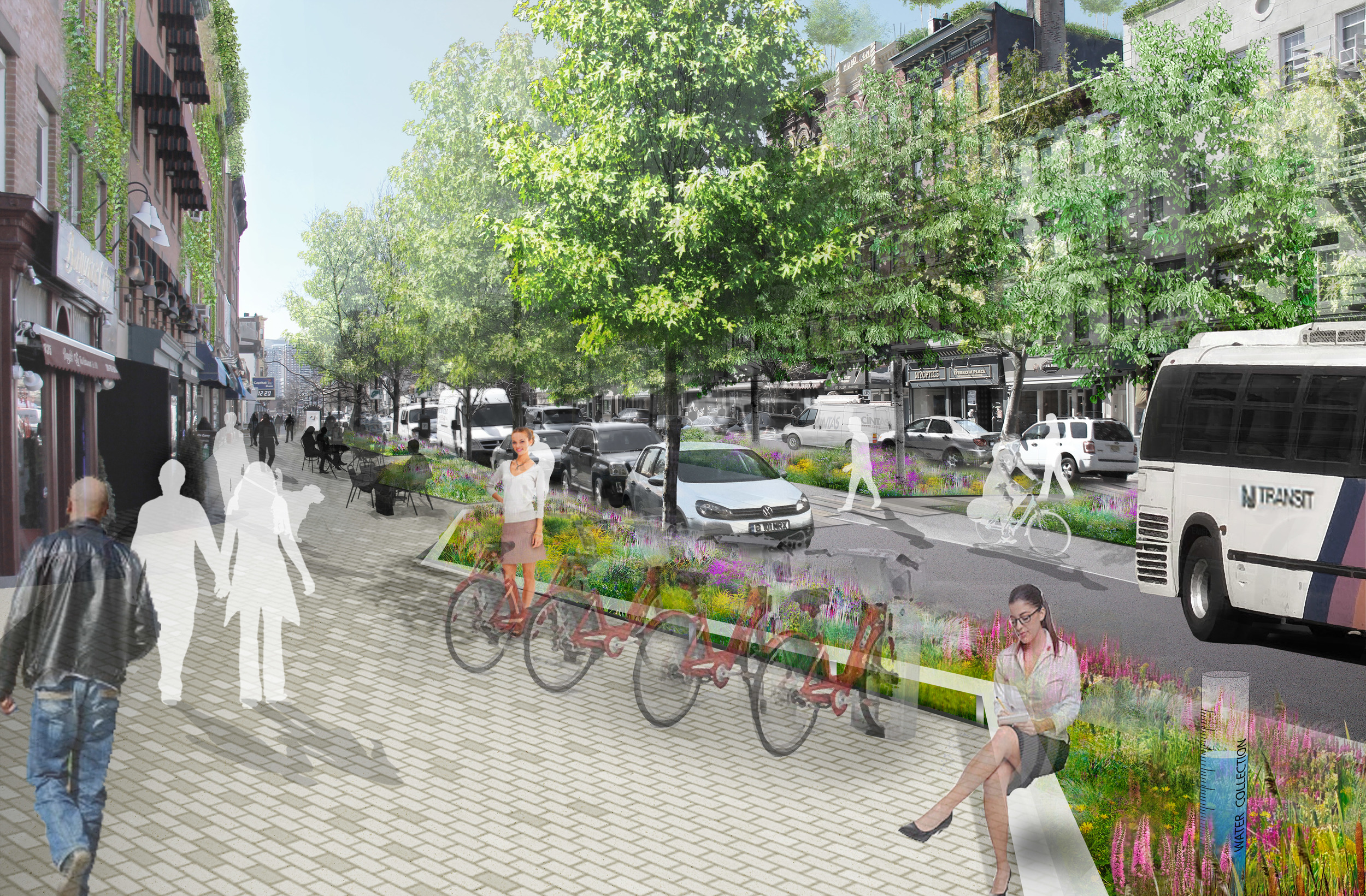
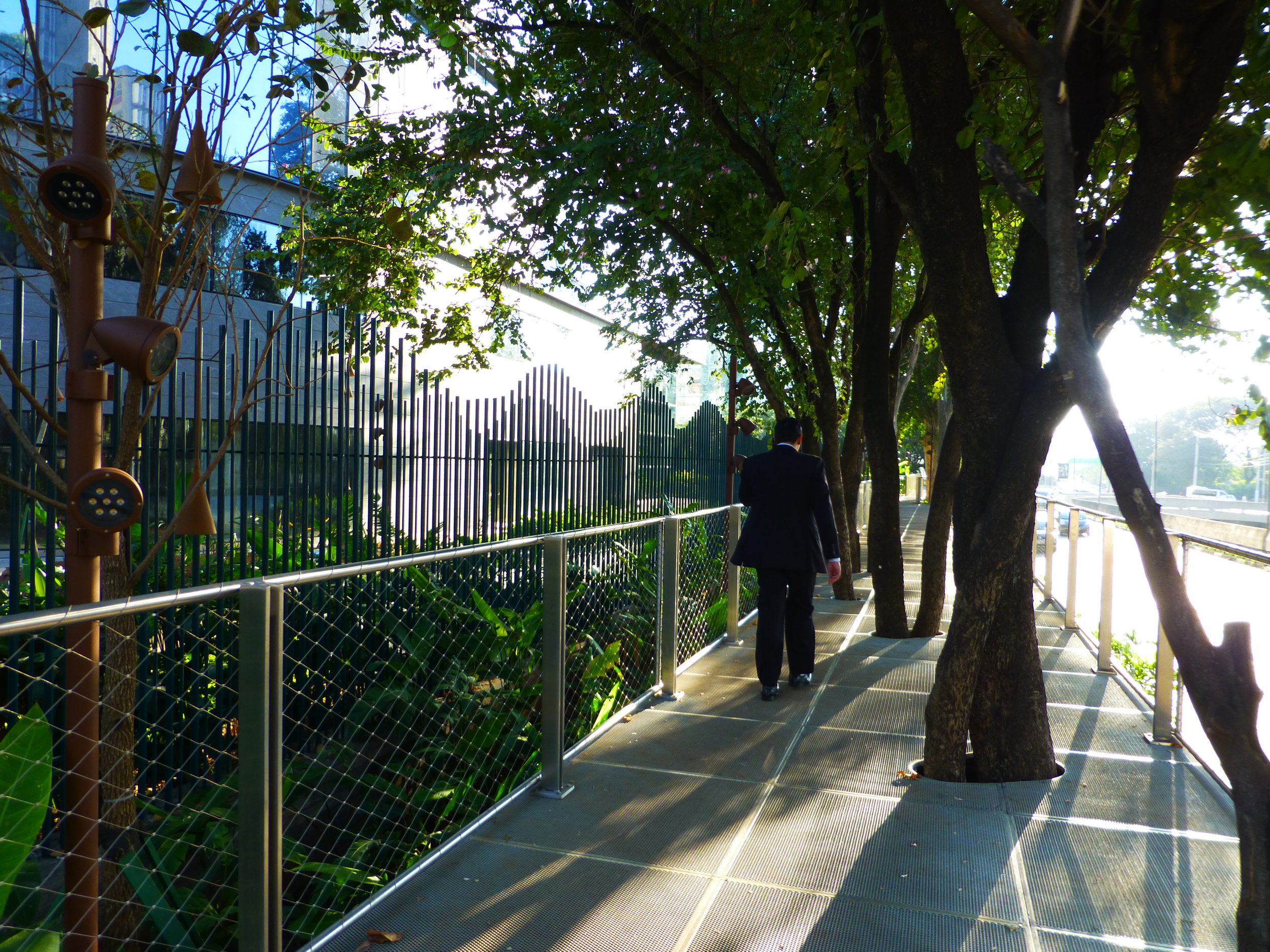
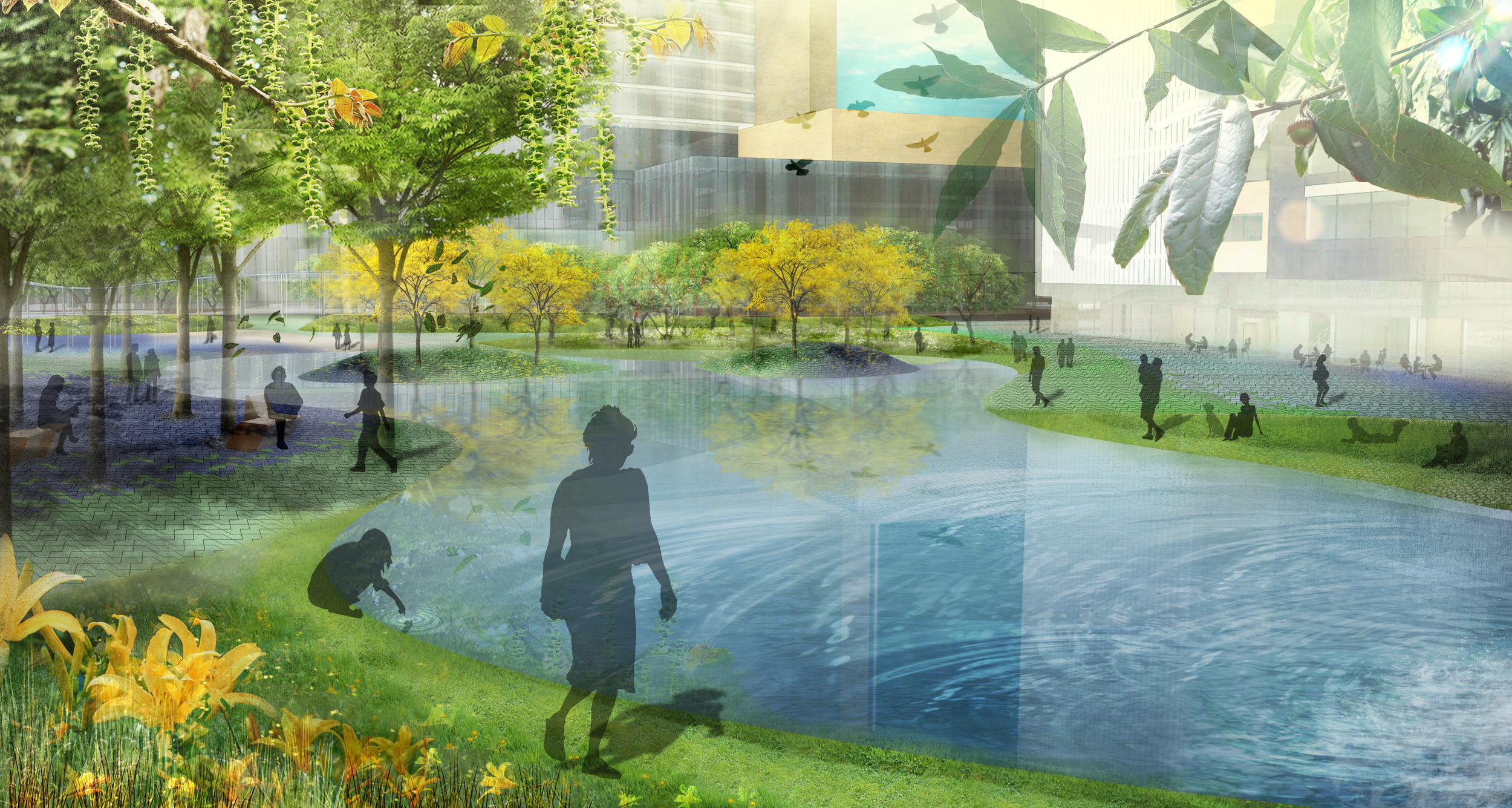
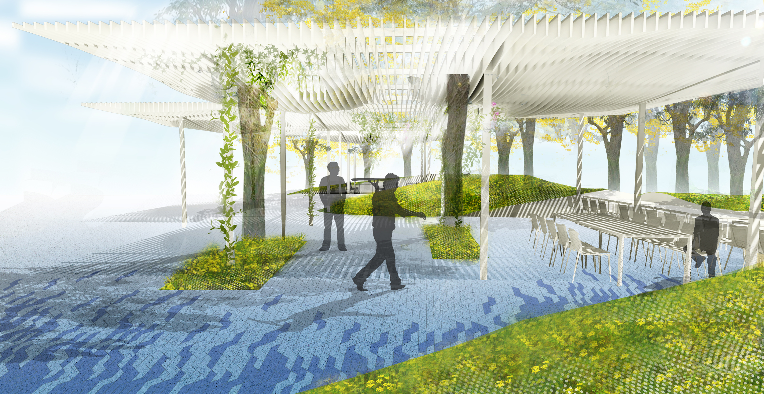
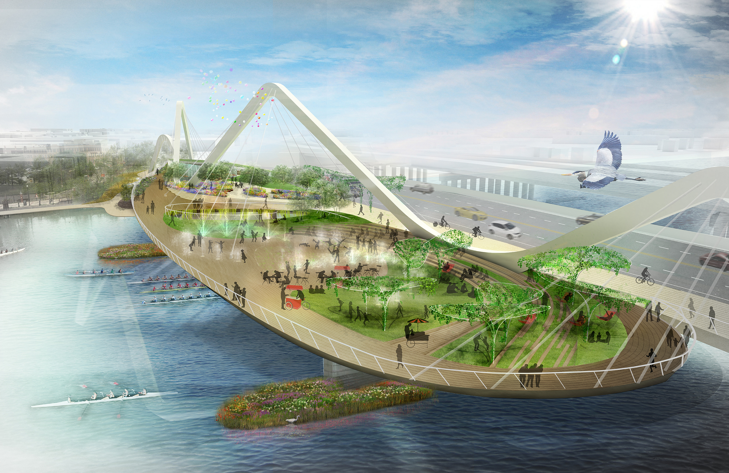
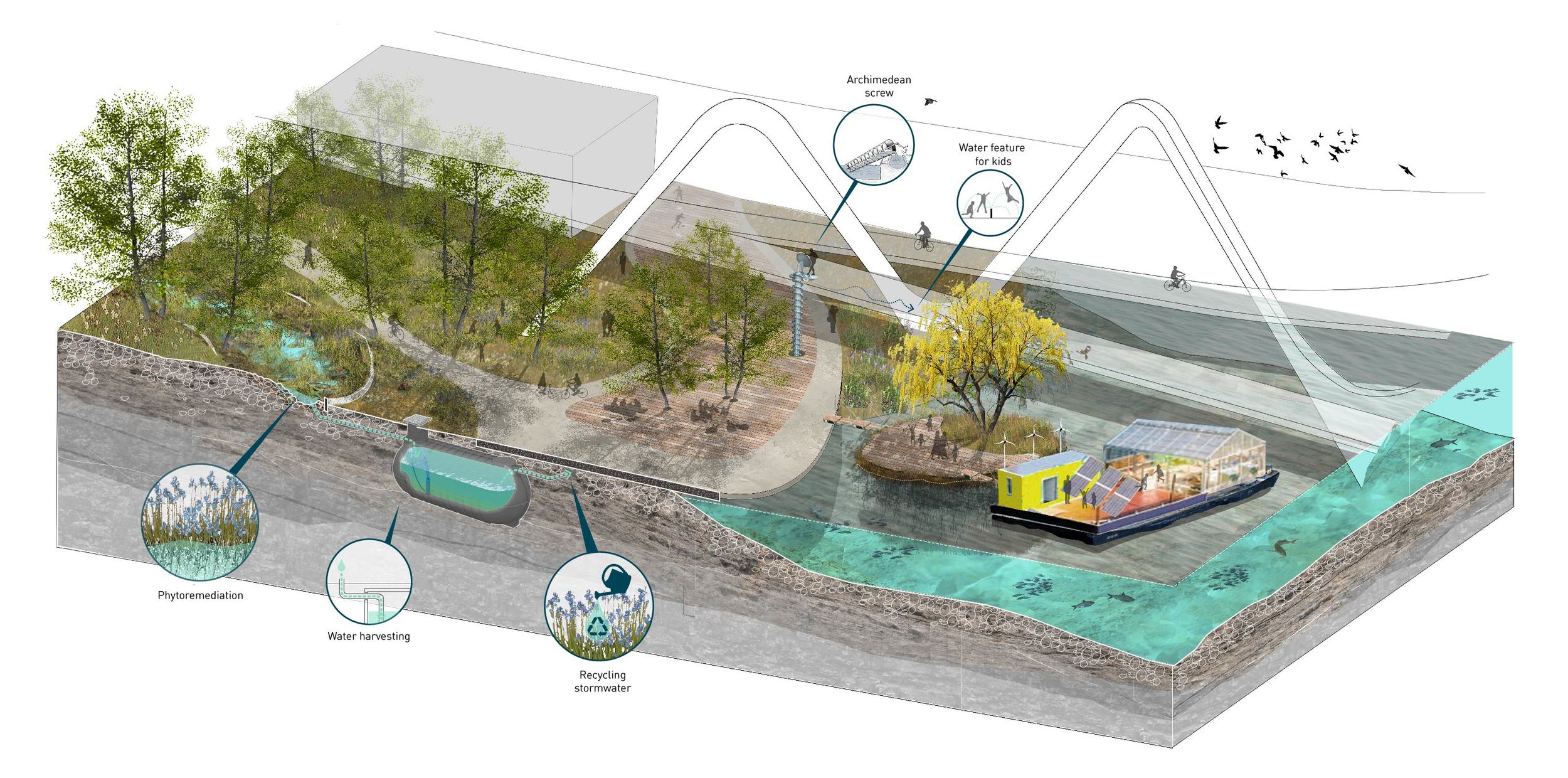
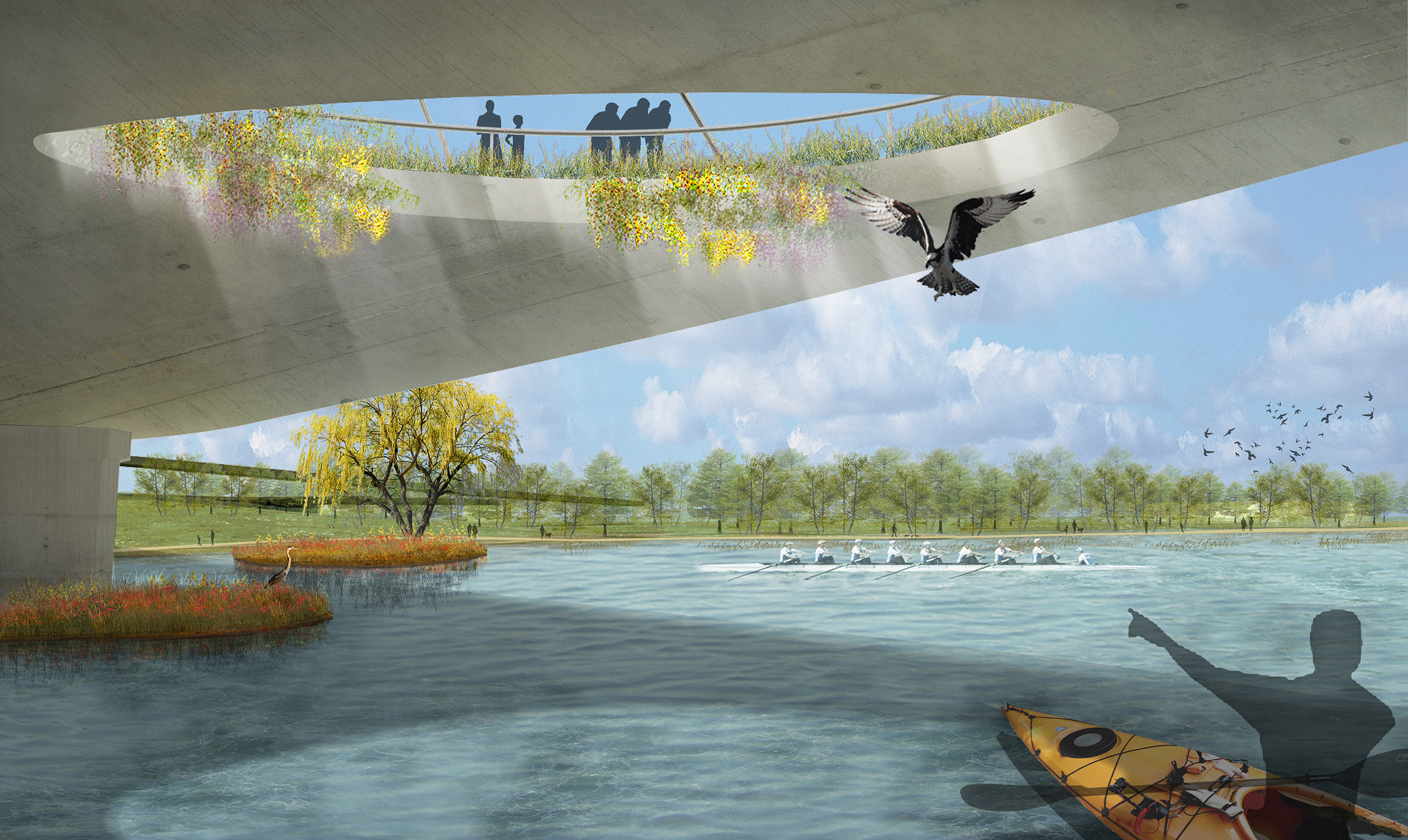
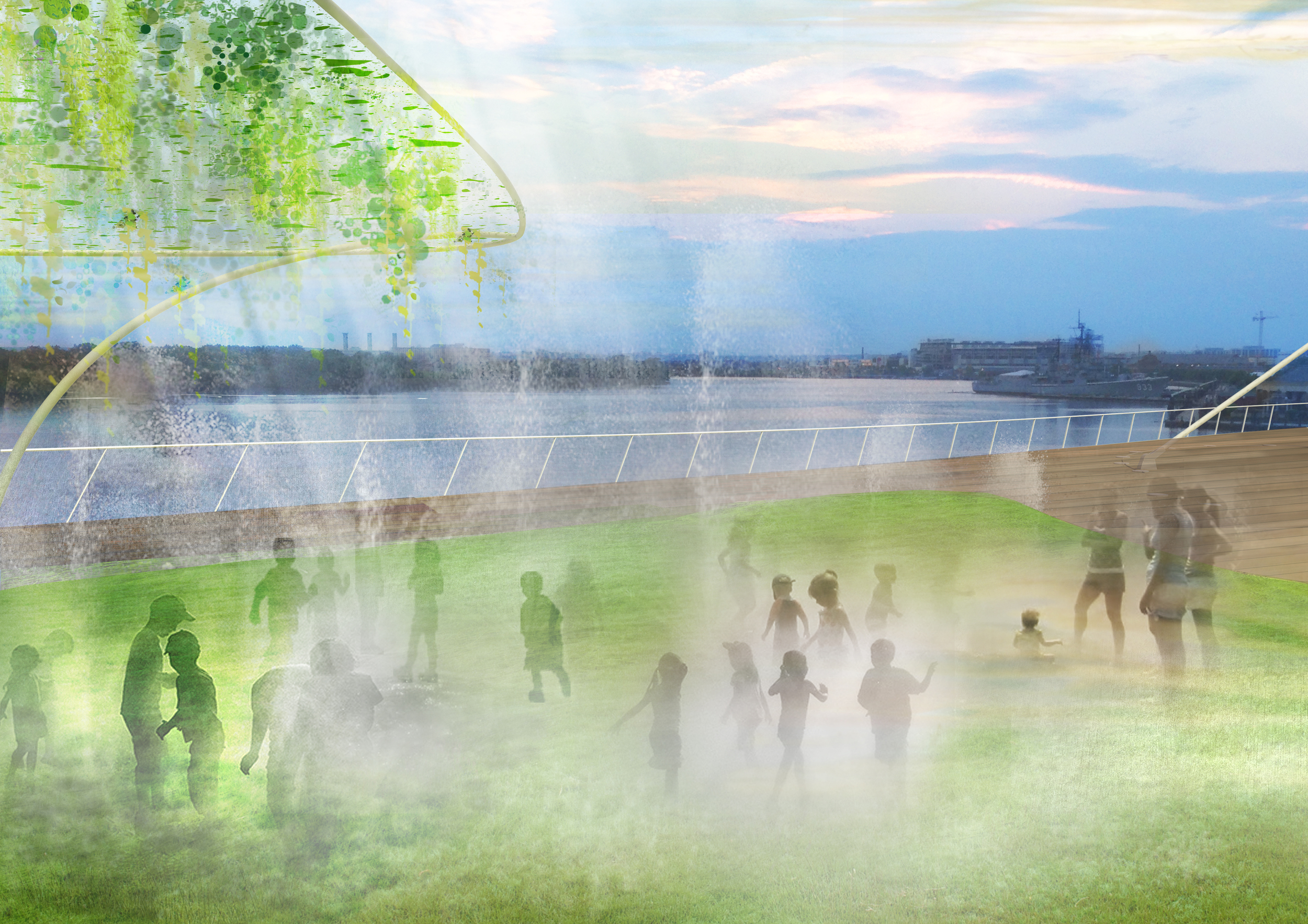
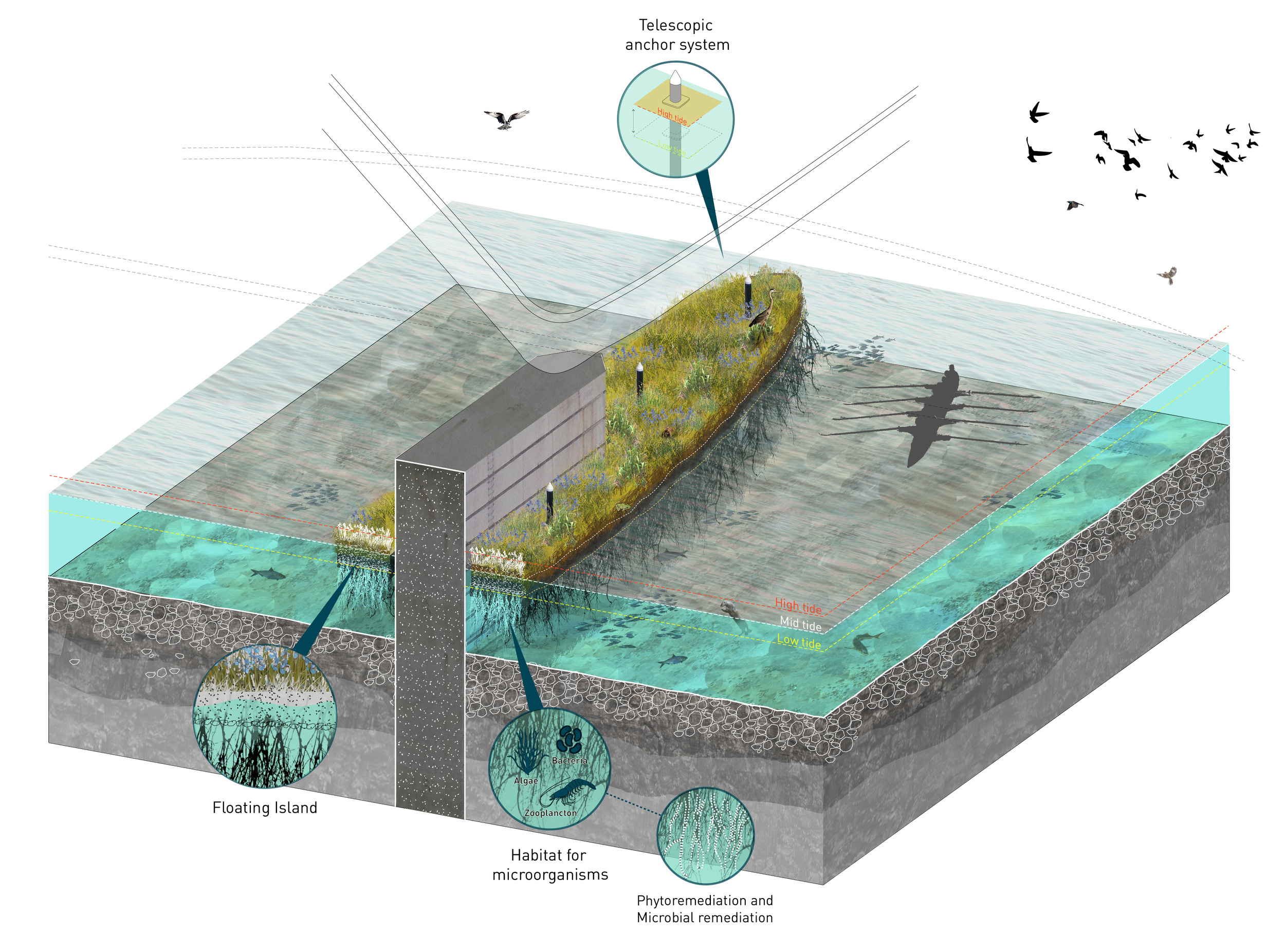
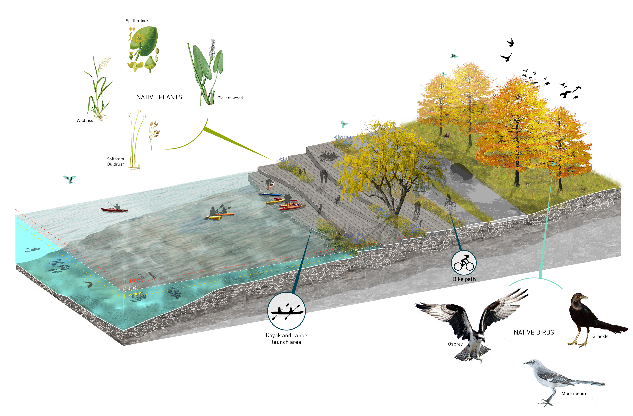
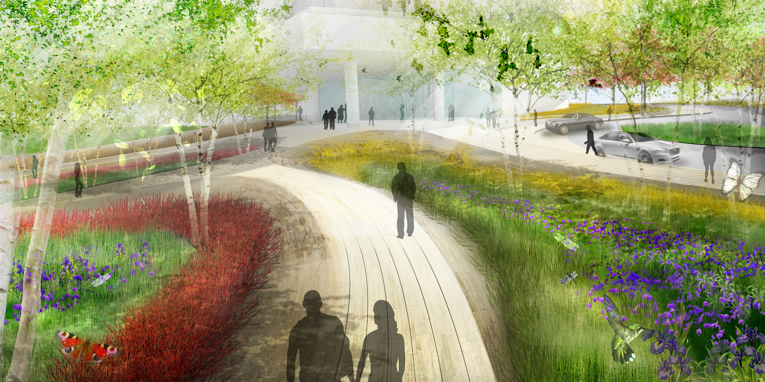
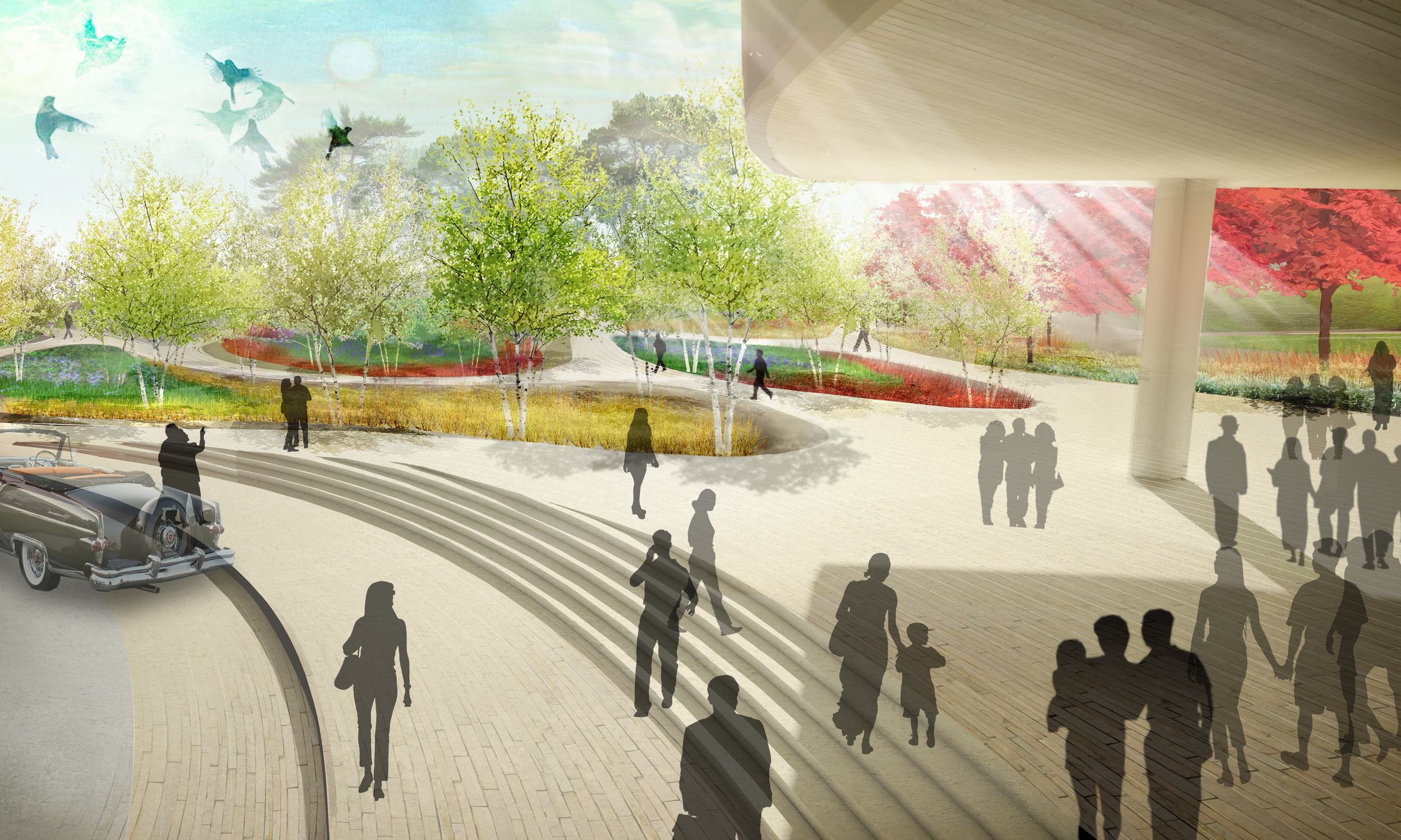
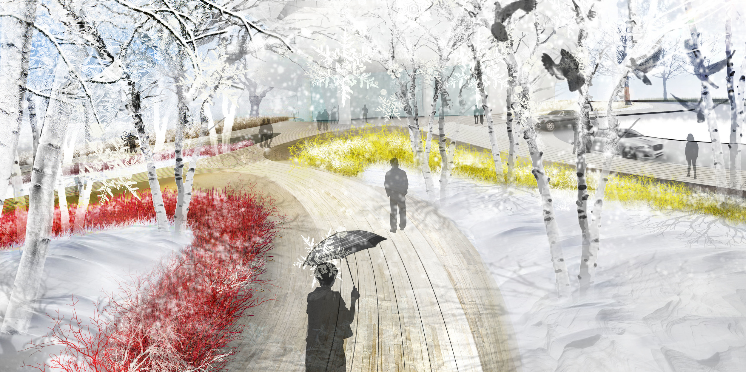
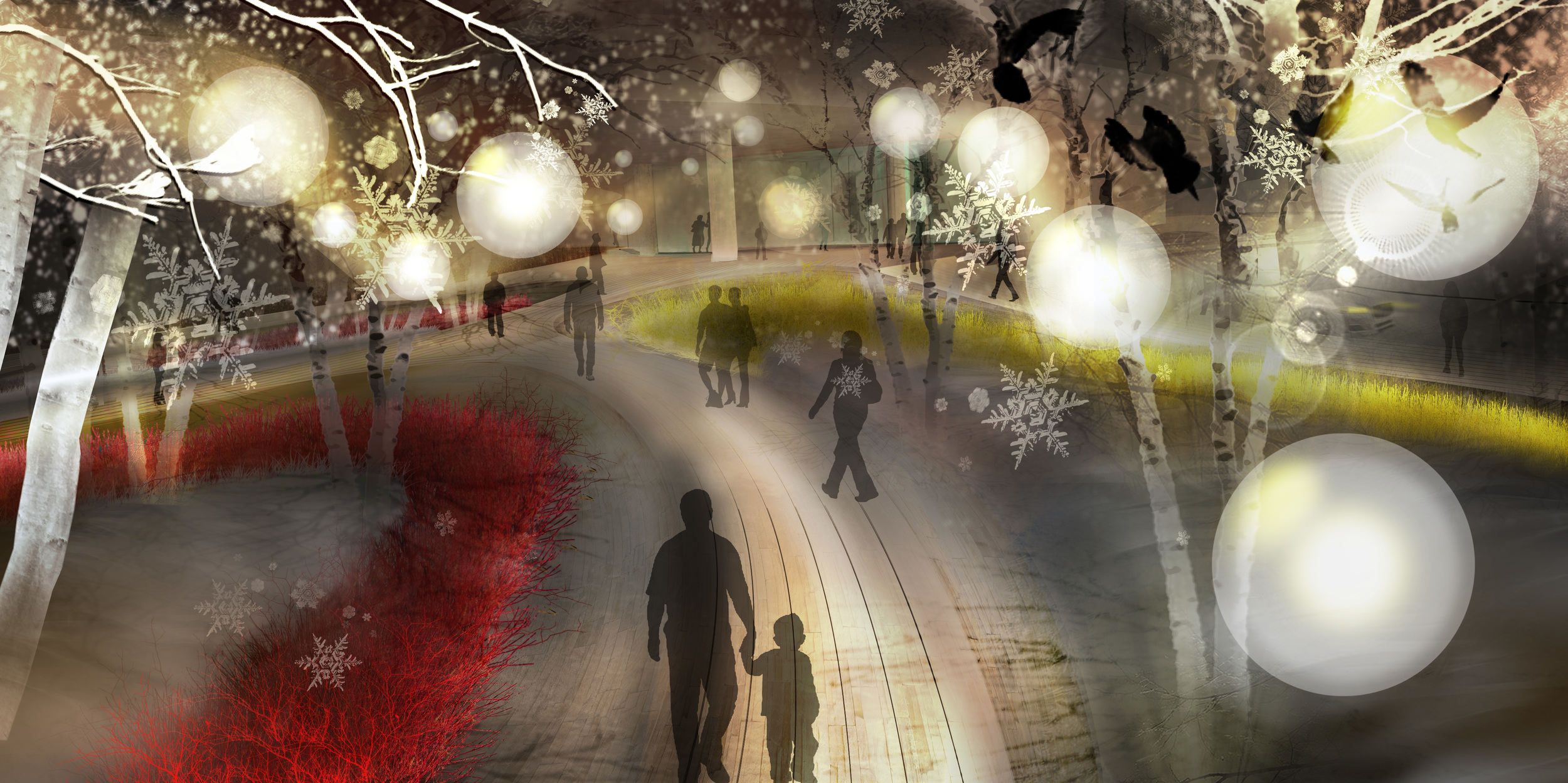
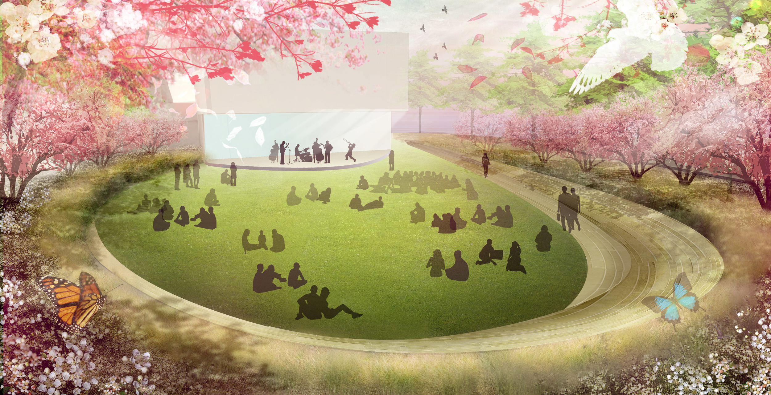
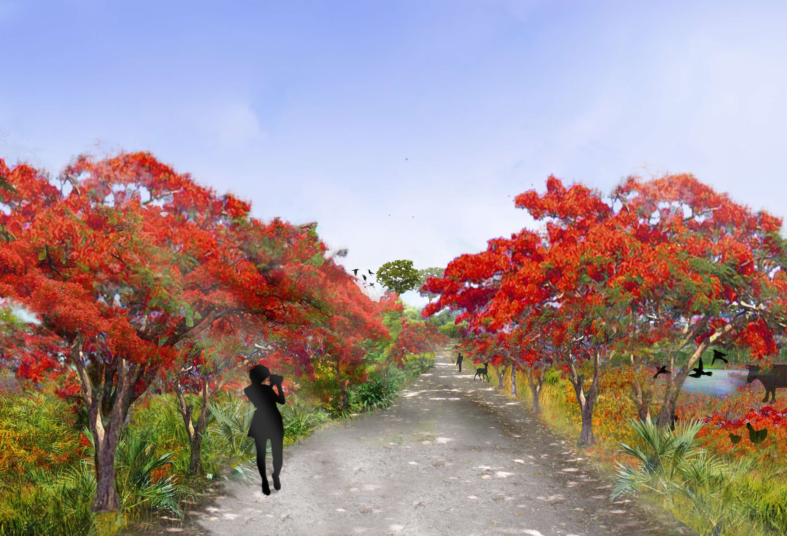
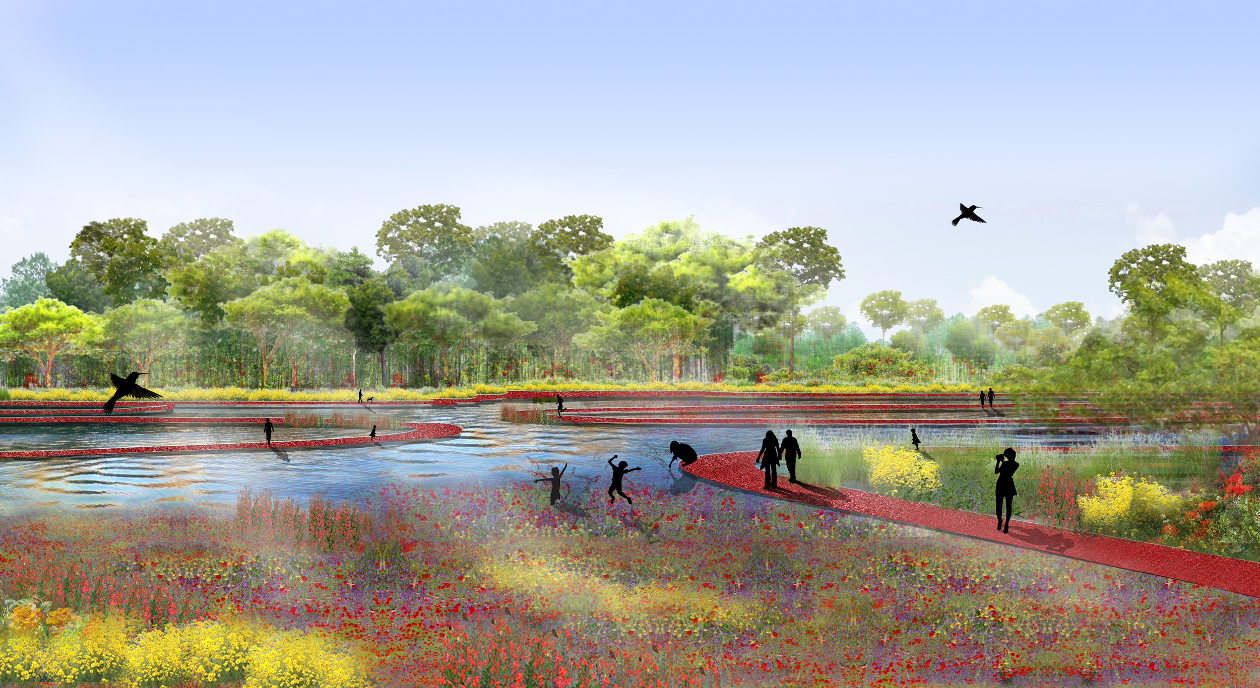
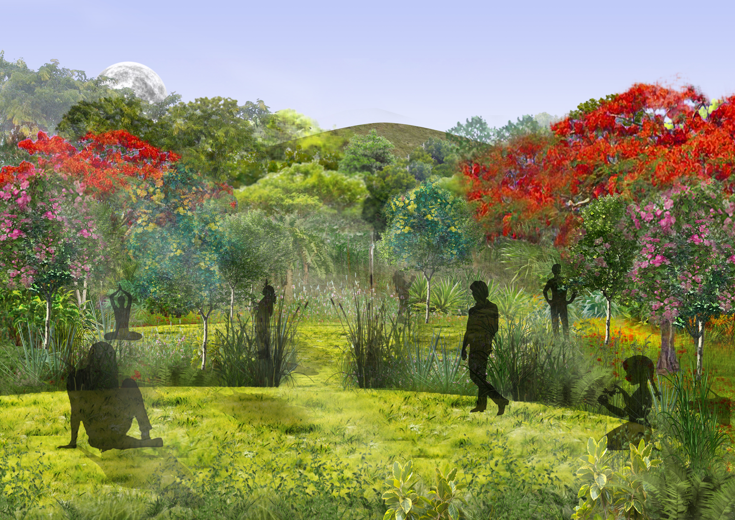
Madrid Nuevo Norte will not only be a dynamic hyper-connected urban center, but also has the potential of becoming an environmental corridor bringing the enormously rich biodiversity of Monte El Pardo forest to the center of Madrid. Guided by natural processes the design of the public realm will restore natural resources to create flexible environments that support novel ways to showcase local culture, celebrate communities’ identities, and sustain economic businesses.

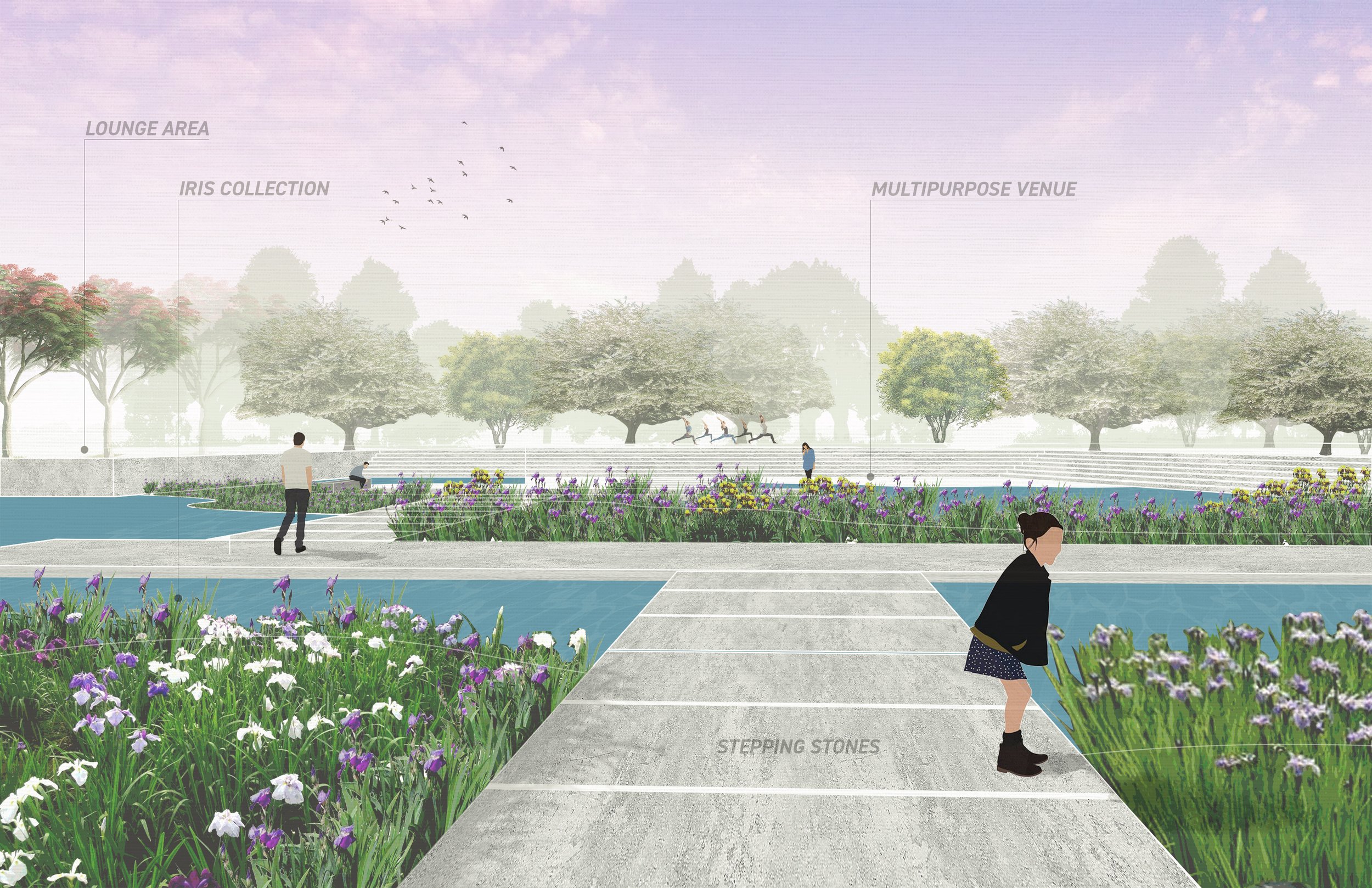
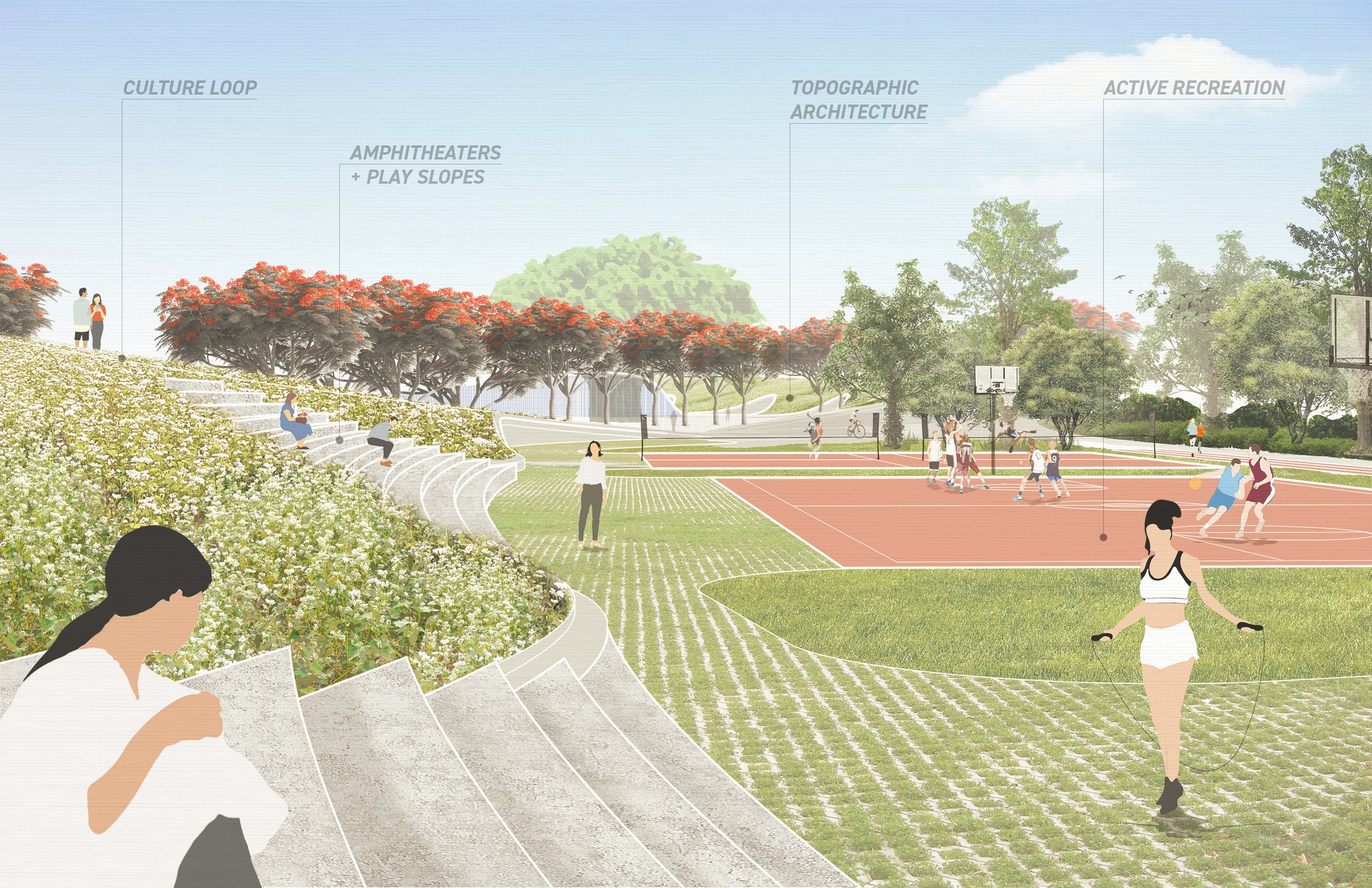
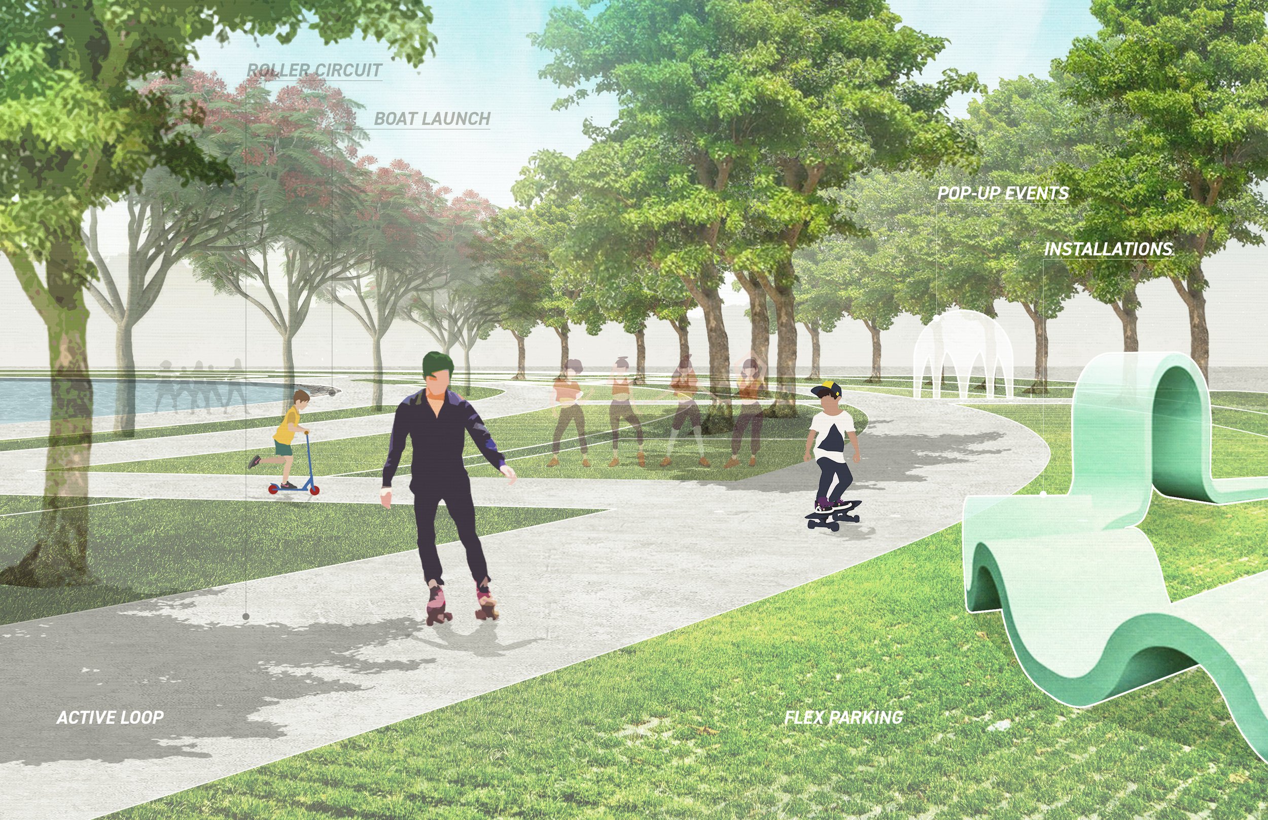
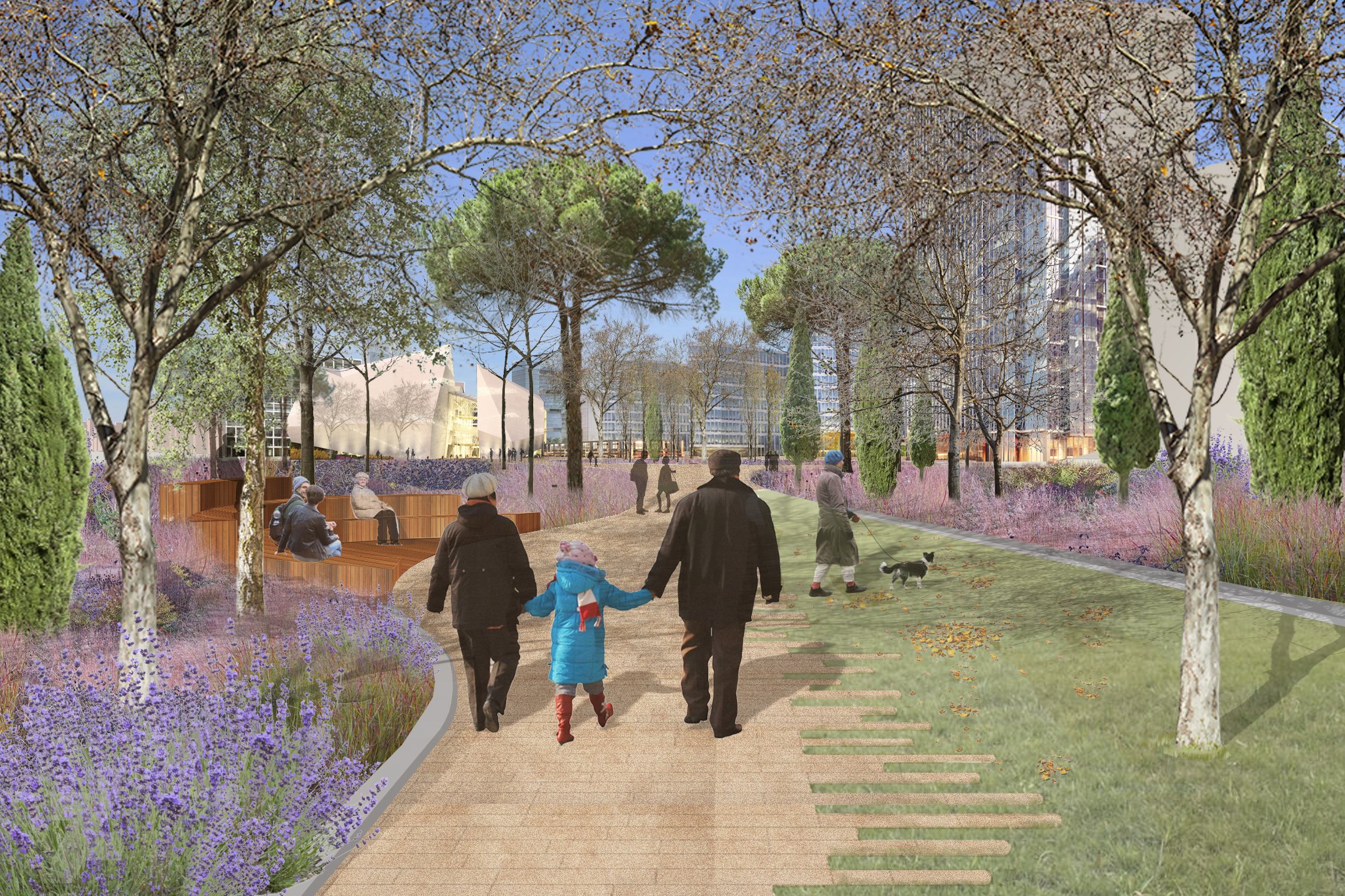
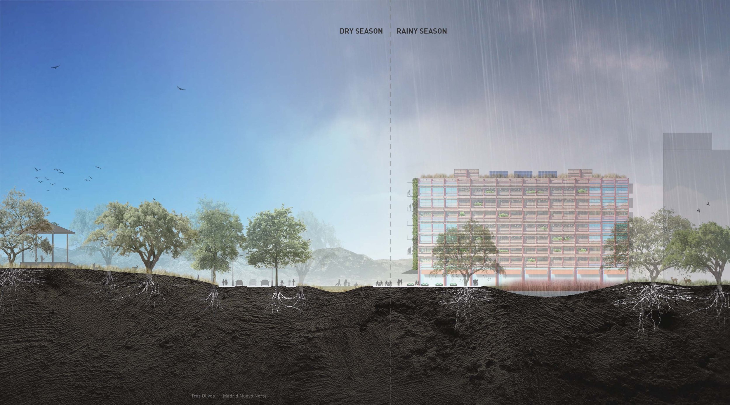
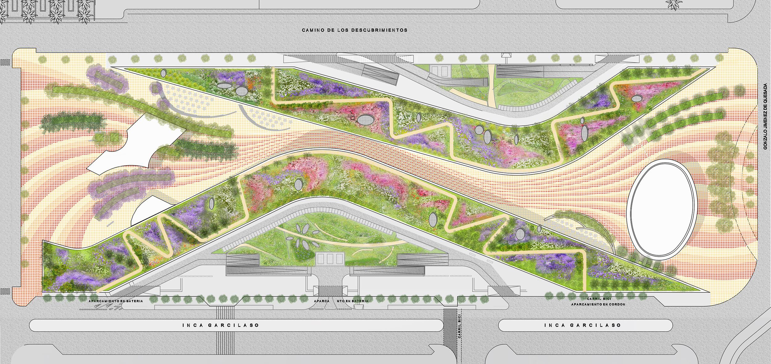
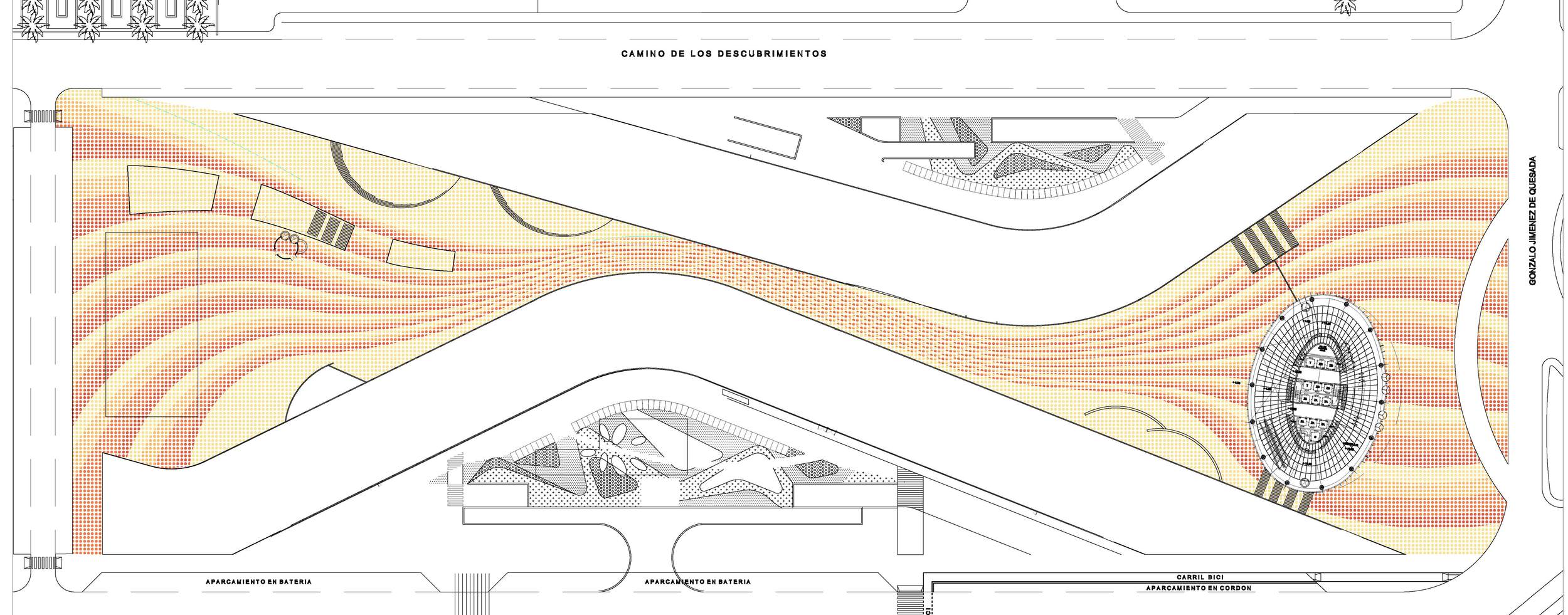
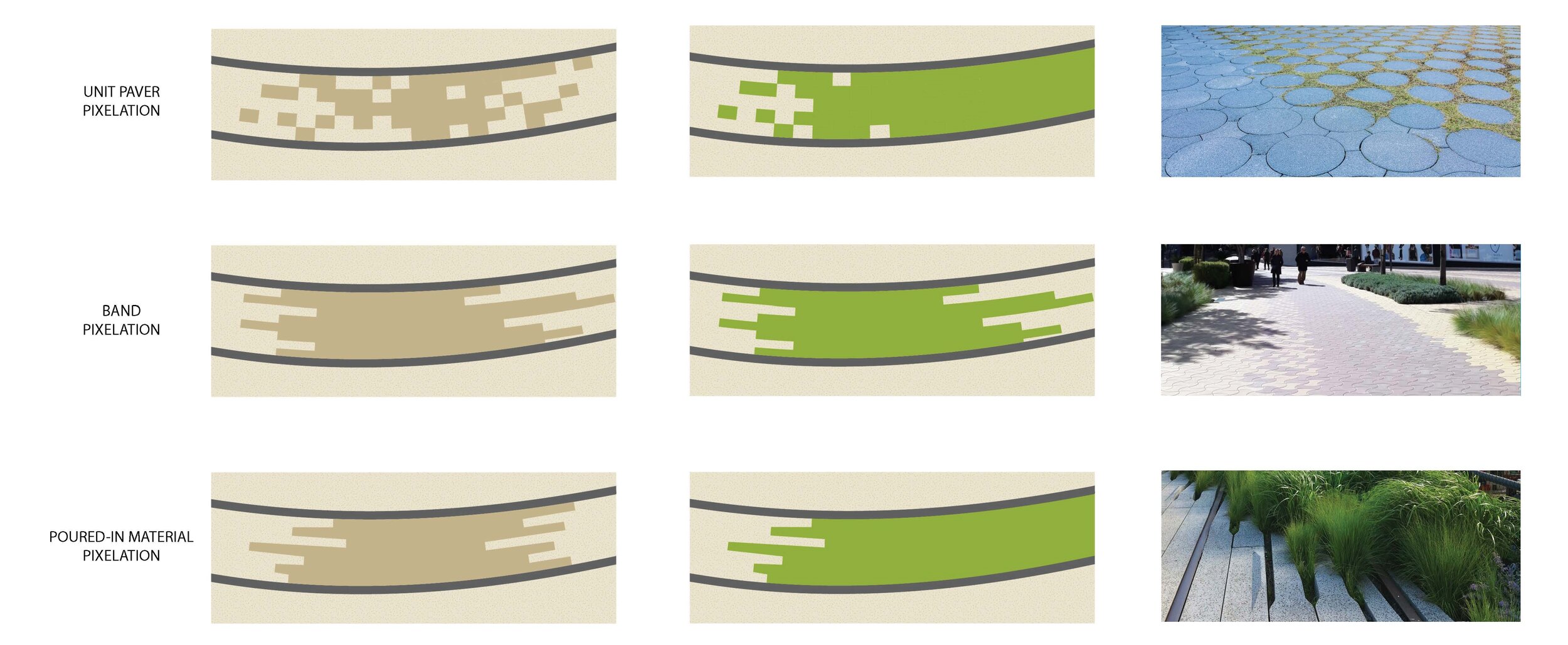
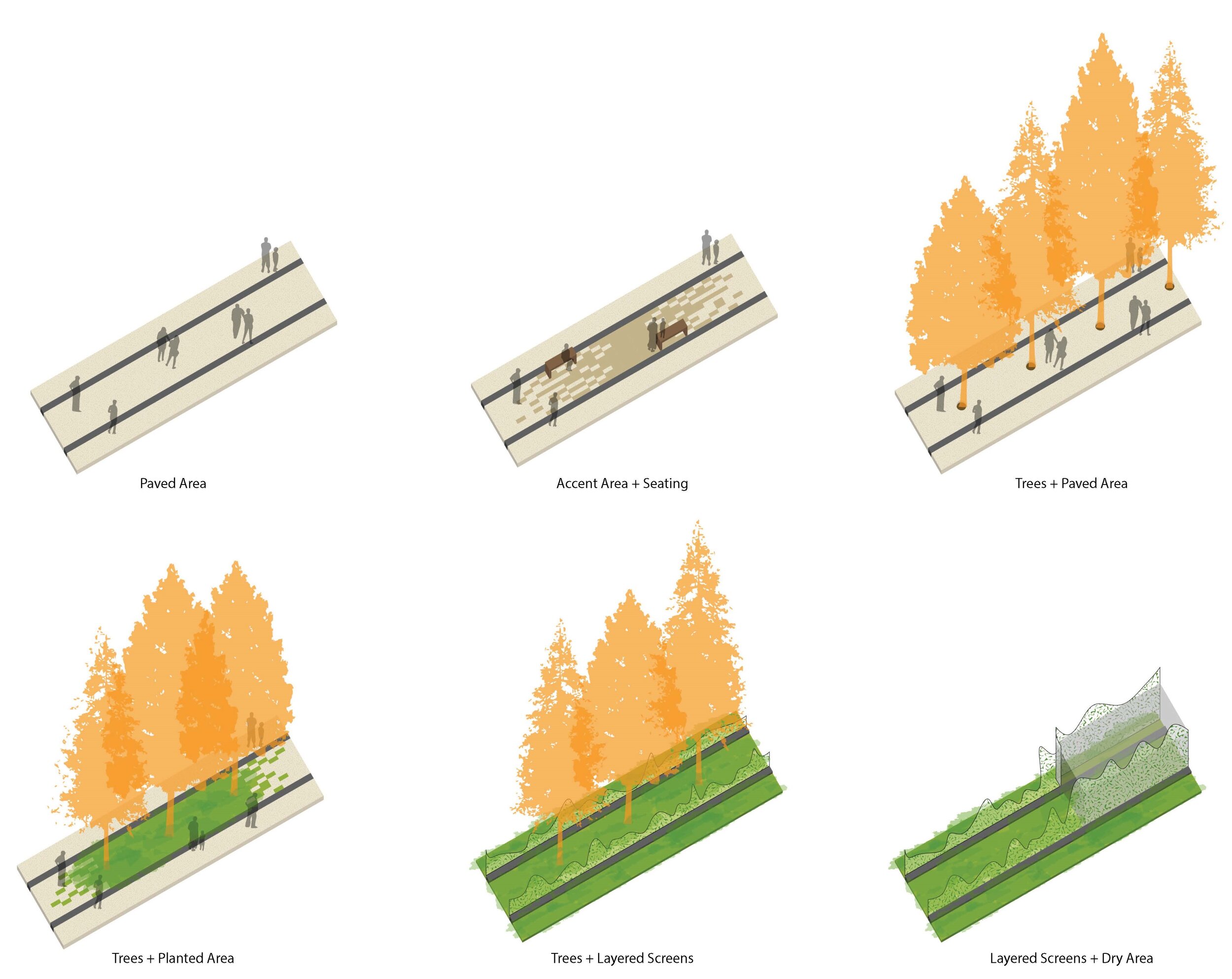
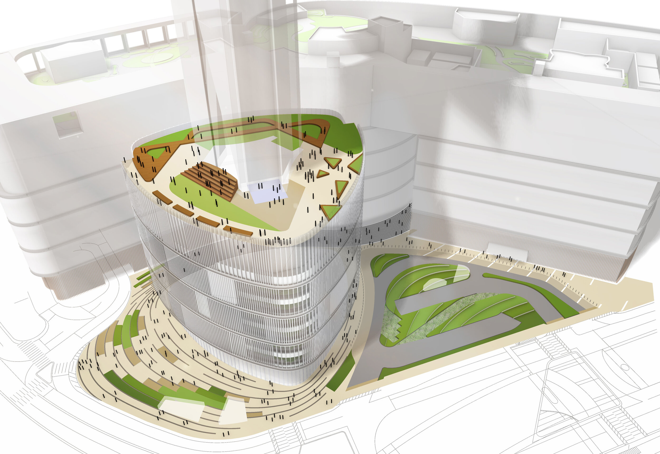
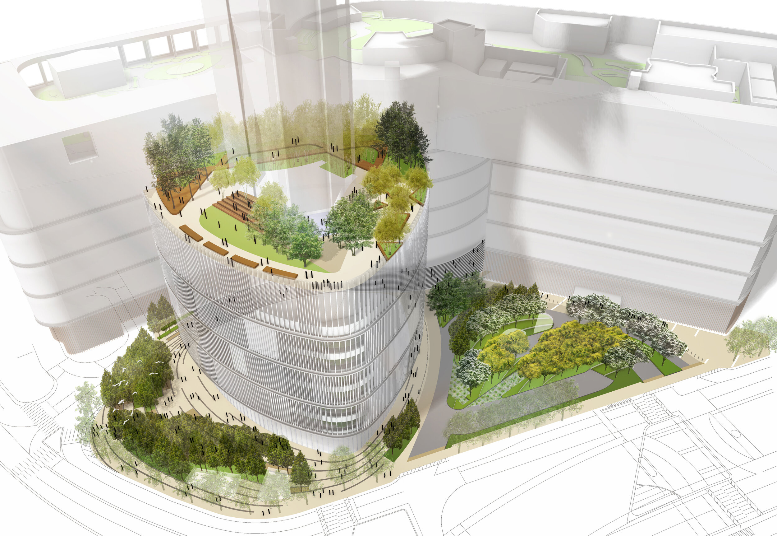
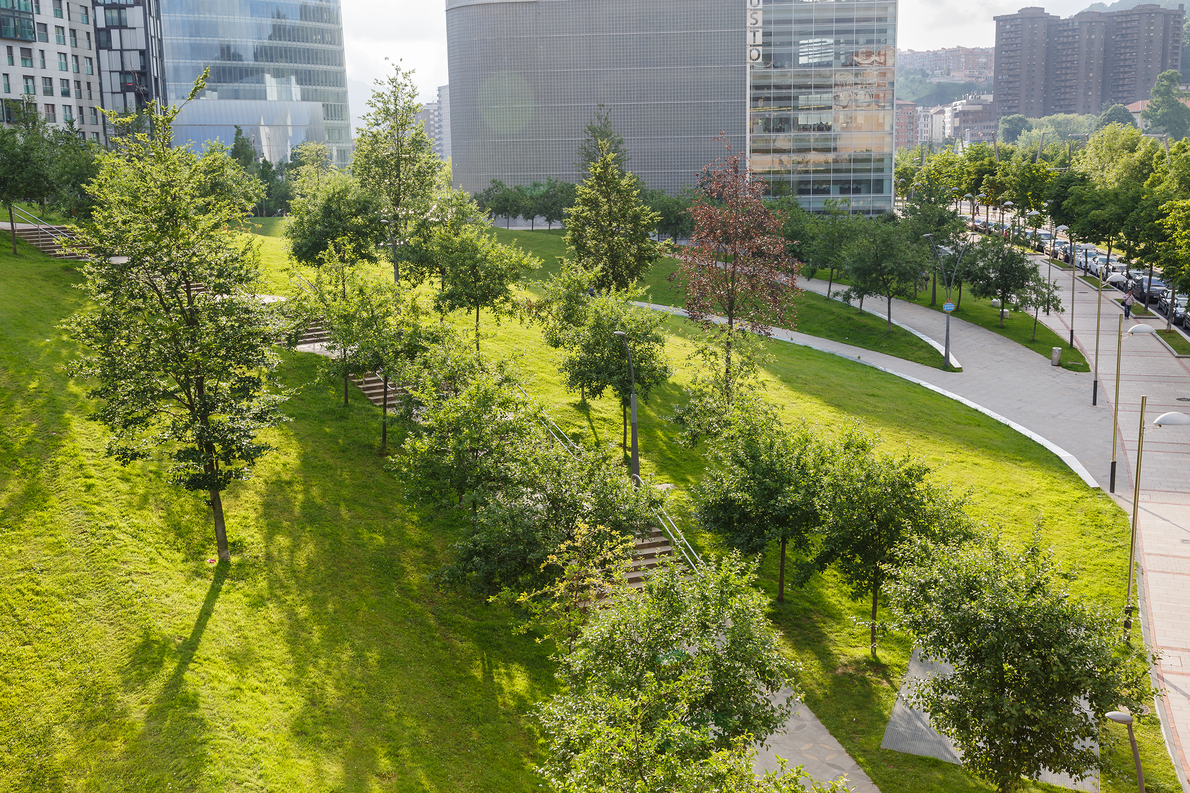
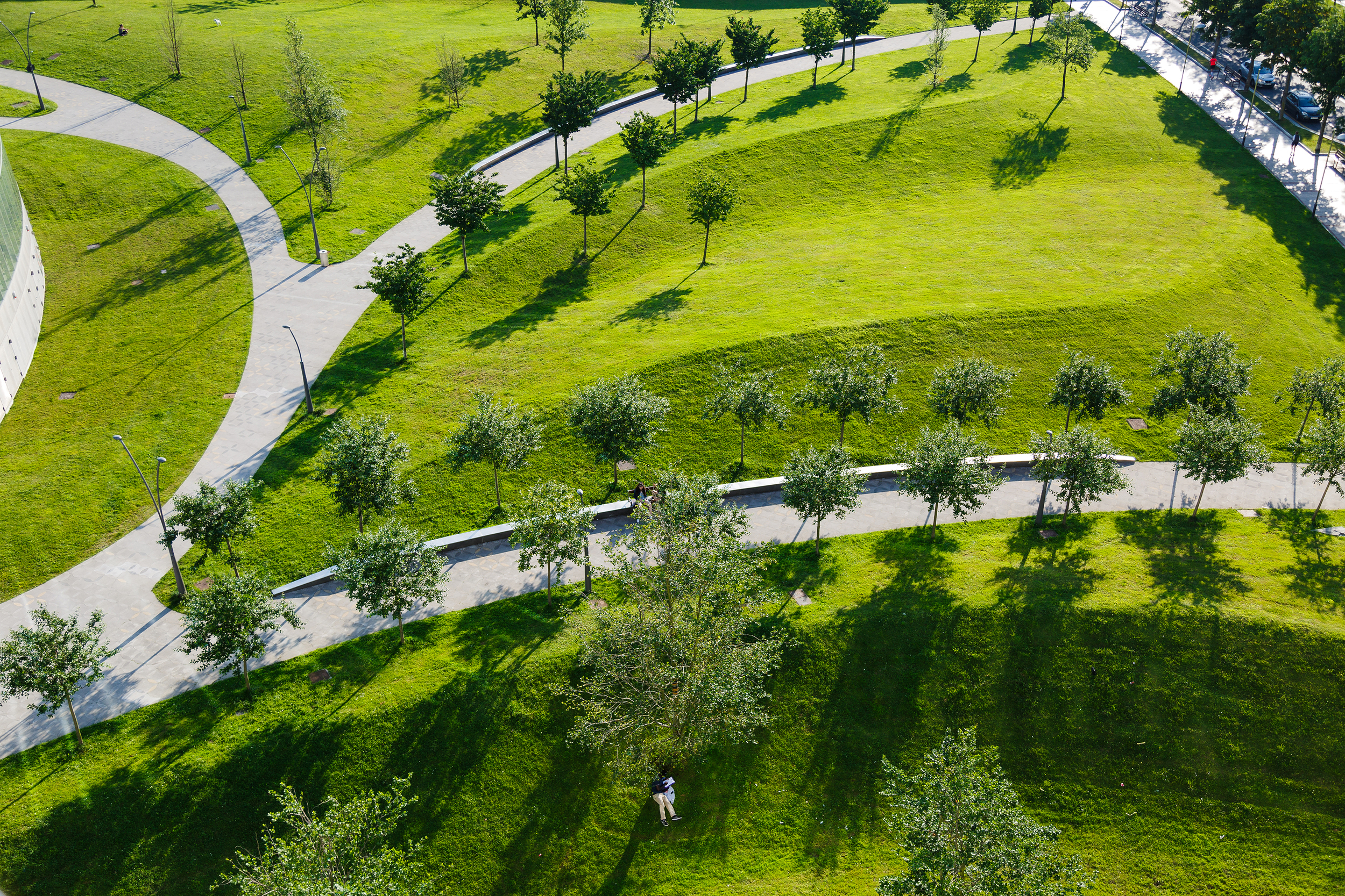
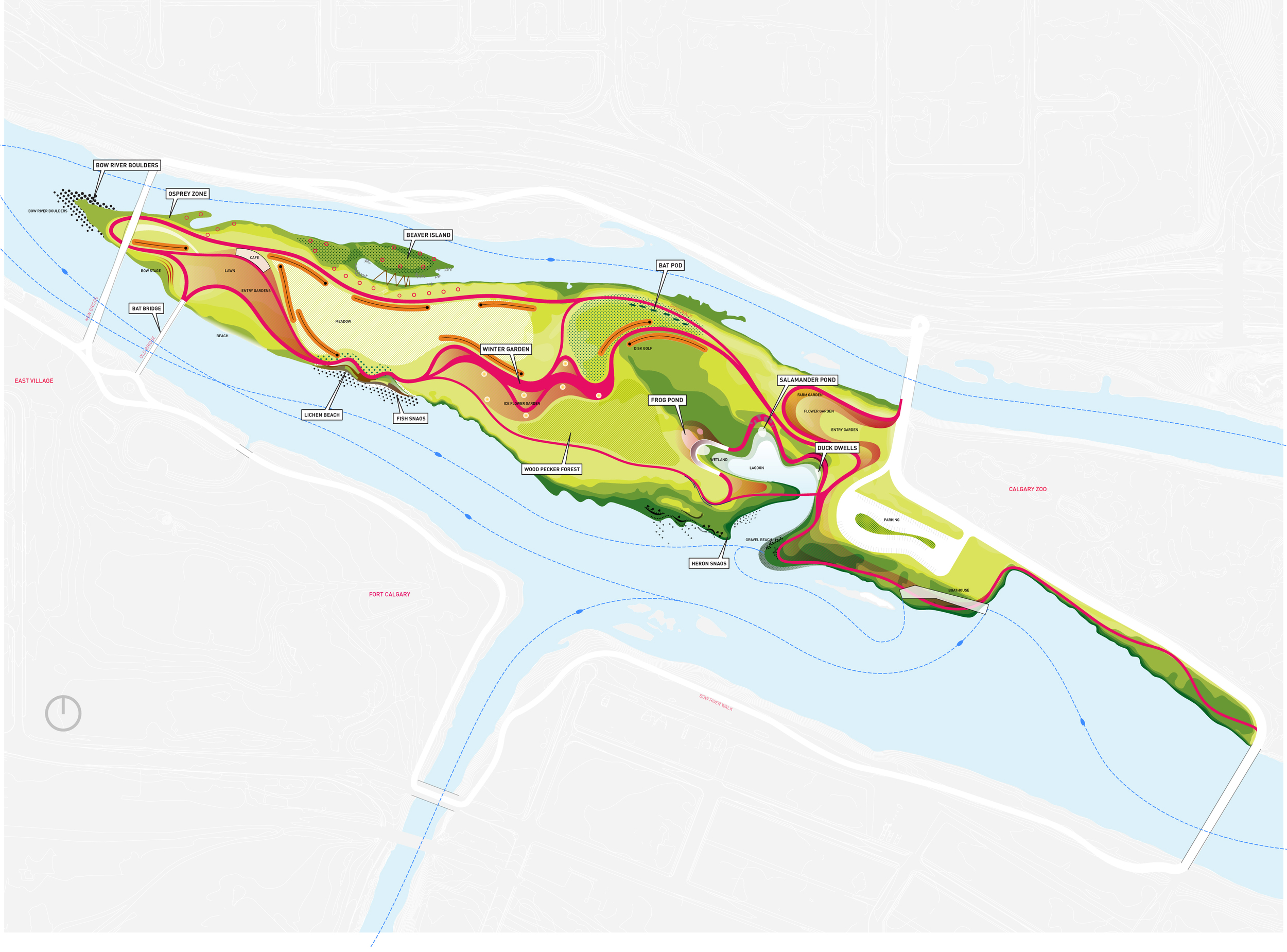
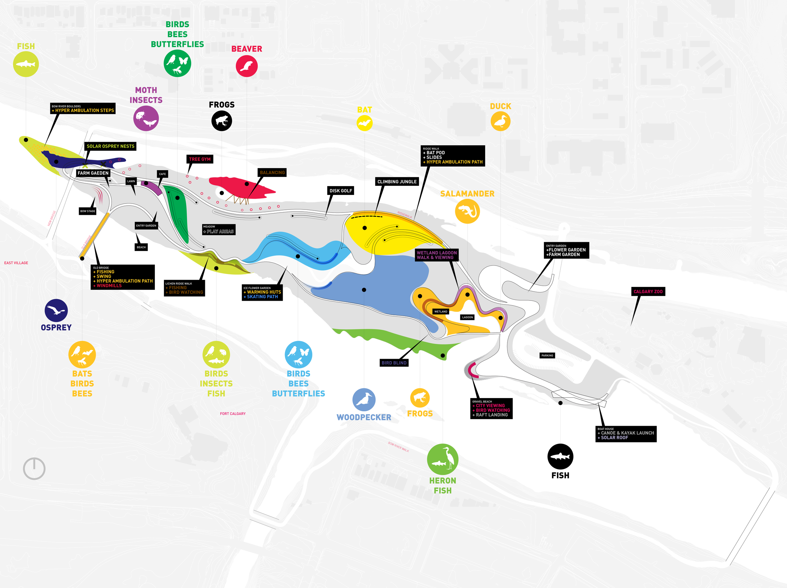
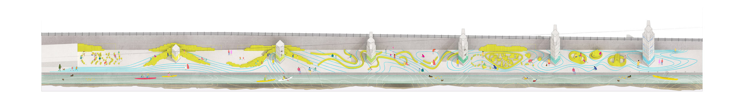
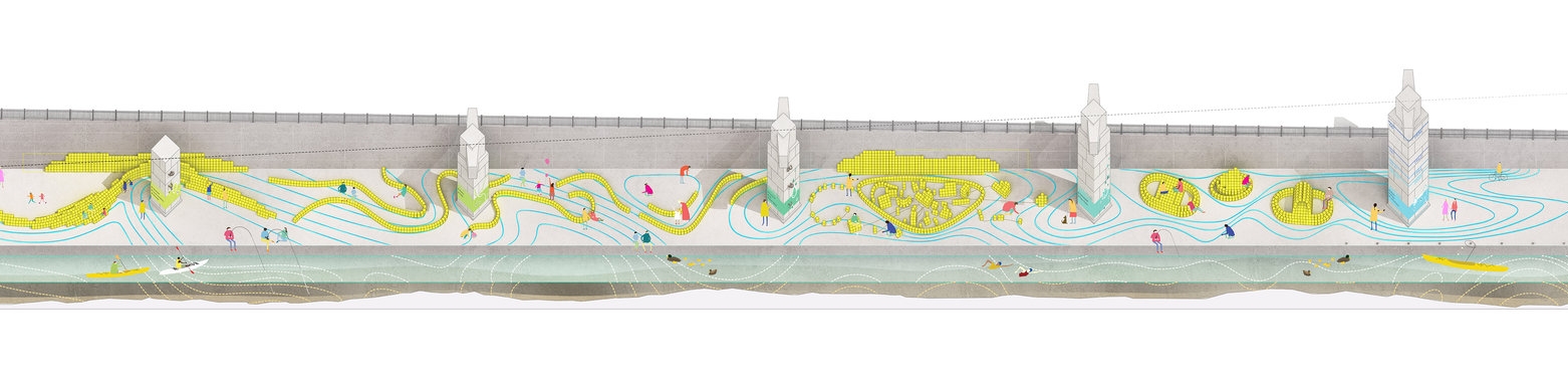
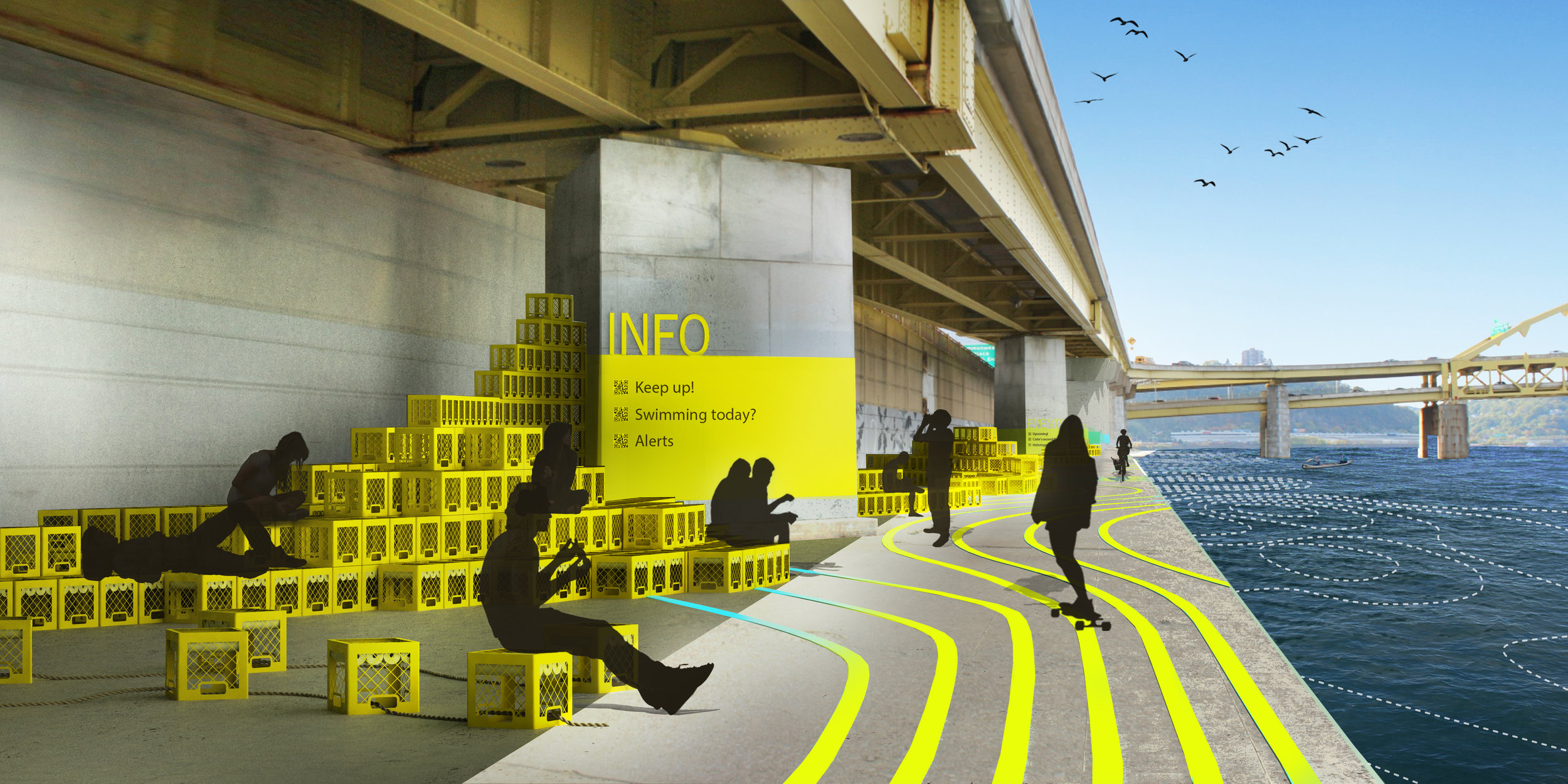
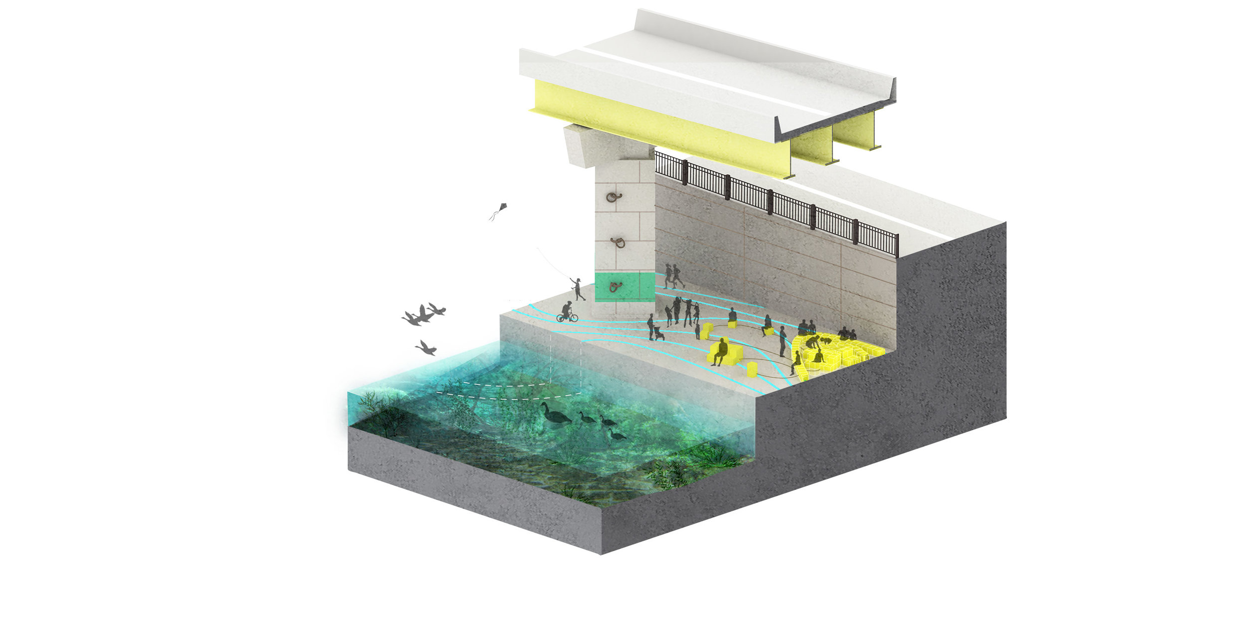
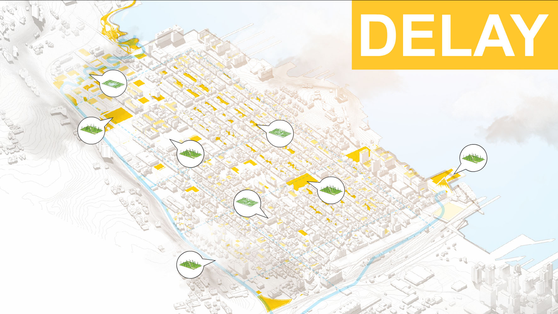
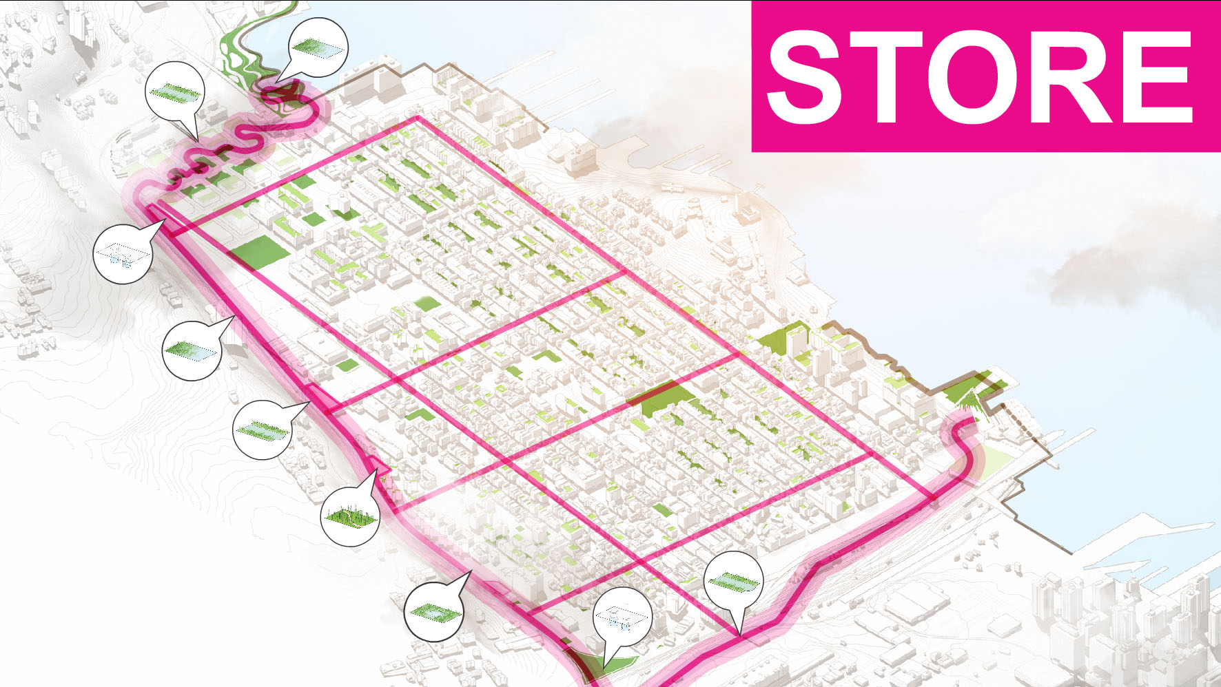
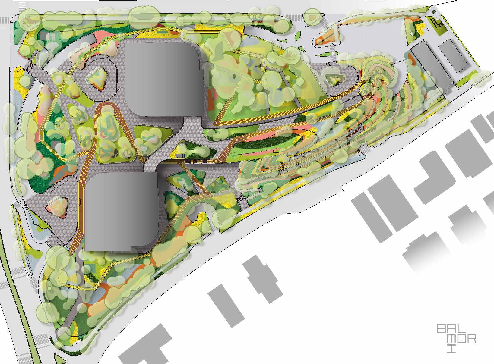
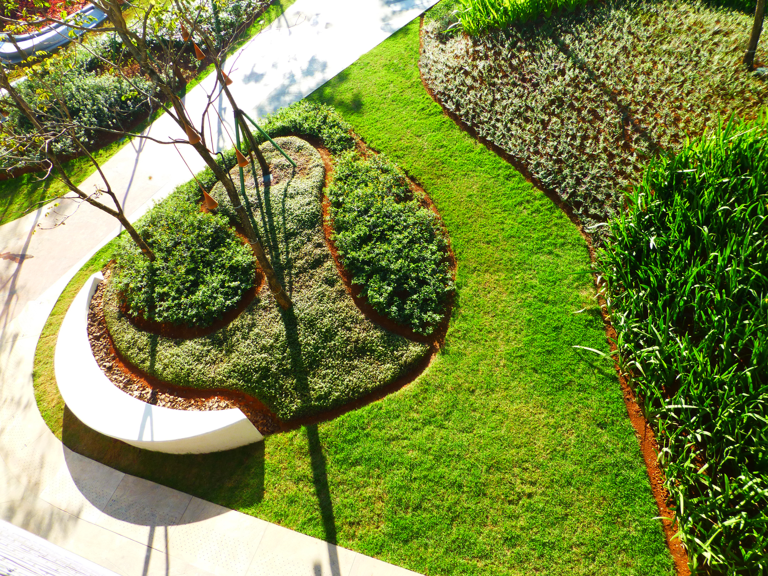
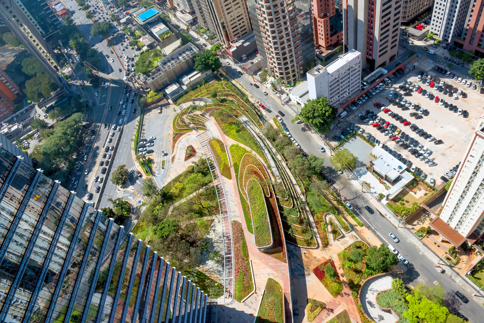
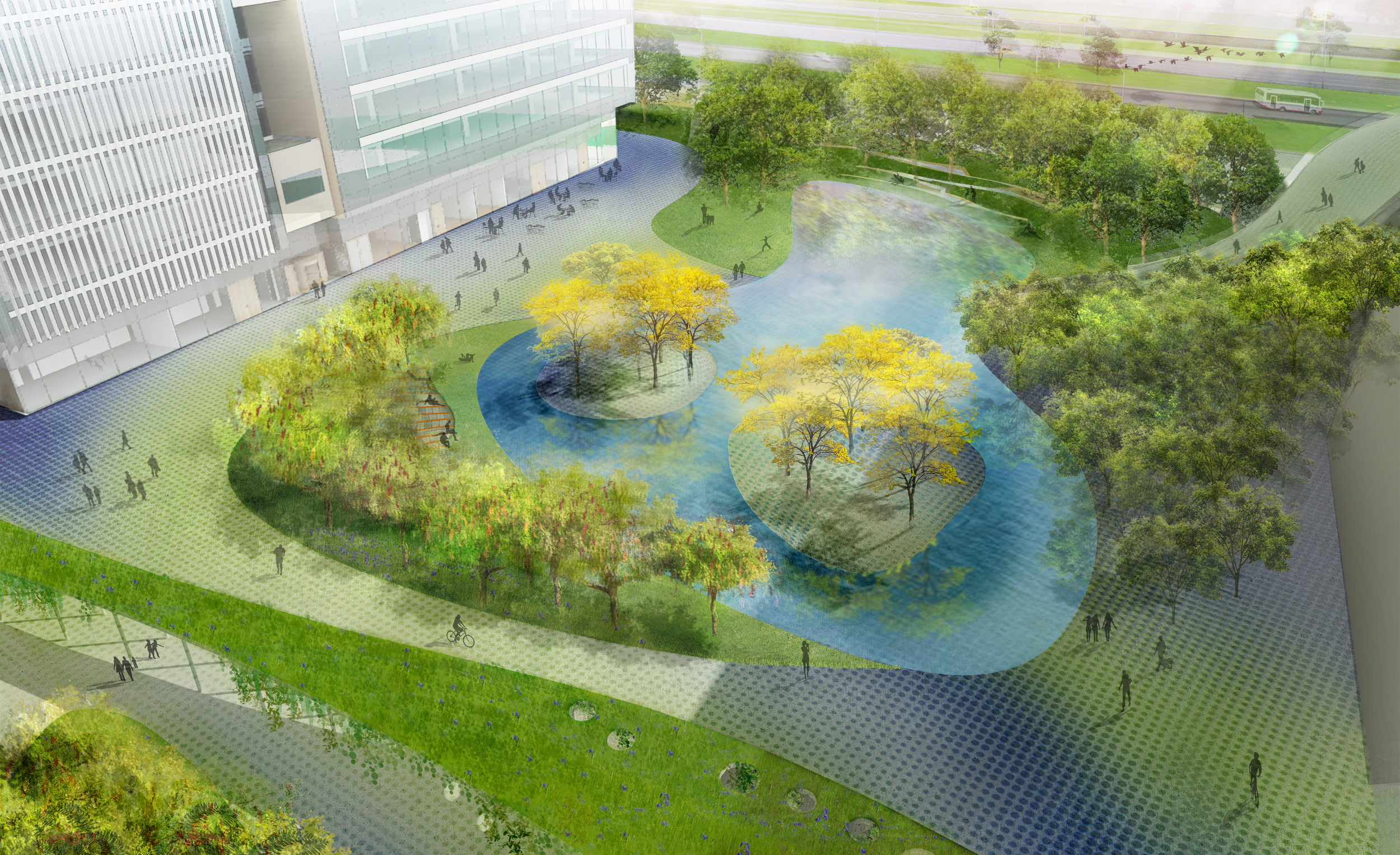
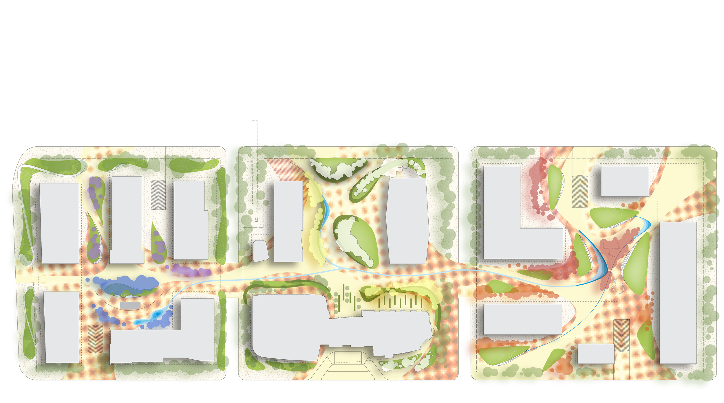
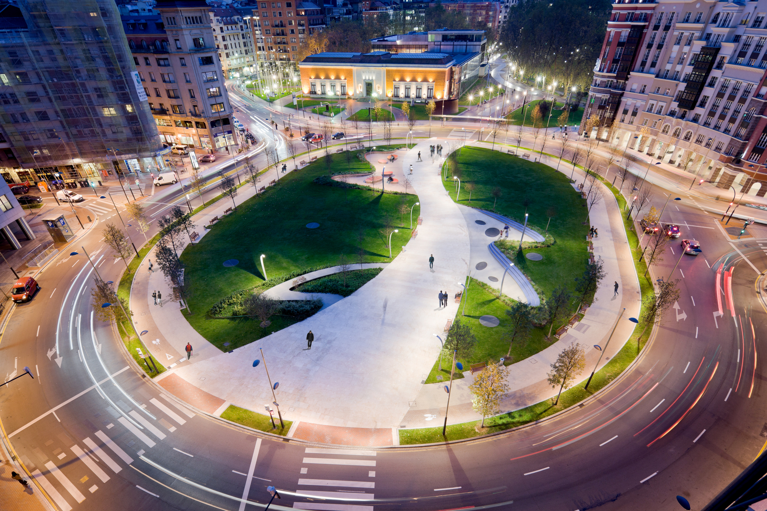
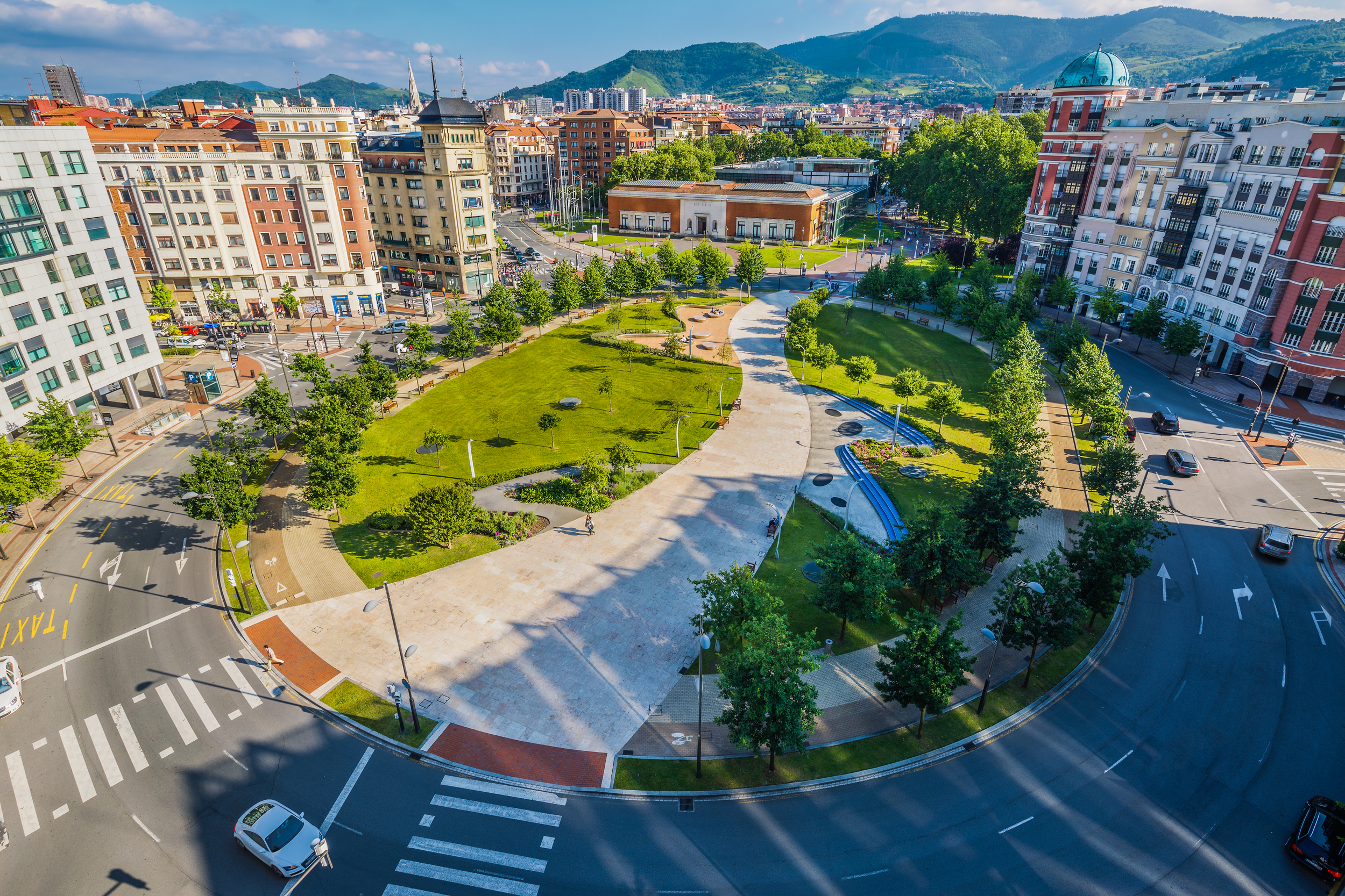
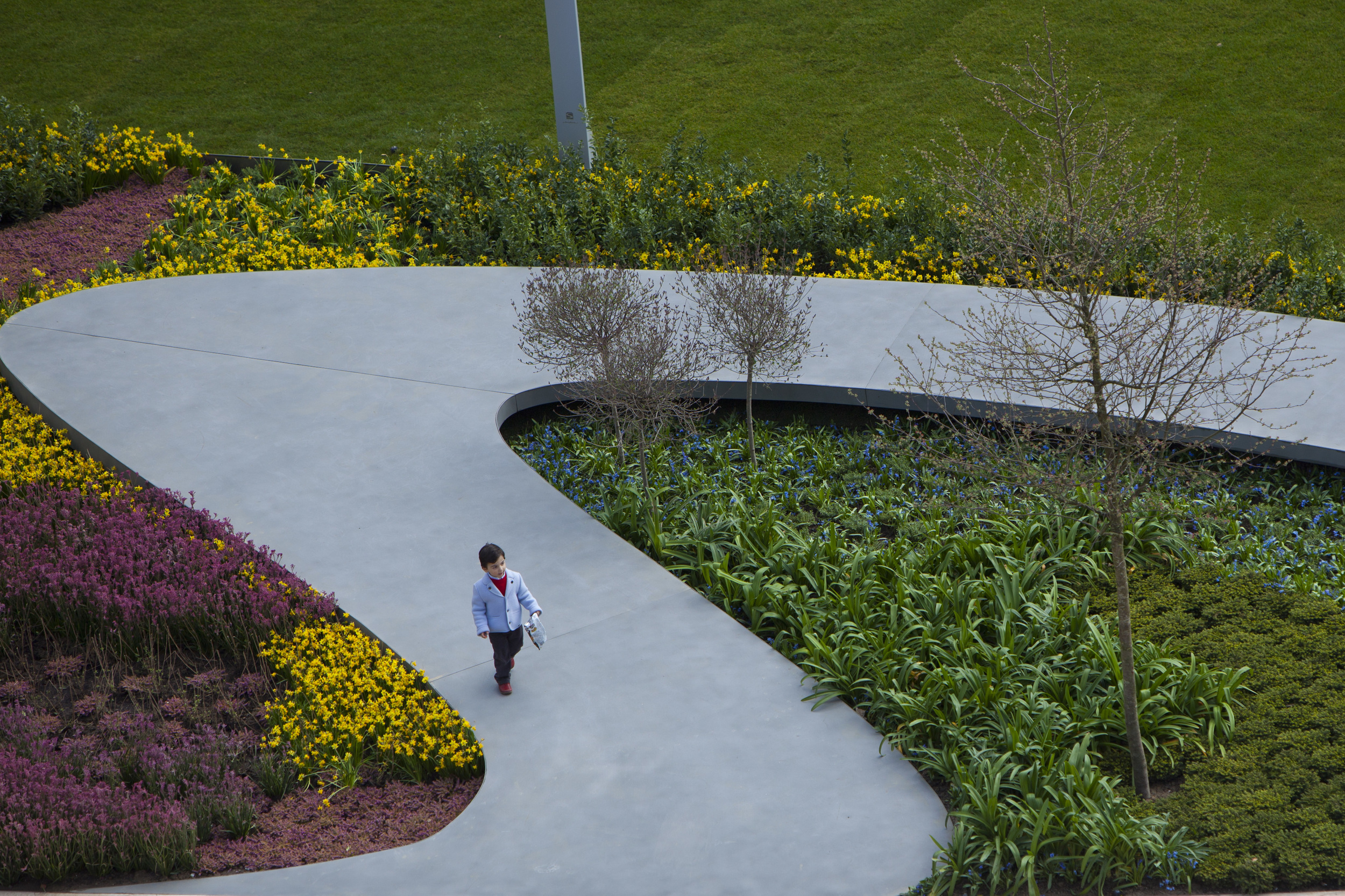
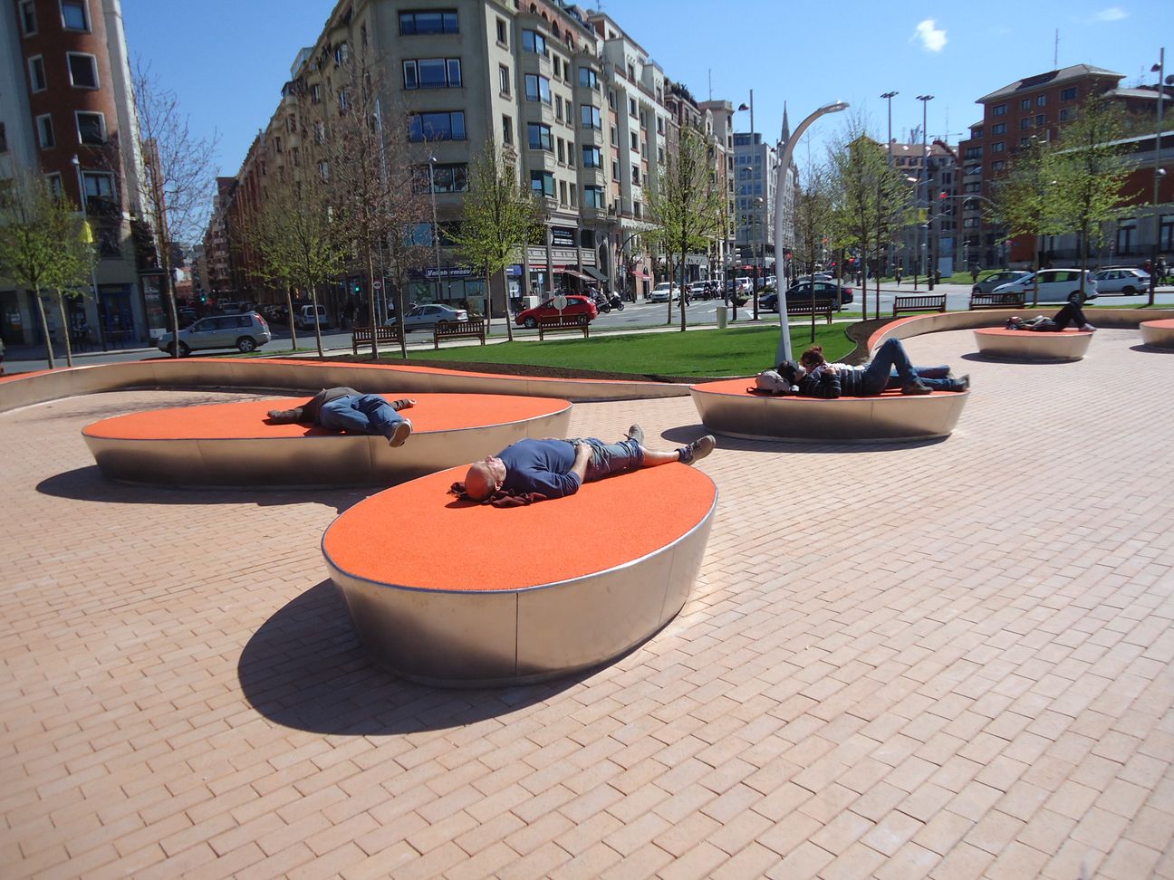
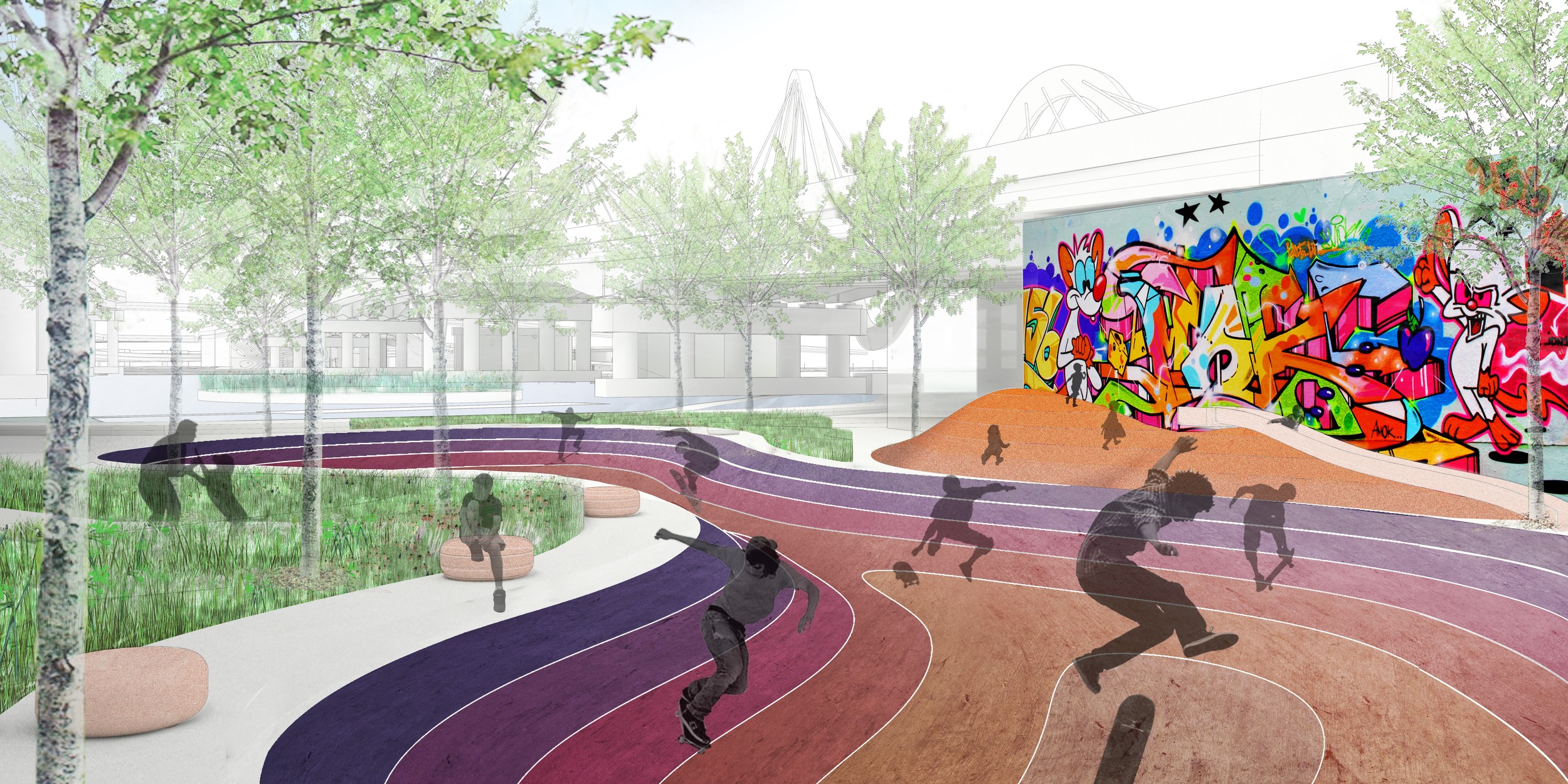
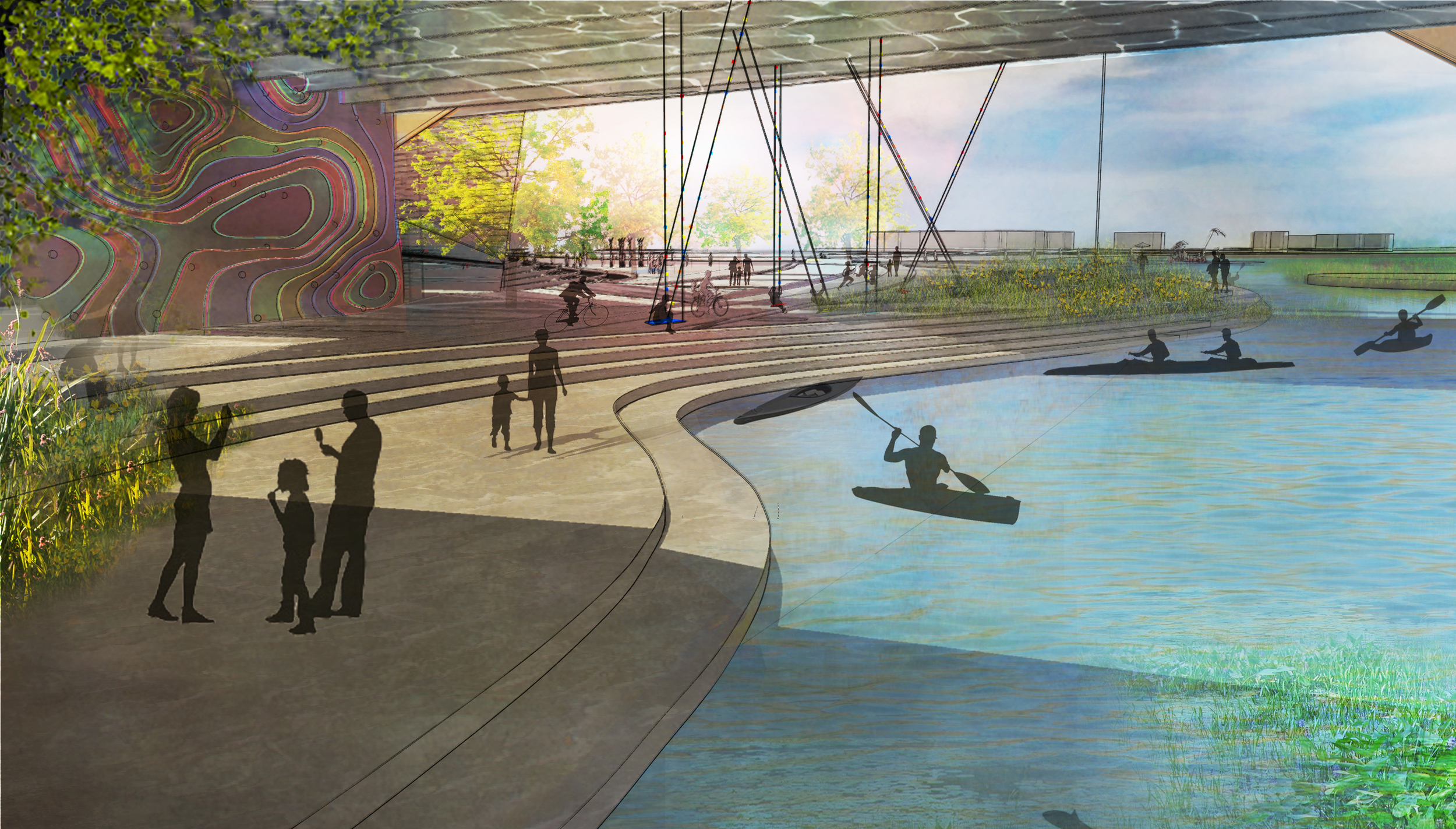
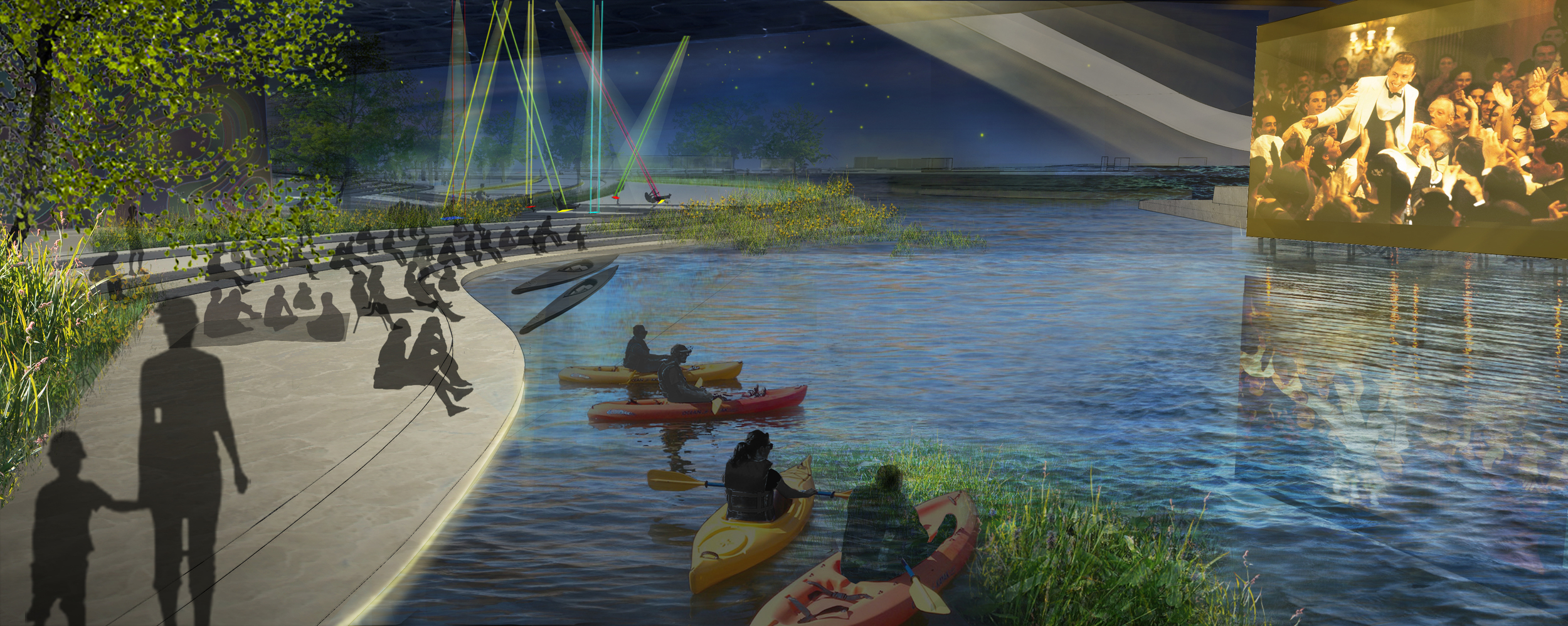
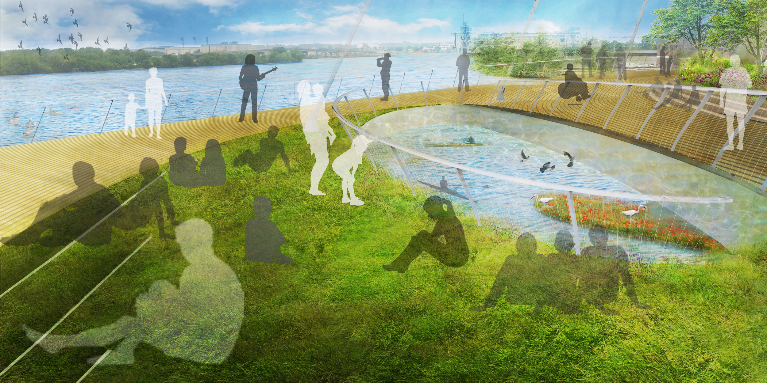
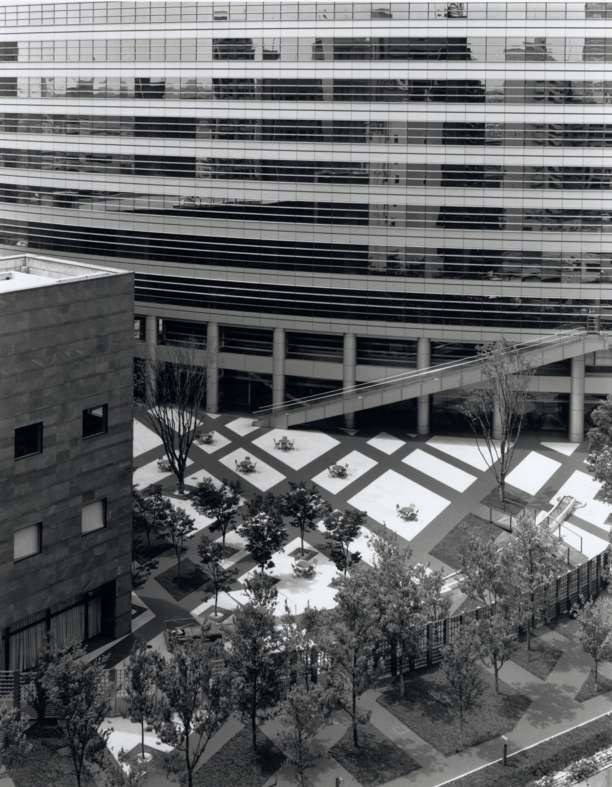
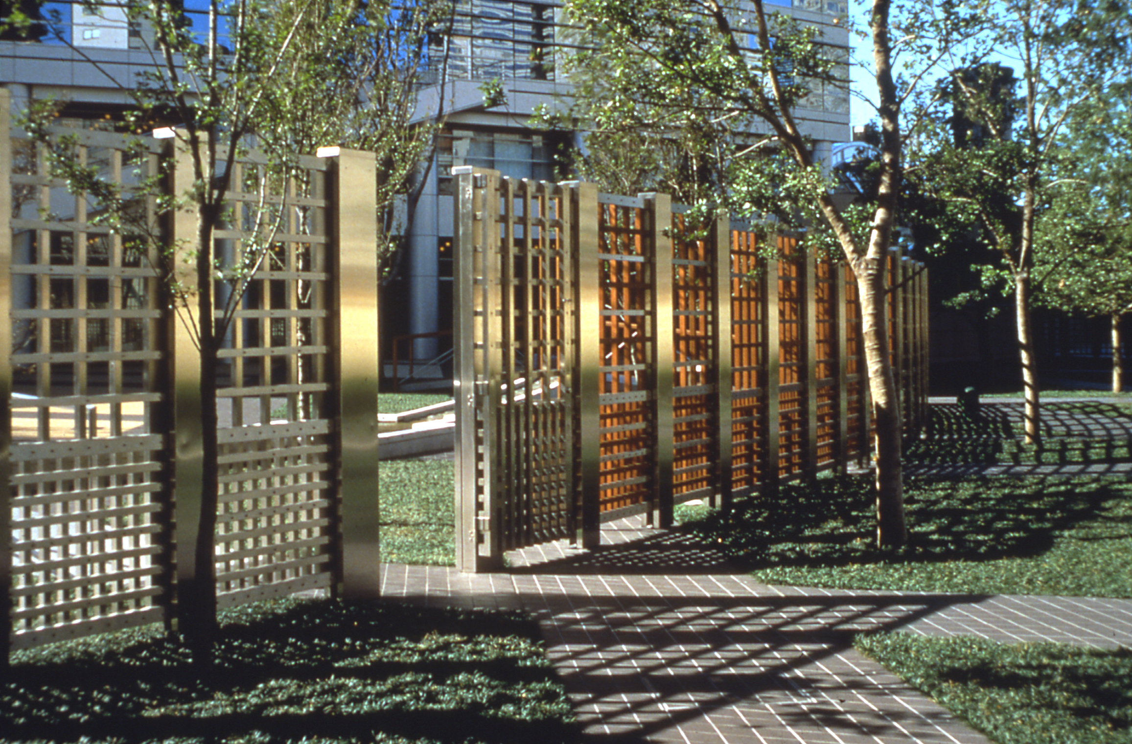
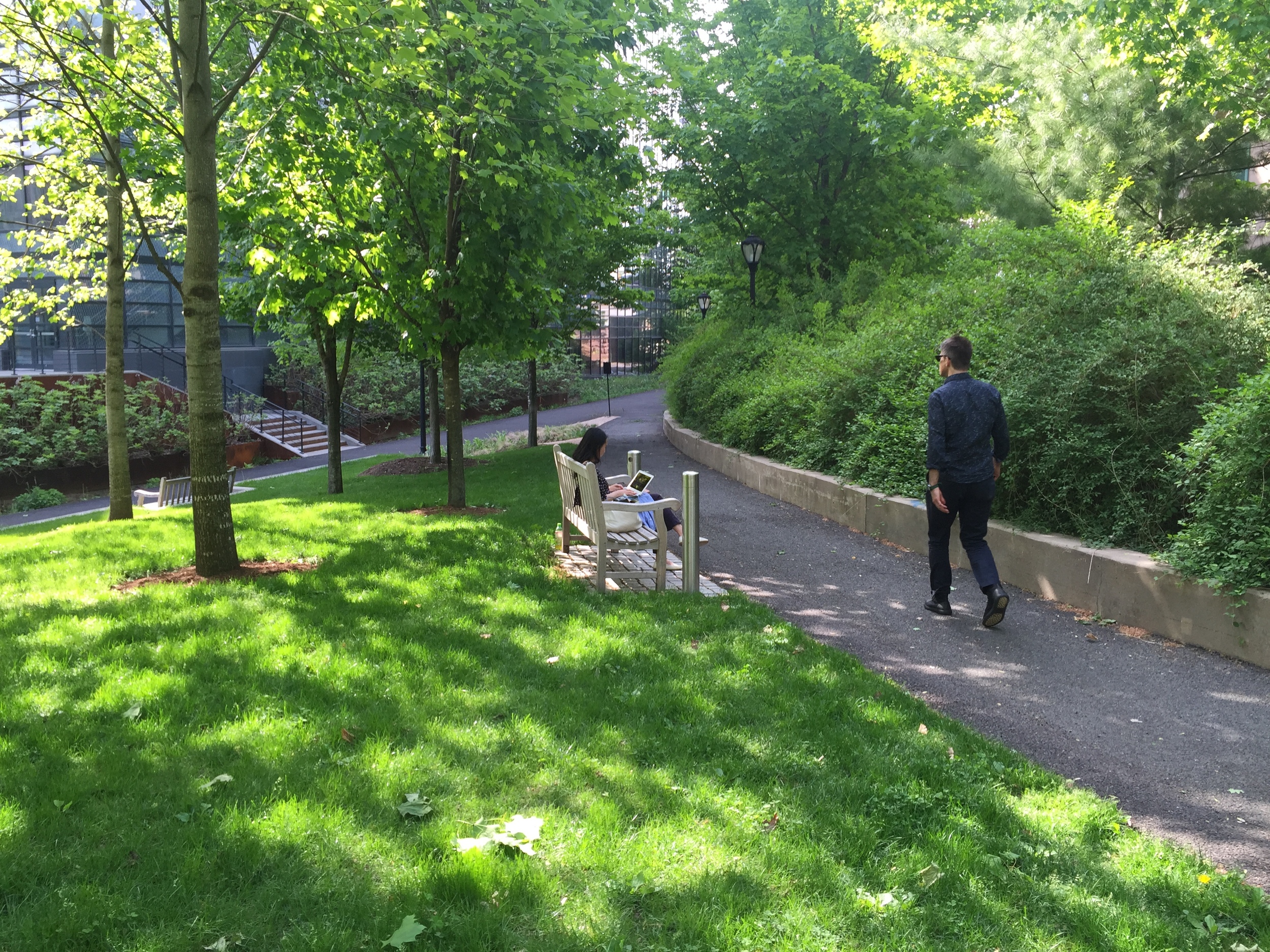
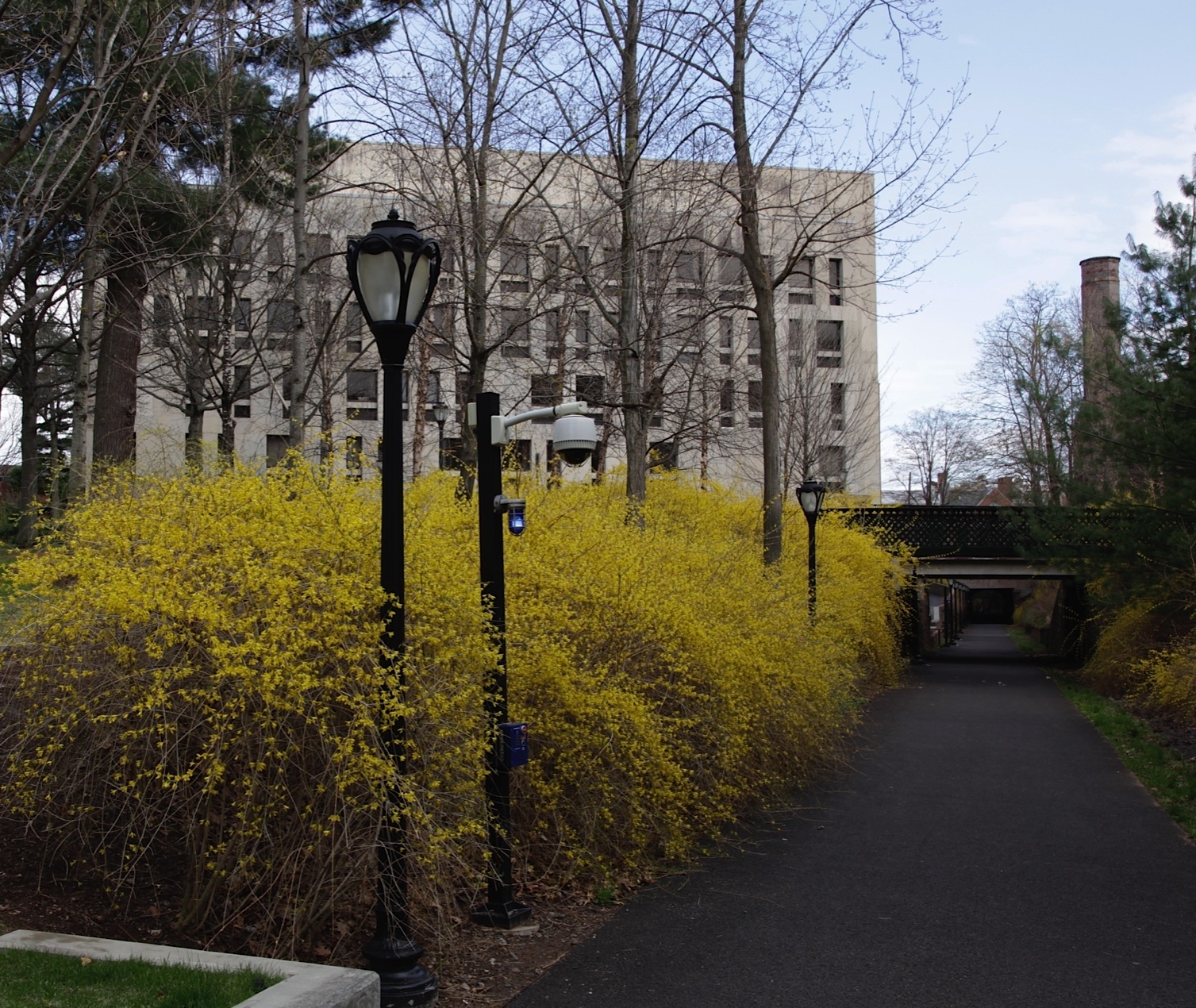
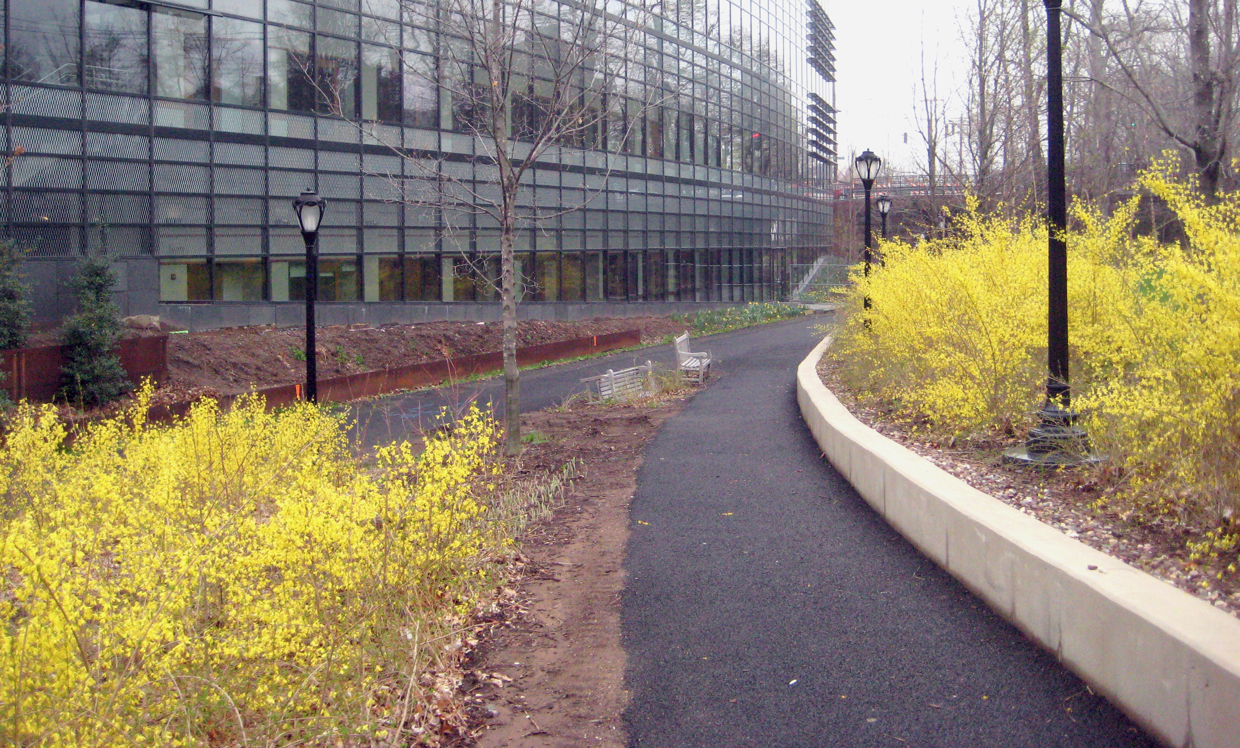
With more than 400,000 m2 of green spaces MNN will form an extensive green network centered around two unique spaces: Parque Central built on the structure above Chamartín Station railyard, and the north-south linear park or spine that connects the proposed network of parks with existing ones.

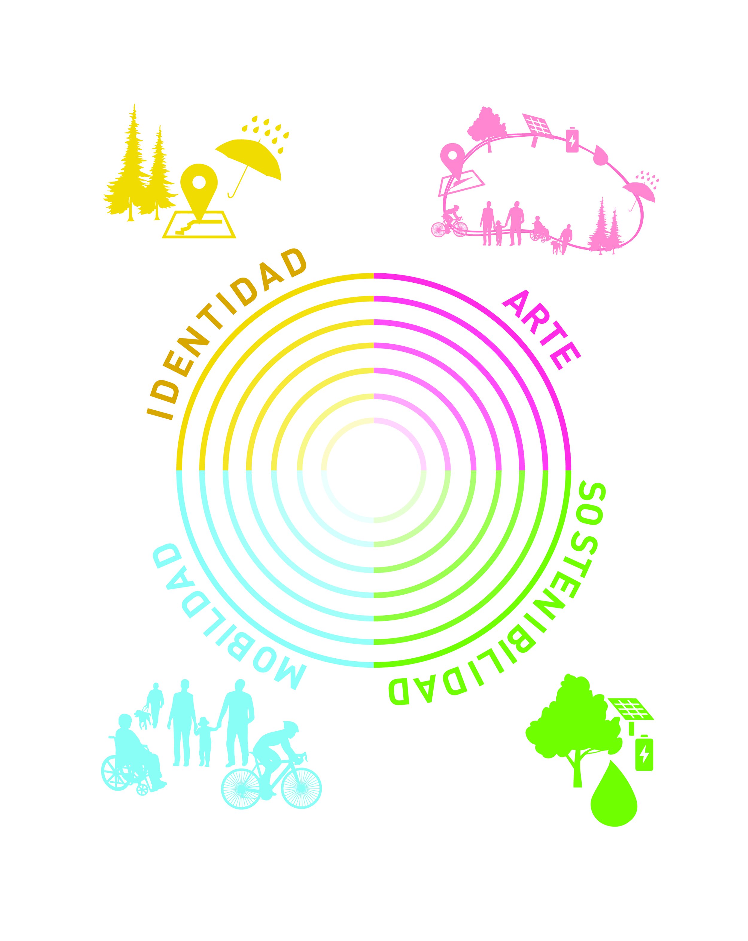
Three key factors will contribute to the development’s success: (1) a continuous linear park that promotes a common and continuous sense of identity;  (2) its sizeable offer of recreation and services for the rest of Madrid; (3) and its capacity to create value through the improvement in sustainability, accessibility, and public space quality for the project itself as well as its surrounding neighborhoods.

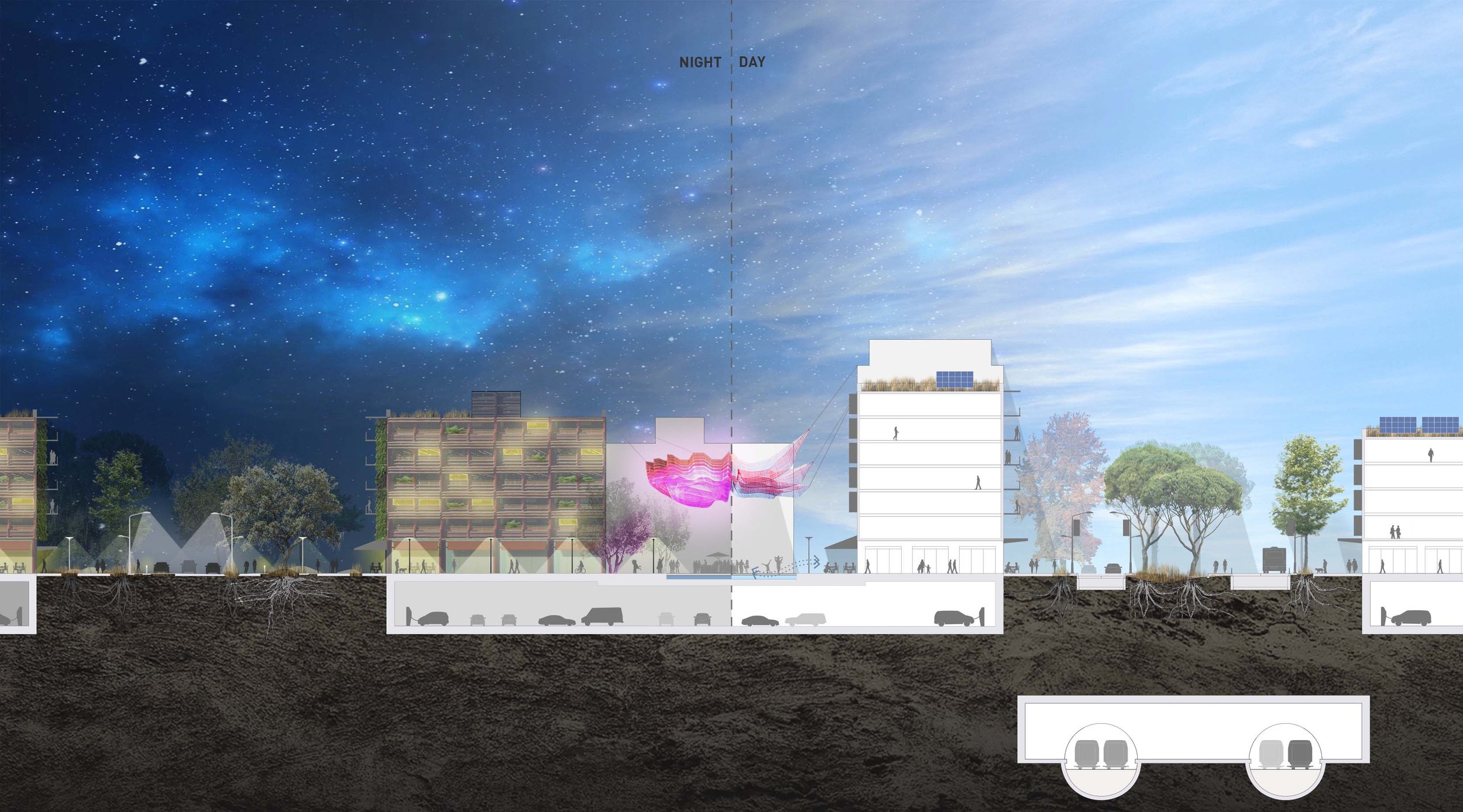
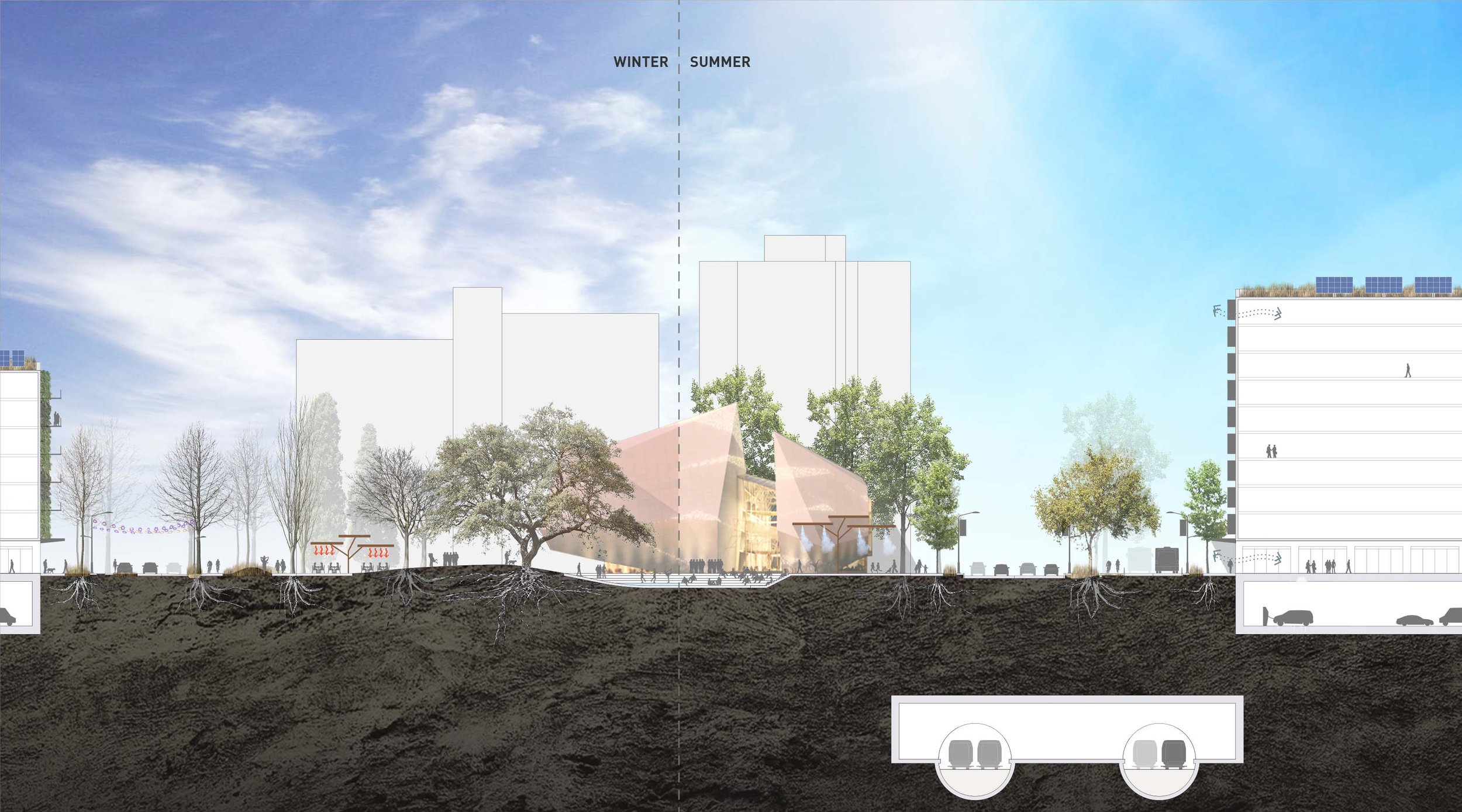
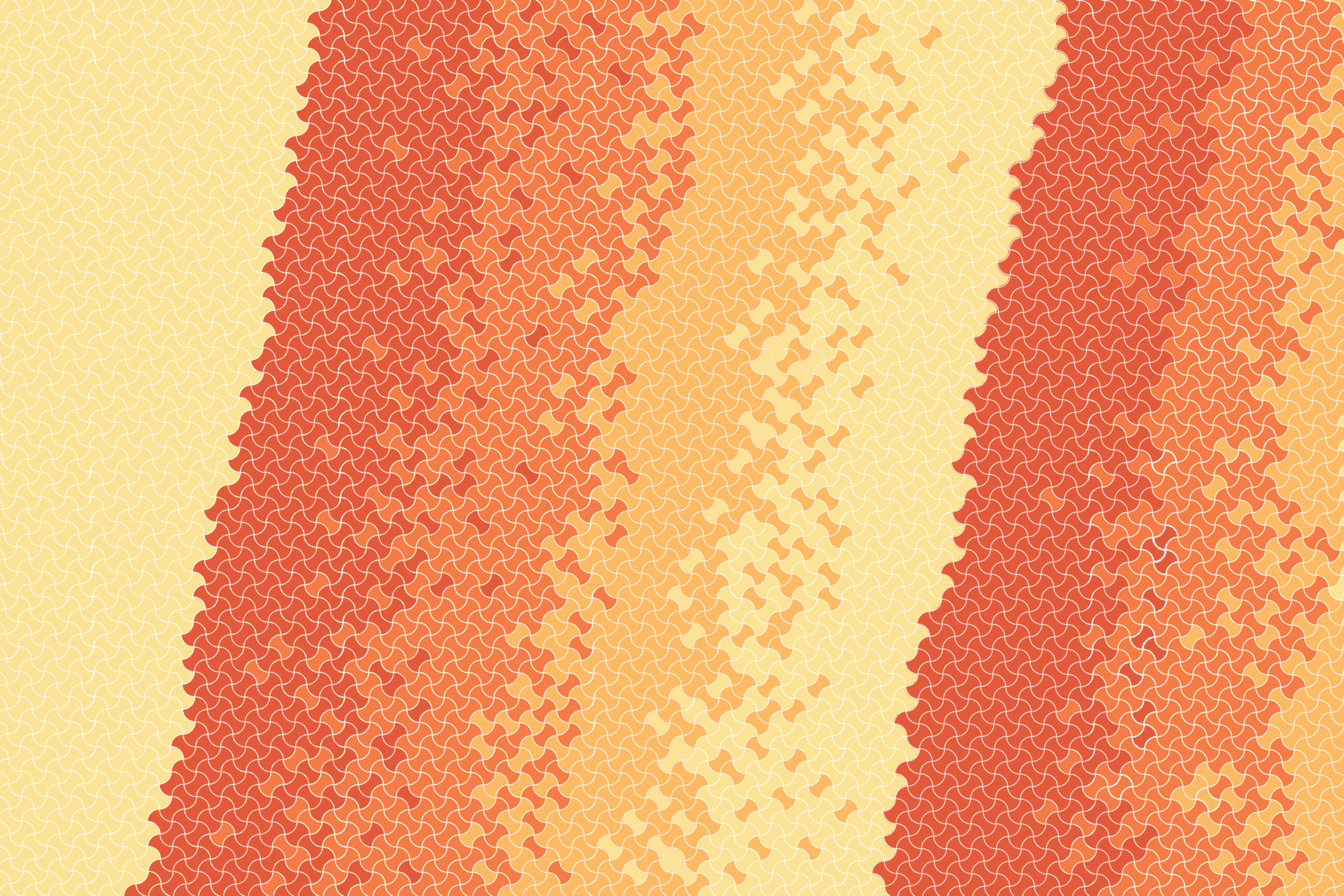
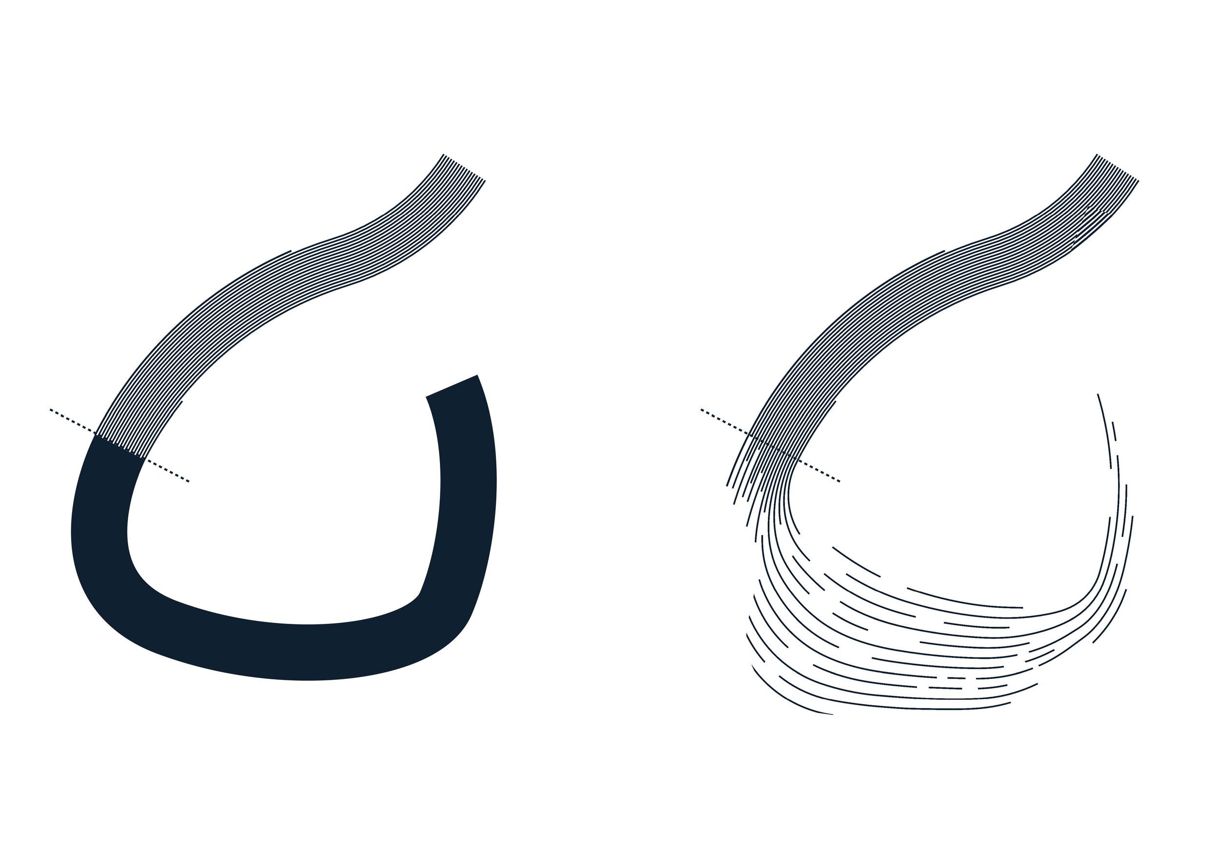
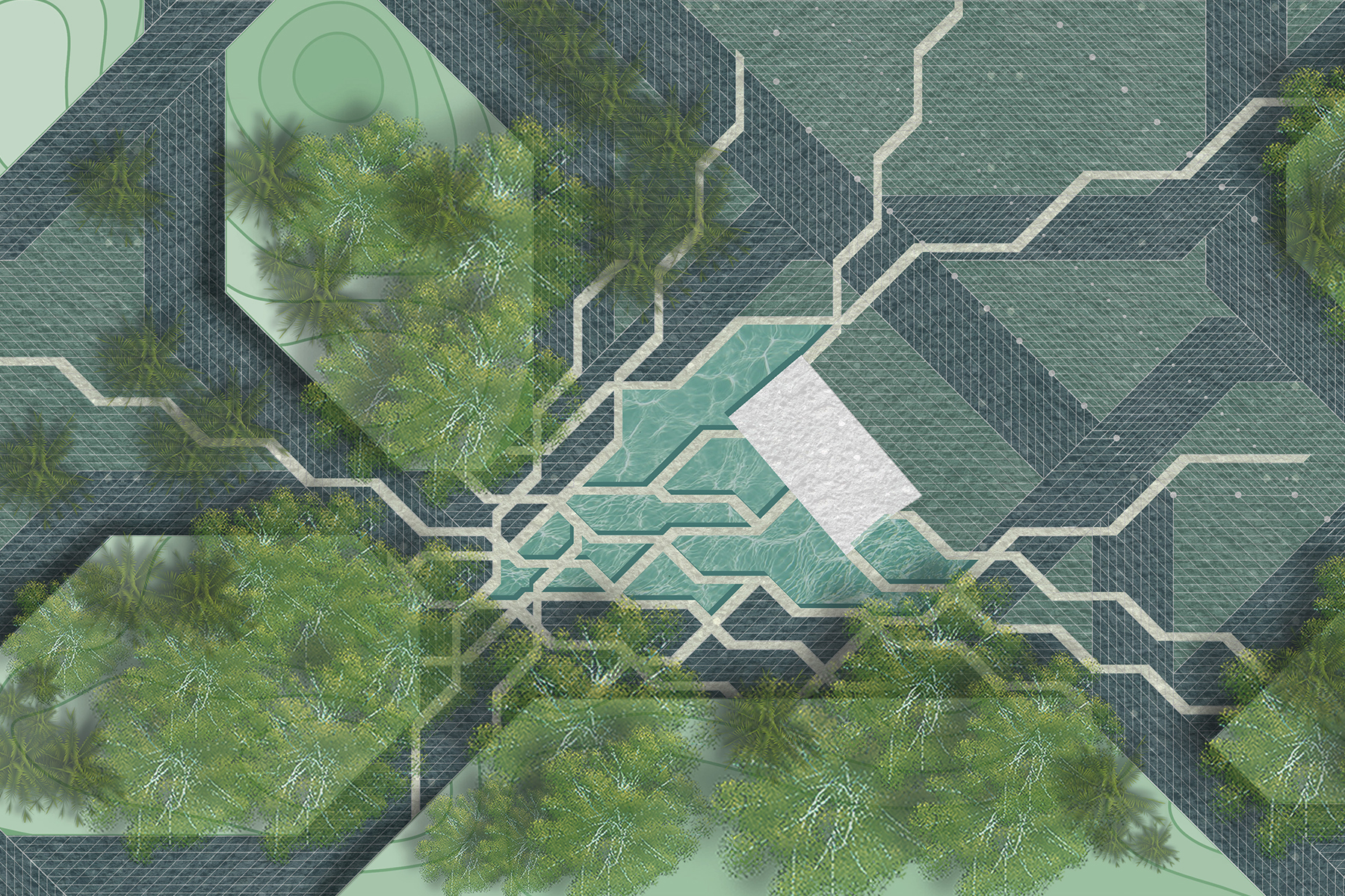
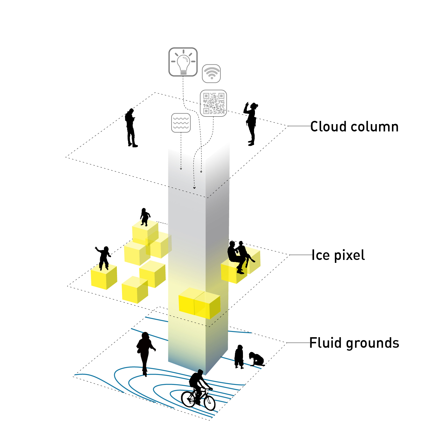
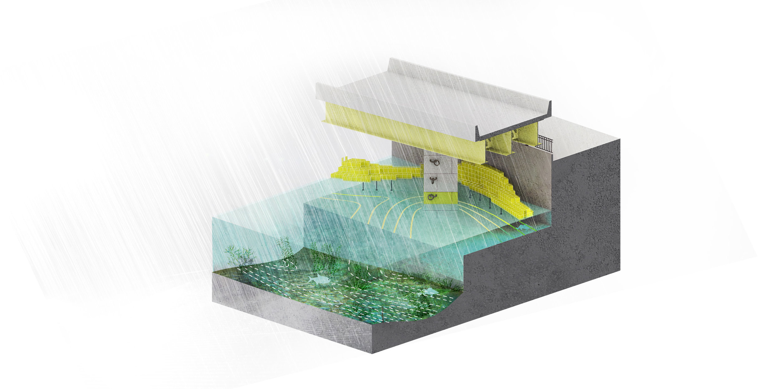
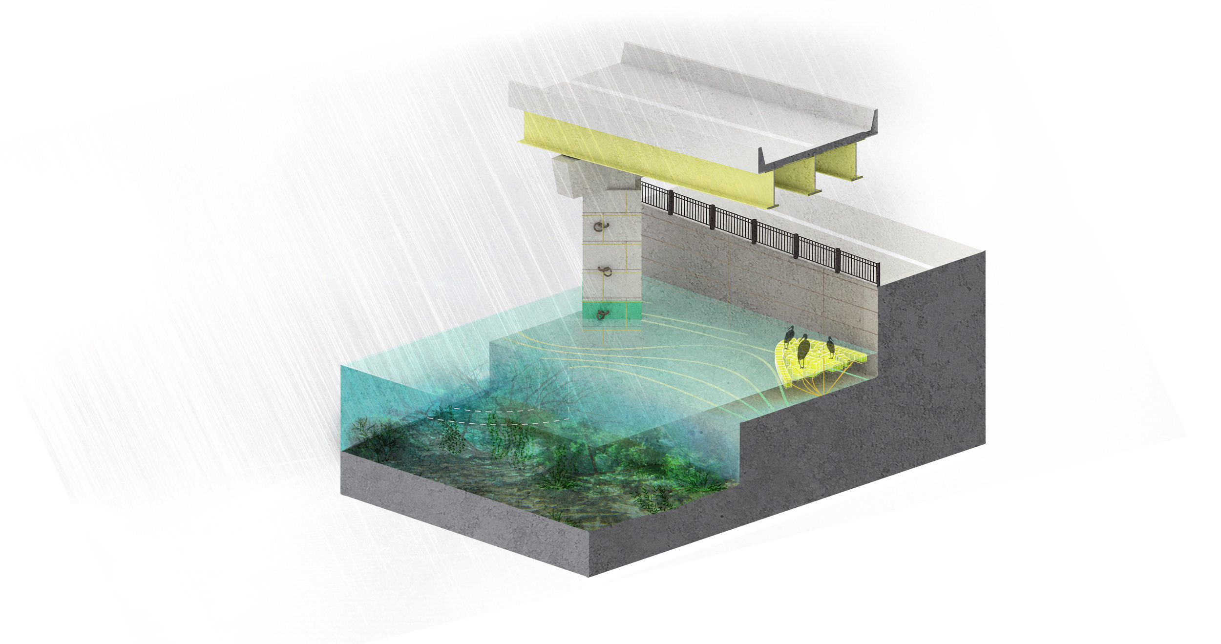
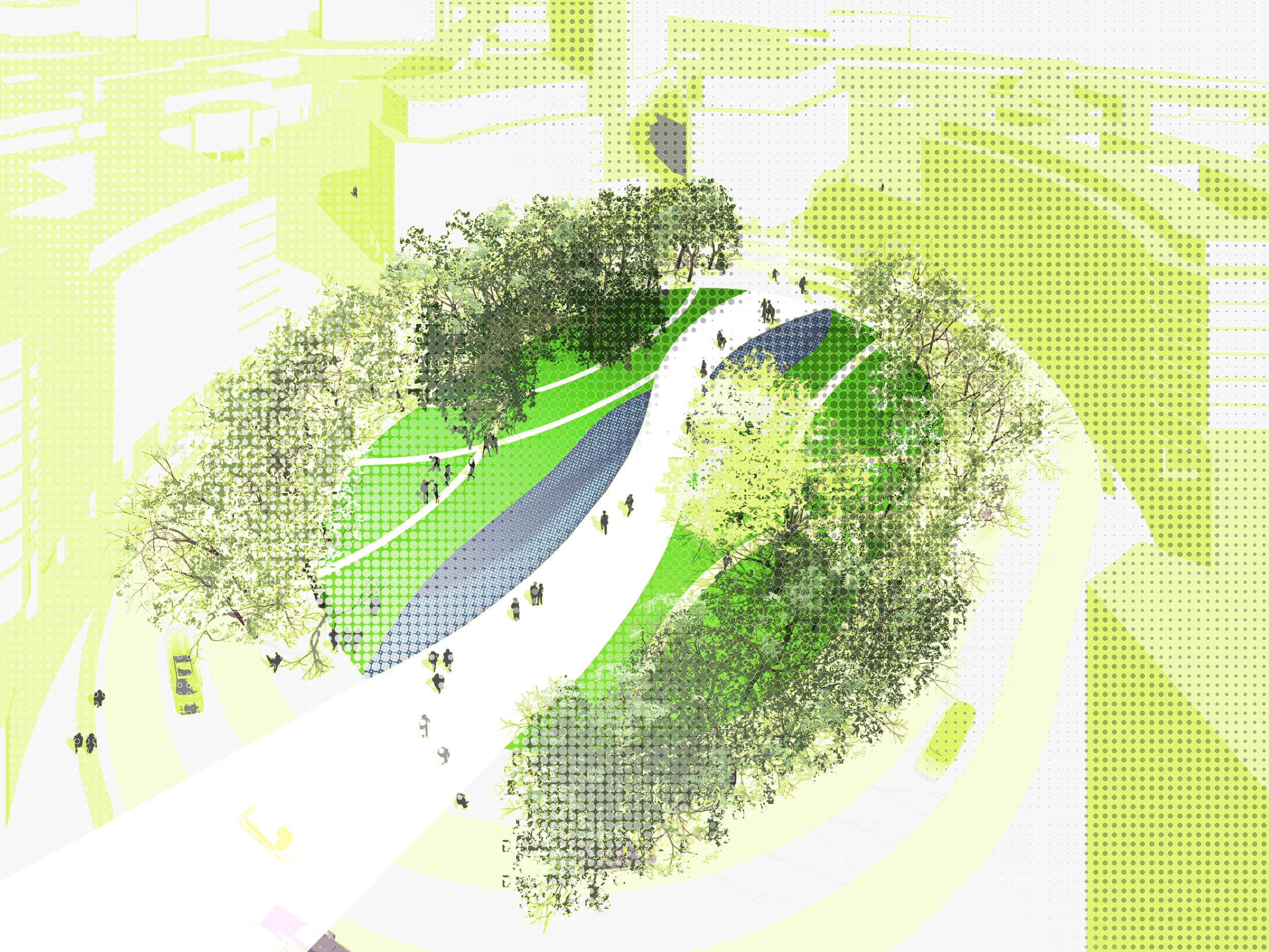
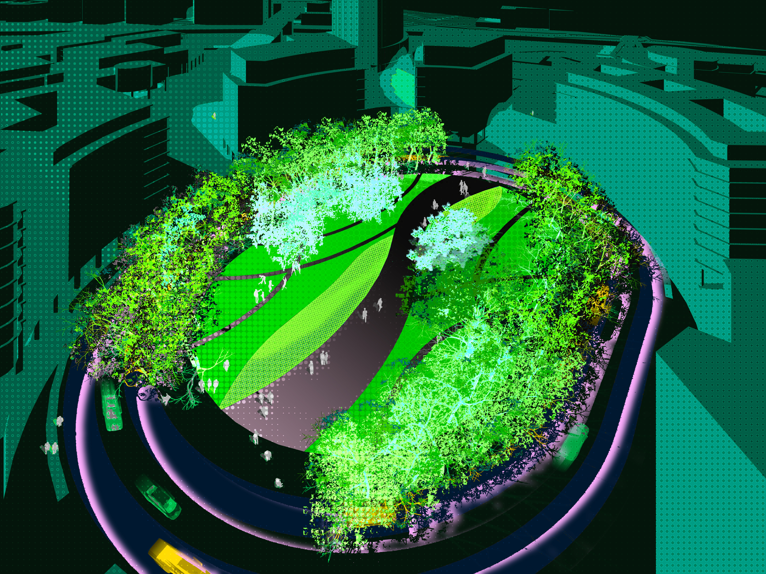
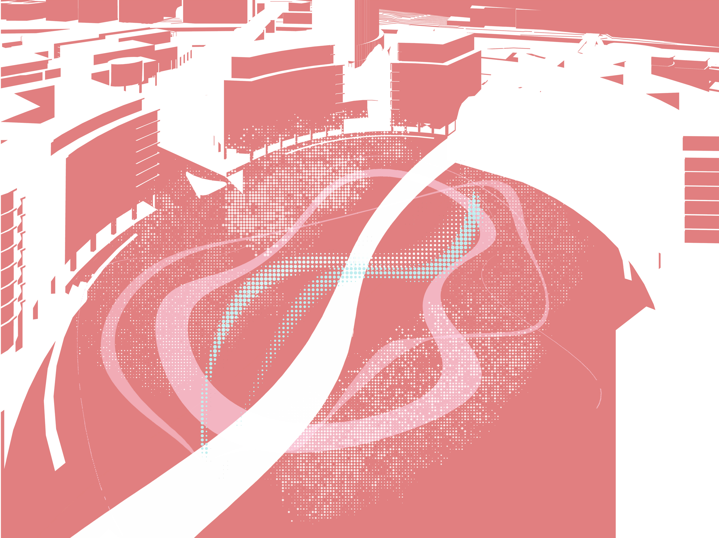
The design strategies through digital tools will allow a precise diagnosis of the sensory and perceptual properties of each environment and to experience them in real-time. This allows the designers to enhance these environment’s performance on a global or specific scale, anticipating problems, and providing solutions from the initial phase of the landscape project. Through an iterative and cyclical process, calculations and analyzes can be carried out, facilitating an informed and multisensory decision-making process that allows the introduction of modifications until the desired result is achieved.

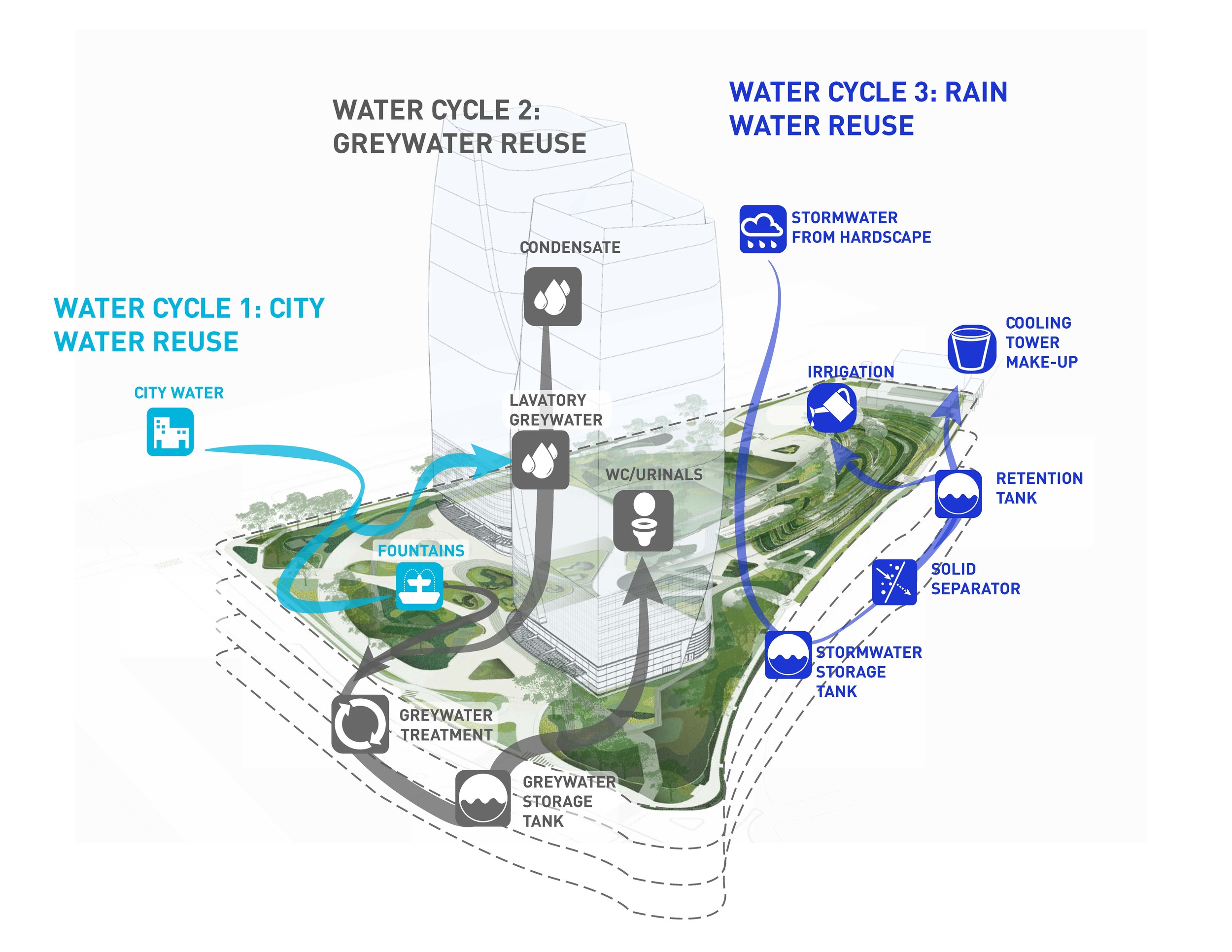
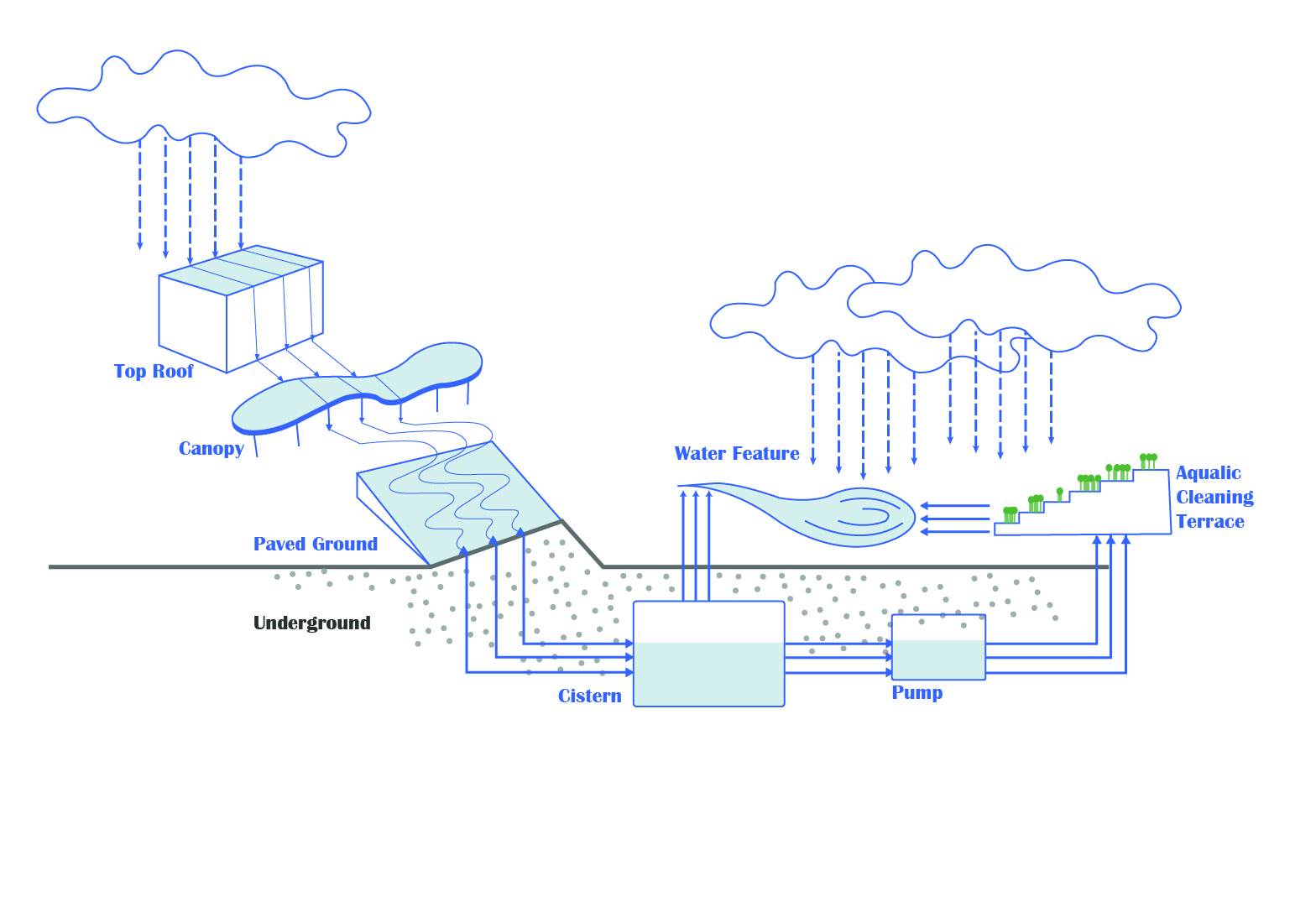
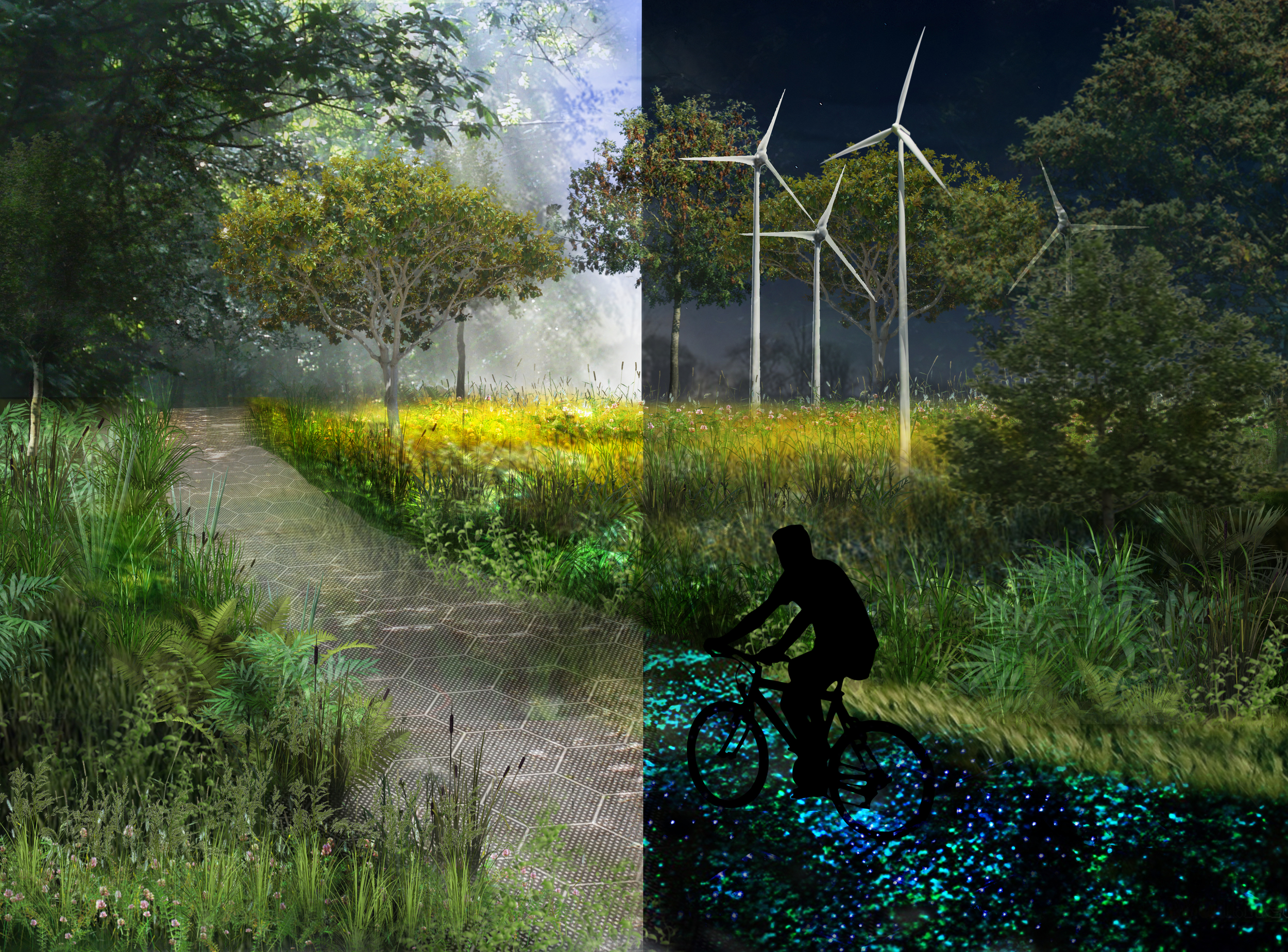
The new concept of urban development for Madrid Nuevo Norte is rooted in its capacity of adaptation and its commitment to mitigation of climate change. As a permeable city with a novel concept of water management and energy efficiency, the development is based on distinct sustainable strategies. This will be achieved by engineering systems that function like natural systems do and deriving form from them. Madrid Nuevo Norte will be “a city in nature.”

Puerto Triana Development Sevilla

SEVILLE, SPAIN

PUERTO TRIANA DEVELOPMENT SEVILLA

SEVILLE, SPAIN

SIZE 40,000 m2 / STATUS Competition Winner 2007 / Completed 2016 / DESIGN TEAM Balmori Associates / Pelli Clarke Pelli Architects / AYESA

The project is located across Guadalquivir River from Seville, on a site that was previously part of the Expo '92. It is composed of a tower flanked by two podiums that run north-south. The tower’s program is offices and a 5-star hotel, the podiums’ is shops, cafes, and restaurants.

The dynamic public space defined by the podiums concentrates pedestrian flow through an active “street” with spaces for cultural, recreational, and commercial activities that leads to Caixaforum Madrid, a museum and cultural center.

The podiums create a pedestrian-scale urban environment; they open like arms to welcome people who arrive from different parts of the city, and then get closer to create a more intimate space protected from the sun.

The top of the podiums are parks accessible to the public, offering a space for walking and recreation. 

Balmori Associates has designed two modular concrete benches for Escofet for the project.

Busan Lotte Tower

BUSAN, SOUTH KOREA

Busan Lotte Tower

CLIENT Lotte / SIZE 3.3 ha, 8 acres / STATUS Under Design / DESIGN TEAM Balmori Associates / Samoo Architects

The Busan Lotte Town Tower (also known as Busan Lotte World Tower) is a 500m supertall skyscraper in Busan, South Korea. The tower is planned on a site next to Nampo-dong subway station and transportation hub. The first phase included a department store with a market and a cinema and it was completed in 2014. This current phase includes an observation deck, offices, and cultural facilities in a 107-story arboretum skyscraper designed by Samoo Architects. The tower’s underground parking space for over 2,400 cars will be covered by a landscaped plaza.

The landscape at Busan Lotte Tower represents an incredible opportunity to integrate landscape to this superb vertical structure. Balmori’s landscape intervention in the project includes the entry plaza and the observation deck. The central idea behind this landscape is generated by an urgent need for programmatic flexibility in a limited outdoor plaza space. This landscape is designed to be experienced and frame multiple viewpoints towards the bay.

Hermas Development

DOHA, QATAR

Hermas Development

CLIENT Hermas Development Company / SIZE 10. 000 m2 / STATUS Under Construction / DESIGN TEAM Balmori Associates / Kohn Pedersen Fox Associates / One Lux Studio

The Hermas Development will feature four office buildings organized around a central courtyard. Each building has retail on the ground floor, nine office floors, and a tenth roof level amenities connecting all four buildings. The roof level amenities house the Al Kamal headquarters, a Spa, Gymnasium and a restaurant for fine dining. Sitting on a site area of 15,220 m2 and rising 47 meters in height Hermas Development will be LEED Certified and have a 5 star QSAS rating.  

An Islamic pattern is reinterpreted through the site.  Modified, scaled, simplified, the pattern becomes at times the layout of the courtyard, at others, a paving pattern, the edge of the water feature, and benches.

The shade, the sound of the water, the vegetation and the color palette will provide a sense respite and freshness as soon as one enters the courtyard. Materials with warm colors are selected for the streetscape and cool color ones such as greens and greys for the courtyard.

The planting palette for the courtyard showcases native tall vertical palms and acacias well-known for their horizontal canopy. The sun study of the courtyard maps areas of sun exposure suitable for planting trees, and consequently where the earth berms up to allow for planting depth.

The terraces on the 4th and 10th floors feature pixel like planters allowing for more intimate spaces where one can sit alone or in a small gathering. The terraces of the 4th floor have a white, a red, a blue and a yellow garden; the ones on the 10th floor have a scent garden, an edible garden and an orange grove. The vegetated roof of the 9th floor displays arabesques of sedums.

Campa de los Ingleses Park

2012 - BILBAO, SPAIN

CAMPA DE LOS INGLESES PARK

BILBAO, SPAIN

CLIENT Sociedad Bilbao Ria 2000 / SIZE 25,000 sq. m2 / 6.17 acres / STATUS Completed 2012 / DESIGN TEAM Balmori Associates / Lantec (Local Partner) / RTN Architects / PHOTO CREDIT Iwan Baan / Efrain Mendez / Borja Gomez

Campa de los Ingleses Park designed by Balmori Associates with RTN Architect is the results of an international design competition (2007). 

The park flows from the Guggenheim Bilbao Museum, unifying the Abandoibarra area of Bilbao and the Nervión River. The Park's design was based on gracefully mediating for pedestrians a ten meter (33 feet) elevation difference between the city above and the Nervión River below. This was achieved with ramps, terraces, and topography, earthforms serving to control vistas and to allow for a café to be tucked under.

Instead of an “Industrial Lawn”, a “Freedom Lawn” was planted by introducing various grass species, clover and wildflowers that fixes nitrogen and reduces the need for pesticides. The paving designed by Balmori contains an additive called GeoSilex® which absorbs CO2; the paving was developed with the University of Granada and made entirely from industrial waste. The local newspaper referred to the park as “a new lung for the city.”

St. Patrick's Island

2011 - CALGARY, CANADA

ST. PATRICK'S ISLAND

CALGARY, CANADA

CLIENT Calgary Municipal Land Corporation / SIZE 12.5 Ha. / 31.0 Ac. / STATUS Competition finalist, 2011 / DESIGN TEAM Balmori Associates / Allied Works Architecture / David Skelley / NIP / Creative Concern / Knippers  Helbig / Sherwood / Design Engineers / Trans Solar / Hanscomb / Anne Georg / Terry Bullick

Balmori Associates’ entry for St. Patrick’s Island competition revisits and modernizes the eternal idea of Eden and the foundation of a new era. We propose attracting and supporting wildlife on their terms, not ours. In doing so, we offer a powerful point of comparison with the adjacent Calgary Zoo and create a model for our future relations with other living things.

An assemblage of habitats as an ecological mosaic allows local fauna and flora to thrive.  Diversified vegetation cover, enhanced topographical features and integrated water-based ecosystems are relevant to the site’s situation within the Bow River floodplain. Known as “edge effect”, the overlap zones between habitats (ecotones) are privileged as they typically present increased variety of plants.

TBD: Grow With the Flow

2018 - Pittsburgh, PA

TBD: Grow With the Flow

Pittsburgh, PA, USA

CLIENT Riverlife PA / SIZE 0.17 acres / 697m2 / STATUS 2018 Finalist / DESIGN TEAM Balmori Associates


OCCUPY FORT DUQUESNE       How can this urban void located under the Ft. Duquesne Bridge overpass become a public space? Shaping the space to balance flexibility while giving an identity and sense of place stipulated the reinvention of a new design language.

1,000 to 3,000 milk crates turned up to be the perfect tool: They are modular and offer many layout configurations. They are comfortable: one can sit on it, lounge on it. They are flexible: they become furniture, construction blocks. They are stackable, easy to put away. They are light and can be moved around easily.  They are inexpensive.  They are playful and interactive. They are durable. They are desirable. We propose a ‘Second Life’ program that encourages the community to take this highly coveted module and transform it according to their needs... And they are yellow and refer to the iconic Aztec gold color that defines Pittsburgh.

CELEBRATE THE RIVERS       2018 marks the 260 year anniversary of Pittsburgh. This summer, let’s celebrate the rivers! Our scheme responds to the fluctuations of the river and uses flood as leverage for design. 
When the site floods the crates equipped with flotation devices lifts up and stays dry until the water recedes leaving a trace of the river. This presents a playful spectacle on site while keeping the maintenance after flood to a minimum. Grow With The Flow memorializes the floods with the tallest bridge column bearing the marks of the past 100 years floods – from the 46ft mark of the Great St. Patrick Day flood of 1936 to the 2005 flood. 

REVEAL NATURE’S FORCE       The bathymetric map reveals the topography of the riverbed invisible to us at the water edge. We propose to extend theses contours onto TBD site, softening the hard edge of the river while reminding users that the river occupies the site occasionally. 
The 2-dimensional representation of topography is traced with blue temperature sensitive paint that transitions into yellow at a specific temperature threshold. The thermochromic paint’s immediate and interactive process captures nature’s lack of fixity. The contour lines render the concept of landscape as part of an interconnected system, which extends and connects to other systems around it. Grow With The Flow aims to reestablish our relationship with nature.


This project included a public engagement stage. Our main objective was to understand better the relationship between people and the Allegheny River to advocate for a better relationship between people, other living things, cities and larger natural systems.

Hoboken: resist, delay, store, discharge

2015 - HOBOKEN, NJ, USA

Hoboken: resist, delay, store, discharge

HOBOKEN, NJ, USA

CLIENT US Department of Housing and Urban Development / Hurricane Sandy Rebuilding Task Force / Rebuild by Design / City of Hoboken / SIZE 735 acres / 300 ha / STATUS Competition Winner 2015 / DESIGN TEAM OMA / Balmori Associates / Royal Haskoning /  HR&A

Organized by Hurricane Sandy Rebuilding Task Force, Rebuild by Design was a multistage regional design competition aimed at developing innovative projects to protect and enhance Sandy-affected communities. The OMA, Balmori Associates, Royal Haskoning, HR & A proposal Resist, Delay, Store, Discharge for Jersey City, Hoboken and Weehawken was awarded $230 million.

Jersey City, Hoboken and Weehawken are susceptible to both flash flood and storm surge. As integrated urban environments, discreet one-house-at-a-time solutions do not make sense. What is required is a comprehensive approach that acknowledges the density and complexity of the context, galvanizes a diverse community of beneficiaries, and defends the entire city. Our comprehensive urban water strategy deploys programmed hard infrastructure and soft landscape for coastal defense (resist); policy recommendations, guidelines, and urban infrastructure to slow rainwater runoff (delay); a circuit of interconnected green infrastructure to store and direct excess rainwater (store); and water pumps and alternative routes to support drainage (discharge).

Our approach is framed by a desire to understand and quantify flood risk. In doing so, we are better positioned to identify those opportunities that present the greatest impact, the best value, and the highest potential — our areas of focus. Our objectives are to manage water for both disaster and for long-term growth; enable reasonable flood insurance premiums through the potential redrawing of the FEMA flood zone; and deliver co-benefits that enhance our cities. These are replicable innovations that can help guide our communities on a sustainable path to living with water.

For the landscape team the project galvanized the ideas of the importance of the size of the unit to be protected, in this case the whole town of Hoboken, a small town, and let to the conclusion that units of a similar size were ideal sizes in which work, leading to rather less costly solutions.

Community Member's Outline Hoboken's Rebuild by Design Initiative
Promoting Resilience Through Innovative Planning and Design
Rebuild by Design Team
Final Proposal

Creation From Catastrophe: How Architecture Rebuilds Communities

São Paulo Corporate Towers

2017 - São Paulo, Brazil

São Paulo Corporate Towers

São Paulo, Brazil

STATUS Completed 2017 / DESIGN TEAM Balmori Associates / Pelli Clarke Pelli Architects / Atelier 10 / PHOTO CREDIT Pelli Clark Pelli Architects

The landscape design for the project is driven by the character of the Mata Atlantica Forest found on the site. Only 9% of this Brazilian ecosystem remains in the world and a few disconnected patches of this forest exists in São Paulo. Our project celebrates its biodiversity and spatial richness in the urban landscape of São Paulo.

São Paulo Corporate Towers’ landscape follows the spatial rhythm, heights and patterns of the forest as it weaves across the site and through the two towers of the architectural program.  Tree canopies of various heights create magical outdoor spaces of dappled sunlight and shade, providing a cooler environment. Landforms accentuate the display of the vegetation in their multiple canopy layers. A large green roof accessible by a series of ramps becomes a link between the two towers and integrates the amenity building. An elevated metal path weaving through the site and becoming a public sidewalk on the street offers a unique experience of walking in the canopies of trees. The collection of rain water on site and the selection of native species with lower water demand, allows for minimum irrigation.

Ciudad Empresarial Sarmiento Angulo

Bogota, Colombia

Ciudad Empresarial Sarmiento Angulo

Bogota, Colombia

CLIENT Sarmiento Angulo / STATUS Under Construction / SIZE 18.53 acres / 75,000 m2 / DESIGN TEAM Balmori Associates, Construcciones Planificadas

Ciudad Empresarial Sarmiento Angulo is an urban project in the heart of Bogota, Colombia that marks the midpoint between Bogota’s historic downtown and the international airport. As Bogota has rapidly developed along Calle 26, the city’s most important axis, Ciudad Empresarial Sarmiento Angulo will emerge as Bogota’s prominent cultural and commercial center.

The master plan for Ciudad Empresarial Sarmiento Angulo spans three blocks creating an integrated system of public space that will serve as a critical junction between three distinct areas of the city: Parque Simon Bolivar to the north, Centro Administrativo Nacional to the east, and a residential neighborhood to the west. A public pedestrian spine connects all three blocks with a series of bridges over vehicular cross streets. The center piece of this mixed use development is a public square that contains a new performing arts center and hotel. The square fuses the existing open space together, creating a new public center for the city.

The landscape expresses the diverse ecology found in Colombia with each block containing a distinct botanical environment and color palette comprised of indigenous Colombian plants. The blocks are connected through water elements that fluctuate in level depending on water availability, accommodating a variety of social and ecological programs. Vibrant colors are found in both the paving and vegetation, creating a link to the city’s colorful historic district, La Candelaria, and regional ecological events like the algae blooms of the Cano Cristales. Topographic undulations in the surface of the landscape create depth for large planting areas above the underground parking structure and provide lush enclaves for people to enjoy in an urban setting.

Plaza Euskadi

2012 - BILBAO, SPAIN

PLAZA EUSKADI

BILBAO, SPAIN

CLIENT Sociedad Bilbao Ria 2000 / SIZE 2.5 acres / 10,117 m2 / STATUS Completed 2012 / DESIGN TEAM Balmori Associates / LANTEC (Local Partner) / PHOTO CREDIT Iwan Baan / Borja Gomez / Efrain Mendez

Plaza Euskadi connects the nineteenth century section of the city called “El Ensanche” to the new section of Bilbao, Deusto university campus, the Guggenheim Museum, and the Nervión River. The Plaza is a pivot, unifying diverse elements of the city.  Apart from the Museum of Fine Arts and historic residential buildings, the plaza is surrounded by contemporary buildings such as university and library buildings, a shopping mall, a subway station, hotels, residential buildings, an office skyscraper, designed by different architects including Gehry, Moneo, Pelli, Siza, Krier, Legorreta, and Stern.

Oval in form, the plaza has two forms of circulation: a tree-lined perimeter path for leisurely walks and sitting, and a dominant central path which brings the people from downtown to Abandoibarra to the Campa de los Ingleses Park, The Rivers, and the pedestrian bridge crossing the river to Deusto University and its neighborhoods.

Three public park “pockets” hook onto the sides of the central path, which provide colorful and playful seating made from recycled rubber. Each pocket has a different character: an amphitheater section with reflection puddles, an ottoman seating section, and a “garden” section of flowering shrubs with a 100 year old Laegostremia tree.

In 2008 the construction of the plaza was impacted by the economic downturn in Spain leading to a complete re-design. The final design cost was half of the original construction budget which required the removal of fountains, a more modest planting and grading scheme, and a shift in materials. 

11th Street Bridge Park

2014 - WASHINGTON DC, USA

11TH STREET BRIDGE PARK

WASHINGTON DC, USA

CLIENT District of Columbia / THEARC (Town Hall Education Arts Recreation Campus) / STATUS Competition Finalist, 2014 / SIZE 50,000 SF / 4,645 m2 / DESIGN TEAM Balmori Associates / Cooper, Robertson + Partners / Guy Nordenson Associates / Johnson, Mirmiran & Thompson / Fisher Marantz Stone / Jones Lang LaSalle / City Activators / Dr Mindy Thompson Fullilove / Mark Dion / Dr. Kimberly Sebek / ARUP Acoustic / ETM Associates

The 11th Street Bridge Park competition was a design effort to integrate the forces of gentrification that its development would unleash into an overall design approach ruled by protective policies. The 11th Street Bridge Park design encourages the economic development of local enterprises, introduces cultural elements that the Anacostia and D.C. communities are lacking, and incorporates aspects of local history, kicking off a new era of urban development through policies that protect the local population from gentrification while strengthening the community. The integration of economic, social and cultural policies would make this a resilient urban planning. The design approach and the community programs proposed for the bridge park reinforced one another through the creation of hybrid programmatic spaces.

The design of the bridge creates a space for diverse communities to come together on this neglected Anacostia. It provides a vehicle for very separate communities to communicate.

Cutsheet USA, Washington, DC, Bridge Park

Beale Street Landing

2015 - MEMPHIS, TN, USA

BEALE STREET LANDING

MEMPHIS, TN, USA

CLIENT Riverfront Development Corp / SIZE 5 acres / 20,235 m2 / STATUS Completed 2015 / DESIGN TEAM Balmori Associates / RTN Architects / Bounds & Gillepsie Architects / Consulmar / L'Observatoire International PHOTO CREDIT Aeria Innovation

A twenty-five-foot bluff rises from a once busy commercial harbor in Memphis' old downtown, which, like many American waterfront cities, historically turned its back on the river that was once its lifeblood. 

Balmori Associate’s design consists of a series of level, landscaped islands formed in the terraced slope of the river’s edge, highlighting the tidal changes at the river’s edge, which can exceed forty feet. The intent of the design was for public space to interact with the changing levels of the river. The islands are each planted with a distinct native plant community of Western Tennessee, strategically corresponding to the fluctuating levels of water inundation.   Water collected on site is filtered and cleaned through vegetated terraces and then stored in a cistern for reuse in irrigation.  Each island creates a unique public space, including a river overlook, a children’s play area, a performance space and wetland gardens, choreographed with the changes in The Mississippi River.  

The five-acre riverfront park is the departure and arrival point for thousands of river travelers and will provide a destination point for individuals and groups to celebrate the spot where the world’s most powerful river engages the home of the blues.

NTT Shinjuku Headquarters Building

1995 - TOYKO, JAPAN

NTT SHINJUKU HEADQUARTERS BUILDING

TOYKO, JAPAN

CLIENT Nippon Telephone, Telegraph Headquarters / STATUS Completed 1995 / SIZE 78,899 SF / DESIGN TEAM Balmori Associates / Pelli Clarke Pelli Architects

This design of this project is all about the relationship between nature and artifice. This is sought through the use of different materials. The plaza, bisected by a fence, is completely public except for a few occasional private fairs hosted on a monthly basis when the fence is closed off. The fence dividing the plaza begins as a wooden structure; gradually stainless steel members are added, mingling with the wood, increasing in number until the fence is entirely of stainless steel, moving from natural to more artificial materials.

The fountain rill, powered by a windmill, moves water over a patterned bed of concrete on one side to stainless steel on the other based on hydrological patterns from riverbeds. Two bridges are added to the design, one of steel, and one of wood. Stone-tile paths with planted and gravel surfaces let the rain seep in to ground water or to collection points for cleaning and reuse.

New Hancher Auditorium

2016 - Iowa City, IA, USA

NEW HANCHER AUDITORIUM

Iowa City, IA, USA

CLIENT University of Iowa / SIZE 7.6 acres / STATUS Completed 2016 / DESIGN TEAM Balmori Associates / Confluence / Pelli Clarke Pelli Architects PHOTO CREDIT Pelli Clarke Pelli

In 2008 a dramatic 500 year flood devastated a large portion of the Iowa University Art Campus. Balmori Associates’ set out to re-imagine the relationship between the Iowa River and its surrounding landscape where the Arts Campus resides.  Balmori's Master Plan for the Arts Campus that provides the river and university with new currents of connectivity, creativity, and environmental performance. 

Topographic depressions around the New Hancher Auditorium create spaces that are flexible and configured to embrace the variable character of the river. These depressions are designed to provide public space for large outdoor performances and social events, but also allow for the river to expand during large flood events. 

Considering the larger effects of the 2008 flood, Balmori’s strategy can be seen as a prototype for water management, that if replicated on a regional level would be capable of attenuating increased flooding threats brought about by the urbanization of the Iowa River Corridor. Additional areas of water treatment and infiltration serve to collect, clean and permeate storm water on site instead of piping it directly into the river. This decreases water flow and velocity of water in the Iowa River implementing a soft approach to flood prevention, a strategy that becomes a powerful flood management tool when repeated. 

Osaka National Museum of Art

2004 - OSAKA, JAPAN

OSAKA NATIONAL MUSEUM OF ART

OSAKA, JAPAN

CLIENT Ministry of Construction / Ministry of Culture / The Kin Ki Regional Bureau / SIZE 3,500 m2 / STATUS Completed 2004 / DESIGN TEAM Balmori Associates / Pelli Clarke Pelli Architects 

A new contemporary art museum in Osaka, Japan was constructed completely underground, adjacent to an existing science museum. The plaza above the museum ends on a pyramidal mountain form meant to invoke a mountain. This black granite pyramid is covered with a thin sheet of cascading water. Curvilinear stairs lead down to the ‘plain,’ where the stainless steel ribbons flow across the main plaza, leading toward the stainless steel sculpture that marks the new museum’s entrance. A large liquid arc at handrail height starts at the museum’s entrance sculpture. The water flows over small black river stones along the side of the staircase descending into the museum, ending in a cascade.

Farmington Canal Greenway

2011 - NEW HAVEN, CT, USA

Farmington Canal Greenway Master Plan and Yale Section 

NEW HAVEN, CT, USA

CLIENT Yale University Office of Facilities / SIZE 2.1 miles / STATUS Master Plan Completed 1995 / Engineering School Section Completed 2011 / DESIGN TEAM Balmori Associates / Pelli Clark Pelli

The Farmington Canal, a 2-mile-long section of railroad in eastern Connecticut, has been abandoned since 1982. A canal that ran three miles through the city of New Haven and six miles through Hamden, a New Haven suburb, preceded the railroad. The masterplan for the Farmington canal reuse was initiated as part of the federal Rails-to-Trails rehabilitation program. Developed by Balmori Associates it sought, through substantial research, to reactivate the canal and transform it into a recreational corridor that connects disparate parts of the city with its center. By modest moves, the canal corridor can eventually affect projects that occur along it, becoming a spine on which to hang other built development. 

The two mile long Yale owned section sits by the new Engineering Research Building of Yale University, located at the corner of Prospect Street and Trumbull Street. Working together with its design architects, civil and environmental engineers, Balmori Associates explored numerous sustainable design ideas. The porous paving used as part of a larger storm water management strategy reduces runoff's volume and velocity.

The section of abandoned railway is envisioned not simply as a trail but a new prototype of public open space, a linear park made up of discrete green segments that respond individually to their respective urban or suburban contexts.

Liamuiga National Park

2015 - Basseterre, St. Kitts and Nevis

Liamuiga National Park

Basseterre, St. Kitts and Nevis

CLIENT Valmiki Kempadoo / STATUS Master Plan Completed 2015 / SIZE 378 acres / 153 hectares / DESIGN TEAM Balmori Associates


The vision for St Kitts National Park will become a symbol of the region’s progress and the country’s renaissance. St Kitts is leading the way to sustainable energy and other initiatives transforming communities such as improvements to infrastructure, health care initiatives, intergovernmental cooperation, and economic development strategies.  Centrally located, the National Park will become an important destination for the local community and an attraction in the tourism network of the island, while fulfilling the ecological need of replenishing the aquifer.